Powder Forecast – Friday November 15th, 2019
Ted Schlaepfer CCM —- Mammoth Mountain WeatherGuy
Snowfall forecasts are valid at the Sesame snow course (Main Lodge) for the prior 24 hours as reported in the 6-7 AM morning snow report.
**Snowfall forecast confidence ranges from very low (1) to very high (5)
Sat 11/16 = 0”
Sun 11/17 = 0”
Mon 11/18 = 0”
Tue 11/19 = 0”
Wed 11/20 = 0 – 1”
Thu 11/21 = 2 – 4”
Fri 11/22 = 0 – 1”
Sat – Mon 11/23– 25 = 0”
November Snowfall = 0”
November Forecast = 15 – 25”
Detailed 4-day Snowfall Forecast:
Sat 11/15 through Tue 11/19 —No snowfall expected all days until possibly late Tuesday night/early Wednesday.
Forecast Summary:
Short Term (Days 1 – 4):
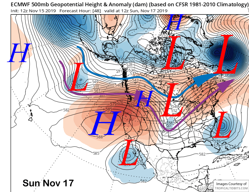
High pressure build back into CA over the weekend (image below) and holds into Monday next week for fair weather and above normal temperatures back into the 50s. Snow-making should be poor by Sunday/Monday.
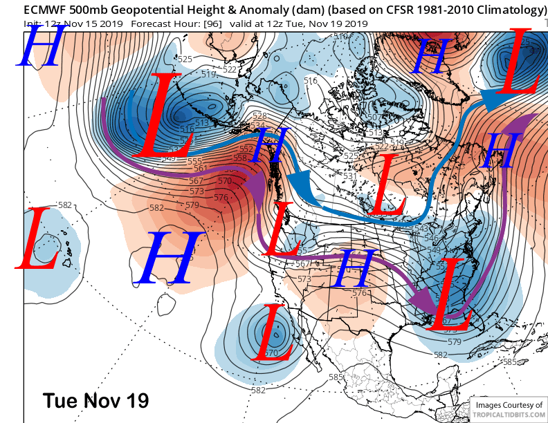
An upper level low-pressure system (image below) will move southward into CA on Tuesday next week for colder weather and increased southwest winds. No snowfall is expected from the passage of the dry cold front Tuesday morning other than possibly some flurries.
Long Range (Days 5+):
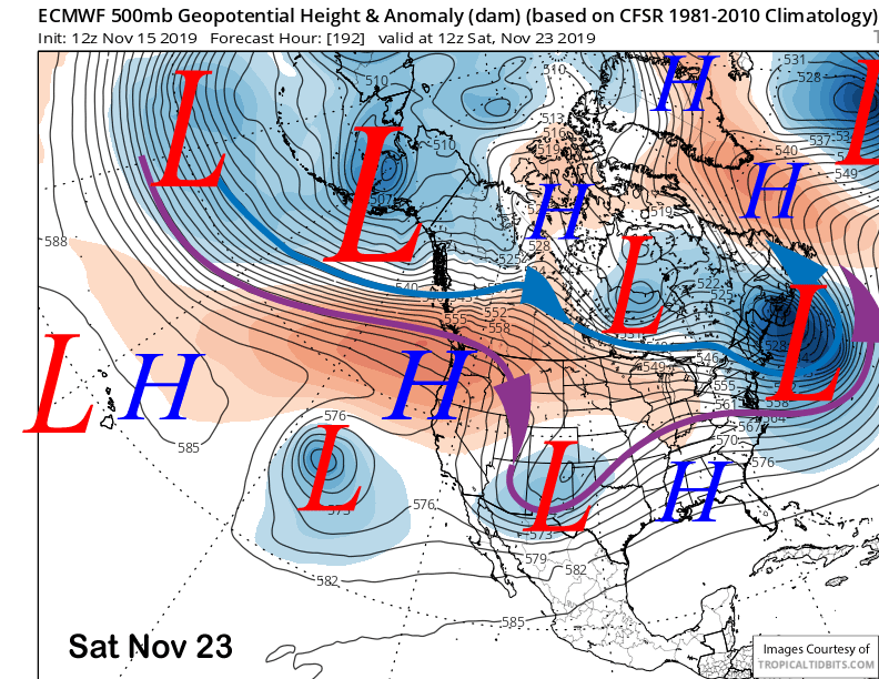
The upper level low pressure system is then favored to cut off from the jet stream and meander southward into SoCal (image below) around Wednesday or Thursday next week. That should bring even colder temps into Mammoth for good snow-making.
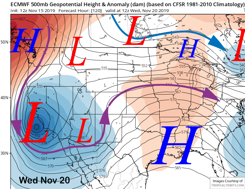
The system is also expected to pull in some moisture into the circulation from a cut-off previously positioned off Baja. The wrap-around counterclockwise flow around the upper low will produce moist easterly upslope flow on the eastern side of the Sierra in addition to the likely formation of a deformation zone over the Great Basin.
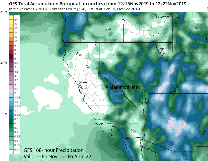
The end result should be mostly light snowfall at times starting on early Wednesday and possibly peaking overnight into Thursday. It doesn’t look significant, but models are suggesting up to half an inch liquid (image below) for possibly a solid few inches or slightly more.
The system is expected to move eastward Thursday with weak high pressure building back into the area over the following weekend (image below). That should bring back warmer temperatures with snow-making likely confined to nights and early mornings.
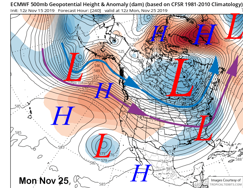
This pattern is expected to last into the following week (image below) with just a chance for a storm toward the end of the month.
These very dry starts are usually not a great sign for a big season, but there was no snow to start 1995 until the second week of December and it ended up near average at around 320”. And 78-79 ended up with nearly 450”. Keep hope alive. WG