Powder Forecast – Tuesday November 19th, 2019
Ted Schlaepfer CCM —- Mammoth Mountain WeatherGuy
Snowfall forecasts are valid at the Sesame snow course (Main Lodge) for the prior 24 hours as reported in the 6-7 AM morning snow report.
**Snowfall forecast confidence ranges from very low (1) to very high (5)
Wed 11/20 = ~1” **3
Thu 11/21 = 3 – 4” **3
Fri 11/22 = 0”
Sat 11/23 = 0”
Sun 11/24 = 0”
Mon 11/25 = 0”
Tue 11/26 = 0”
Wed – Fri 11/27 – 29 = 3 – 12”
November Snowfall = 0”
November Forecast = 15 – 25”
Detailed 4-day Snowfall Forecast:
Wed 11/20 —Light to moderate snow showers during the day and into the evening, ending by dawn Thursday. Accumulations 3-4”, possibly up to 6” up top by Thursday AM.
Thu 11/21 —No snowfall expected except for a chance for a late afternoon flurry.
Fri and Sat 11/22 -23 —No snowfall expected both days
Forecast Summary:
Short Term (Days 1 – 4):
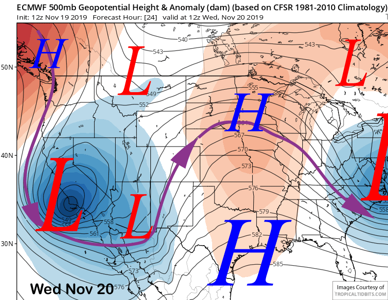
An upper level low pressure system is currently moving southward through CA and will become a cut-off low positioned over the southern Central Coast tomorrow morning (image below). Not only will temperatures get colder for better snow-making today and tomorrow, but there will also be some snowfall, starting late this afternoon and evening.
The cut-off low is expected to pull in some moisture and wrap-around counterclockwise flow around the upper low will produce moist easterly up-slope flow on the eastern side of the Sierra in addition to the likely formation of a deformation zone over the Great Basin by early tomorrow.
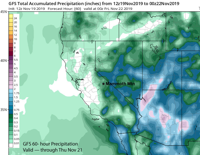
The end result should be mostly light snowfall at times through tomorrow. It doesn’t look significant, but models are suggesting around a quarter/third inch liquid (GFS image below) for possibly a few inches or slightly more up top.
Long Range (Days 5+):
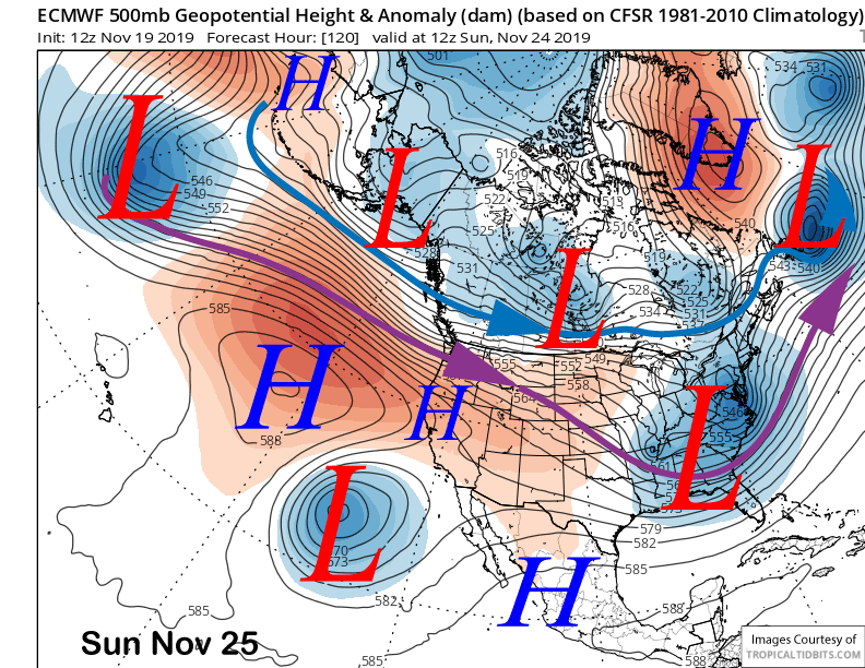
The system is expected to move eastward Thursday with weak high pressure building back into the area over the following weekend (image below). That should bring back warmer temperatures with snowmaking likely confined to nights and early mornings.
Another upper level low will move east of the Sierra around Monday next week (image below). That will be a more typical inside slider type storm and will mostly produce north winds, although temps will get colder again for better snow-making.
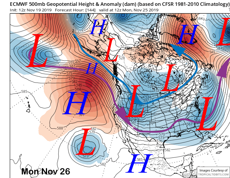
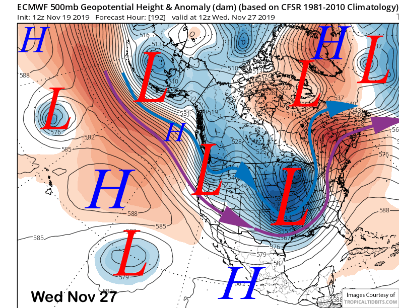
Models then diverge on solutions for the middle part of next week. The ECM (image below) moves an upper level low southward again, this time slightly farther west and not the typical inside slider trajectory. It does produce some snowfall, but only light or a couple inches.
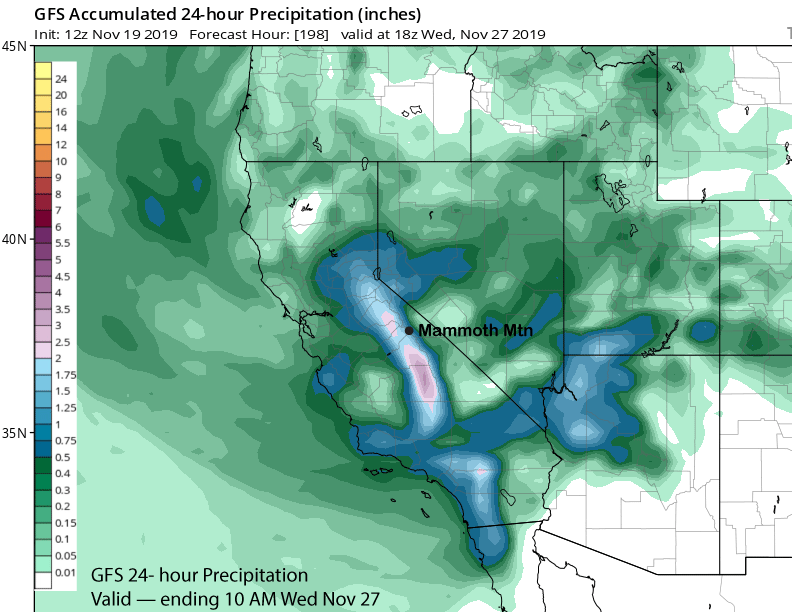
On the other hand, the GFS (image below) and Canadian (two images below) models move the upper level trough southward into CA from a father west and over the ocean trajectory. That would pull in needed moisture along with better orographic enhancement.
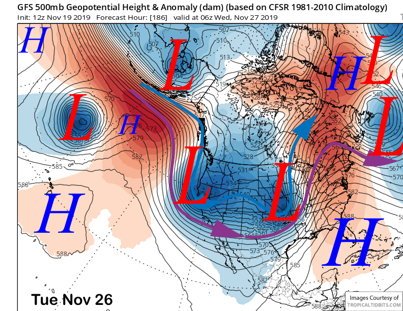
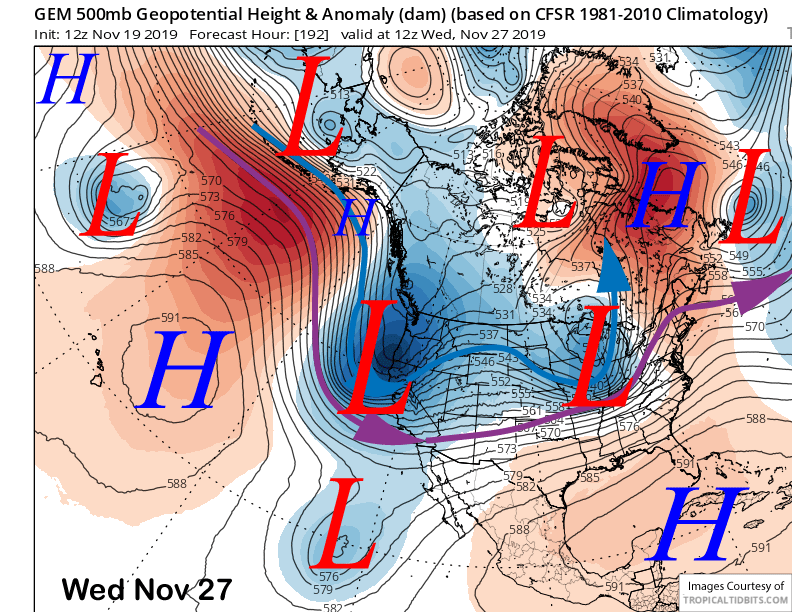
Both those models are showing good dumpage with the GFS (image below) showing over 1.5” for a solid foot and the Canadian having slightly more. Unfortunately, most of the GFS ensembles (two images below) are showing a ridge including the ensemble mean with only few showing a trough/storm. Thus, confidence is low in the wet solutions right now.
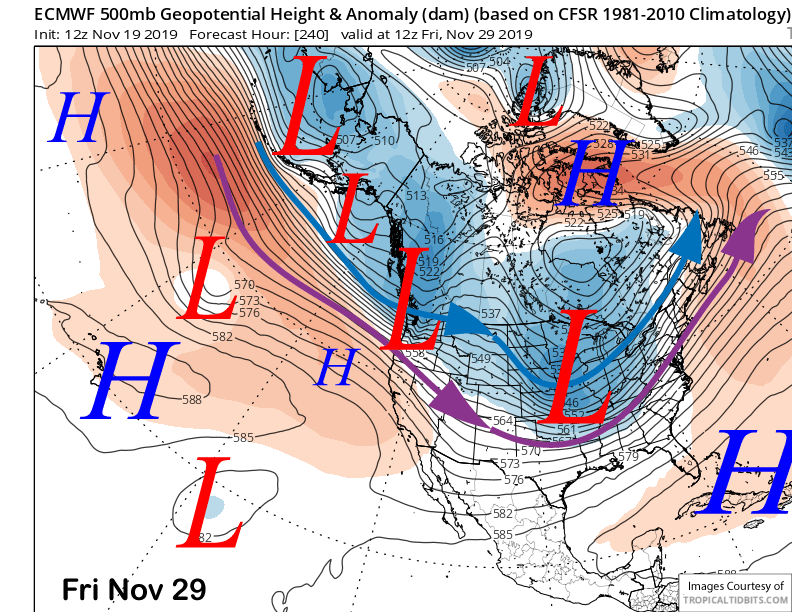
The ECM model then has the storm track north of California (image below) to end the month for continued dry weather. The GFS moves another storm into CA around the first part of December. The differences possibly lie in the MJO forecast with the ECM not as progressive into phase 2 or 3 in the 6-10 day period. The models don’t handle the MJO well beyond a week. WG