Ted Schlaepfer CCM —- Mammoth Mountain WeatherGuy
Snowfall forecasts are valid at the Sesame snow course (Main Lodge) for the prior 24 hours as reported in the 6-7 AM morning snow report.
Sat 11/23 = 0”
Sun 11/24 = 0”
Mon 11/25 = 0”
Tue 11/26 = 0”
Wed 11/27 = 9 – 15”
Thu 11/28 = 12 – 20”
Fri 11/29 = 9 – 15”
Sat – Mon 11/30 – 12/2 = 6 – 12”
November Snowfall = 2”
November Forecast = 30 – 50”
Detailed 4-day Snowfall Forecast:
Sat through Monday 11/23 -25 —No snowfall expected all days
Tue 11/26 —Snow likely develops during the afternoon and becomes heavy overnight into Wednesday. Accumulations 9 – 15” by Wed AM with 15”+ up top
Forecast Summary:
Short Term (Days 1 – 4):
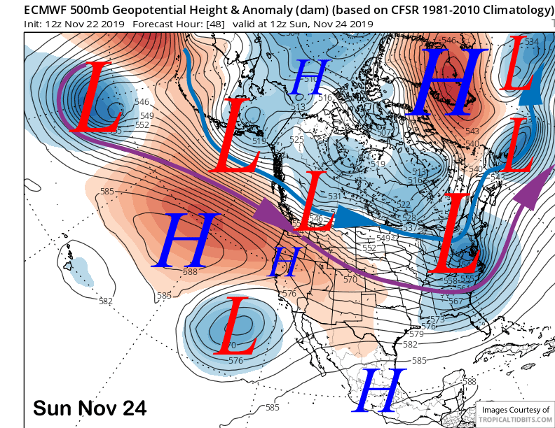
High pressure will build over Mammoth this weekend and is expected to peak in strength Sunday (image below) for fair weather and warmer temperatures again. A weather system will slide east of Mammoth Monday for colder weather and gusty northwest winds, otherwise it will remain dry into next Tuesday with increasing snowfall chances by the afternoon and especially Tuesday night.
Long Range (Days 5+):
A significant and favorable pattern change is then forecast for the middle part of next week that will result in significant snowfall. The models (ECM below) moves a short wave down the West Coast that develops into a very deep and near stationary cold upper-level low-pressure system just off the California coast.
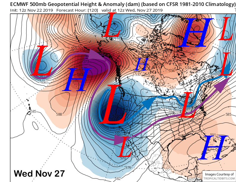
The initial cold front is expected to move through Mammoth overnight Tuesday and Wednesday morning for a round of heavy snowfall before post-frontal showers continue during the day as cold moist air funnels inland off the Pacific.
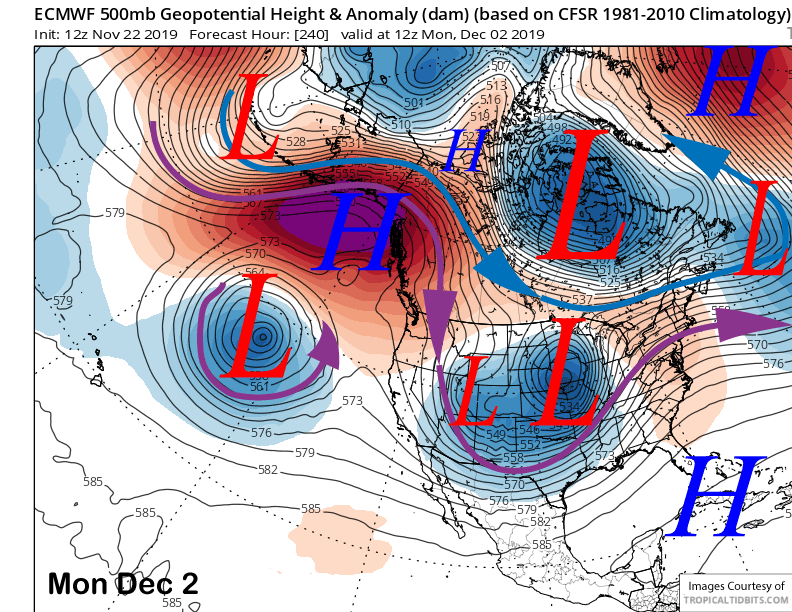
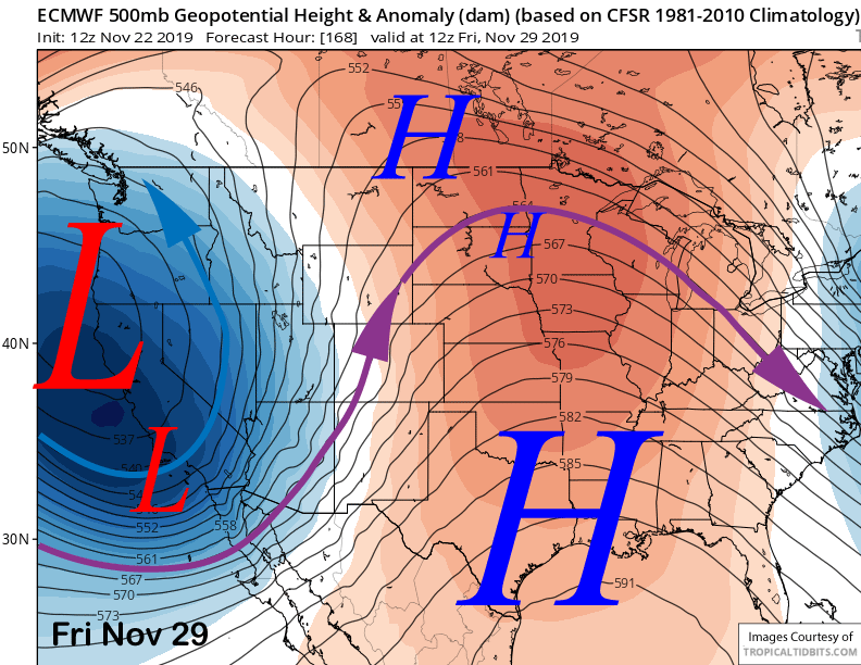
The ECM model (image below) keeps the upper low basically stationary through Thanksgiving and into Black Friday before finally moving it eastward on Saturday. That would result in continued moist and cold up-slope southwest flow into Mammoth and nearly continuous snowfall over the period.
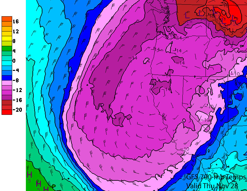
The storm will be cold with 700-mb or 10K elevation temperatures (image below) around -12C by Thanksgiving that translates into a 2500-3000 foot snow level and there could be snow in the upper end of the Owens Valley as well, especially Bishop. Good chance the Grapevine and Cajon pass close on Wednesday night or early Thursday due to snow as snow levels in SoCal will get down to near 3500 feet on Thanksgiving as that part of the state will take the brunt of the storm (3-5 feet or more in the SoCal mountains).
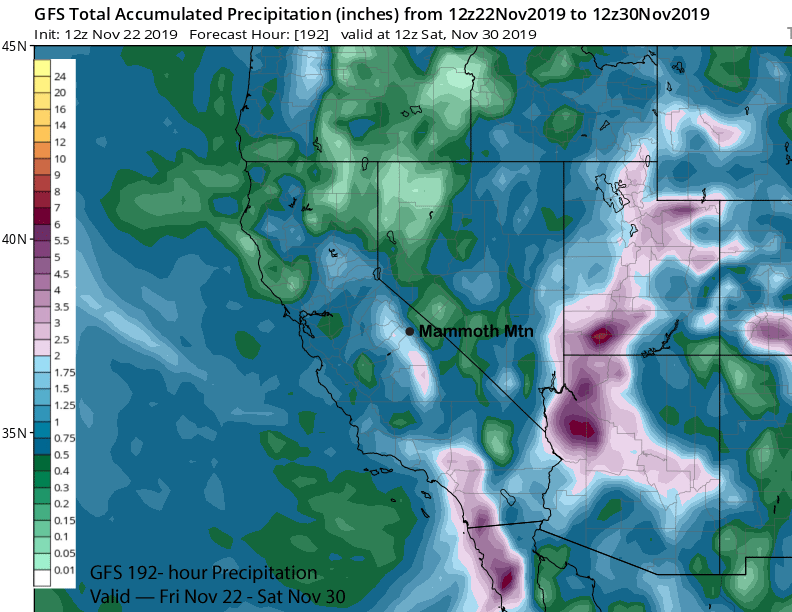
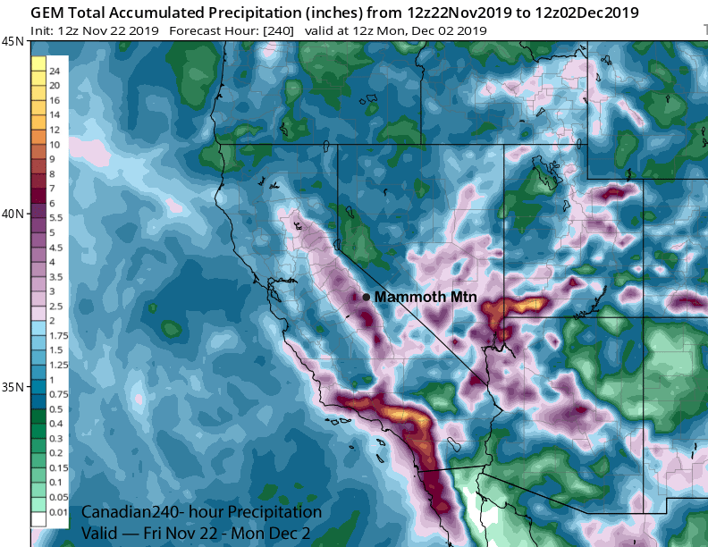
So that also means this is not base now, but the cold dry powder that is preferred after we have a nice base. Regardless, there will likely be lots of it. The GFS model is the driest model (image below) with just under 2 inches liquid while the Canadian is closer to the ECM model with over 3 inches of liquid for the event (two images below).
With the very cold air, snow ratios will be at least 15”:1” or higher for most of the event and that could mean three feet of snowfall or more at Main before it is over. The lower part of the mountain will also see big amounts and likely two feet plus.
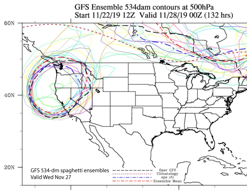
Confidence is high for the pattern change as the spaghetti ensembles are pretty much lined up (image below) showing a deep closed upper low centered just off CA.
Models are saying the closed low will move eastward by Sunday and Monday (image below) and high pressure will build into the state for a few days for a return to fair and dry weather.