Ted Schlaepfer CCM —- Mammoth Mountain WeatherGuy
Snowfall forecasts are valid at the Sesame snow course (Main Lodge) for the prior 24 hours as reported in the 6-7 AM morning snow report.
**Snowfall forecast confidence ranges from very low (1) to very high (5)
Wed 12/4 = 0”
Thu 12/5 = 4 – 6” (H20 = 0.40” -0.60”)**4
Fri 12/6 = 0”
Sat 12/7 = 5 – 7” (H20 = 0.50” -0.65”)**3
Sun 12/8 = 11 – 14” (H20 = 1.25” -1.50”)**3
Mon 12/9 = 6 – 8” (H20 = 0.60” -0.75”)**3
Tue 12/10 = 0”
Wed – Fri 1211– 12/13 = 0– 3”
December Snowfall = 19”
December Forecast = 70 – 90”
Detailed 4-day Snowfall Forecast:
Wed 12/3 —Light to moderate snow develops during the early morning and continues into the evening hours. Accumulations 4 – 6” by Thu AM with 6”+ up top
Thu 12/4 —No snowfall expected
Fri 12/5 — No snowfall expected during the day, but windy. Snow starts after midnight with moderate/heavy snowfall by dawn Saturday. Accumulations 5– 7” by Sat AM with up to 10” up top
Sat 12/6 — Moderate to heavy snowfall during the morning with moderate snowfall continuing overnight into Sunday. Accumulations 11– 14” by Sun AM with up to 18” up top
Forecast Summary:
Short Term (Days 1 – 4):
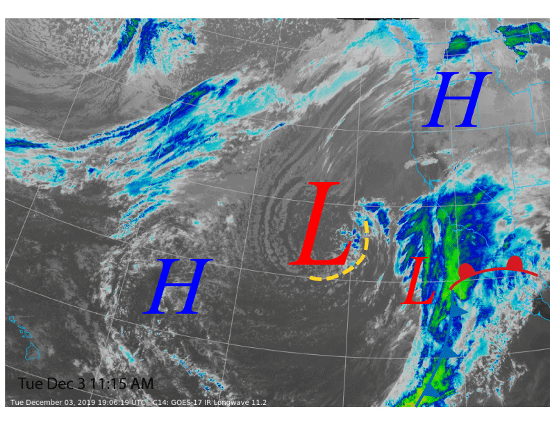
Satellite imagery today (image below) shows a low-pressure system off the California coast pulling in abundant subtropical cloudiness as it slowly moves toward the coast. The low isn’t particularly strong or deep but does have a decent moisture tap.
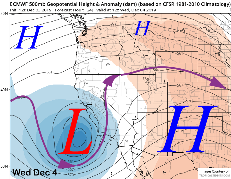
The weather system will move ashore tomorrow into the Central Coast (image below) and snowfall should begin during the early morning hours. Since it is a closed low, there won’t be good orographic enhancement of the moisture plume (S/SE winds as opposed to SW winds aloft) and the dynamics associated with the upper low will produce the generally light to moderate snowfall.
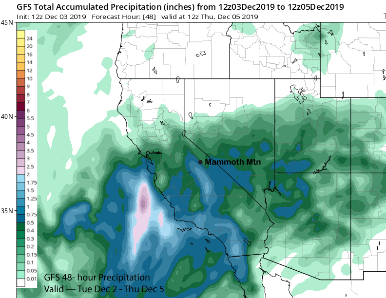
GFS model is showing just over half an inch liquid (image below) while the ECM has slightly less. Looks like about 4-6” accumulation by the evening when the snowfall stops is a good bet at Main with most of the snow falling during the late morning. There will be some fun turns to be had tomorrow afternoon.
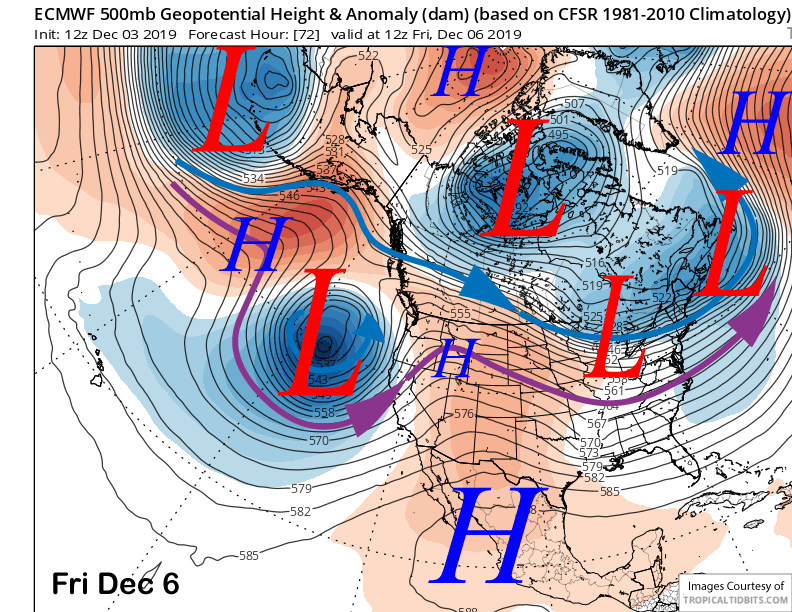
The system exits eastward by early Thursday for a dry day with the next storm approaching the coast by Friday (image below). It should remain dry during operations Friday with just gusty winds before the cold front moves into Mammoth by early Saturday.
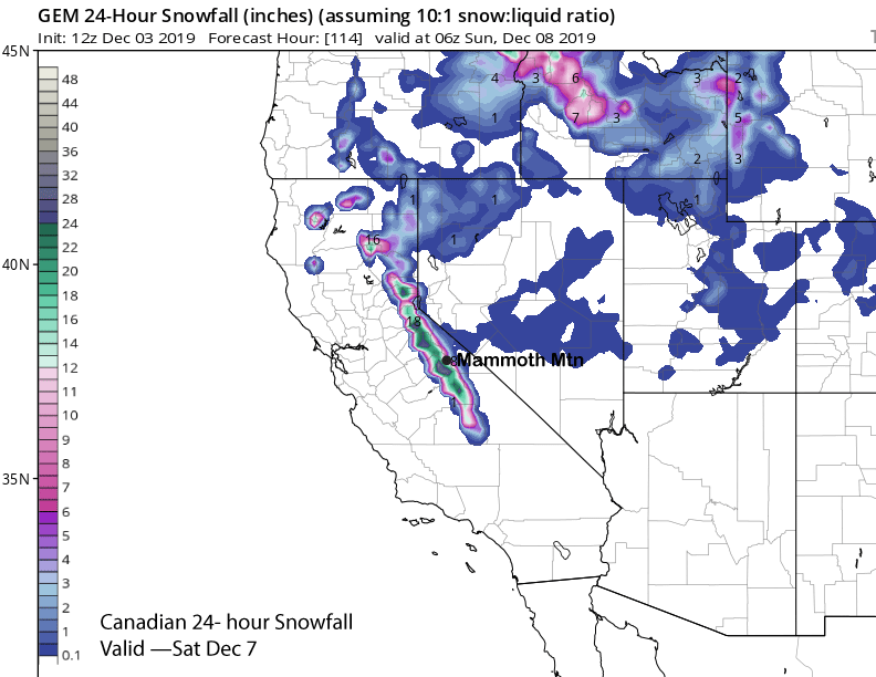
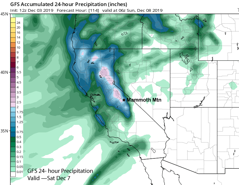
Numerical guidance is favoring most of the snowfall to occur on Saturday and Saturday night with a solid foot likely at Main by midday Saturday. The Canadian model is showing about 20” (image below) of total snow accumulation for the day and the GFS model concurs with about 2” liquid (two images below). ECM model is showing similar amounts.
Long Range (Days 5+):
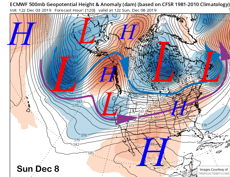
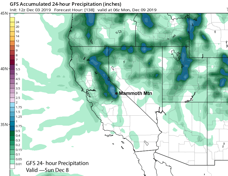
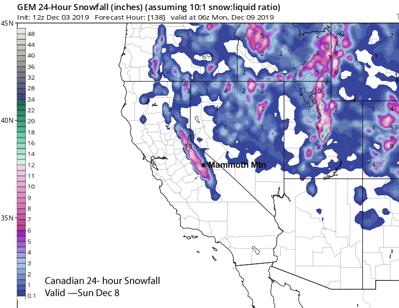
The storm will move slowly through the state through Sunday (image below) before finally moving eastward. That means snowfall will continue through Sunday and into Sunday night before ending early Monday.
Models are showing about another inch of liquid (image below) and about another 9-12” of snowfall (two images below) Sunday. Snow levels will drop to near 5500 feet by Sunday after starting out near 7000 feet Saturday. The Sierra cement should then get a bit drier in quality, but certainly nothing fluffy. This is base type snow and about two feet total should fall at Main and hopefully close to three feet up top.
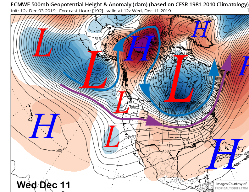
Dry weather should return early next week followed by just a chance for light snow showers from a splitting trough that is expected to move through the area around Wednesday (image below). Dry weather is then favored for the rest of next week and into the following weekend as storminess tapers off. The next chance would be around the 15th and again the 17th. WG