Powder Forecast – Friday, December 13th, 2019
Ted Schlaepfer CCM —- Mammoth Mountain WeatherGuy
Snowfall forecasts are valid at the Sesame snow course (Main Lodge) for the prior 24 hours as reported in the 6-7 AM morning snow report.
**Snowfall forecast confidence ranges from very low (1) to very high (5)
Sat 12/14 = 5 – 7” (H20 = 0.70” – 0.90”)**3
Sun 12/15 = 2 – 3” (H20 = 0.15” – 0.25”)**3
Mon 12/16 = 0”
Tue 12/17 = 0”
Wed 12/18 = 0 – 2”
Thu 12/19 = 0 – 2”
Fri 12/20 = 0”
Sat-Mon 12/21– 12/23 = 6 – 15”
December Snowfall = 45”
December Forecast = 70 -90”
Detailed 4-day Snowfall Forecast:
Sat 12/14 —Scattered snow showers during the day, then a period of light snowfall is expected overnight, ending early Sunday. Accumulation 2 – 3” by Sunday AM, 3”+ up top
Sun 12/15 through Tuesday 12/17 —No snowfall expected all days until possibly overnight Tuesday.
Forecast Summary:
Short Term (Days 1 – 4):
Satellite imagery today (image below) shows a nice subtropical plume of moisture moving into NorCal associated with a low-pressure system and front. That boundary is expected to move southward later today and tonight to increase the snowfall in Mammoth. Snow will continue into early Saturday before tapering off during the morning hours.
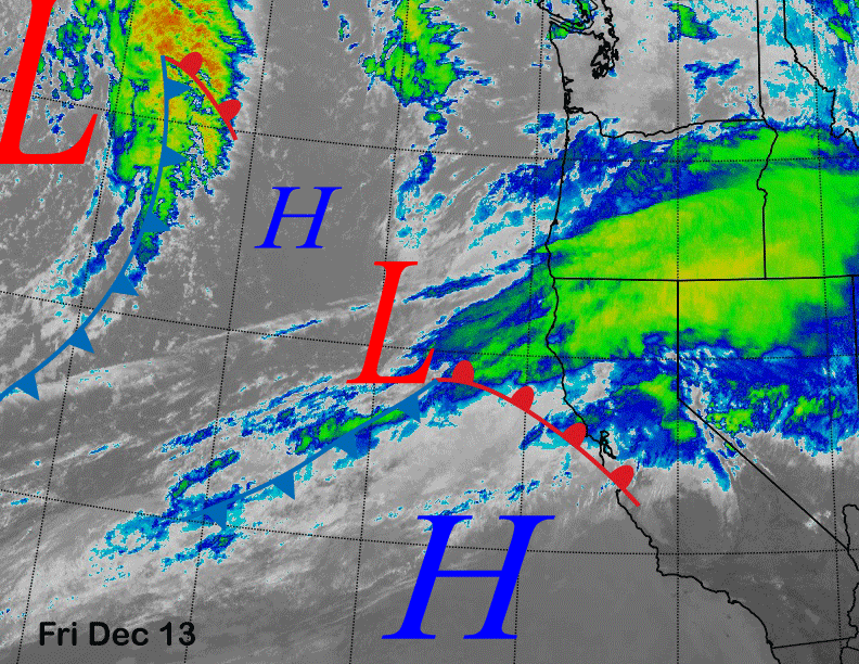
There could be scattered snow showers during the day Saturday, then the system well off the coast on the satellite image will move through the Sierra late Saturday before exiting eastward by early Sunday (image below) for one last round of light snowfall.
The quantitative precipitation forecast (QPF) from the numerical guidance is favoring at least half an inch of liquid with the Canadian the wettest at over an inch (image below). The GFS (two images below) and ECM are showing around 0.75” or slightly more for the event.
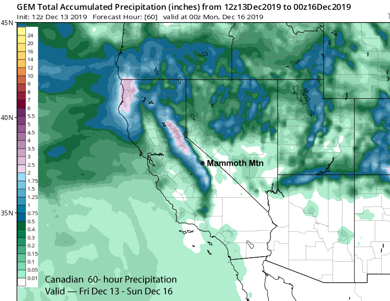
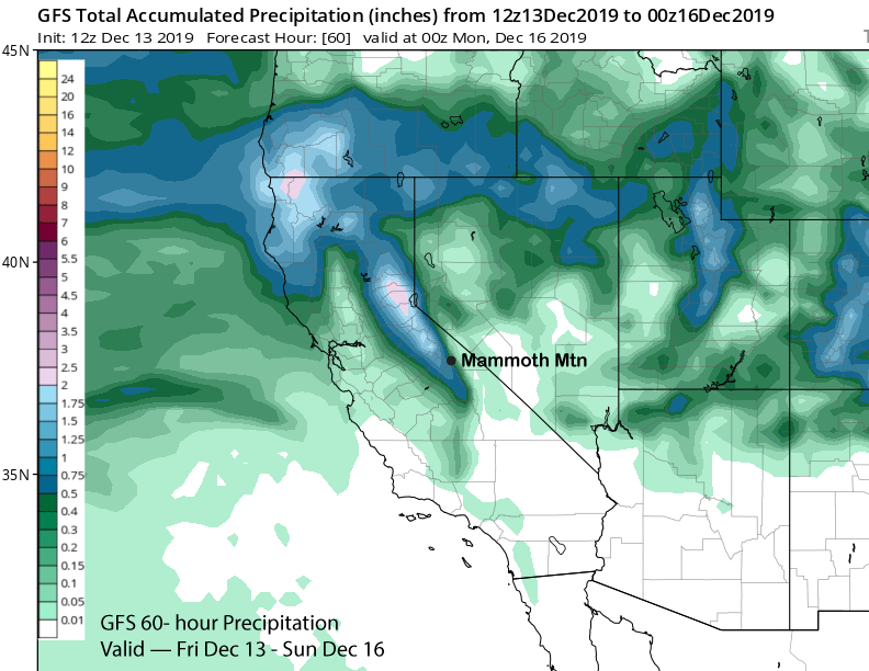
Snow levels will be rather high during the bulk of the precipitation and around 7-8000 feet before lowering Saturday morning to around 6000 feet. That means it will be Sierra cement type base snow for the first round of snowfall tonight with snow levels falling to near or below 4000 feet for the last round of light snowfall early Sunday when a drier layer of snowfall may occur. Overall, it looks like around 6” of snow for Main and 9-12” up top.
High pressure will then build into California Sunday and through early next week for a few days or longer of dry weather. Temperatures will remain seasonably cold and the snow quality should be good with just some increasing clouds Tuesday and maybe some SW winds during the afternoon for wind buff up top.
Long Range (Days 5+):
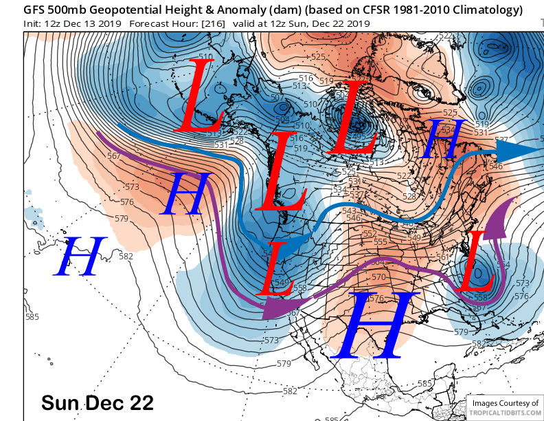
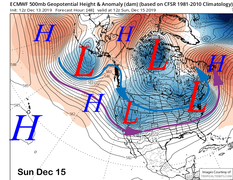
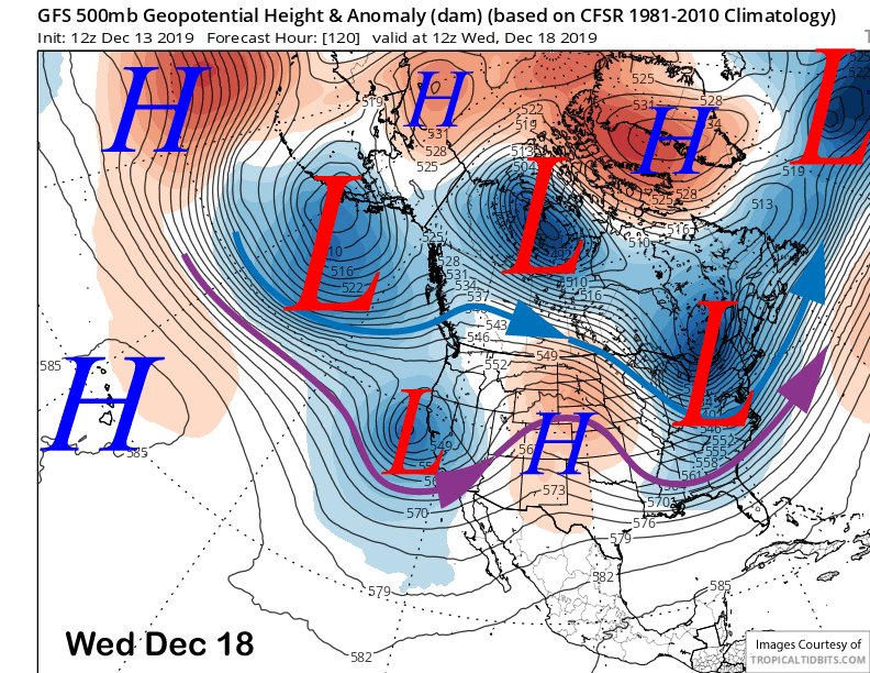
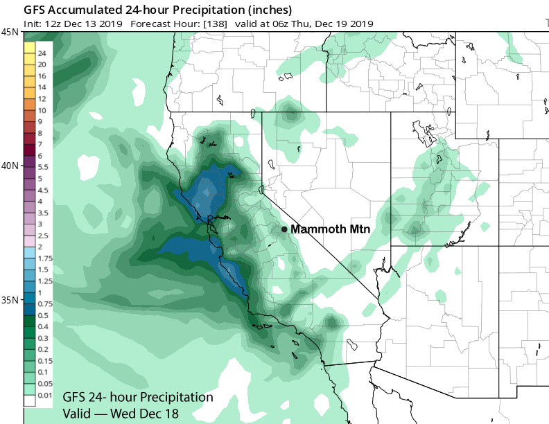
The models for the middle and end part of next week have now become in better agreement for the most part, although it is still a low confidence forecast. The GFS model has been the most consistent in moving a cut-off upper-level low-pressure system to the coast around mid-week (image below).
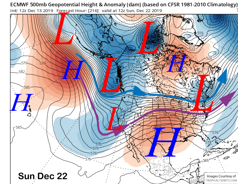
The ECM (image below) has now trended toward the GFS solution after bouncing around with several different solutions over the last few days. Both models wash the system out upon landfall with the Canadian model washing it out before landfall.
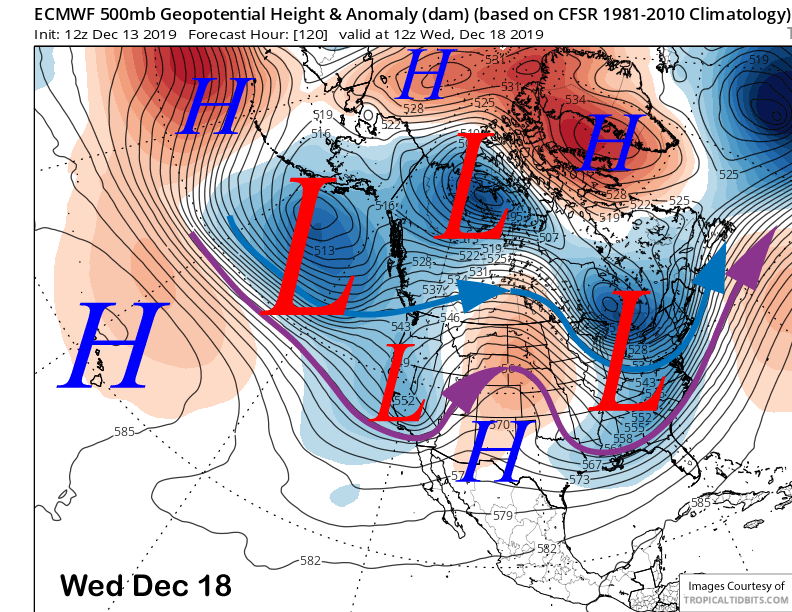
GFS model (image below) keeps most of the precipitation near the coast with only minor amounts in the Sierra. The latest ECM model is showing a very similar output with less than a quarter-inch of liquid. The Canadian model is completely dry.
So it looks like there is a chance for light snowfall around Wednesday with current guidance suggesting anything that falls won’t add up to be enough for powder conditions with just an inch or two of snowfall and also a chance for nothing. It is still 5-6 days out, but I am not expecting a big storm or anything over 6” snowfall at this time. Regardless, the increased SW winds will allow for wind buff conditions to form.
There is a better chance for more significant snowfall over the following weekend and into early the next week. The GFS model is the deepest (image below) while the latest ECM model (two images below) weakens the system considerably just before landfall. The former would produce almost a couple feet while the latter would be under a foot. The current forecast splits the difference. The next chance would be around Christmas Eve or Christmas Day. WG