Powder Forecast – Tuesday December 17th, 2019
Ted Schlaepfer CCM —- Mammoth Mountain WeatherGuy
Snowfall forecasts are valid at the Sesame snow course (Main Lodge) for the prior 24 hours as reported in the 6-7 AM morning snow report.
**Snowfall forecast confidence ranges from very low (1) to very high (5)
Wed 12/18 = 0 – 1”
Thu 12/19 = 0 – 1”
Fri 12/20 = 0”
Sat 12/21 = 0”
Sun 12/22 = 0”
Mon 12/23 = 6 – 9”
Tue 12/24 = 2 – 4 ”
Wed – Fri 12/25– 12/27 = 6 – 12”
December Snowfall = 51”
December Forecast = 70 -90”
Detailed 4-day Snowfall Forecast:
Wed 12/18 —Scattered light snow showers or flurries during the day, ending at night. Cold and windy. Accumulation 0 – 1” by Thursday AM
Thu 12/19 through Saturday 12/21 —No snowfall expected all days.
Forecast Summary:
Short Term (Days 1 – 4):
Satellite imagery this afternoon (image below) shows a low-pressure system off the NorCal coast and another low-pressure system breaking off from the parent low west off the Central Coast. That weather system will continue to split as it moves onshore tonight and tomorrow with most of the remnant energy/dynamics with the surface low moving northward along the CA coast and missing the Sierra.
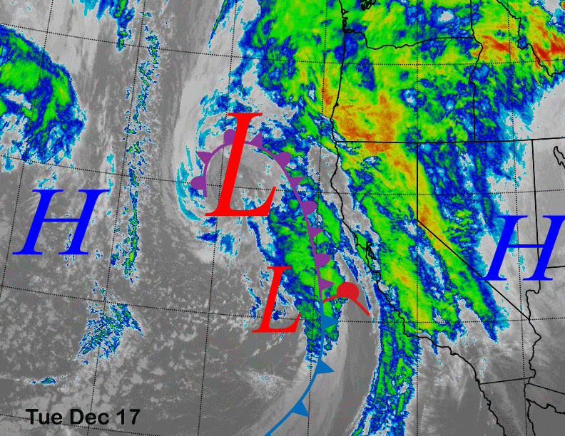
Nonetheless, flurries or light snow showers are possible starting early tomorrow morning and continuing during the day before the chance ends tomorrow night. Not expecting more than a trace or inch accumulation. It will be also colder and breezy/windy with teens to low 20s expected on the mountain. The SW winds could lead to wind buff in the normal favored locations.
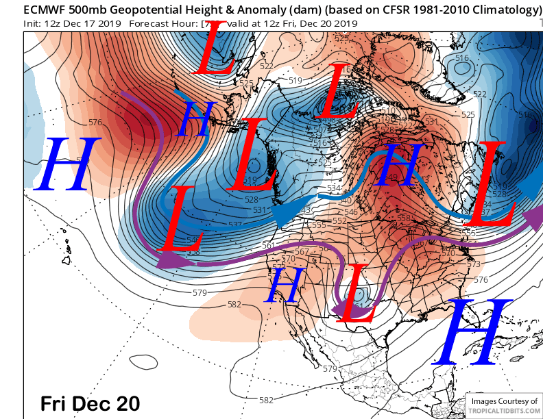
High pressure (image below) will then build into central California Thursday through Saturday for a few days of fair weather as a trough moves into the eastern Pacific. Southwest winds should increase Saturday out ahead of the next system for Sunday and those winds could produce wind buff conditions up top.
Long Range (Days 5+):
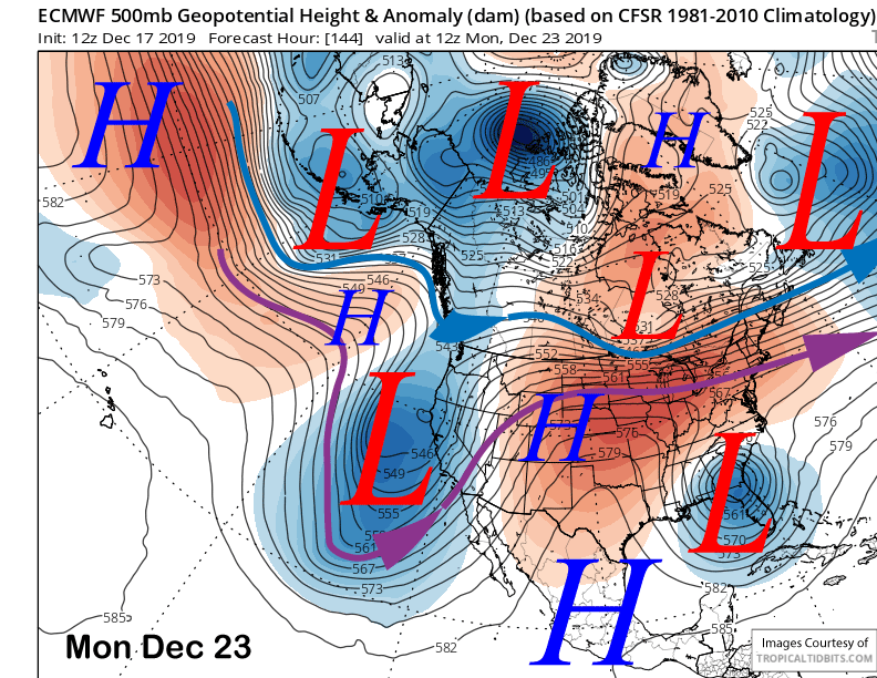
The ECM model then moves a weakened trough into central CA on Sunday and into early Monday (image below). That should result in a round of snowfall that should last at times into Monday. Current guidance is saying around an inch of liquid or slightly less for at least six inches of snowfall and possibly up to a foot by Monday AM.
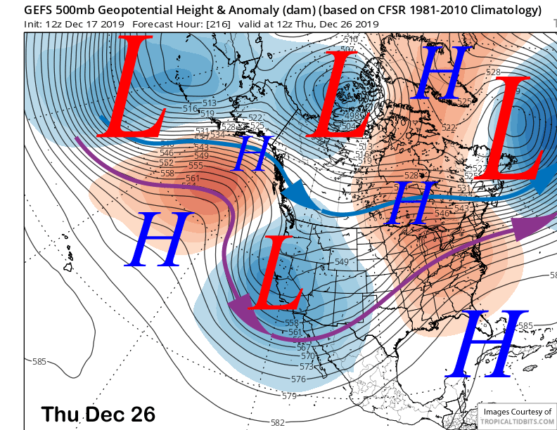
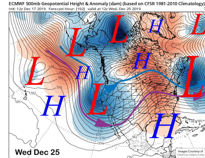
Another trough is forecast to quickly move into the Sierra and Mammoth on Christmas Day (image below) for another round of snowfall—maybe a foot. That system looks colder and may produce some nice powder if it verifies. What a nice X-mas present that would be.
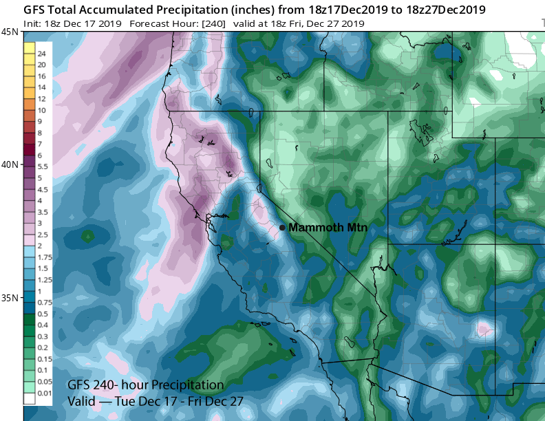
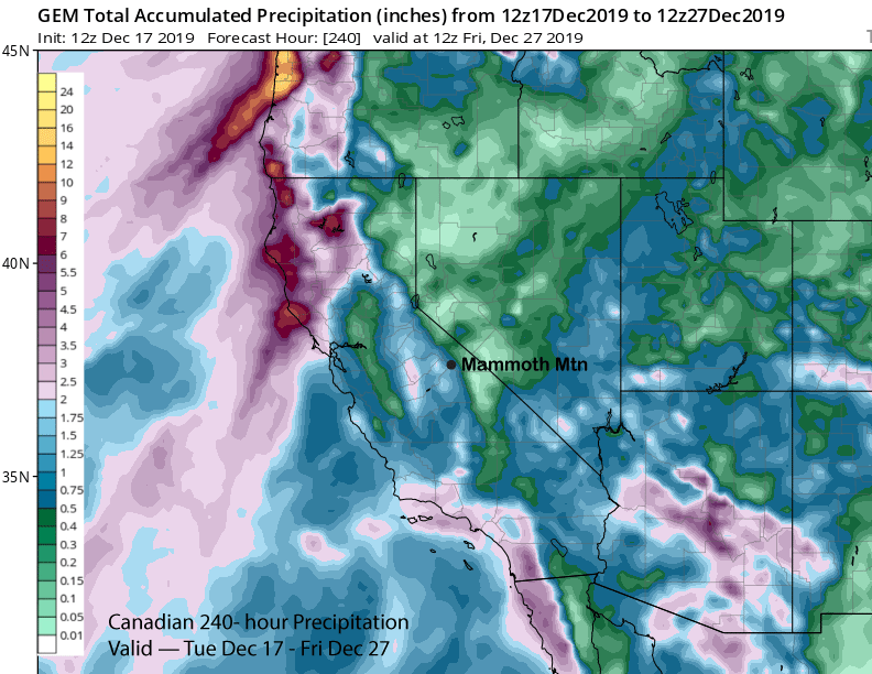
Total QPF from the models is around 1.50” -2.25” for the 10 day period. The GFS is the wettest (image below) while the Canadian is the driest (two images below). The ECM operational model is around 1.5” liquid as is the ensemble mean. So it doesn’t look like a big storm series.
The longer-range GFS ensemble mean (image below) keeps the trough in place into the end of next week that may keep snow showers ongoing at times along with colder temperatures. Dry weather could return over the following weekend. The next chance would then be around Dec 29-30th. WG