Powder Forecast – Friday, December 20th, 2019
Ted Schlaepfer CCM —- Mammoth Mountain WeatherGuy
Snowfall forecasts are valid at the Sesame snow course (Main Lodge) for the prior 24 hours as reported in the 6-7 AM morning snow report.
**Snowfall forecast confidence ranges from very low (1) to very high (5)
Sat 12/21 = 0”
Sun 12/22 = 0”
Mon 12/23 = 8 – 10” (H20 = 0.85” – 1.00”)**3
Tue 12/24 = 1 – 2 ”
Wed 12/25 = 0 – 1 ”
Thu 12/26 = 4 – 8”
Fri 12/27 = 4 – 8”
Sat – Mon 12/28– 12/30 = 3 – 9”
December Snowfall = 51”
December Forecast = 70 -80”
Detailed 4-day Snowfall Forecast:
Saturday 12/21 —No snowfall expected.
Sun 12/22 —Dry during the morning, then snow starts about late morning or midday and continues into Sunday night before ending overnight. Accumulation 8 – 10” by Monday AM and ~12”+ up top
Mon 12/23 —A few flurries are possible during the morning with snow showers more likely during the afternoon and evening. Accumulation 1 – 2” by Tuesday AM
Tuesday 12/24 —No snowfall expected except for a chance for PM flurries.
Forecast Summary:
Short Term (Days 1 – 4):
Short report today due to time limitations.
After a dry day Saturday, the models move a weakened trough into the central Sierra on Sunday and into early Monday (image below). That will result in a round of brief and heavy snowfall that should end overnight with most of the snowfall Sunday afternoon and evening.
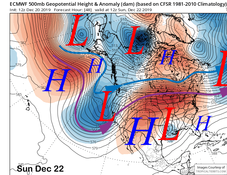
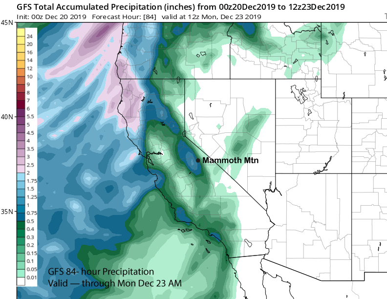
The latest guidance is saying at least 0.75” liquid with the GFS slightly more (image below) and the ECM similar at around 1” Looks like a solid eight inches at Main and possibly more than a foot up top. The snow will be on the light side for CA and should be nice powder for Monday AM with cold temperatures upper single digits to teens.
Snow flurries could continue during the morning Monday with snow showers more likely during the afternoon and evening resulting in another inch or two. Tuesday looks dry.
Long Range (Days 5+):
The longer-range guidance is showing the next storm for Christmas afternoon and night (image below) following by another round of snowfall around Thursday afternoon and into next Friday.
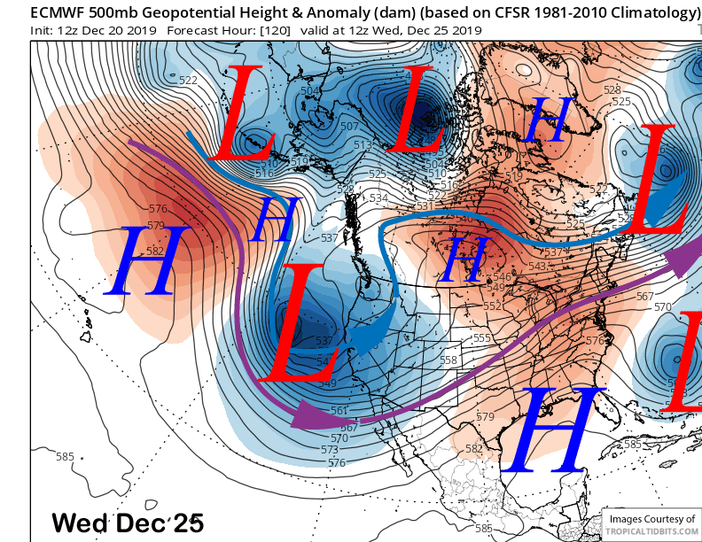
These will be cold storms with limited moisture, but likely really nice powder. Good thing there is a decent base, although there are still plenty of exposed rocks and trees. Details are still sketchy, but another 6-12” of snow is possible at the end of next week.
The next chance for snowfall would be just before the end of the year. WG


