Powder Forecast – Tuesday, December 24th, 2019
Ted Schlaepfer CCM —- Mammoth Mountain WeatherGuy
Snowfall forecasts are valid at the Sesame snow course (Main Lodge) for the prior 24 hours as reported in the 6-7 AM morning snow report.
**Snowfall forecast confidence ranges from very low (1) to very high (5)
Wed 12/25 = 0 – 1”
Thu 12/26 = 1 – 2”
Fri 12/27 = 0 – 1”
Sat 12/28 = 0”
Sun 12/29 = 0”
Mon 12/30 = 1 – 2”
Tue 12/31 = 0”
Wed – Fri 1/1– 1/3 = 0”
December Snowfall = 66”
December Forecast = 66 – 70”
Detailed 4-day Snowfall Forecast:
Wednesday 12/25 — A few flurries are possible during the day with light snow possible overnight and into Thursday morning. Accumulation 1 – 2” by Thursday AM
Thursday 12/26 — A few flurries or light snow showers are possible during the morning, ending PM. Maybe an inch accumulation.
Friday and Saturday 12/27 and 12/28 —No snowfall expected both days.
Forecast Summary:
Short Term (Days 1 – 4):
Satellite imagery this afternoon (below) shows a couple low pressure systems and associated fronts moving eastward toward the CA coast. The first weaker front will move inland overnight and there will be a chance for flurries or light snow showers late tonight and Christmas, but no sustained snowfall.
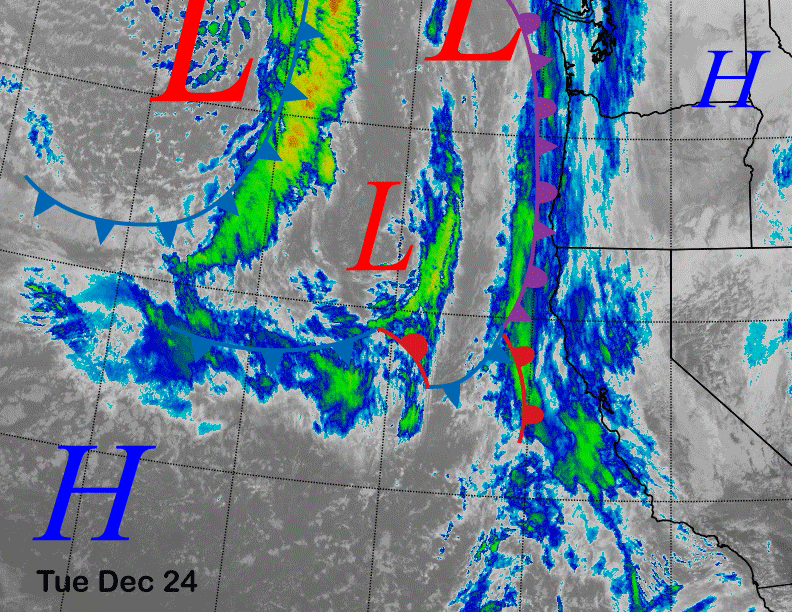
The stronger system farther off the coast will unfortunately take a southern route into SoCal Christmas night and Thursday (image below) where those mountains may get a couple feet of powder with snow down to 3000 feet, possibly lower in the deserts. Good luck trying to get over the SoCal passes Christmas night and Thursday.
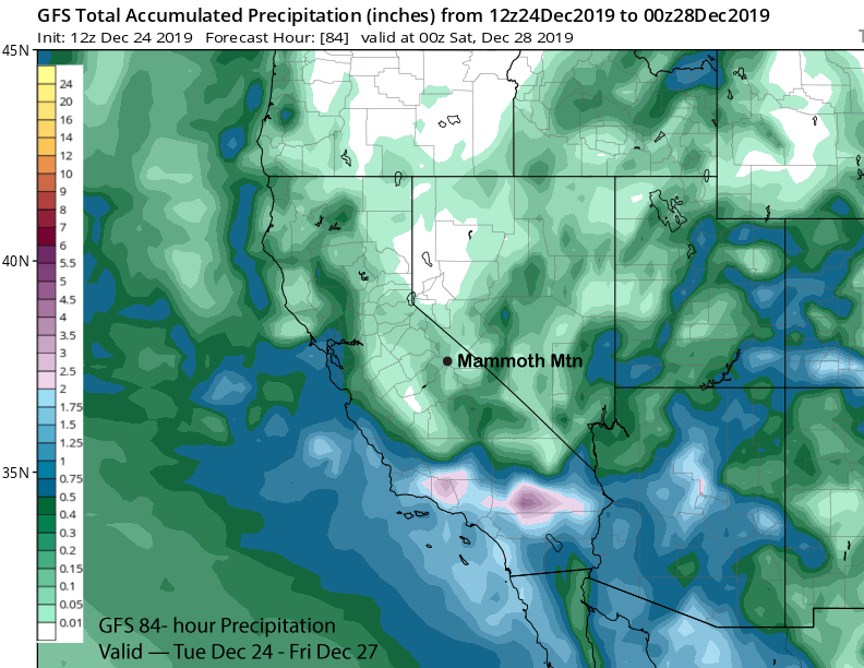
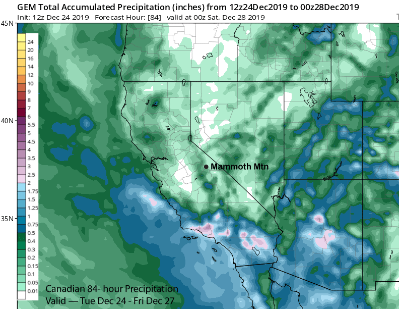
There does look like there will be some wrap-around moisture moving into the eastern Sierra overnight on Christmas and through Thursday morning that could result in an inch or two, but not expecting enough for powder conditions. Model QPF is generally under a quarter inch with the GFS (image below) and Canadian (two images below) showing about a tenth. ECM has about 0.15”.
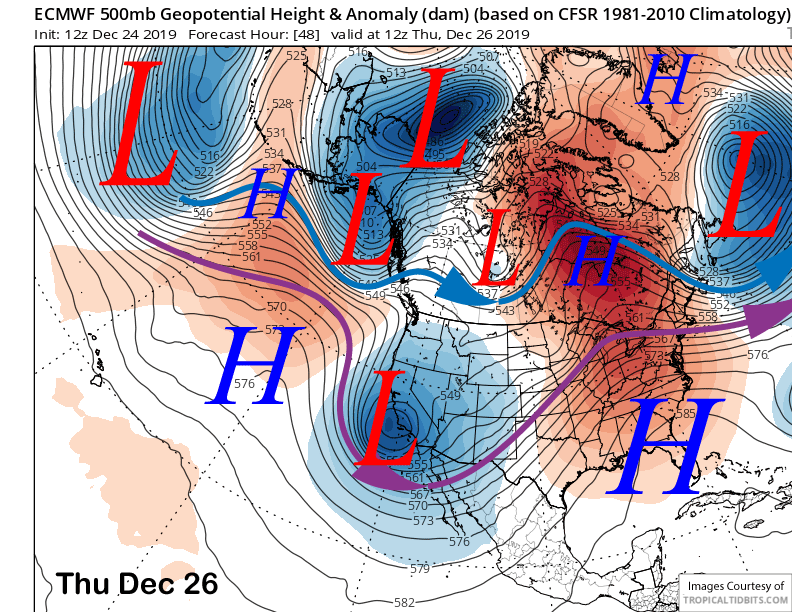
High pressure will then build into Mammoth on Friday and Saturday for fair and dry weather with seasonably cold temperatures Friday and seasonable temps Sunday.
Long Range (Days 5+):
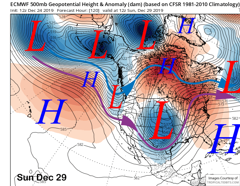
The longer range guidance is mostly dry with just one chance for snowfall on Sunday, although the models are not in agreement. The ECM moves a trough toward the coast early Sunday (image below) and splits it upon landfall with most of the precipitation remaining near the coast. It has an inch or two of snowfall.
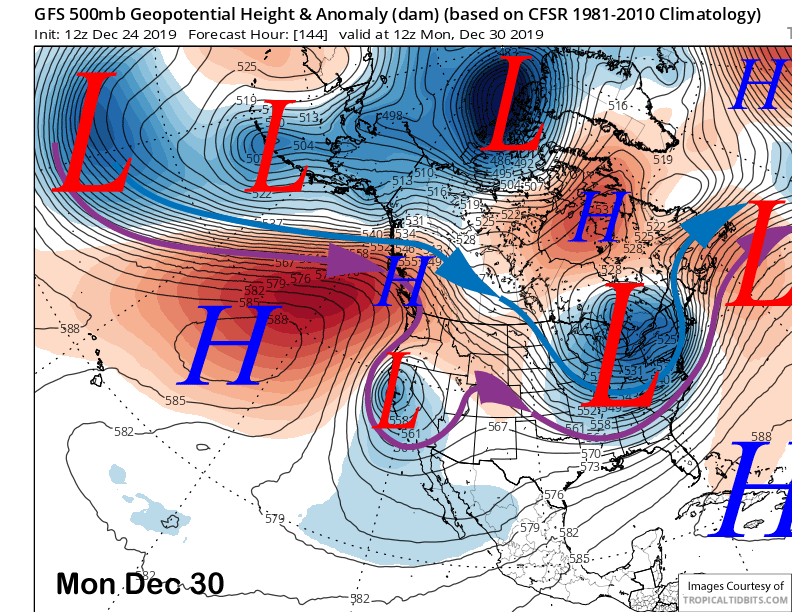
The GFS (image below) also has an upper level low pressure system moving toward the coast, but about a day later and it develops it into a cut-off that drifts down the coast and then westward off the SoCal coast. The Canadian model is similar, but it has a little snowfall while the GFS is dry. Current forecast follows the ECM mean with an inch or two, but likely not enough for powder conditions.
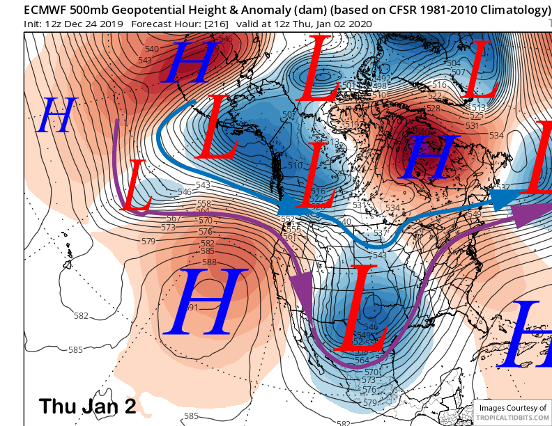
High pressure will then build into the state early next week and should last into the middle part of next week (image below) for fair and dry weather. Next chance for snowfall might not be until the second week of January. WG