Powder Forecast – Friday, December 27th, 2019
Ted Schlaepfer CCM —- Mammoth Mountain WeatherGuy
Snowfall forecasts are valid at the Sesame snow course (Main Lodge) for the prior 24 hours as reported in the 6-7 AM morning snow report.
**Snowfall forecast confidence ranges from very low (1) to very high (5)
Sat 12/28 = 0”
Sun 12/29 = 0”
Mon 12/30 = 2 – 4” (H2O = 0.20” – 0.45”)**2
Tue 12/31 = 1 – 2” (H2O = 0.10” – 0.20”)**2
Wed 1/1 = 0”
Thu 1/2 = 0”
Fri 1/3 = 0”
Sat – Mon 1/4– 1/6 = 3 – 12”
December Snowfall = 70”
December Forecast = 70 – 75”
Detailed 4-day Snowfall Forecast:
Saturday 12/28 —No snowfall expected.
Sunday 12/29 — Dry during operations, then snowfall likely occurs overnight. Accumulation 2 – 4” by Monday AM
Monday 12/30 — Scattered snow showers during the day and into Monday evening, ending overnight. Accumulation 1 – 2” by Tuesday AM
Tuesday 12/31 —No snowfall expected.
Forecast Summary:
Short Term (Days 1 – 4):
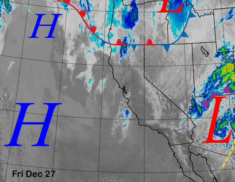
Satellite imagery this afternoon (below) shows that the storm system that produced the heavy rainfall and low elevation snowfall across SoCal yesterday has now moved eastward into Arizona. High pressure off the coast will build into CA over the next couple of days for fair and dry weather and seasonable temps on the hill into the 20s to low 30s Saturday, slightly colder Sunday.
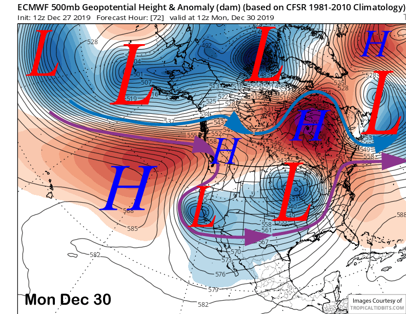
Models are then depicting an upper-level low-pressure system breaking off from the jet stream and moving southward through CA on Sunday and Monday (image below). The latest ECM model solution is slightly farther west with the upper low and keeps most of the precipitation on the west side of the Sierra.
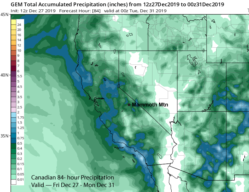
The Canadian model is similar with half-inch liquid amounts in the valley (image below) and only minor amounts in Mammoth. The latest GFS model is farther east with the upper low and has the precipitation band farther east as well and into the E. Sierra with about 0.60” for Mammoth (image below).
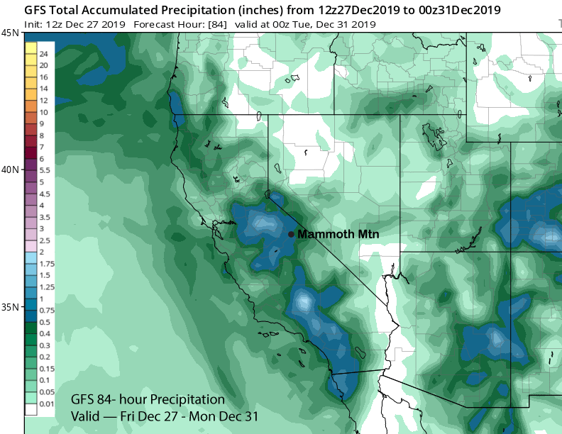
Those amounts also include wrap-around moisture Monday under moist up-slope easterly flow as the upper low moves southward into SoCal. I’d expect snowfall to start Sunday evening/night and taper off by early Monday before increasing again Monday late morning and into the evening before ending overnight into Tuesday. A few inches is the best forecast right now with a chance for up to 6” that would be enough for powder condition. Low confidence overall.
Long Range (Days 5+):
High pressure will then build into CA by mid-week next week (image below) for a return of fair and dry weather. As of yesterday, it was supposed to hold through the end of next week and the following weekend for a longer period of dry weather.
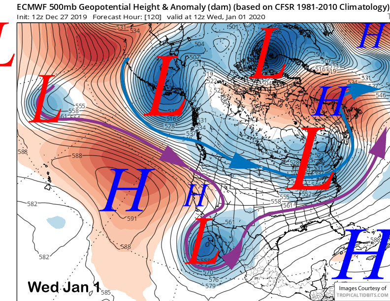
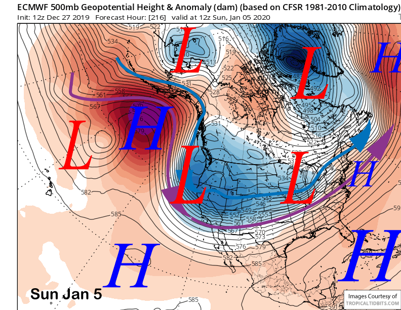
However, the latest guidance has taken a more positive twist with the ECM model now moving a trough southward into CA next Friday (image below) followed by a deeper and colder one over the following weekend (two images below). That would result in substantial snowfall with the second system producing epic cold/dry powder.
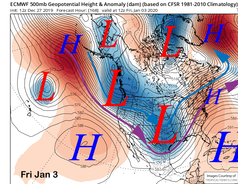
Unfortunately, the other models are not in total agreement with the Canadian closer to the ECM with a weaker trough while the GFS operational model is completely dry and has the long-wave trough farther east into the Great Basin and Intermountain West.
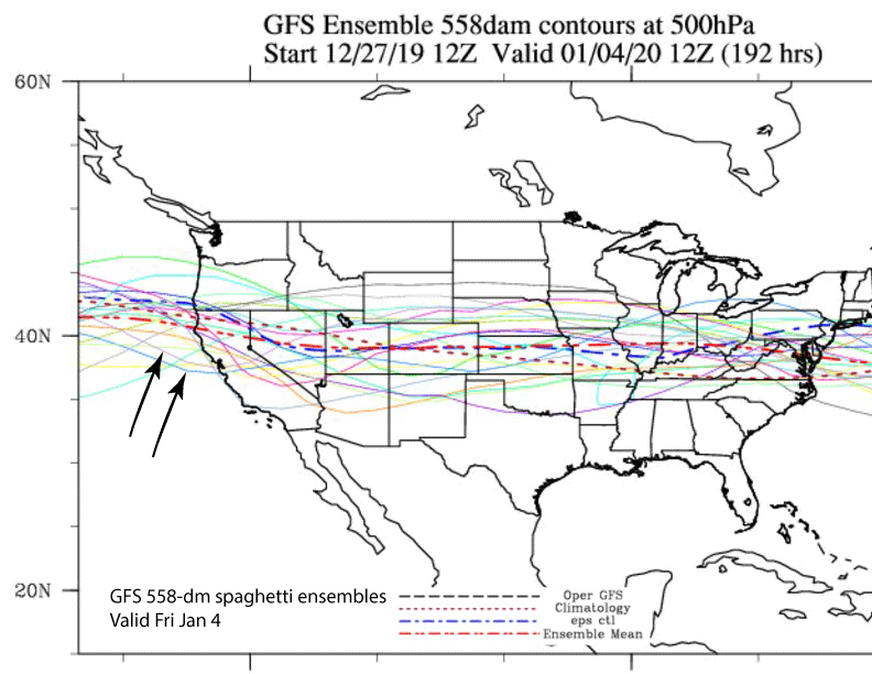
GFS ensembles (image below) mostly keep the jet stream north into Oregon/NorCal, although a couple of ensembles do show something similar to the Canadian and ECM models (black arrows). Most of the ECM ensembles are dry too.
The current forecast follows the ECM mean that is only favoring a few inches of snowfall with consideration given to the wetter operational models as they sometimes trend in the right direction when the overall forecast is uncertain.
The next chance for snowfall would then be over the following week around the 10-11th. WG


