Powder Forecast –Tuesday January 7th, 2020
Ted Schlaepfer CCM —- Mammoth Mountain WeatherGuy
Snowfall forecasts are valid at the Sesame snow course (Main Lodge) for the prior 24 hours as reported in the 6-7 AM morning snow report.
**Snowfall forecast confidence ranges from very low (1) to very high (5)
Wed 1/8 = 0”
Thu 1/9 = 0”
Fri 1/10 = 2 – 3”
Sat 1/11 = 0”
Sun 1/12 = 1 – 2”
Mon 1/13= 0 – 2”
Tue 1/14 = 4– 6”
Wed – Fri 1/15– 1/17 = 9 – 15”
January Snowfall = 0”
January Forecast = 40 – 60″
Detailed 4-day Snowfall Forecast:
Wed 1/8—Flurries or a light snow showers are possible during the early morning hours, then dry during the day. No accumulation expected. Breezy west winds during the afternoon.
Thu 1/9—A period of light to moderate snowfall develops during the morning hours before ending Thursday afternoon. Accumulation 2 – 3”
Fri 1/10—No snowfall expected
Sat 1/11—Light to moderate snowfall develops during the morning hours and continues through the afternoon, possibly evening. Gusty southwest winds. Accumulation 1 – 2”.
Forecast Summary:
Short Term (Days 1 – 4)
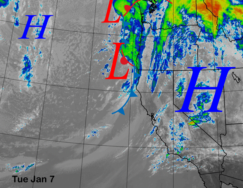
Satellite imagery this afternoon (below) shows another splitting weather system moving onto the North Coast and it will move north of Mammoth overnight and early Wednesday. There could be some flurries or light snow showers during the morning hours tomorrow, otherwise no snowfall is expected from its passage.
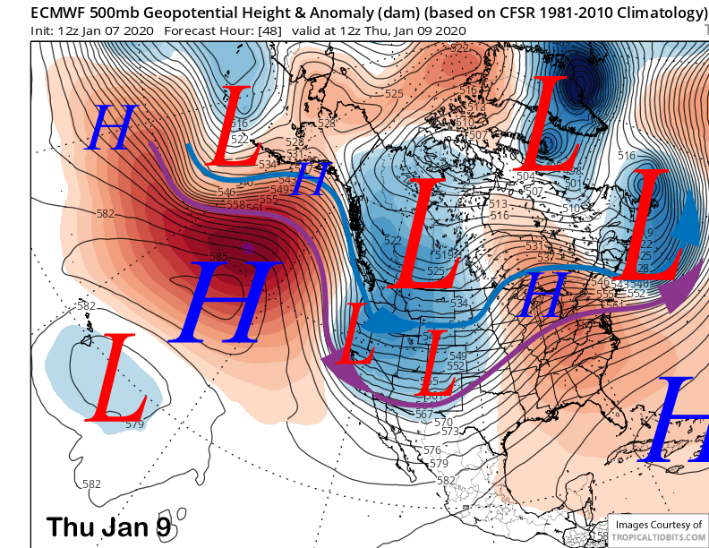
The next weather system will move into CA out of the Gulf of Alaska Thursday (image below) for a period of light to moderate snowfall during the morning hours and into the afternoon, ending by dusk. The forecast is only calling for a few inches and probably not enough for widespread powder conditions, but it is a cold system and the snow will be on the light/dry side.
Another upper level low short wave trough will then move through CA on Saturday (image below) after a dry day Friday. The latest ECM model below is farther eastward with this system now and is only favoring an inch or two of snowfall at best.

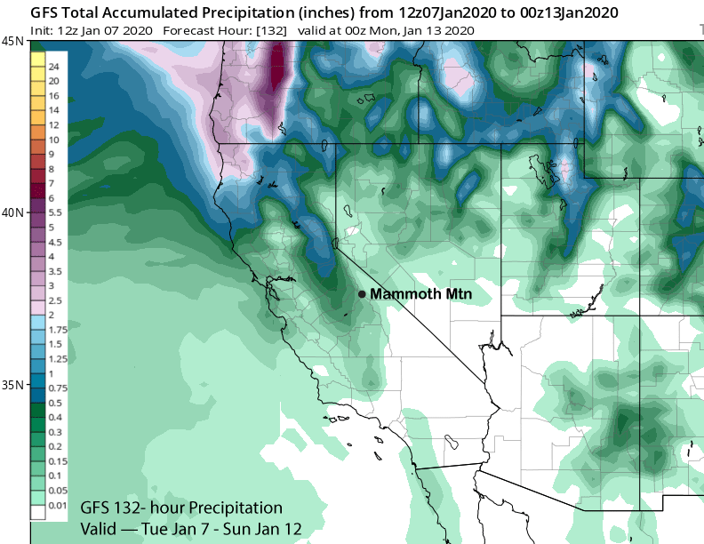
GFS model is similar and that model is not showing much precipitation into Mammoth through Sunday (image below). ECM has some light snow Sunday, but overall, powder conditions are not looking likely this weekend with only light snowfall.
Long Range (Days 5+):
The longer range guidance is favoring better chances for more significant snowfall, although considerable uncertainty exists due to the lack of a consensus solution. The next upper low looks to take a similar track southward from the Gulf of Alaska around next Monday or Tuesday for the next round of snowfall.
The latest ECM run is also farther eastward with this system (image below) and has little over-water trajectory to entrain moisture to produce snowfall. The GFS model is farther westward with this low-pressure system, but not as far west or as deep as the Canadian model (two images below) that has a very deep upper level trough situated into CA.
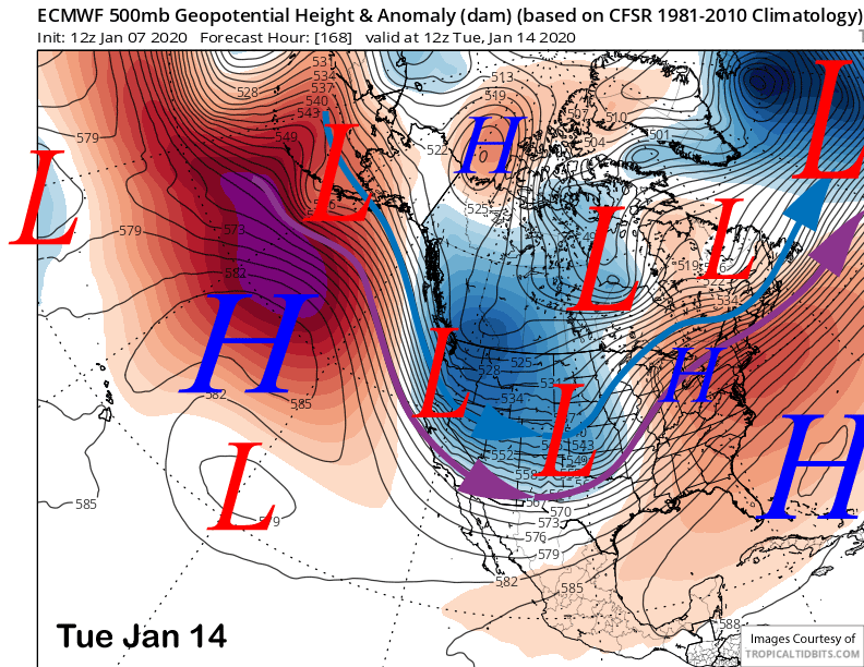
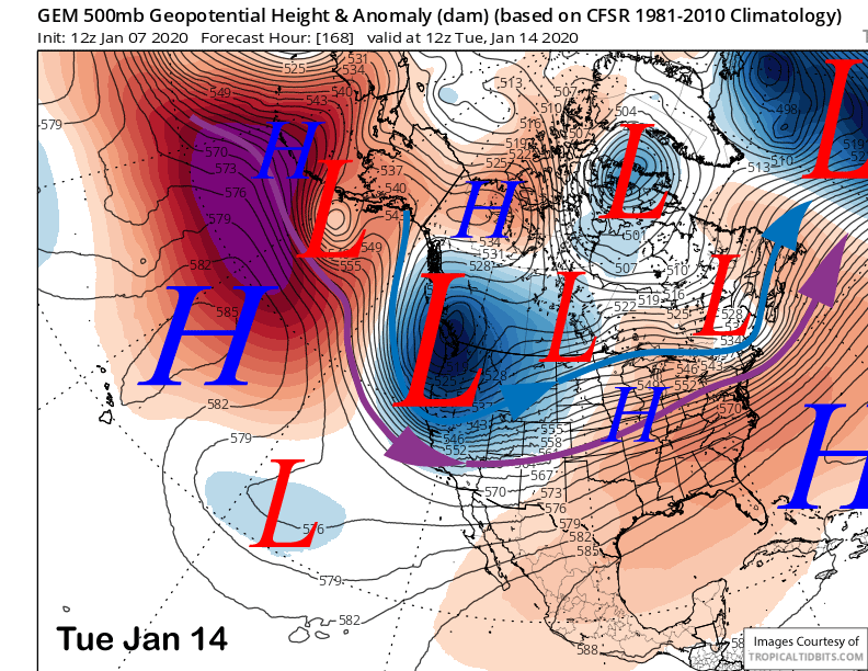
The Canadian solution would result in over a foot of snowfall at Main while the GFS has about 6 inches and the ECM only a few inches. Forecast follows the ECM mean that has around 0.50-0.75” liquid or about 6-10” as it would be a cold storm with high snow to liquid ratios. Most of the snowfall looks to be Monday night and during the day Tuesday.
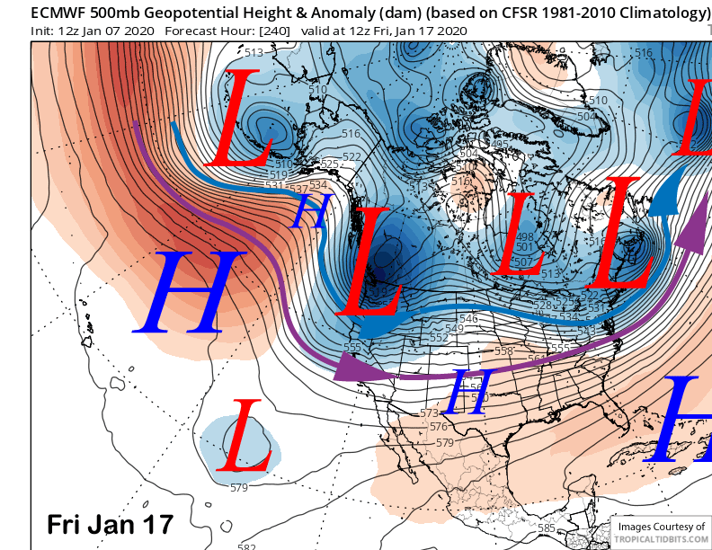
Super long rang guidance is even more mixed. We were expecting a deep upper level trough to develop toward the end of next week and the GFS is still on board (image below). The Canadian also has a deep trough that would result in heavy snowfall, but the latest ECM is much weaker and shows the trough splitting upon landfall (two images below).
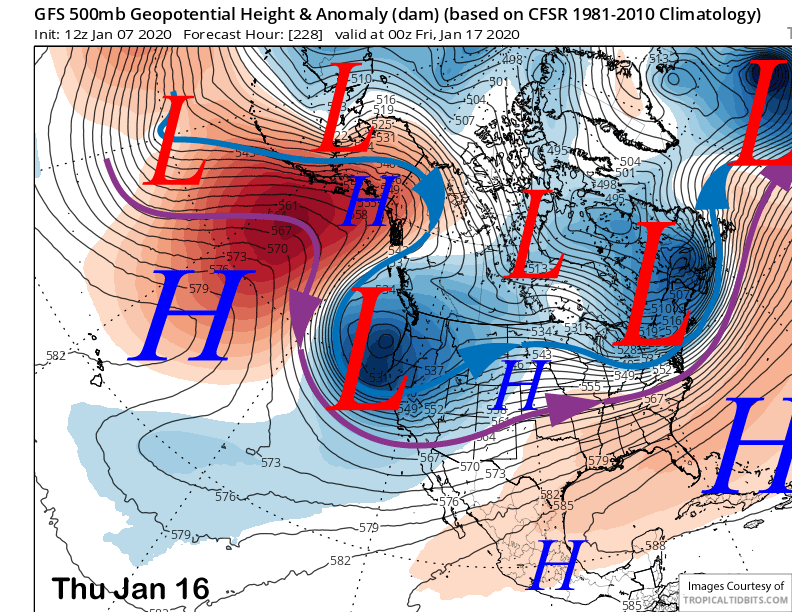
It is still very far out in time and a lot could change. Current thinking follows closer to the GFS ensemble mean (image below) that has been very consistent in predicting this solution, although I suspect it may end up weaker.
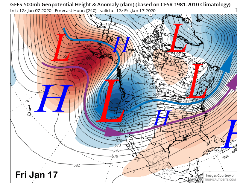
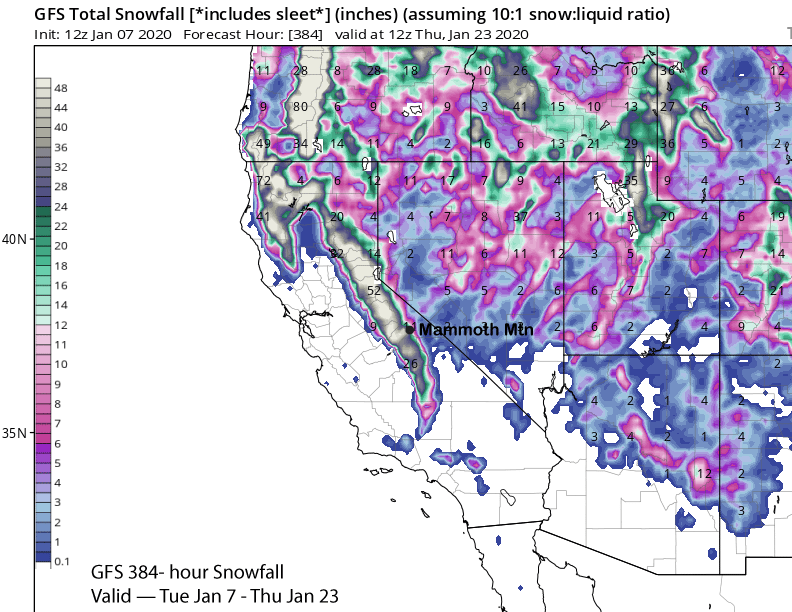
Hopefully it won’t verify weaker, as that model keeps the trough in place (two images below) through the MLK Holiday weekend for cold and powdery conditions. The operational GFS model has over 3 feet at Main through the period (two images below), most of it falling just before or over the holiday weekend. WG