Powder Forecast –Saturday, January 18th, 2020
Ted Schlaepfer CCM —- Mammoth Mountain WeatherGuy
Snowfall forecasts are valid at the Sesame snow course (Main Lodge) for the prior 24 hours as reported in the 6-7 AM morning snow report.
**Snowfall forecast confidence ranges from very low (1) to very high (5)
Sun 1/19 = 0”
Mon 1/20 = 0”
Tue 1/21 = 0 – 1”
Wed 1/22 = 1 – 2”
Thu 1/23 = 0”
Fri 1/24 = 0”
Sat 1/25 = 0”
Sun – Tue 1/26– 1/28 = 6– 12”
January Snowfall = 10”
January Forecast = 20 – 30″
Detailed 4-day Snowfall Forecast:
Sun 1/19—No snowfall expected.
Mon 1/20— Dry during the day, then a chance for light snow showers or flurries overnight. Maybe an inch accumulation by Tuesday AM
Tue 1/21— Dry during the morning, then a chance for light snow during the afternoon and overnight. Maybe an inch or two accumulation by Wednesday AM
Wed 1/22—Other than a chance for an AM flurry, no snowfall expected.
Forecast Summary:
Short Term (Days 1 – 4)
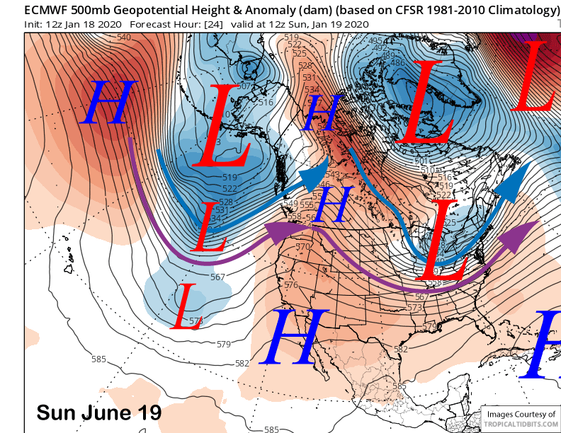
High pressure will build into CA and Mammoth Sunday (image below) for fair and seasonably mild weather with passing high clouds at times as it will be a dirty ridge. That should hold into the MLK Holiday before the ridge moves eastward.
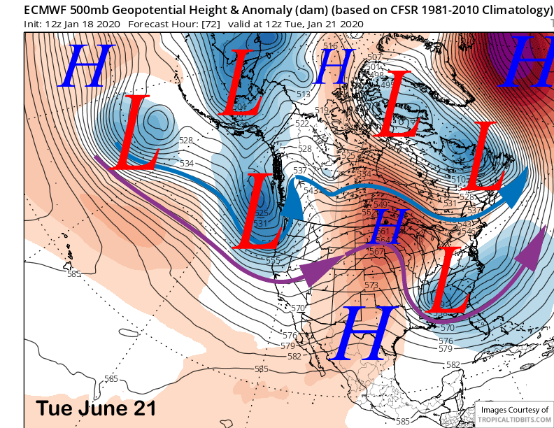
The models then move a trough of low pressure into the West Coast next Tuesday (image below) for colder weather and breezy to gusty winds. It looks like some subtropical moisture will spill into CA ahead of the trough Monday overnight and there could be some light snowfall or flurries
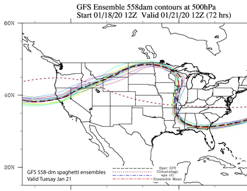
GFS ensembles (image below) are consistent in keeping most of the precipitation well north of Mammoth during the trough passage Tuesday as none of the members move the jet stream southward into central CA. Both the ECM and GFS are only showing very light amounts of precipitation from the southern edge of a passing cold front resulting in maybe an inch or two of accumulation.
There could be a lingering flurry into Wednesday, otherwise, high pressure will rebuild over CA through the middle part of next week.
Long Range (Days 5+):
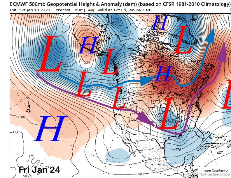
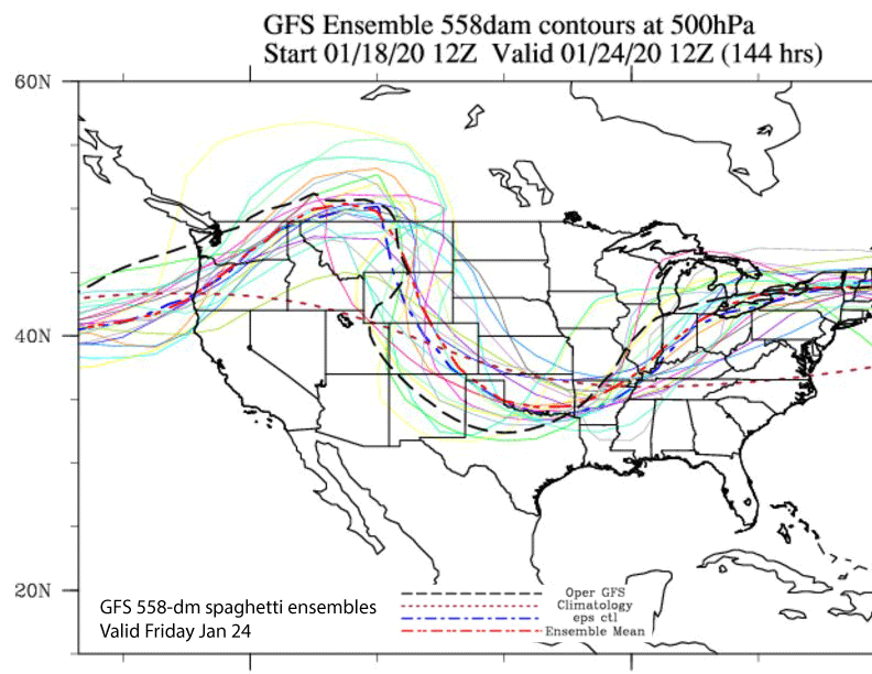
The ECM model moves the next trough into the West Coast toward the end of next week (image below) with the precipitation staying north of Mammoth again. GFS ensembles (two images below) also favor the jet stream staying into the PacNW with only a couple members southward into NorCal. High pressure will then rebuild into Mammoth into Saturday.
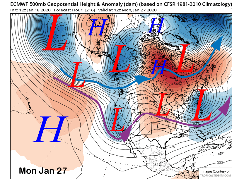
It looks like the next decent chance for powder conditions will be around January 26-27th. The latest ECM (image below) splits a trough off from a moisture-laden jet stream into CA late over the weekend and into Monday as the split slows the troughs eastward progression. That model has about 2” liquid, probably too much.
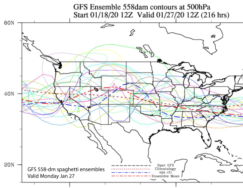
The GFS ensembles also favor a trough farther southward into CA early that week (image below) with most of the members showing the southward movement of the jet stream. So the odds are better for some snowfall in the extended time frame.
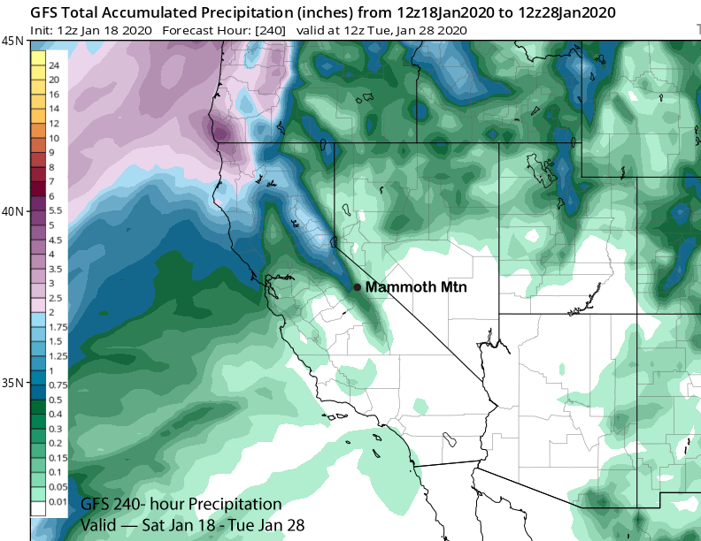
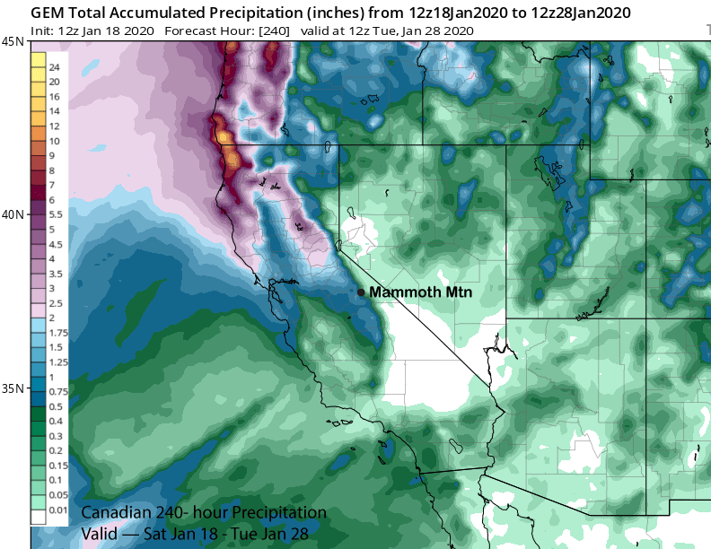
The ECM certainly is the wettest model at the moment and tends to overdo things that far out. The GFS operational model (image below) is the driest with under half an inch liquid while the Canadian has almost an inch (two images below). So it doesn’t look like a major storm at this time but could be enough for powder. The next chance would be around the 28th and then nothing insight through early February. WG