Powder Forecast –Tuesday, January 21st, 2020
Ted Schlaepfer CCM —- Mammoth Mountain WeatherGuy
Snowfall forecasts are valid at the Sesame snow course (Main Lodge) for the prior 24 hours as reported in the 6-7 AM morning snow report.
**Snowfall forecast confidence ranges from very low (1) to very high (5)
Wed 1/22 = 1 – 2”
Thu 1/23 = 0”
Fri 1/24 = 0– 1”
Sat 1/25 = 0”
Sun 1/26 = 0 – 1”
Mon 1/27 = 3 – 6”
Tue 1/28 = 1 – 2”
Wed – Fri 1/29– 1/31 = 0”
January Snowfall = 10”
January Forecast = 15 – 25″
Detailed 4-day Snowfall Forecast:
Wed 1/22—Light snow possible during the morning, otherwise no snowfall expected during operations. No accumulation expected.
Thu 1/23 through Sat 1/25—No snowfall expected all days except for a chance for light snow or flurries overnight Thursday, no meaningful accumulation expected.
Forecast Summary:
Short Term (Days 1 – 4)
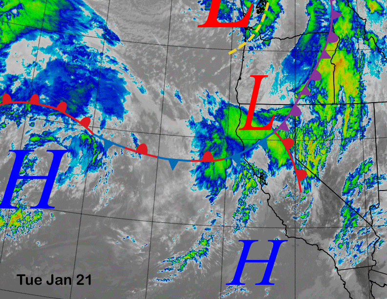
Infrared satellite imagery below shows a low-pressure system and frontal boundary has moved into NorCal and it is expected to drift southward overnight while dissipating. The end result should be some light snow tonight and into tomorrow morning that may could yield an inch or two.
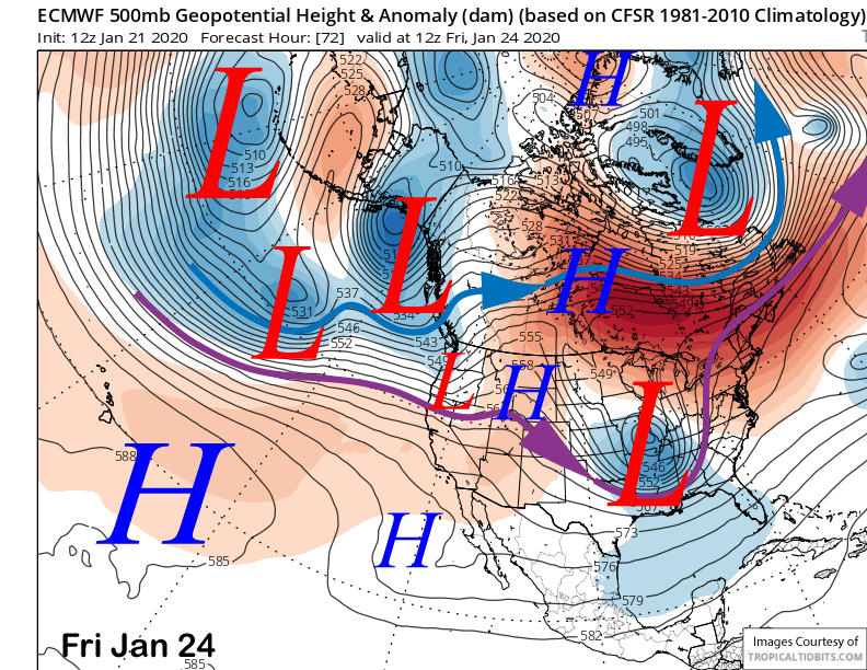
High pressure will then rebuild into CA and Mammoth tomorrow and should hold through Thursday. A weak short wave trough will then move into Oregon and NorCal Thursday night and early Friday (image below) and the subtropical clouds could produce flurries or a light snow shower as far south as Mammoth, but no accumulation.
High pressure will then rebuild on Friday and into Saturday before there is a better chance for snow over the latter part of the weekend.
Long Range (Days 5+):
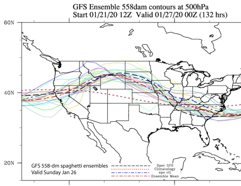
The models (ECM below) then move another short-wave trough to the coast on Saturday night and early Sunday. Although it isn’t a strong wave, it will be laden with subtropical moisture and heavy rain is expected across NorCal. Unfortunately, it is forecast to weaken when it moves southward into Mammoth by Sunday morning. Almost all the GFS ensemble members keep the jet-axis to the north of Mammoth Sunday (two images below)
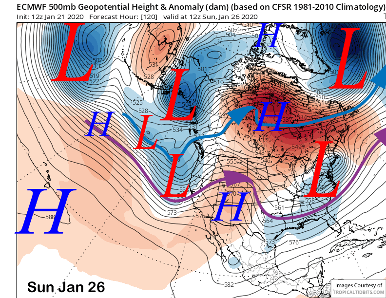
Model Quantitative Precipitation Forecast (QPF) amounts for the event are about half an inch liquid with the ECM mean showing about that amount too. Snow levels will be around 6-6500 feet. So a hefty few inches is possible, maybe enough for low-end powder conditions.
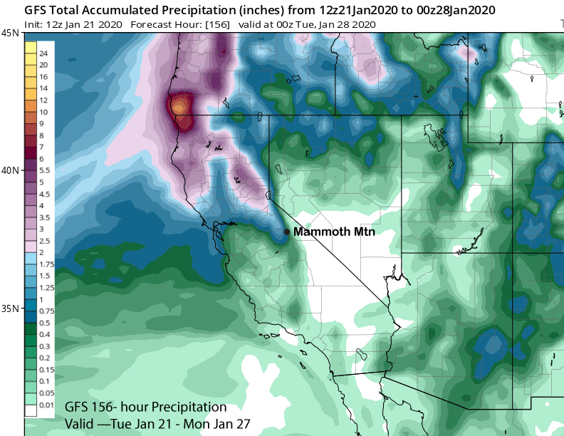
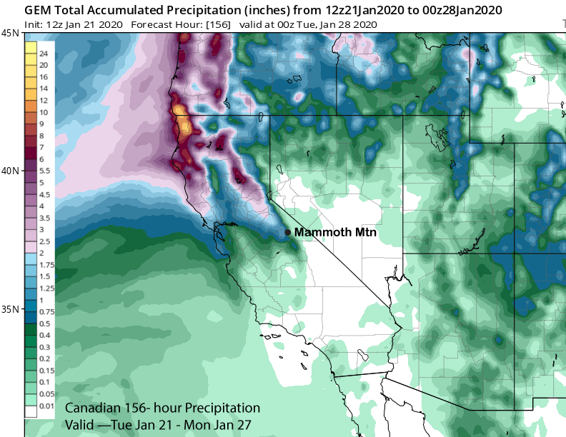
Overall, models are not showing significant snowfall through the upcoming weekend with the GFS (image below) showing a little over 0.50” liquid for the period and the Canadian (two images below) only slightly more. The ECM operational model is similar to the GFS while the ECM ensemble mean is slightly wetter.
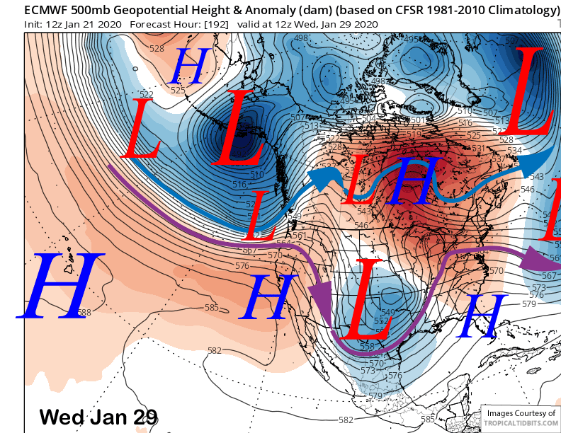
It looks like the jet stream will retreat back northward by the middle part of next week (image below) and potentially hold there through the end of the week (two images below) for dry weather. It will likely be a dirty ridge with passing high clouds at times.
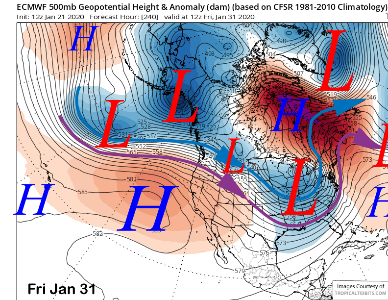
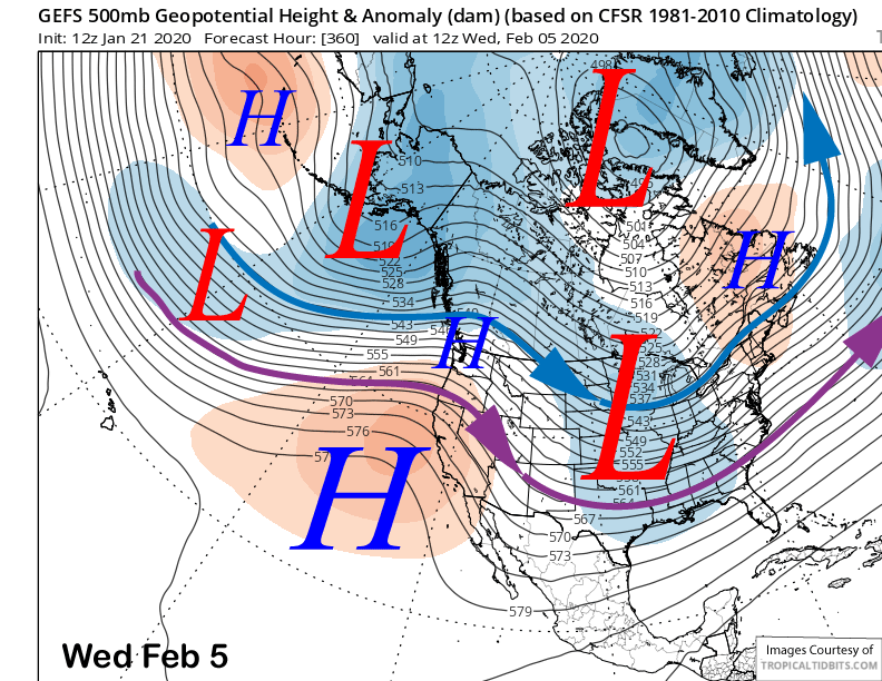
The fantasy range ensemble guidance has been rather bullish on a keeping that ridge over CA and potentially the West Coast through early February (image below). If the climate models are right, this will be the dominant pattern for most of February that is looking dry and mild. WG