Powder Forecast –Friday January 24th, 2020
Ted Schlaepfer CCM —- Mammoth Mountain WeatherGuy
Snowfall forecasts are valid at the Sesame snow course (Main Lodge) for the prior 24 hours as reported in the 6-7 AM morning snow report.
**Snowfall forecast confidence ranges from very low (1) to very high (5)
Sat 1/25 = 0”
Sun 1/26 = 2 – 3” (H20 = 0.20” – 0.30”)**3
Mon 1/27 = 1 – 2” (H20 = 0.15” – 0.20”)**3
Tue 1/28 = 0”
Wed 1/29 = 0”
Thu 1/30 = 0”
Fri 1/31 =0”
Sat – Mon 2/1– 2/3 = 0 – 3”
January Snowfall = 10”
January Forecast = 12 – 15″
Detailed 4-day Snowfall Forecast:
Sat 1/25—Dry during the day and through the late evening hours, then snowfall develops before dawn Sunday. Accumulations 2 – 3”, 3”+ up top by Sunday AM
Sun 1/26—Light snow during the morning tapers off during the afternoon. Accumulations 1 – 2”, 2”+ up top
Mon 1/27 and Tue 1/28—No snowfall both days except for a chance for flurries Tuesday afternoon.
Forecast Summary:
Short Term (Days 1 – 4)
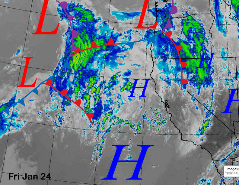
Infrared satellite imagery below shows a low-pressure system moving into the PacNW and a warm frontal boundary through NorCal resulting in windy conditions today in Mammoth. Brief high pressure will build into Mammoth tonight and early Saturday before the next system on the edge of the satellite image moves into the area early Sunday.
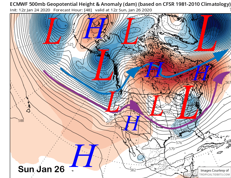
The system has abundant subtropical moisture backed by a decent jet stream that unfortunately is forecast by the models to weaken considerably by the time it reaches central CA and Mammoth. The ECM splits the trough upon landfall (image below) with the southern short wave moving through the Mammoth area on primarily Sunday morning into the early PM hours.
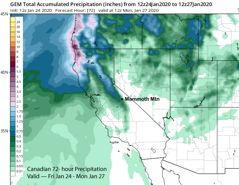
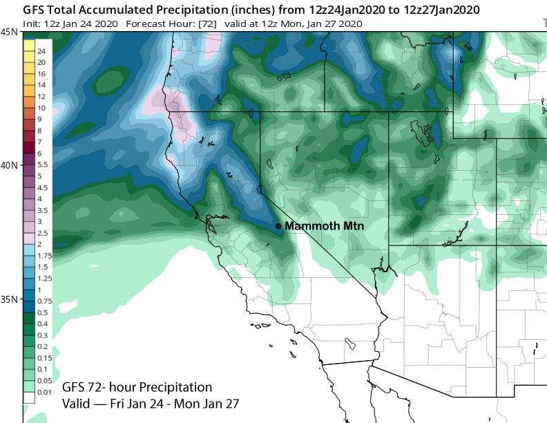
Model QPF ranges from about a quarter inch per the Canadian (image below) to around a half an inch with the wetter GFS (two images below). The latest ECM is showing around a third of an inch. Snow levels will be around 6500-7000 feet. So it looks like a few inches of snow by midday Sunday and possibly some very low-end powder conditions and/or fun turns.
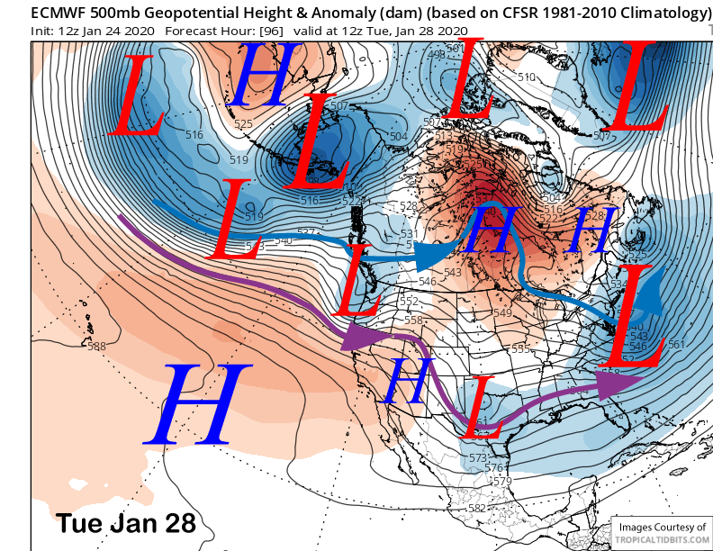
High pressure will rebuild Sunday night and Monday before the next short-wave trough moves into NorCal early Tuesday (image below). Guidance is favoring all the precipitation to remain north of Mammoth, but flurries are certainly possibly Tuesday during the day at times.
Long Range (Days 5+):
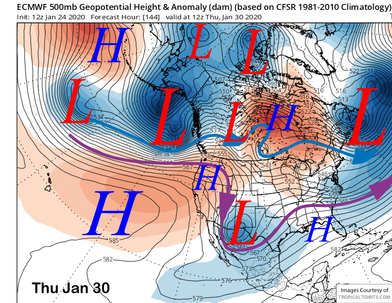
The models (ECM below) are then favoring the formation of an upper-level high-pressure ridge along the West Coast by the middle/end of next week. That means fair and warmer weather in addition to light winds.
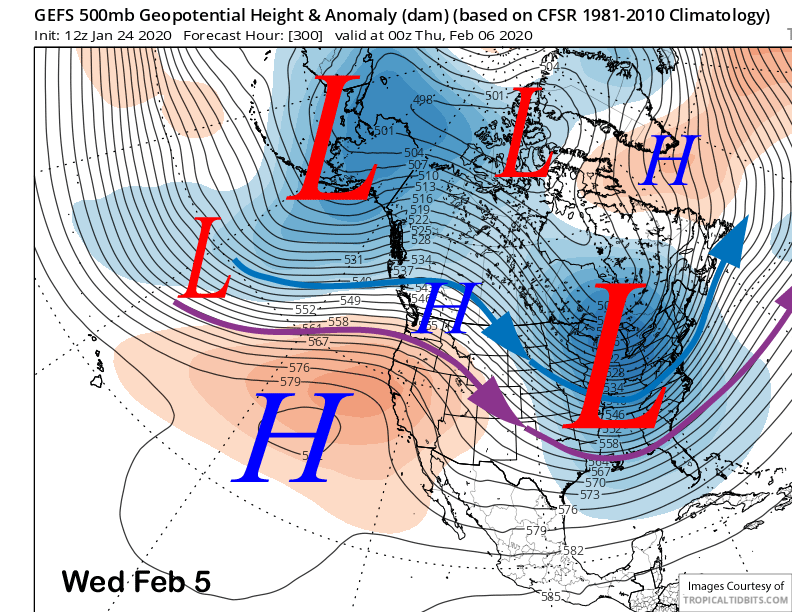
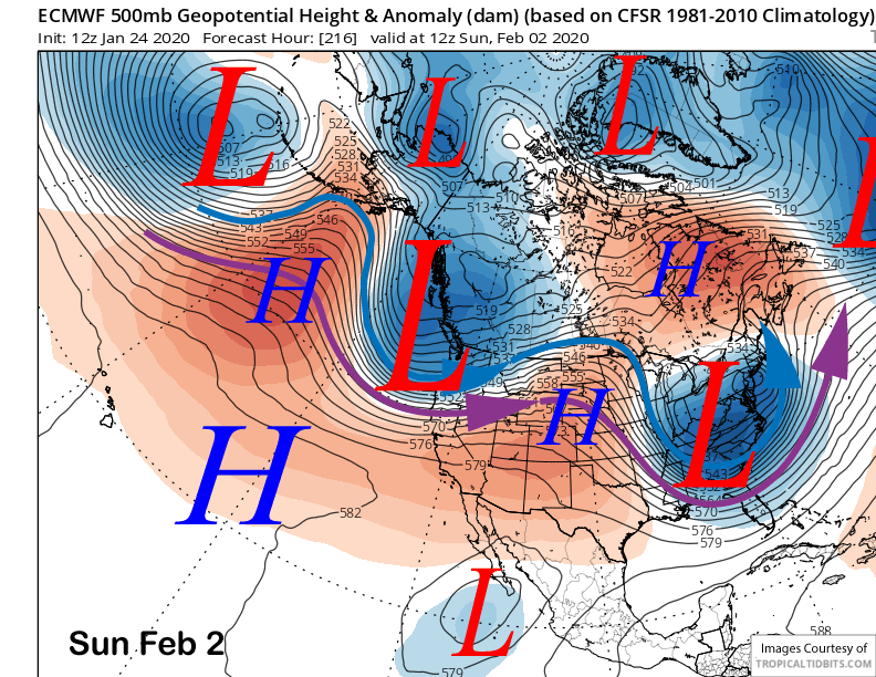
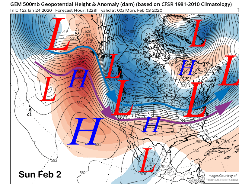
It may break down by the latter part of the following weekend suggests some of the guidance with the ECM showing a deep trough into the PacNW (image below) and the Canadian (two images below) also showing potentially high-latitude type systems around the same time period. Right now it looks like a better chance for wind/colder temperatures versus meaningful snowfall as systems moving into CA from that direction usually lack a good moisture tap.
Longer range ensemble guidance is favoring the return of the West Coast ridge (image below) by the middle part of the following week. So it looks like fair/dry weather for about a week or longer with possibly one system moving north of Mammoth over that period. Super long-range guidance is hinting that the ridge could weaken around the 10th of February or slightly later for a chance for a pattern change. WG