Powder Forecast –Friday February 7th, 2020
Ted Schlaepfer CCM —- Mammoth Mountain WeatherGuy
Snowfall forecasts are valid at the Sesame snow course (Main Lodge) for the prior 24 hours as reported in the 6-7 AM morning snow report.
**Snowfall forecast confidence ranges from very low (1) to very high (5)
Sat 2/8 = 0”
Sun 2/9 = 0 – 1”
Mon 2/10 = 1 – 2”
Tue 2/11 = 0”
Wed 2/12 = 0”
Thu 2/13 = 0”
Fri 2/14 = 0 – 1”
Sat – Mon 2/15– 2/17 = 0 – 6”
February Snowfall = 0”
February Forecast = 15 – 30″
Detailed 4-day Snowfall Forecast:
Sat 2/8—No snowfall expected
Sun 2/9—Light snowfall develops early Sunday and continues at times through the afternoon before ending evening. Becoming very windy by the afternoon with damaging winds possible Sunday night. Accumulations 1 – 2”, 2” up top (if it all doesn’t blow into Fresno Bowl)
Mon 2/10 and Tue 2/11—No snowfall expected both days. Wind remain strong through Monday AM. Lighter winds Tuesday, but still breezy/gusty
Forecast Summary:
Short Term (Days 1 – 4):
Infrared satellite imagery (below) this afternoon shows a large area of high pressure has built into CA for fair and mild weather with an area of low pressure and frontal system now entering into the PacNW.
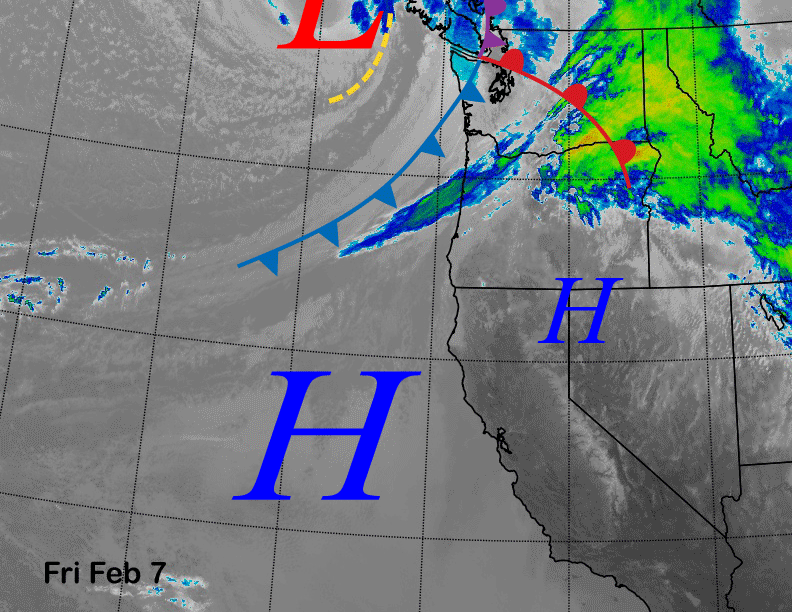
The models show that system moving southward into CA by early Sunday (image below) and due to the orientation of the low most of the precipitation will be on the back side of the system. This moist NE up-slope flow will produce light snow for Mammoth starting early Sunday morning and continuing through the afternoon.

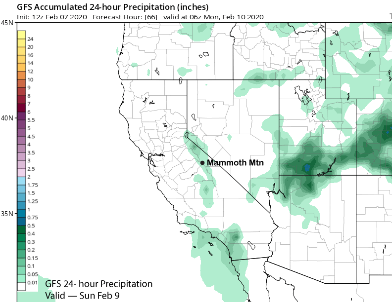
It won’t add up to much at all (GFS below shows about 0.05” liquid) and it may all blow up the mountain and towards Fresno as strong east/northeast winds are forecast to develop during the afternoon. Those winds may become damaging Sunday night with 100+ gusts probable on the mountain, not just up top. Town should be rocking too.
The winds will remain strong through Monday morning and then breezy/gusty into Tuesday. Dry weather is expected both days as the cut-off positioned near SoCal will move into Baja mid-week.
Long Range (Days 5+):
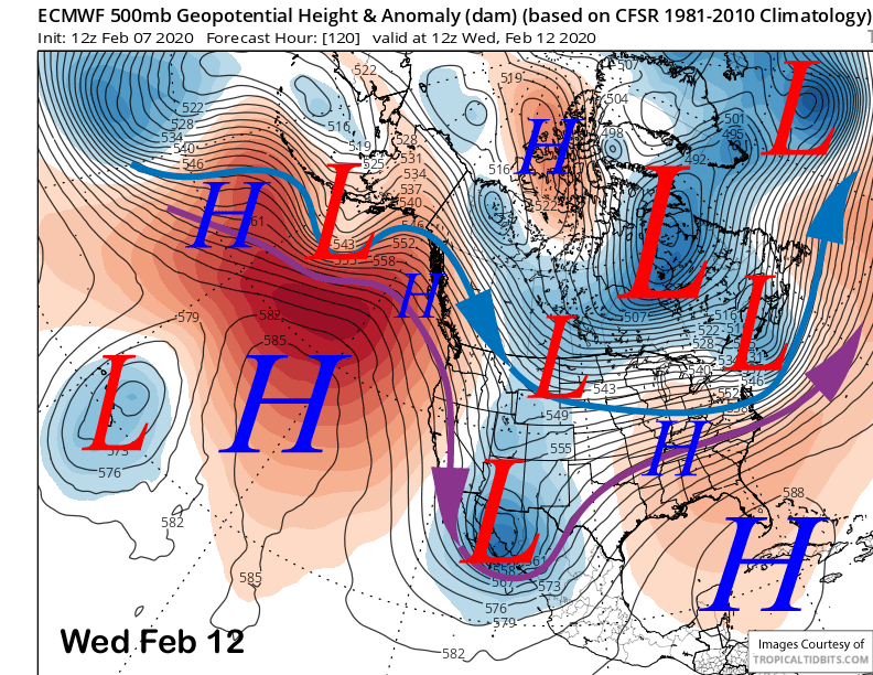
The numerical guidance is now favoring the next upper level short wave to move east of CA through the Great Basin Wednesday (image below). That means continued dry weather and probably another uptick in NE winds.
The ECM model then moves another high-latitude type upper-level trough into CA on Friday (image below) that has a little over-water trajectory. That model is showing about 6” of snowfall and the ECM mean has about 3-4” of snow.
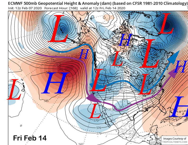
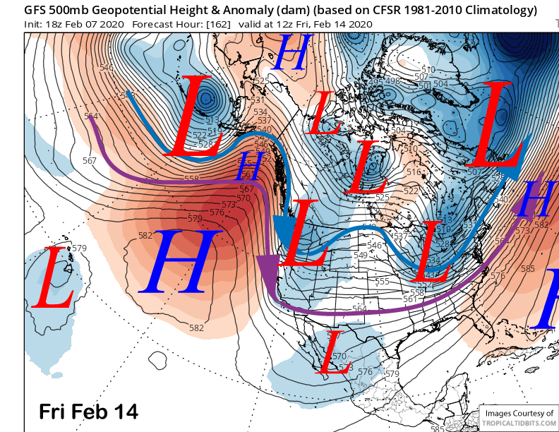
However, the other guidance is not as favorable. Both the GFS (image below) and the Canadian (two images below) have it as an inside slider type system for just more NE winds and no snowfall other than possibly flurries. So we will have to wait and see how it turns out.

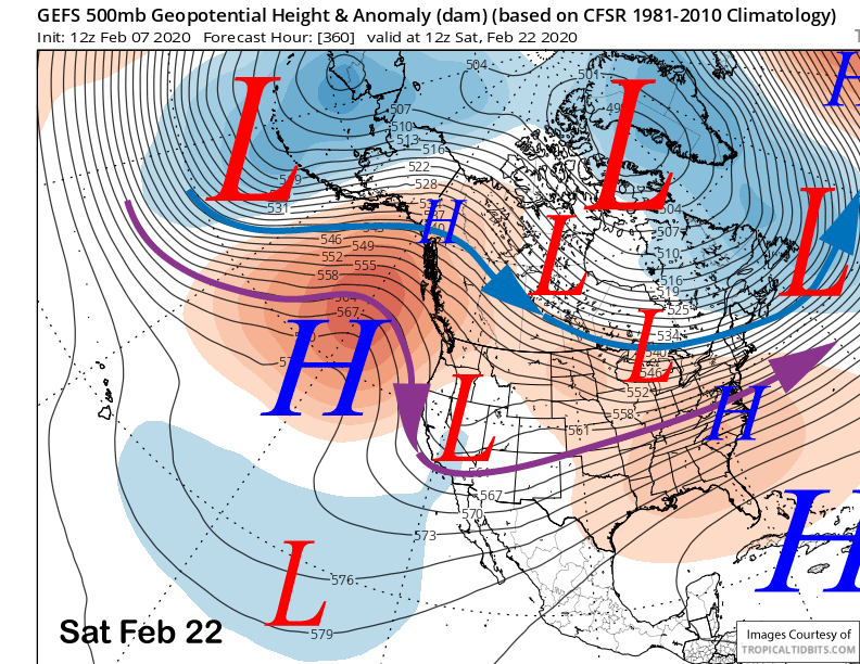
This weather pattern is forecast by the longer range models to continue through the third week of February (image below) favoring a blocking ridge off the coast and weak system moving southward on the back side of the ridge into Arizona. It would be more of the same, hoping one of the systems takes a more over-water trajectory before moving inland.
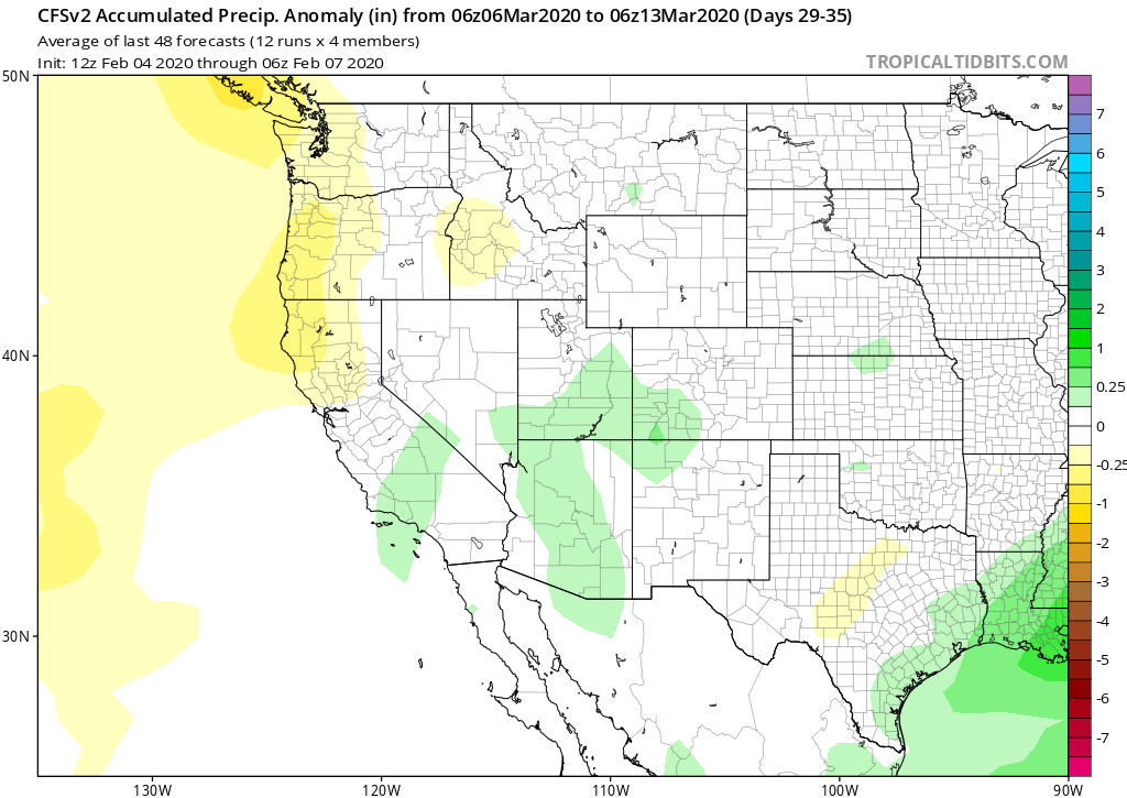
The dry pattern could last all of February and the climate models don’t favor any meaningful precipitation until the second week of March (image below). And that would be just normal precipitation that week. Hopefully the dry pattern won’t last that long. WG