Powder Forecast –Tuesday, February 25th, 2020
Ted Schlaepfer CCM —- Mammoth Mountain WeatherGuy
Snowfall forecasts are valid at the Sesame snow course (Main Lodge) for the prior 24 hours as reported in the 6-7 AM morning snow report.
**Snowfall forecast confidence ranges from very low (1) to very high (5)
Wed 2/26 = 0”
Thu 2/27 = 0”
Fri 2/28 = 0”
Sat 2/29 = 0”
Sun 3/1 = 2 – 4”
Mon 3/2 = 1 – 2”
Tue 3/3 = 0 – 1”
Wed – Fri 3/4 – 3/6 = 0”
February Snowfall = 0”
February Forecast = 0″
Detailed 4-day Snowfall Forecast:
Wed 2/25 through Fri 2/28—No snowfall expected all days.
Sat 2/29—Dry during the morning, then a chance for snow by the afternoon with a period of steady snowfall possible overnight and into Sunday. Accumulations 2 – 4” by Sunday AM, up to 6” up top.
Forecast Summary:
Short Term (Days 1 – 4):
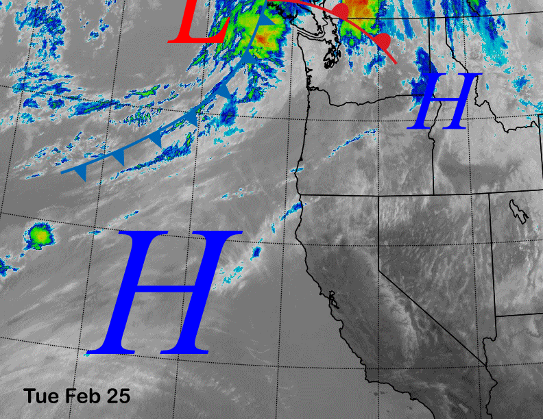
Infrared satellite imagery (below) today high pressure off the coast having built eastward into the interior West for fair and dry weather along with seasonable temperatures for the end of February.
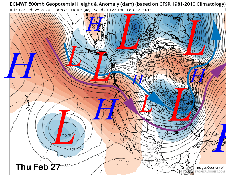
Models peak the ridge on Thursday (image below) and keep it in place through Friday for continued fair and slightly warmer weather. It won’t get super warm, but the 30s up top and 50s at Canyon should be expected by Thursday including spring conditions at the bottom areas.
Colder and windy weather develops by Saturday along with increasing cloudiness. Snow is possible by Saturday afternoon with a good chance for a period of snowfall overnight Saturday and into Sunday.
Long Range (Days 5+):
It is a sure bet that February 2020 will end as the record low snowfall February in the Mammoth historical snowfall record with no accumulating snowfall and only a couple period of flurries. However, model guidance says March will start on a better note.
The guidance moves an upper level trough southward into CA by early Sunday (image below) and it will have enough over-water trajectory and strength to likely squeeze out a few inches of snowfall to end the dry period that goes back to January 28th. You have to go all the way back to just before Christmas since the last time it snowed at least a foot—over two months!
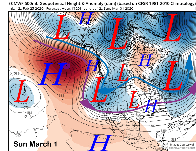
While a foot is very unlikely, models are suggesting at least a few inches may fall overnight Saturday and into Sunday morning with snow showers possibly starting Saturday afternoon and lasting into early Monday. The GFS model is the wettest showing around 0.75” (image below) with the Canadian around 0.50” (two images below).
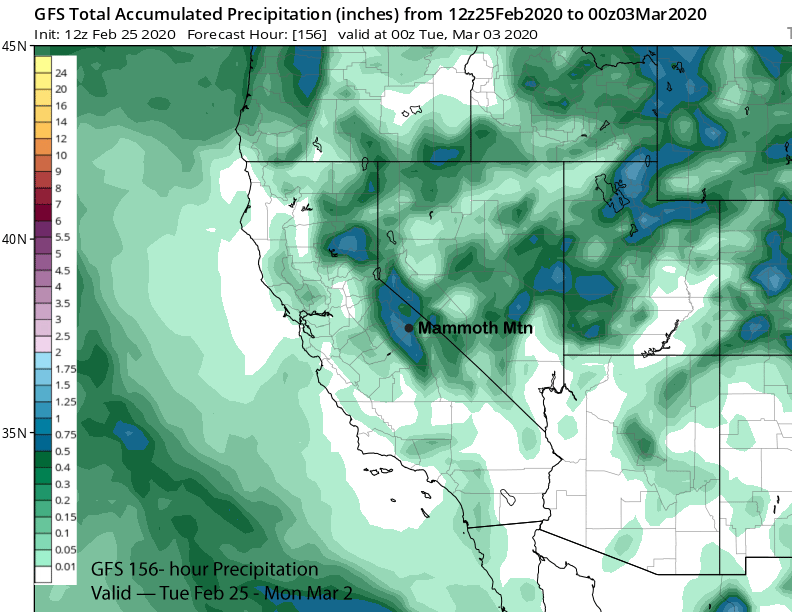
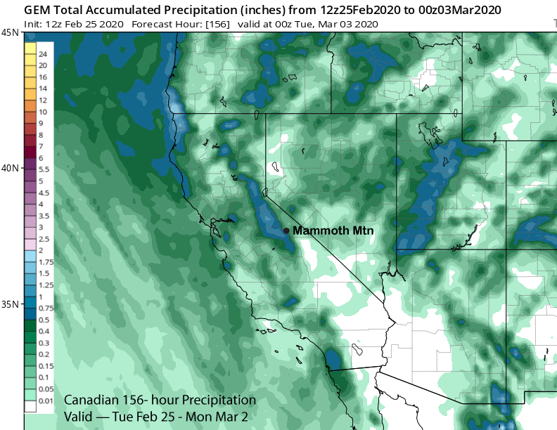
The ECM 12Z deterministic run has just under 0.50” and that is similar to the ensemble mean. It is still a few days out to get overly confident, but hopefully 6” will fall up top and 4-5” at Main, probably enough for low-end powder conditions. Snow levels will start at 7K Saturday PM before lowering to 4K Sunday morning.
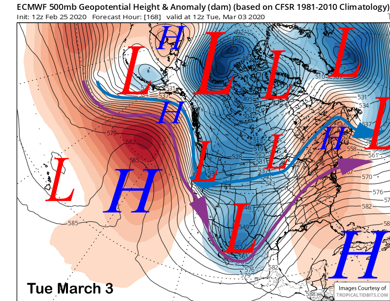
The ECM moves another upper-level trough southward on Tuesday (image below) as a slider type system with limited moisture. It does generate an inch or two of snowfall. The GFS and Canadian models are both farther east and/or north with the system and don’t produce any snowfall. The current forecast favors only a dusting or nothing. An increase in NE winds is surely possible Tuesday.
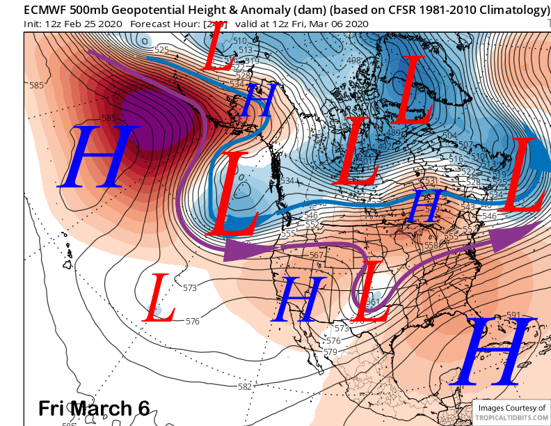
High pressure is then expected to rebuild and last for the rest of the workweek. The ECM model does move a trough southward toward CA toward the following weekend (image below) and both the GFS and Canadian are faster with the approach of that system, probably too fast.
The GFS and ECM ensemble means both favor weak riding until about the 8th or 9th. That is when the GFS ensemble develops a fairly deep closed low off the CA coast under a split jet stream flow (image below). It produces southwest jet stream flow into CA that would allow any weather systems to finally move ashore with higher moisture entrainment. The ECM mean is similar, but weaker with the southern branch jet stream break-though.
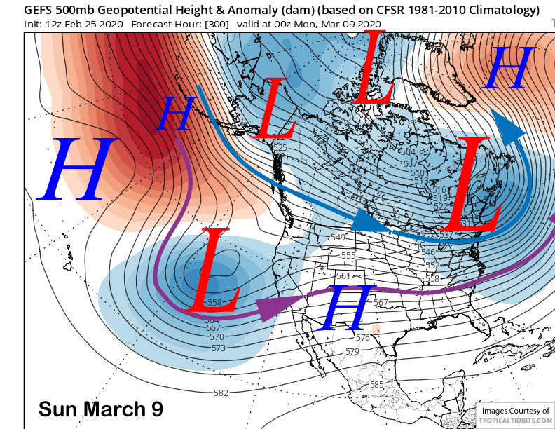
Under this scenario, weak or moderately strong systems could move into central CA with periods of snowfall for Mammoth. And these would be warmer storms with needed base snow to extend the season. Let’s hope it comes to fruition.
Longer range fantasy guidance by the GFS ensemble shows a modestly deep trough of low pressure setting up along the West Coast (image below) heading into mid-month. This time there is no split jet stream flow and that could allow stronger systems to move into the West Coast and CA.
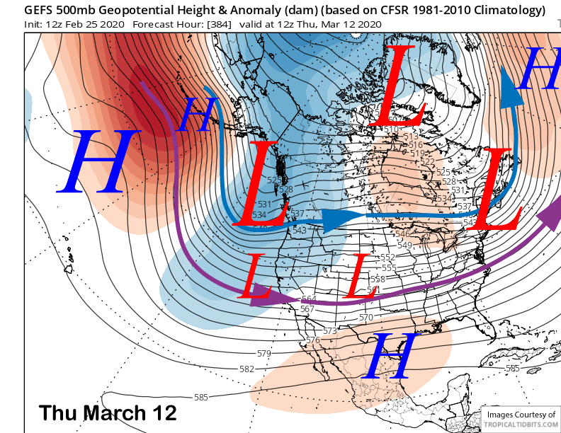
However, the ECM model is showing a weak ridge. If the MJO moves into the drier phases 4 and 5 as forecast by the ECM model, then we may just end up with weaker type systems. The models are not at all in agreement with the latest MJO forecast. Fingers crossed that we finally get some storms and powder days. WG


