It’s 4 PM on 8-19-2020 – Currently, at the top of Mammoth Mountain it’s 66 with WSW winds to 34 gusting to 42 MPH, down in the town of Mammoth Lakes it’s 81 with a 86 at the Mammoth Lakes Airport.
For the rest of today, there is a 30% chance of T Storms, with heavy rain, hail, and gusty winds in areas that have storms firing off. Chances of storms will be down to zero starting on Thursday.
Highs this week will continue to be into the low to mid-80s in Mammoth Lakes (7900 Feet) with 70’s up in the Lakes Basin and up at the Mammoth Mountain Main Lodge (8900 Feet). Down in Crowley Lake expect the upper 80s to low 90’s with low 100s for Bishop.
Expect Southwest winds 5 to 15 mph, with gusts as high as 25-35 mph in higher elevations during the PM hours.
Nighttime lows are not dropping fast with this current weather pattern, well after midnight Mammoth Lakes could see lows into the mid-50s with mid-60s down in Bishop.
Bring a fan if you’re coming to stay in Mammoth Lakes in a condo or hotel, it’s going to be warm and there is no AC in most units in town. Down in the Bishop area, the hotels all have A/C so it’s a bit more comfortable sleeping at night. Snowman
LONG TERM from NWS Reno……Saturday through Wednesday… Some changes were made to increase t-storm chances for Sunday PM through Monday, including possible showers for Sunday night.
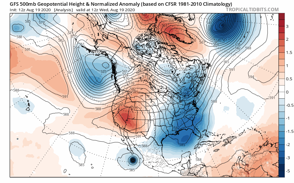
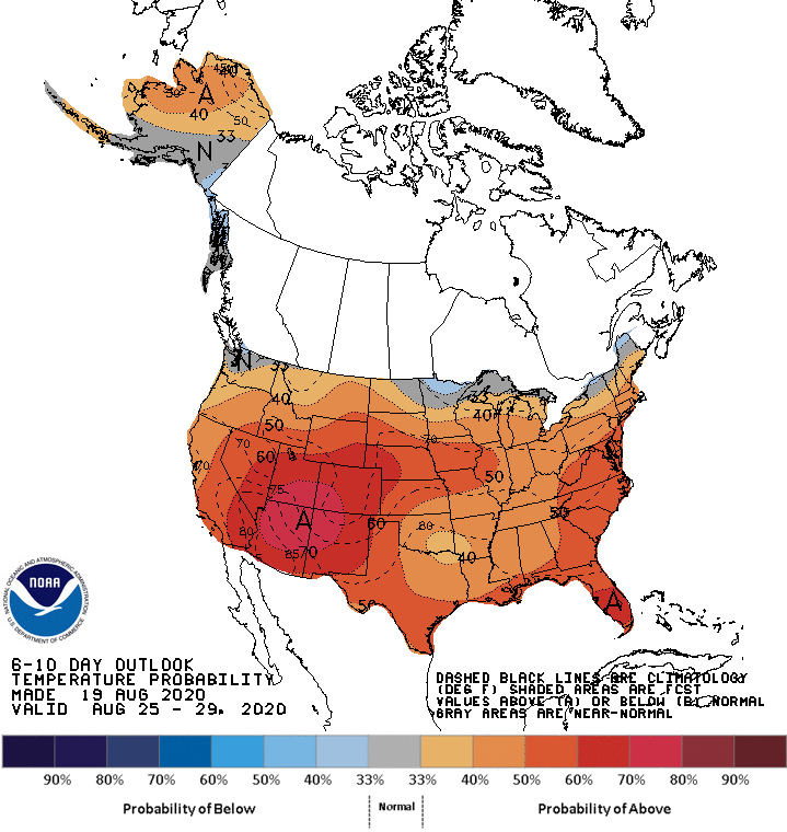
Overall, above-average temperatures are likely to continue, but not quite as hot as our recent heat advisory event. For this weekend, Saturday still looks dry with typical afternoon zephyr breezes, as high pressure remains centered over the southwest US.
This ridge isn`t quite as intense as this week (500 MB heights around 594 DM after peaking over 600 DM) so while we continue to stay on the warm side (highs mid-upper 90s for lower elevations, mid-upper 80s near the Sierra), record highs and heat-related headlines are unlikely.
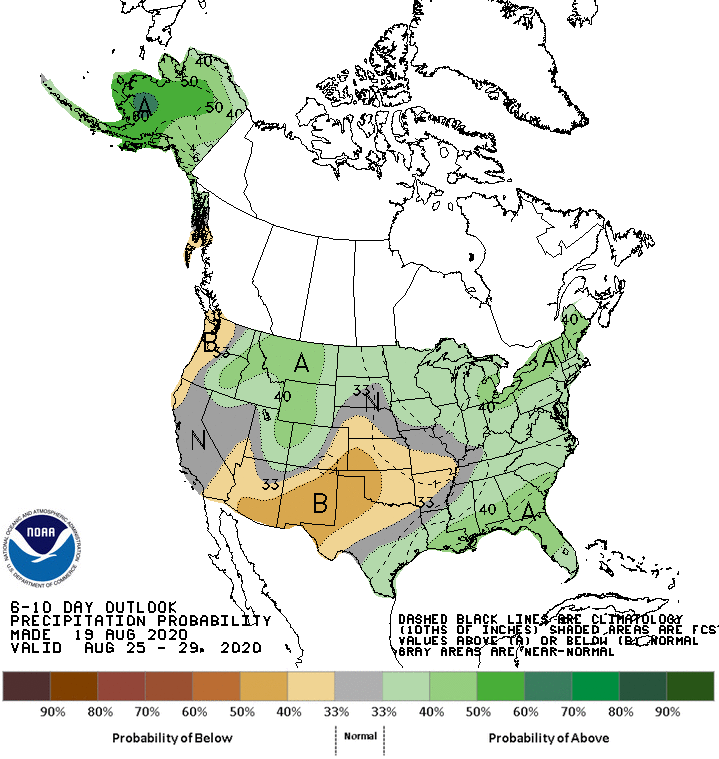
Sunday through Monday looks more like a return to thunderstorm activity, as another trough approaches the Pacific Northwest. Meanwhile, a push of moisture from the southwest US could combine with remnant tropical moisture from Hurricane Genevieve.
The time frame may fluctuate depending on the track of the hurricane, but overall the best chances for thunder appear to remain south of US-50 Sunday afternoon.
The moist air mass with warmer overnight temperatures may be capable of keeping some shower activity going through Sunday night/Monday morning. Then for Monday afternoon as instability increases, the chances of thunder look more favorable, with storms possibly advancing farther north. NWS Reno