Snowman’s Mammoth to Bishop Weather Forecast
9-5-2020 12 Noon – Saturday Summary – More warm summer days are in the forecast right through Labor Day.
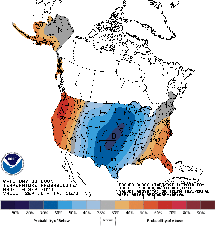
After that, the Eastern Sierra will see a good 8-12+ degree drop in temperatures as we get an East flow of cooler air from a low over Colorado.
The cooldown will be short-lived and highs will come up again by next Friday, the jury is still out how warm it will get by the end of next week into next weekend.
For the Labor Day Weekend expect:
Highs for the summit at Mammoth Mammoth in the mid-60s with lows at night at the 11,000 foot level into the 50s. Winds at this elevation will be in 10-15 MPH with gusts 20-30 MPH at times.
Highs for Main Lodge and the Mammoth Lakes Basin will be in the upper 70s to possibly low 80s in the next few days. Night times lows are in the mid to upper 50s. Winds are expected to be 5-15 MPH at times especially during the PM hours.
Highs for Mammoth Lakes now look to be in the low 80s this weekend with lows in the 50s at night. Winds are expected to be 5-15 MPH at times especially during the PM hours.
Highs in Crowley Lake will be in the upper 80s to low 90s with night times lows in the 50’s.
Highs down in Bishop have warranted an Excessive Heat warning, for today the high is expected to be 106 with a 105 on Sunday and 104 on Monday. Winds will be light at 5-10 MPH during the afternoon hours.
The 7- 10 Day Forecast is calling for more warm and dry days all the way out to the next 10 days. This is a stable pattern and it’s going to be around for a while.
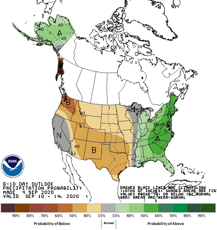
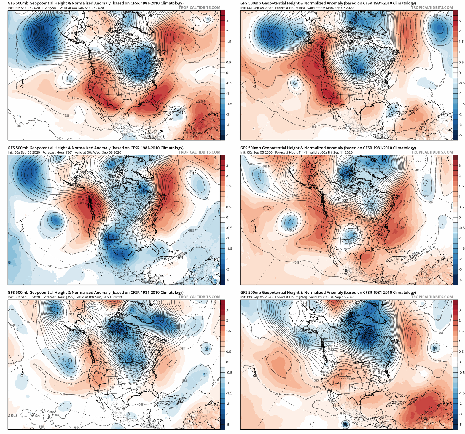
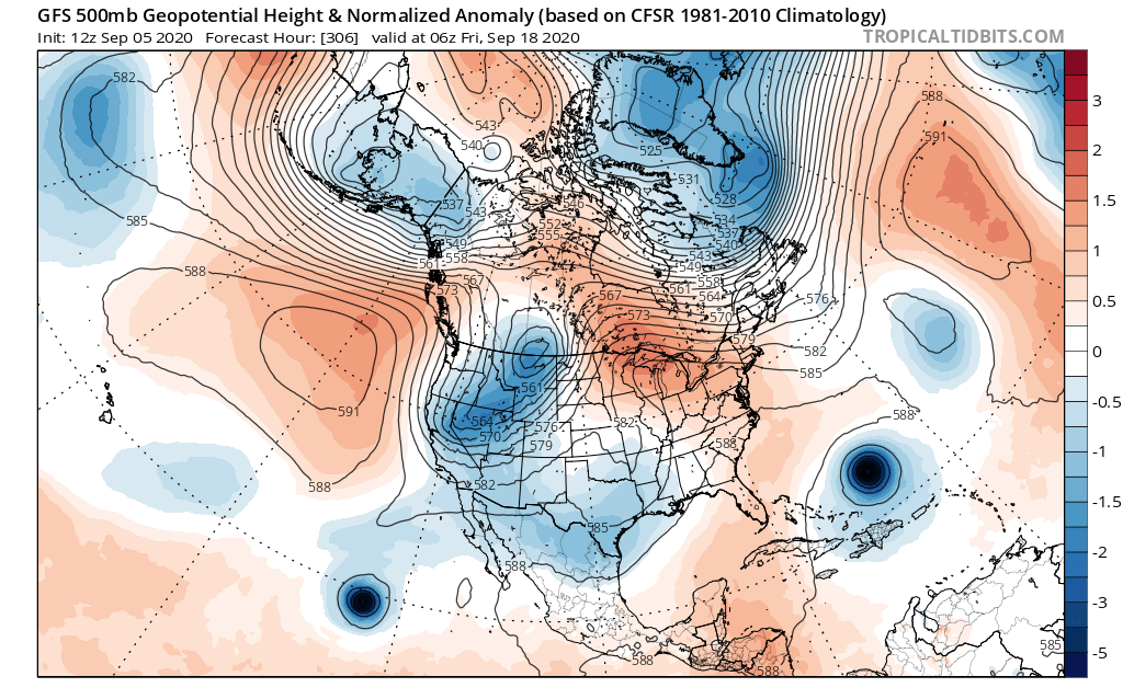
15-20th of September the GFS weather model every few runs as been showing some troughing and cooler air into the area. No signs of any dusting of snow or raindrops yet.
Now that we are into September, Weather Guy and I will be keeping an eye on the long-range weather patterns looking for that first dusting of snow over the higher peaks of the Eastern Sierra.
I will be posting up some model riding fun here on the weather page when we start to see something in the longer range.
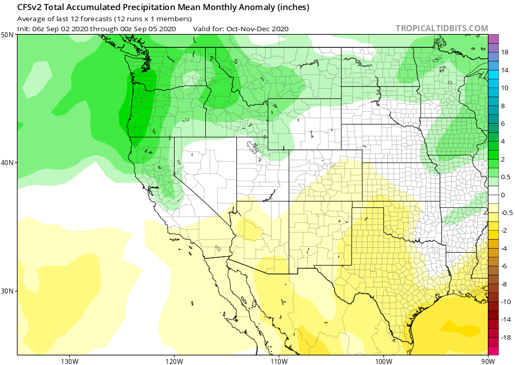
October Outlook from the CFS (confidence is low)
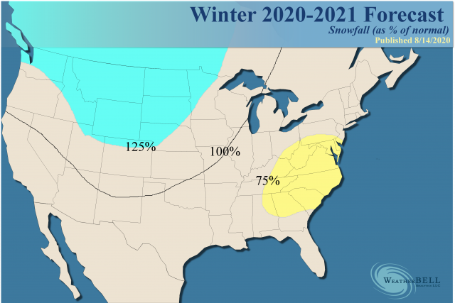
Winter Forecast:
The Winter Outlook: It appears we will be having a weak La Nina event the this winter season. (Winter 2017 was a weak La Nina)
I have seen some really good snowfall during La Nina years and I have also experienced the La Nada versions as well. It’s anyone’s guess what’s really going to happen at this point.
Snowman’s gut feeling for this winter is we will have some really cold spells and 2-3 good storm cycles that pump out some nice powder. In between expect long extended periods of clear weather.
Now that we are into September, Weather Guy and I will be keeping an eye on the long-range weather patterns looking for that first dusting of snow over the higher peaks of the Eastern Sierra.
I will be posting up some model riding fun here on the weather page when we start to see something longer range.
Snowman out
PS: Weather Guy will start his detailed Powder Forecasts posts again in early November or earlier if we happen to get a sign that there could be an early storm pattern.
10 Day GFS Weather Loop for Mammoth Lakes, Mammoth Mountain and Bishop, Ca[/caption
