 Powder Forecast – Friday, November 20th, 2020
Ted Schlaepfer CCM —- Mammoth Mountain WeatherGuy
Snowfall forecasts are valid at the Sesame snow course (Main Lodge) for the prior 24 hours as reported in the 6-7 AM morning snow report.
**Snowfall forecast confidence ranges from very low (1) to very high (5)
Sat 11/21 = 0”
Sun 11/22 = 0”
Mon 11/23 = 0 – 1”
Tue 11/24 = 0”
Wed 11/25 = 0”
Thu 11/26 = 0 – 1”
Fri 11/27 = 0”
Sat – Mon 11/28 – 30 = 0”
November Snowfall = 21”
November Forecast = 21 – 25”
Detailed 4-day Snowfall Forecast:
Sat 11/21 through Tue 11/24 – No snowfall expected all days except a chance for flurries or light snow showers early Monday morning.
Forecast Summary:
Short Term (Days 1 – 4):
The afternoon satellite image (below) shows lots of middle and high clouds streaming into the Mammoth area due to weak subtropical jet stream flow into the state under a generally split jet stream pattern. Weak high pressure is situated in Baja and another area of high pressure is off the Oregon coast and that weak ridge will move over CA tomorrow for continued fair weather and slightly warmer temps.
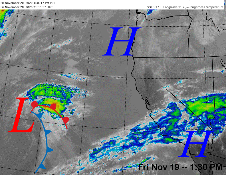
The clouds should clear out tonight before high clouds possibly streaming back over the area tomorrow afternoon. Otherwise, fair weather will continue through Sunday before an inside slider type upper-level short-wave moves through the Sierra early Monday (image below). That will mostly result in colder temperatures and increased winds, but it could produce some flurries or light snow showers early Monday morning, nothing more than a trace expected.
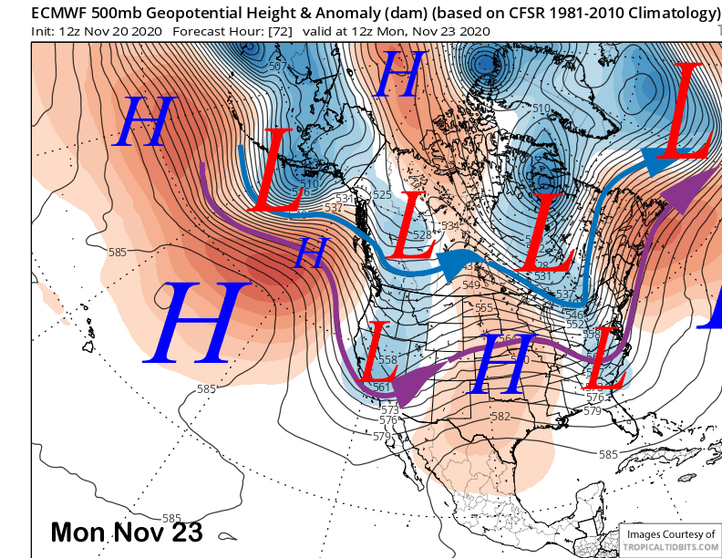
That system will quickly move out Monday during the day and weak high pressure will build into the area Tuesday. Even though that weak short wave won’t produce much snow, if any at all, the colder temperature and drier air mass will produce better snowmaking conditions early next week.
Long Range (Days 5+):
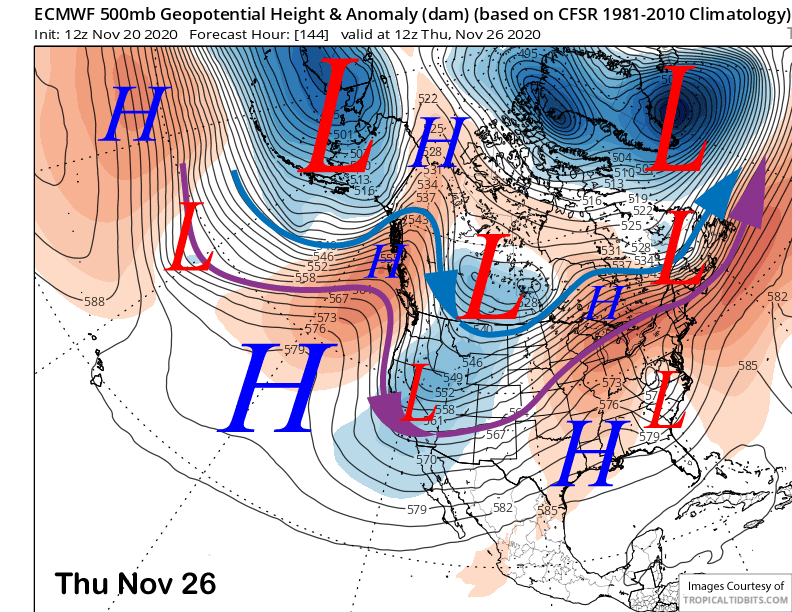
The longer-range guidance has continued to trend drier versus the last update. The ECM model does move another inside slider type system through the Sierra Wednesday and into Thursday (image below) for another chance for flurries or light snow showers Thursday morning, otherwise, the forecast is basically dry in the extended time frame.
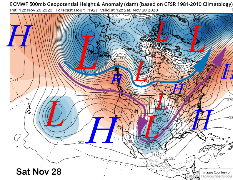
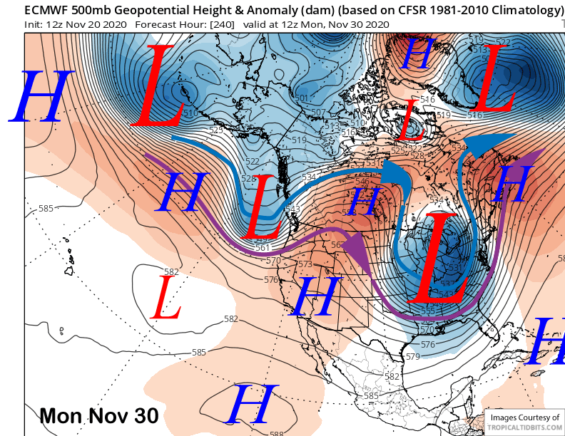
High pressure is forecast to move into the state by the end of the week (image below) with another trough approaching the state at the end of the month (two images below) that was supposed to be the next chance for snowfall from the last update. That now looks like it will be another inside slider type system.
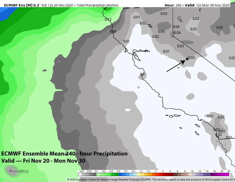
The latest 12Z Fri ECMWF ensemble mean is not showing any meaningful precipitation in the Mammoth area (or anywhere in the Sierra/state) over the next ten days (image below). Every ensemble member is dry after next Thursday and through Thanksgiving weekend.
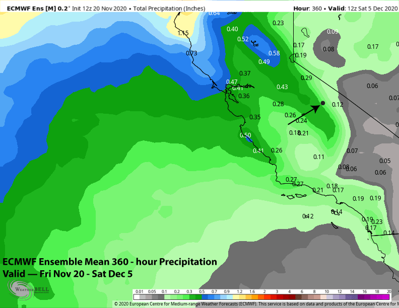
And the fantasy range of the ECMWF ensemble mean out to two weeks is not showing any meaningful precipitation either (image below). The mean is showing about a quarter-inch of liquid for Mammoth as there are a few wetter ensemble members, but with the ensembles favoring a rather strong 500-mb ridge along the West Coast, the more probable outcome will be dry weather.
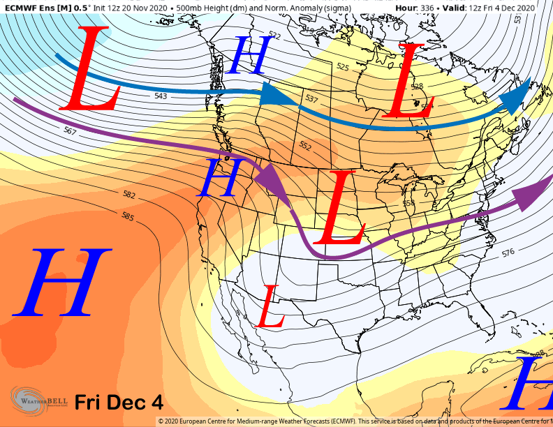
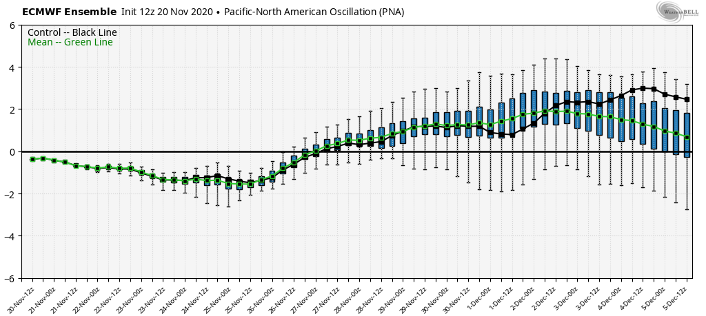
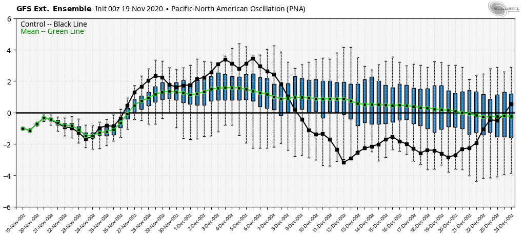
The ridging and dry weather is associated with an increasingly positive PNA index as the ECMWF mean favors a positive PNA pattern (image below) from the end of the month through December 5th. The super long-range GEFS keeps the positive PNA ongoing through mid-December (two images below), although the control run shifts the pattern heading into mid-December.
Overall, with the MJO forecast to remain weak and in the drier phases 4 and 5, there is no clear signs of anything to force a good storm pattern until possibly the latter part of the second week of December when the ECM establishes a West Coast trough that would be typical during a winter-time La Nina. The only good thing I can think about this is that the really long-range model forecasts are usually wrong. Hoping that happens again. WG


