Powder Forecast – Friday December 18th, 2020
Ted Schlaepfer CCM —- Mammoth Mountain WeatherGuy
Snowfall forecasts are valid at the Sesame snow course (Main Lodge) for the prior 24 hours as reported in the 6-7 AM morning snow report.
**Snowfall forecast confidence ranges from very low (1) to very high (5)
Sat 12/19 = 0”
Sun 12/20 = 0”
Mon 12/21 = 0”
Tue 12/22 = 0”
Wed 12/23 = 0”
Thu 12/24 = 0”
Fri 12/25 = 0”
Sat – Mon 12/26 – 28 = 6 – 18”
December Snowfall = 22”
December Forecast = 35 – 45”
Detailed 4-day Snowfall Forecast:
Sat 12/19 through Tue 12/22 – No snowfall expected all days.
Forecast Summary:
Short Term (Days 1 – 4):
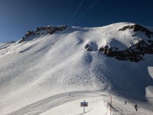
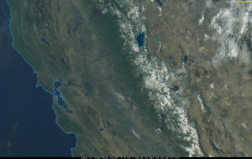
The visible satellite image (below) this afternoon shows clear skies over Central and Northern California and a fresh bright layer of new snowfall over the Sierra. The mountain picked up about a foot or more from the last storm that over-delivered.
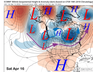
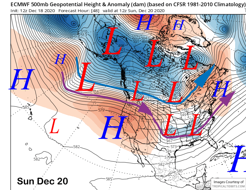
High pressure will continue to build over CA and the Mammoth area through the weekend (image below) and into Monday next week. Temperatures will warm up over the next few days and become seasonably mild by Sunday followed by slightly colder weather Monday under continued fair skies.
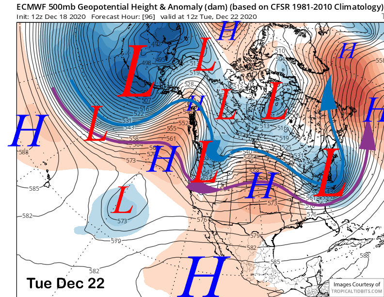
The models then move an insider type system (image below) through the Great Basin in Nevada on Tuesday resulting in colder temperatures and gusty north/northeast winds for Mammoth under continued dry conditions. If you need to take a day off, this would be the day.
Long Range (Days 5+):
High pressure is then expected to build back into CA and the Mammoth area through the Christmas Holiday for more fair and dry weather and seasonably mild temperatures.
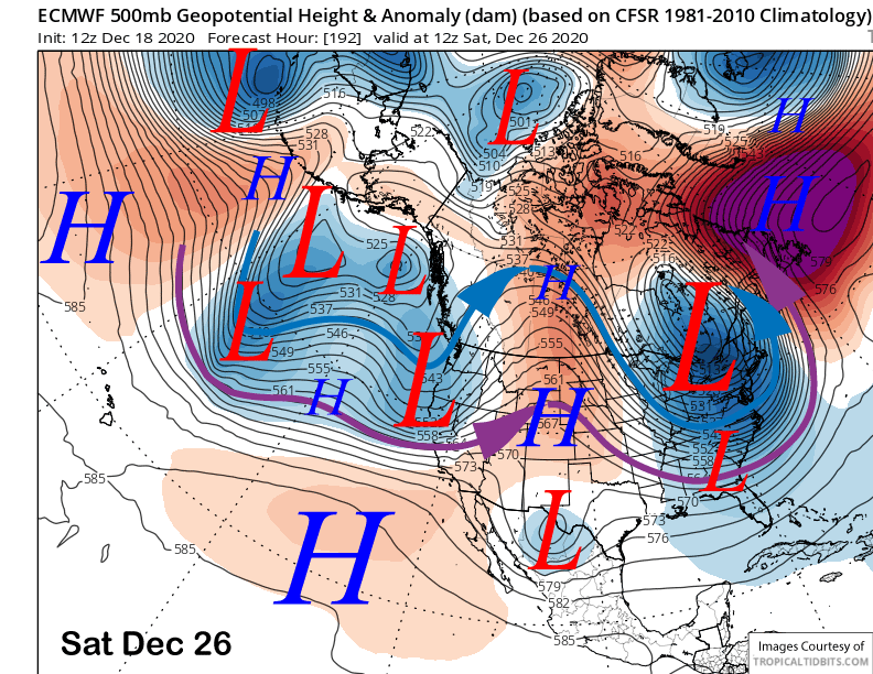
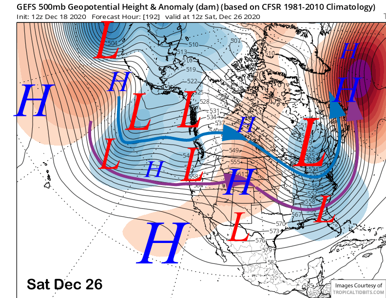
Changes could occur right after Christmas as the guidance is suggesting there could be a brief breakthrough of the westerlies or weak undercut of the jet stream into CA. The latest ECM model moves a short-wave trough into CA the day after Christmas (image below) for a round of snowfall.
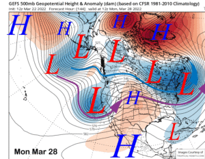
The latest 18Z GFS run is a bit farther southward than the 12Z run and is closer to the ECM solution (image below) that is farthest southward with the jet stream (purple arrow). The Canadian model though, is much farther northward and into Washington and the GFS ensemble (two images below) that has been doing the best lately, has the jet pointed farther northward into NorCal.
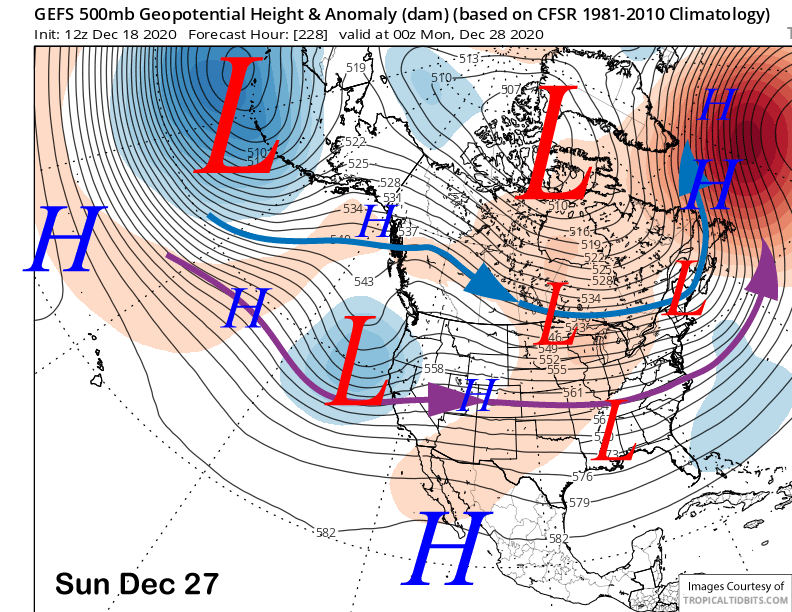
Although there is uncertainty with that potential storm, models are actually more bullish for a storm into the Mammoth area around Sunday the 27th. That was the date we were eyeing per the GFS ensemble in the last update. The ECM moves that upper low off the coast into CA on the 27th and that solution is well supported by the GFS ensemble mean (image below).
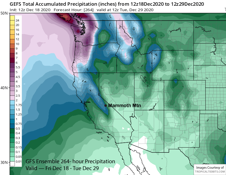
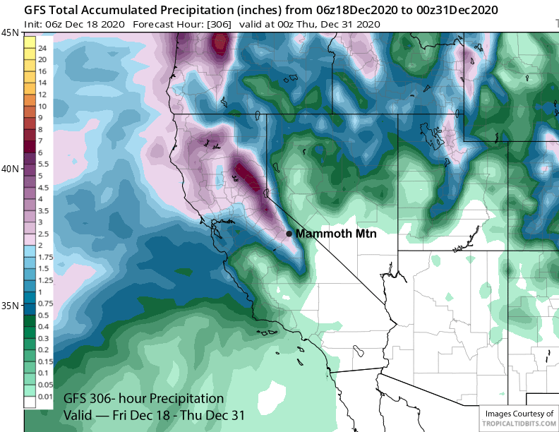
Since the storms would be coming from the west, it would be the needed base-type Sierra cement snowfall. The GFS ensemble mean is not that bullish yet on a big event (image below) and only shows about 0.75”, but other recent runs of the GFS like last night’s 6Z run did show some good amounts over 2” liquid (two images below). It is still 7-9 days out, so details will change, but it is our best bet for snowfall in the foreseeable future.
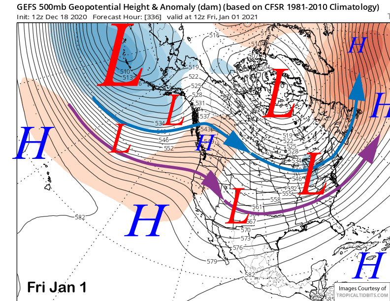
The GFS ensemble has a high pressure ridge building back into CA to end 2020 and begin 2021 (image below). That model then keeps the ridge in place for the remainder of the 15 day forecast period for fair and dry weather.
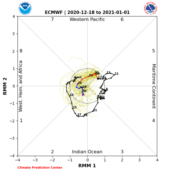
Any dry breaks probably won’t be long lasting if the ECM model MJO forecast pans out (image below). It has the signal finally moving westward around the globe into more favorable phases after being stuck in phases 4-5 over the last three plus weeks. Unfortunately, the other models are not as progressive as the ECM, so there is certainly a lot of uncertainty with that poorly forecast tropical forcing agent. Fingers crossed. WG