Powder Forecast – Friday January 8th, 2021
Ted Schlaepfer CCM —- Mammoth Mountain WeatherGuy
Snowfall forecasts are valid at the Sesame snow course (Main Lodge) for the prior 24 hours as reported in the 6-7 AM morning snow report.
**Snowfall forecast confidence ranges from very low (1) to very high (5)
Sat 1/9 = 0”
Sun 1/10 = 0”
Mon 1/11 = 0”
Tue 1/12 = 0”
Wed 11/13 = 0”
Thu 11/14 = 0”
Fri 11/15 = 0”
Sat – Mon 1/16 – 1/18 = 0”
January Snowfall = 3”
January Forecast = 20 – 35”
Detailed 4-day Snowfall Forecast:
Sat 1/9 through Tue 1/12 – No snowfall expected all days.
Forecast Summary:
Short Term (Days 1 – 4):
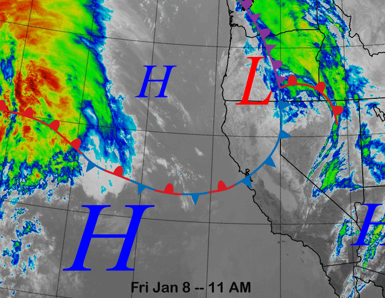
The infrared satellite image (below) today shows a dissipating front moving through the Bay Area and N. Sierra associated with a weak low-pressure system situated in southern Oregon. It will result in just clouds moving through Mammoth and no snowfall. High pressure off the coast will build into the area tomorrow for another dry day under mostly sunny skies.
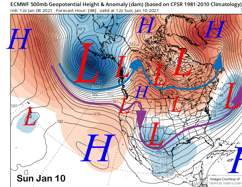
Models move the system that is now entering the eastern Pacific into the southern Oregon (image below) Sunday as a very weak short wave that will only produce passing clouds again. Any precipitation will be confined to the Northern CA coast.
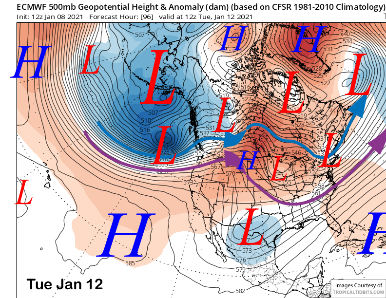
The jet stream is then forecast to lift northward (image below) through early next week with any storm systems moving into the PacNW and only weak fronts brushing the NW coast. It will mean continued dry weather for Mammoth and warming through the week.
Long Range (Days 5+):
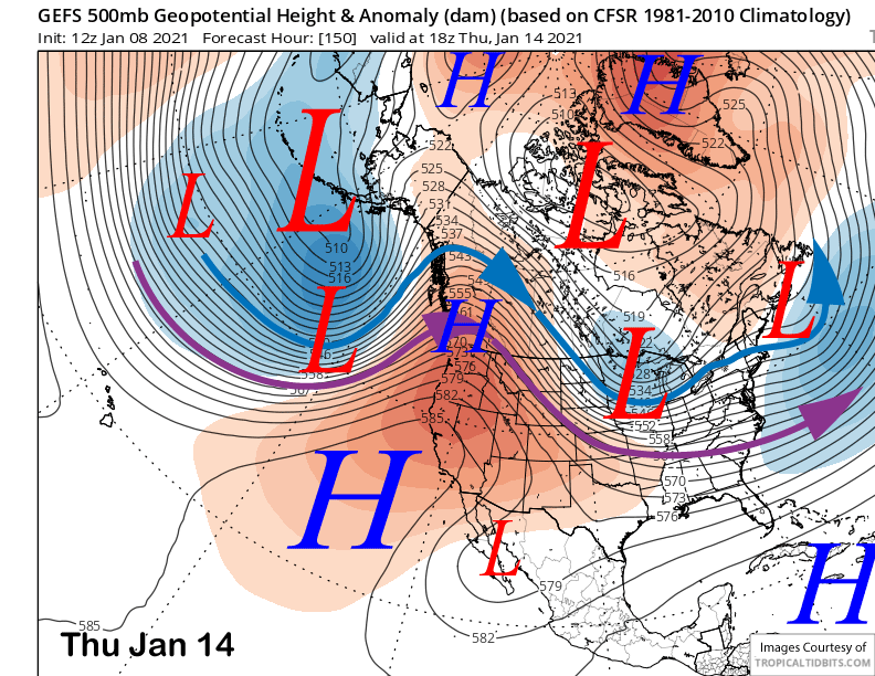
The longer-range guidance continues to build the high pressure ridge through mid-week with the ensemble guidance suggesting it will peak in strength around Thursday next week (image below). That will result in clear skies and above normal temperatures to end next week. Temps will probably get into the mid-50s at Main, mid-40s at McCoy, and possibly mid/upper 30s up top that will probably result in a January thaw.
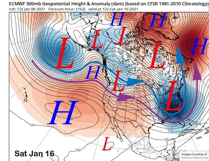
The models do move a weather system through the ridge over the following weekend (ECM model below) with the GFS model having the system farthest southward versus the other models.
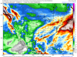
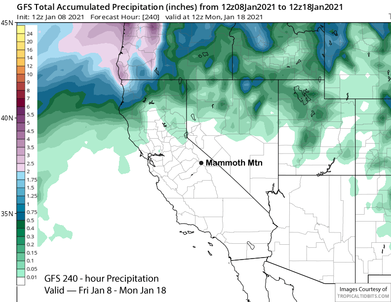
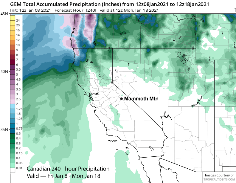
Regardless, it will be unlikely to produce any significant or meaningful snowfall as the 10-day forecast period is looking completely dry right now. All of the latest deterministic model runs are completely dry as shown by the GFS (image below) and Canadian (two images below) models.
There could be a system that busts through the ridge with some light snowfall during the following week, but it appears that our best chance for significant snowfall won’t happen again until the last week of January at the earliest.
It was mentioned in the last post that the long-wave trough that is expected to develop over the mid-continent may undergo discontinuous retrogression westward to the West Coast as part of the ongoing SSW event (see two posts ago for more info on the SSW).
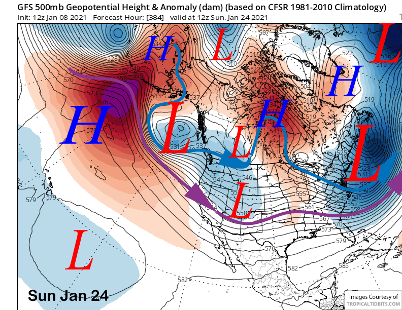
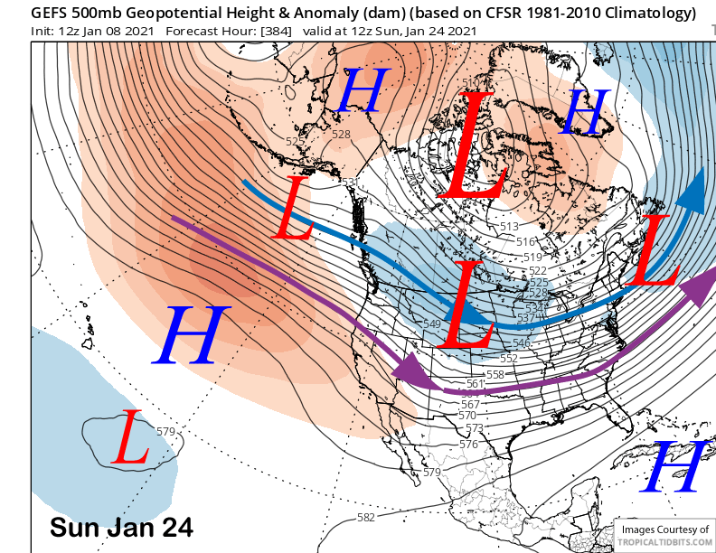
The 12Z GFS is still hinting at that scenario unfolding after the 24th (image below) and that scenario is supported by the latest run yesterday of the ECM climate model. However, the GFS ensemble mean is not exactly bullish about that scenario yet and only shows a flattening of the West coast ridge (two images below).
Overall, it is looking rather dry for the next 10 days or longer with probably no powder days until the last week of the month. The ECM model does keep the trough along the West Coast extending southward into CA through mid-February, so hopefully we will finally get a good set of storms during the height of the precipitation season for central California. WG