Powder Forecast – Tuesday February 9th, 2021
Ted Schlaepfer CCM —- Mammoth Mountain WeatherGuy
Snowfall forecasts are valid at the Sesame snow course (Main Lodge) for the prior 24 hours as reported in the 6-7 AM morning snow report.
**Snowfall forecast confidence ranges from very low (1) to very high (5)
Wed 2/10 = 0 – 1”
Thu 2/11 = 0”
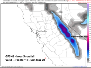
Fri 2/12 = 9 – 11” (H20 = 1.00” – 1.10”)**3
Sat 2/13 = 1 – 2” (H20 = 0.10” – 0.25”)**3
Sun 2/14 = 5 – 7”
Mon 2/15 = 0 – 1”
Tue 2/16 = 5 – 9”
Wed – Fri 2/17 – 2/19 = 3 – 12”
February Snowfall = 0.5”
February Forecast = 30 – 50”
Detailed 4-day Snowfall Forecast:
Wed 2/10– No snowfall expected.
Thu 2/11– Dry during the day with increasing clouds/wind, then moderate to heavy snowfall develops during the evening and continues overnight. Accumulations 9 – 11” by Friday AM, 12+” up top.
Fri 2/12– Lingering snow showers during the morning, ending by midday. Accumulations 1 – 2”, maybe 3” up top.
Sat 2/13– Dry to start the day with increasing clouds/wind, then snow is likely by the afternoon and evening, tapering off overnight. Accumulations 5 – 7” by Sunday AM, 8-10” up top.
Forecast Summary:
Short Term (Days 1 – 4):
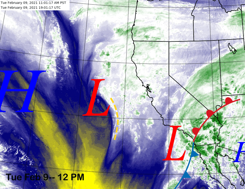
The mid-level water vapor satellite image (below) today shows lots of middle and high level moisture associated with a bunch of cloudiness moving into CA and Mammoth from a couple passing weak low pressure systems that are situated off the coast. There have been some flurries today in Mammoth and flurries or light snow showers are possible through this evening. No meaningful accumulation is expected.
High pressure will build into California tomorrow out ahead of a stronger weather system (image below) poised to bring some snowfall on Thursday evening and overnight into Friday. Clouds and wind are expected to increase during the day with snowfall starting late PM and most of it falling overnight when it could be heavy at times.
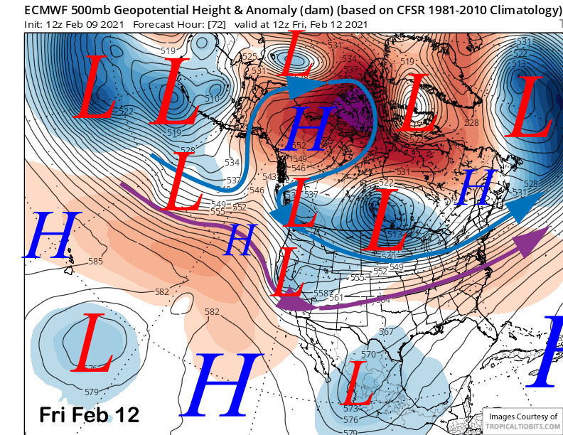
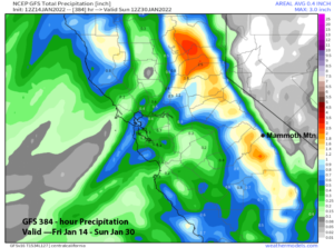
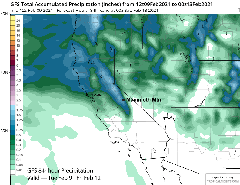
The snowfall will probably end during the morning hours Friday with the afternoon hours dry. Models are suggesting about an inch or slightly more of liquid precipitation (image below) should fall and that could be enough for close to a foot at Main. Snow levels will be 6-6500 feet for the bulk of the snowfall, so it won’t be super dry powder. Nonetheless, Friday looks like a powder day.
Another weather system is forecast to quickly move into the state on the heals of the prior system on Saturday (image below) for another round of snowfall. The morning may be dry with snowfall probably starting during the afternoon and continuing through the evening before ending overnight, although there is still uncertainty with the timing/amounts.
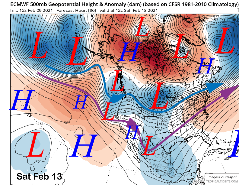
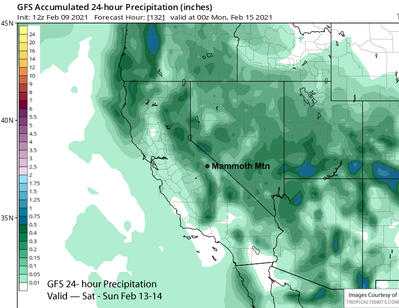
GFS model is only showing light amounts of precipitation (image below) while the GFS ensemble mean has slightly more and is close to the ECM model that has about 0.50” liquid. So it doesn’t look like deep powder, but likely enough for more powder turns on Sunday morning with maybe up to 6” at Main if we get lucky.
Long Range (Days 5+):
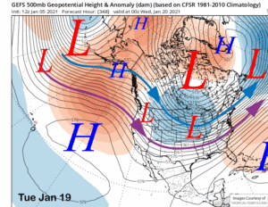
The longer-range guidance isn’t looking too shabby. It is suggesting a chance for at least low-end powder days about every couple of days for next week. It may start on Monday and into Tuesday as the ECM (image below) and other models are moving a fairly deep, but quick moving, upper level trough through CA and the Sierra in northwest jet stream flow.
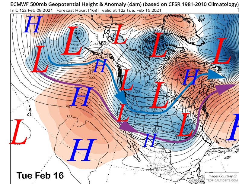
Northwest flow is not a particularly wet direction for CA storms, but if it is deep enough, light to moderate snowfall certainly is possible for Mammoth, especially if it is a warm front producing the snowfall. Right now, models are favoring about 6” give or take except for the GFS that has less and only a few inches of snowfall. Forecast follows the ECM ensemble mean that has about 6″ of snowfall.
After possibly a break Tuesday and Wednesday, the GFS (image below) is suggesting that another storm may move into the area toward the end of the week. The ECM potentially has the storm too, but appears to be slower by about 12-24 hours.
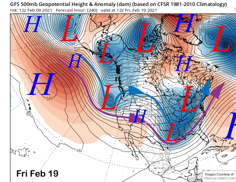
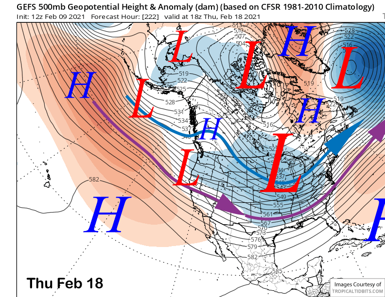
The Canadian is faster and moves into CA on Thursday and that actually matches up better with the GFS ensemble mean (image below) that has the trough axis moving into CA on Thursday too. Right now, the forecast favors the GFS ensemble mean that brings in it around late Wednesday and into Friday.
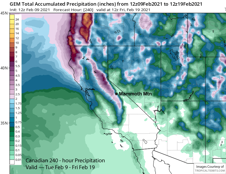
Overall, the ECM and Canadian (image below) models are similar with the 10-day precipitation forecast with around 2” liquid while the GFS is slightly less at 1.5”. None of these potential storms over the next week or longer appears to be a strong one, but certainly could keep the snow conditions prime under winter-like conditions. It should be a good week.
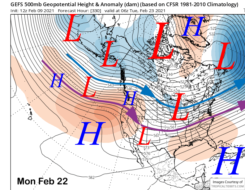
The GFS ensemble has one more chance for snowfall around Saturday the 20th before favoring a ridge of high pressure to build over the West Coast by late in the weekend or early over the following week (image below). That should result in a dry weather for at least a few days.
The longer-range climate models are hinting that storminess will increase again toward the end of the month and into early March or longer. Many drier La Nina winters with a warming equatorial Pacific during spring have seen a wet March. Take 2012 for example, about 93” of snowfall that occurred December through February was followed by 79” in March. Fingers crossed. WG