Powder Forecast – Friday February 19th, 2021
Ted Schlaepfer CCM —- Mammoth Mountain WeatherGuy
Snowfall forecasts are valid at the Sesame snow course (Main Lodge) for the prior 24 hours as reported in the 6-7 AM morning snow report.
**Snowfall forecast confidence ranges from very low (1) to very high (5)
Sat 2/20 = 2 – 3” (H20 = 0.20” – 0.35”)**3
Sun 2/21 = 0”
Mon 2/22 = 0”
Tue 2/23 = 0”
Wed 2/24 = 0 – 1″
Thu 2/25 = 0”
Fri 2/26 = 0 – 2”
Sat – Mon 2/27 – 3/1 = 0 – 2”
February Snowfall = 22”
February Forecast = 25 – 30”
Detailed 4-day Snowfall Forecast:
Sat 2/20 – A brief period of moderate snowfall from overnight ends around dawn, 2 – 3” accumulation at Main when lifts open, 3”+ up top.
Sun 2/21 through Tue 2/23 – No snowfall expected all days.
Forecast Summary:
Short Term (Days 1 – 4):
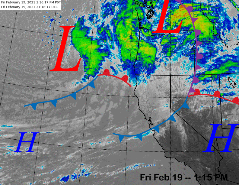
The infrared satellite image (below) this afternoon shows a dissipating front over Central California and another low pressure system off the NorCal coast. The dissipating front will probably only produce clouds/flurries this evening before a period of moderate snowfall develops overnight from the trailing weather system.
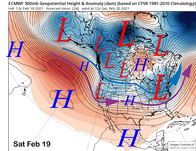
The ECM model (image below) moves the upper-level low through the Sierra early tomorrow morning and quickly eastward by the afternoon. Snow will likely start after mid-night, peak in the early morning hours, and then end around dawn.
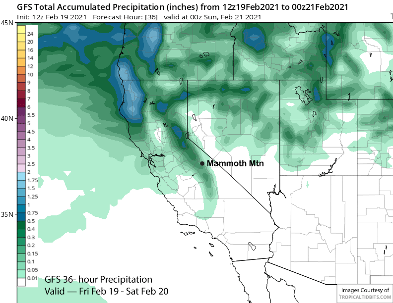
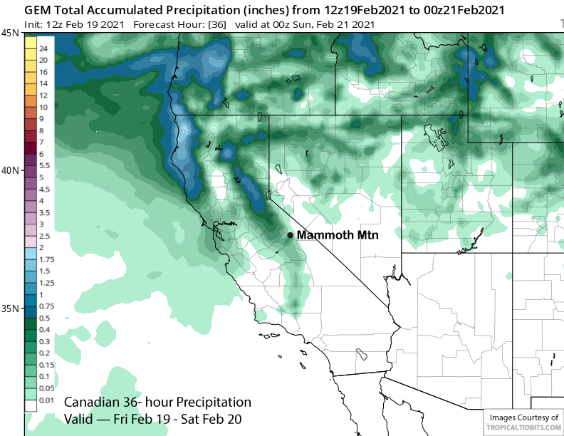
The GFS model has about a quarter inch liquid (image below) while the Canadian model is showing slightly less (two images below). The latest ECM run has about a third of an inch. So a couple to few inches of snowfall is likely and it will the drier type of snow as snow levels will lower to around 4000 feet overnight. There will likely be some fun turns tomorrow morning.
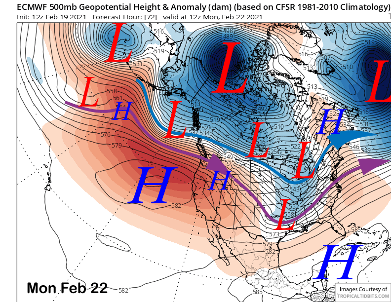
High pressure will then build into the state Sunday and hold through Monday (image below) or Tuesday resulting in fair and warmer weather. It won’t get too warm though with freezing level only rising to around 9000 feet on Monday that is expected to be the warmest day. Slightly colder temperatures and breezy winds are likely Tuesday out ahead of the next short-wave.
Long Range (Days 5+):
The longer-range guidance is now favoring dis-continuous retrogression of the long-wave trough centered over the middle part of the country westward over the West Coast over the next couple weeks, but exactly how far west and how fast is still uncertain.
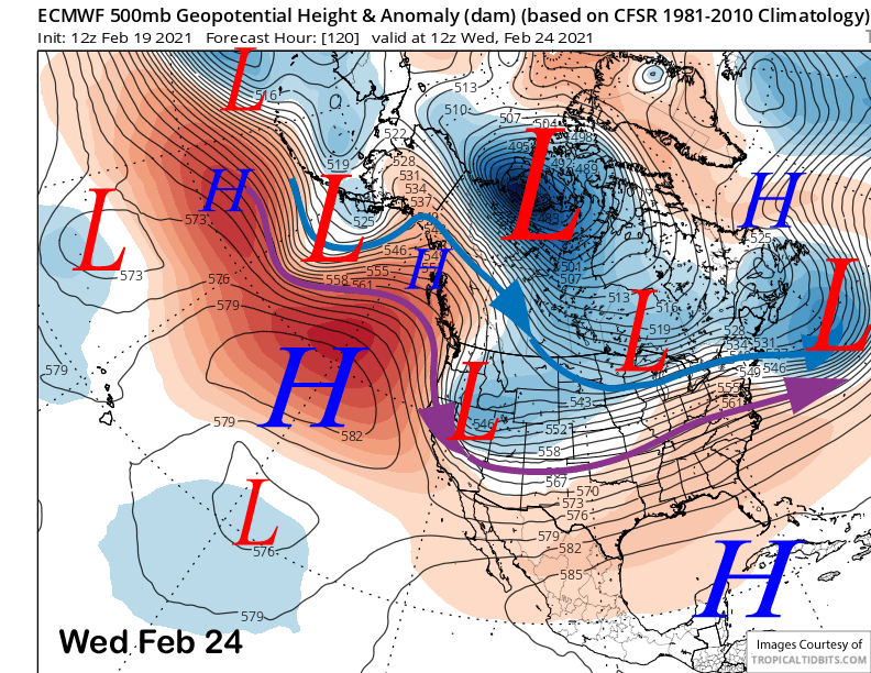
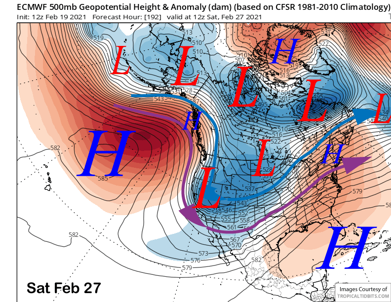
The ECM model moves a slider-type short wave southward through eastern CA and the Great Basin early Wednesday (image below) followed by another one slightly farther westward around Friday or Saturday (two images below) next week. The first one is only expected to produce flurries and the second one only light snowfall. Both systems will result in colder temperatures and gusty north/northeast winds at times that may be strong enough for lift holds.
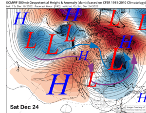
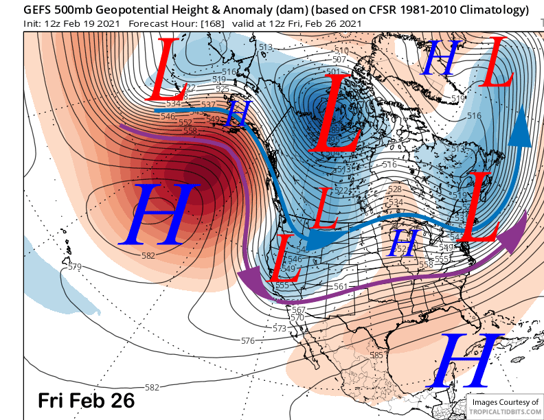
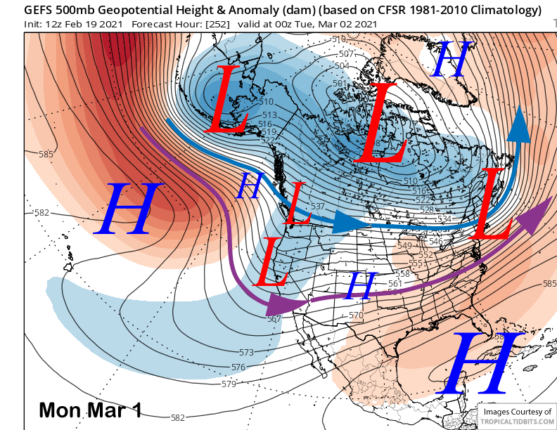
These solutions of minimal over-water trajectory before landfall is well supported by the GFS ensemble mean (image below) that has the trough axis positioned over eastern CA/western Nevada. That favors the northwest/north jet stream flow that is not a wet direction for CA, but usually cold/windy.
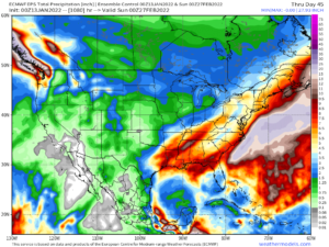
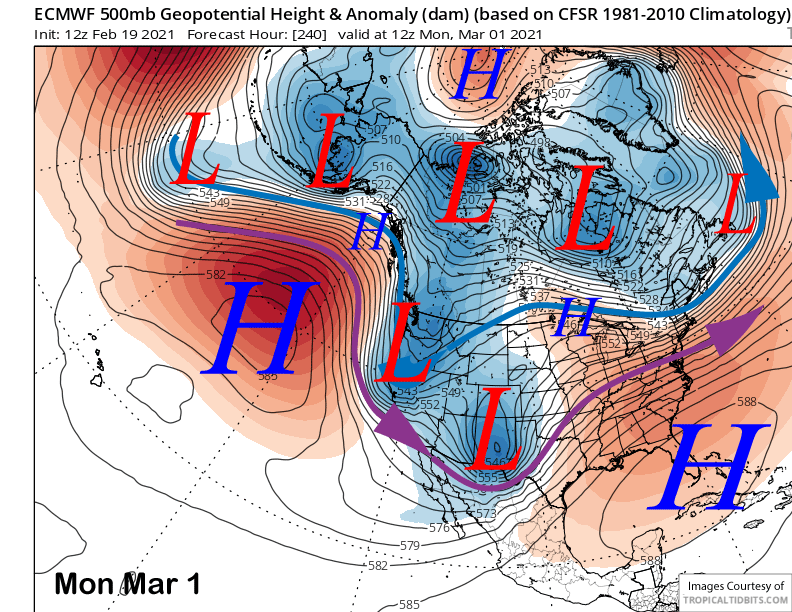
The next chance for more meaningful snowfall might not be until early March as the ECM model (image below) moves the next short-wave down the coast a bit farther westward with a bit more over-water trajectory. This solution is also supported by the GFS ensemble (two images below) that has the trough axis farther westward and just off the CA coast. While this is not a super wet pattern, it could produce enough snowfall for powder conditions if all the cards fall into place.
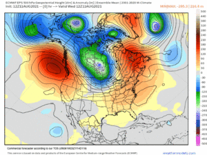
The longer-range fantasy guidance is actually a bit more favorable for storms that may lead to powder days over the first week of March. The GFS ensemble (image below) continues to move the long-wave trough westward off the West Coast that will allow storm system to move off the eastern Pacific and into California.
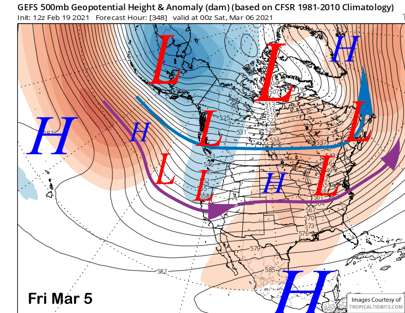
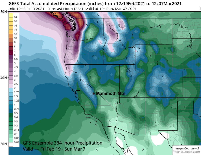
It is a very long ways out and forecasts out that far are generally not reliable. The GFS ensemble mean is not showing significant precipitation (image below) yet with maybe an inch and a half for the entire period. Regardless, that may be the next good chance for deeper powder days. WG