Powder Forecast –Friday March 19th, 2021
Ted Schlaepfer CCM —- Mammoth Mountain WeatherGuy
Snowfall forecasts are valid at the Sesame snow course (Main Lodge) for the prior 24 hours as reported in the 6-7 AM morning snow report.
**Snowfall forecast confidence ranges from very low (1) to very high (5)
Sat 3/20 = 16 – 18” (H20 = 1.70” – 1.90”)**4
Sun 3/21 = 0 – 1”
Mon 3/22 = 0”
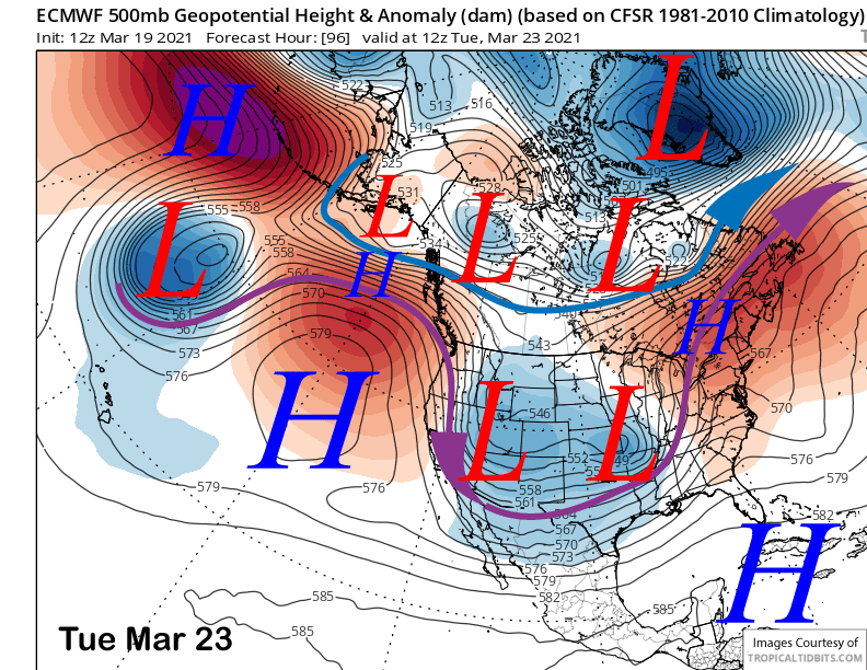
Tue 3/23 = 0”
Wed 3/24 = 0”
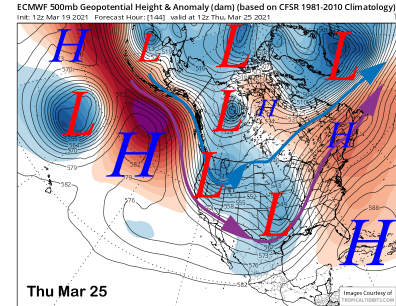
Thu 3/25 = 0”
Fri 3/26 = 0 – 1”
Sat – Mon 3/27 – 3/29 = 0”
March Snowfall = 33”
March Forecast = 50 – 55”
Detailed 4-day Snowfall Forecast:
Sat 3/20 – Lingering snow showers during the morning, then mostly dry with just a chance for an afternoon snow shower. No significant accumulation expected.
Sun 3/21 through Tuesday 3/23– No snowfall expected all days other than a chance for flurries Monday
Forecast Summary:
Short Term (Days 1 – 4):
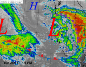
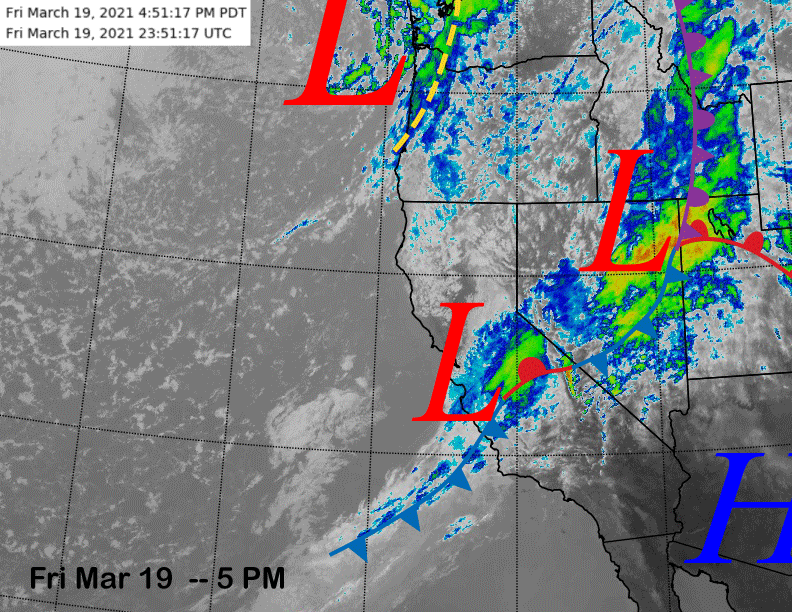
The infrared satellite image (below) this afternoon shows a frontal system stretching across Nevada and Central California with a couple low pressure waves situated along the front. The main wave is just west of the Sierra and will move into the Mammoth area overnight.
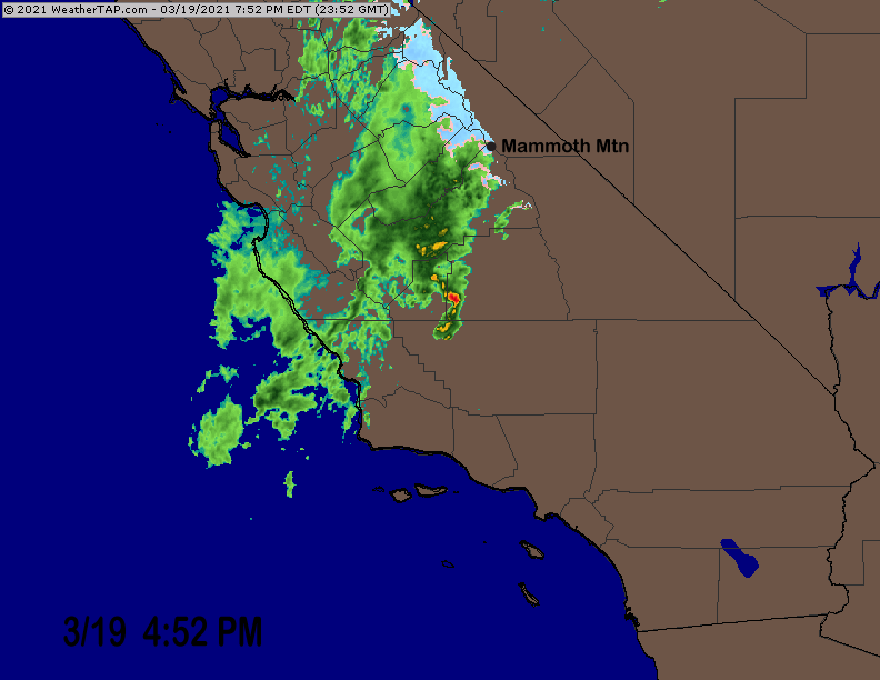
Current radar (image below) shows heavy precipitation west of Mammoth that will increase the snowfall overnight when it will be heavy at times. This is Sierra cement type snowfall with lots of water content and is not fluffy.
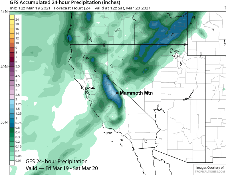
As of 5 PM today, about 7 inches (0.80” liquid) has fallen since 8AM and models are suggesting at least 1.5” total liquid (GFS below) with the ECM having about 1” more overnight. That will equate to about 9-10” of more snow overnight and about 20” total for the storm.
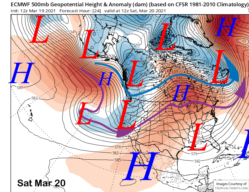
The ECM model moves the trough axis through the Sierra early tomorrow (image below) and snowfall will stop rather abruptly during the morning before opening hours with just a chance for light snow showers for the rest of the day. I suspect it will be a slow opening for the top.
Sunday will be a dry day and Monday likely too with just a chance for light snow showers or flurries from a passing inside slider type weather system (image below) Monday night and early Tuesday. Tuesday should be dry and breezy/windy.
Long Range (Days 5+):
The longer-range guidance is generally not favorable for any significant snowfall for the rest of March.
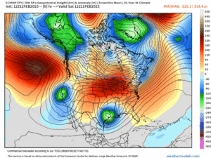
The numerical guidance keeps the jet stream far northward or eastward for the most part with just a slight chance for light snowfall around Thursday (image below) next week from another inside slider weather system that may move southward a bit farther westward this time. It will likely be more wind than snowfall with just an inch or two possible.
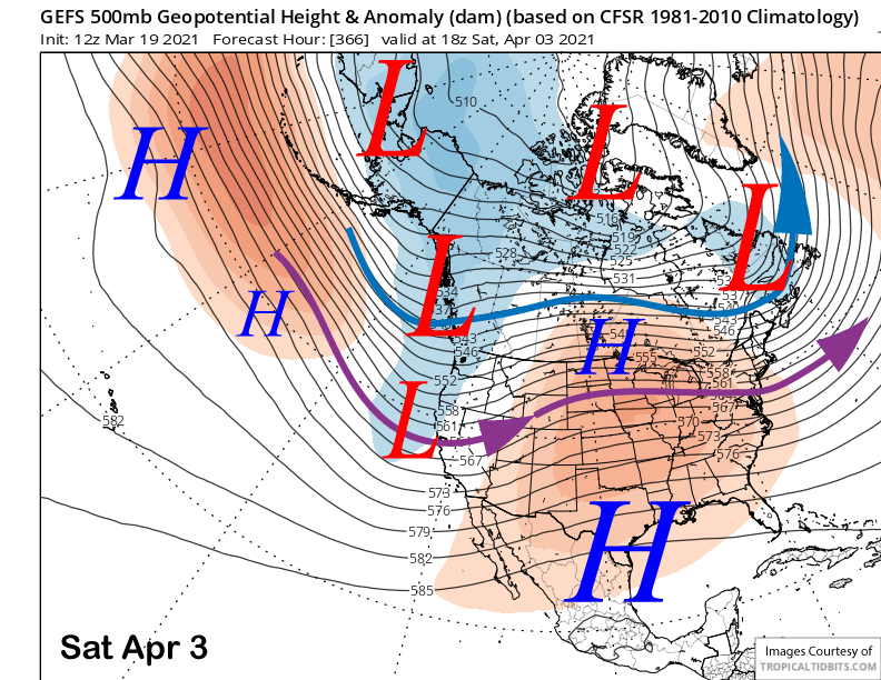
The next chance for a powder day might not be until early April according to the GFS ensemble mean. It moves the jet stream far enough southward (image below) that a storm could produce enough snowfall for powder conditions. It keeps the jet southward for a few days so it might not be a one-shot deal. WG