Powder Forecast –Tuesday March 23rd, 2021
Ted Schlaepfer CCM —- Mammoth Mountain WeatherGuy
Snowfall forecasts are valid at the Sesame snow course (Main Lodge) for the prior 24 hours as reported in the 6-7 AM morning snow report.
**Snowfall forecast confidence ranges from very low (1) to very high (5)
Wed 3/24 = 0”
Thu 3/25 = 0”
Fri 3/26 = 2 – 4” (H20 = 0.25” – 0.35”)**2
Sat 3/27 = 0”
Sun 3/28 = 0”
Mon 3/29 = 0”
Tue 3/30 = 0 – 1”
Wed – Fri 3/31 – 4/2 = 0”
March Snowfall = 50”
March Forecast = 50 – 55”
Detailed 4-day Snowfall Forecast:
Wed 3/24 – No snowfall expected.
Thu 3/25 – Snow showers likely develop during the day before ending at night. Accumulations 2 – 4” by Friday AM, 4”+ up top
Fri 3/26 and Sat 3/27 – No snowfall expected both days
Forecast Summary:
Short Term (Days 1 – 4):
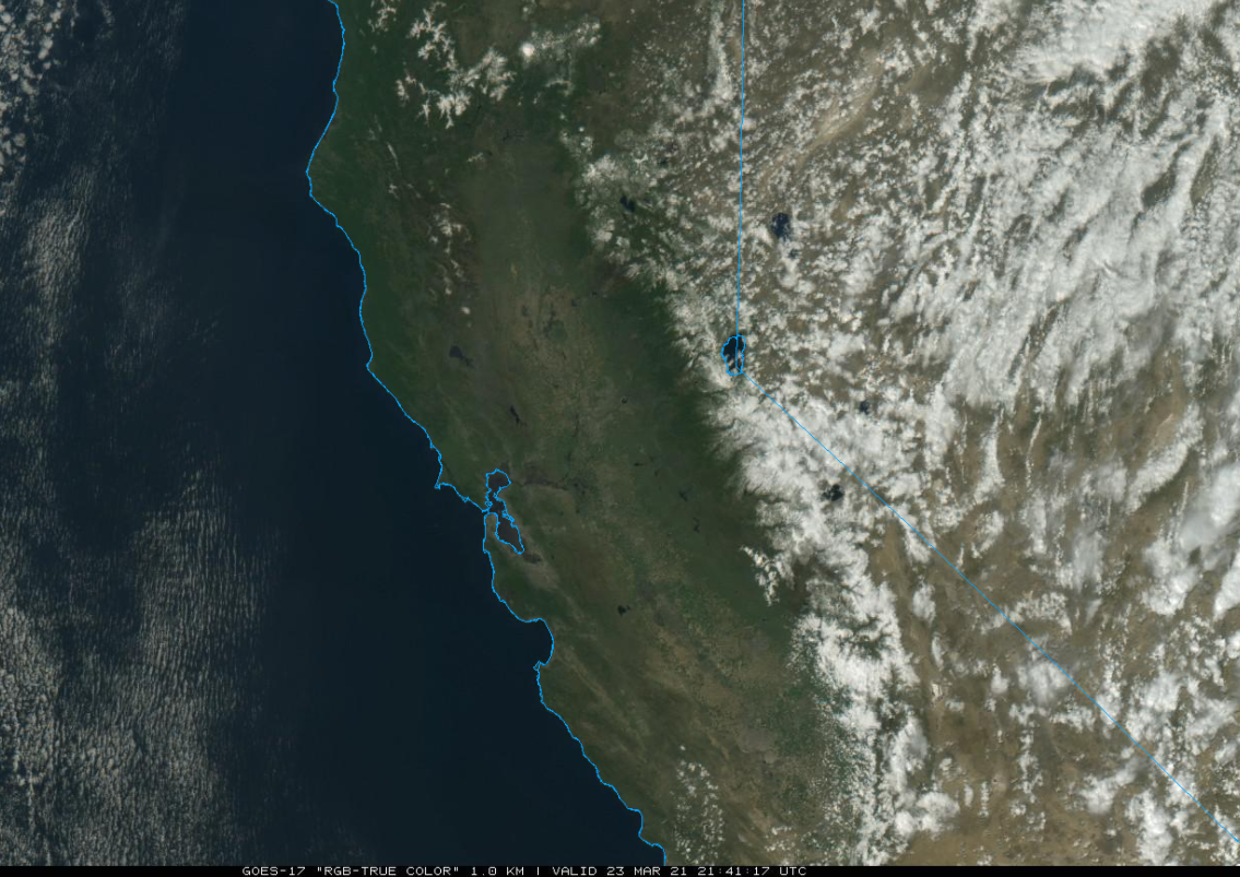
The visible satellite image (below) this afternoon shows lingering clouds across the eastern Sierra from the weather system that moved through overnight with a couple inches of snow and now gusty northeast winds across the upper part of the mountain.
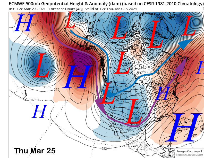
High pressure will build into Mammoth tomorrow for fair weather and lighter winds followed by another inside slider type weather system on Thursday (image below) that may also generate a few inches of snowfall Thursday during the day and into the evening.
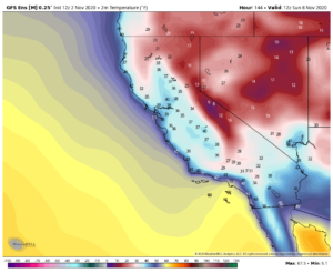
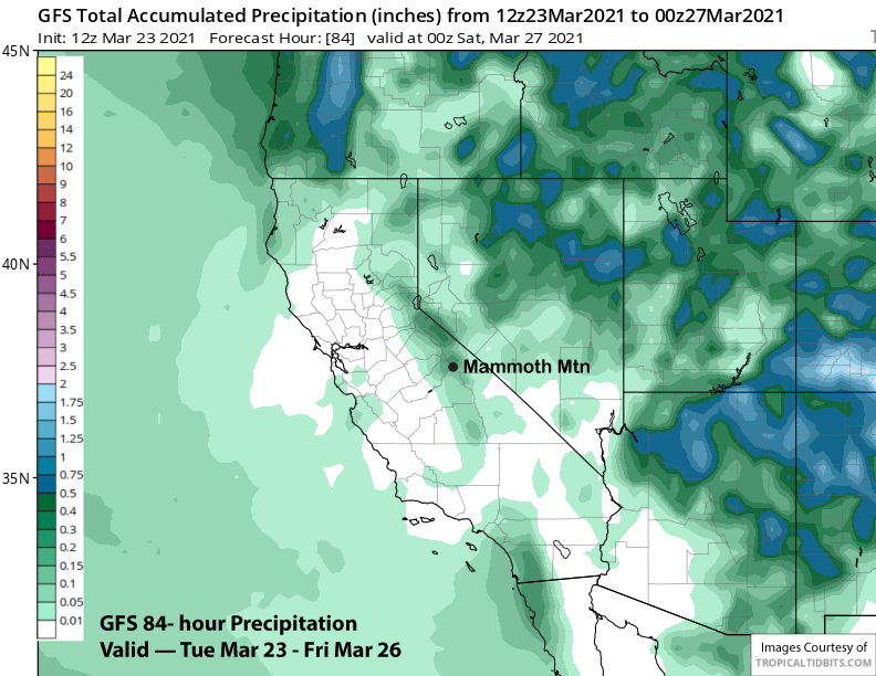
Both the GFS (image below) and ECM models are showing around a quarter inch of liquid from the passing weather system and likely not enough for powder conditions. Nonetheless, conditions should remain good and winter-like across the middle and upper part of the mountain through Friday. Fair and warmer weather is forecast for Saturday.
Long Range (Days 5+):
The longer-range guidance is generally still not favorable for any significant snowfall for the rest of March and now into the first few days of April.
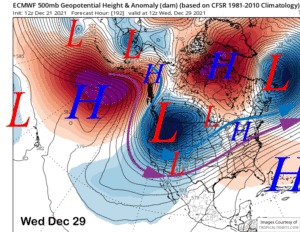
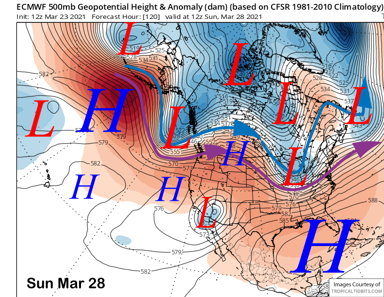
The latest ECM model has a ridge of high pressure holding over CA through Sunday (image below) for continued fair weather and likely spring conditions on the lower part of the mountain and possibly mid-mountain too.
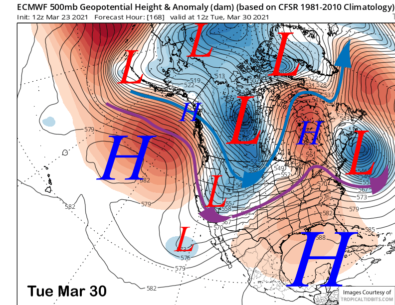
That model then moves another inside slider through CA on Monday and into Tuesday (image below) for colder weather and probably more northeast winds Tuesday. The Canadian is similar to the ECM while the GFS is farther eastward with the system resulting less cooling and wind. Regardless, it will likely be dry through early next week.
And it will likely be dry through the end of the month as the ECM model (image below) and others either keep a ridge in place or have the jet stream too far northward into the PacNW for any snowfall in Mammoth.
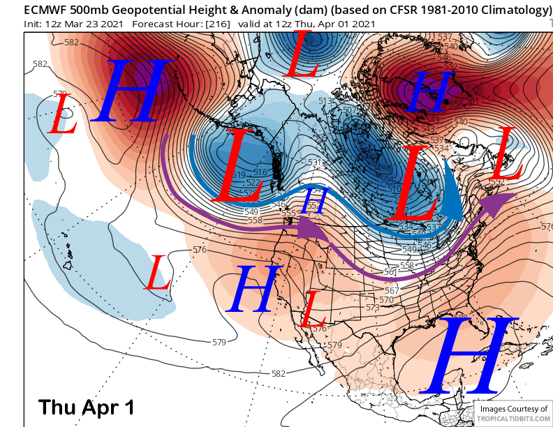
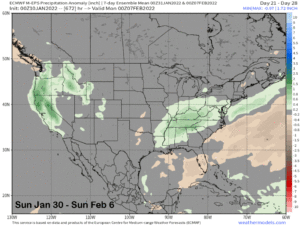
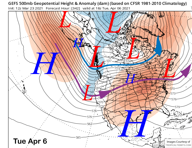
The longer range GFS ensembles are suggesting the next chance for any snowfall will be around the first week of April (image below) if the jet stream does indeed dip that far southward. The ECM ensembles are not quite as bullish and have a weaker trough and the jet stream farther northward.
Forecast favors the GFS ensemble that has done better this season in my opinion. Hopefully we will get another powder day or two before Canyon lodge and that side of the mountain closes April 18th. WG