Powder Forecast –Tuesday April 6th, 2021
Ted Schlaepfer CCM —- Mammoth Mountain WeatherGuy
Snowfall forecasts are valid at the Sesame snow course (Main Lodge) for the prior 24 hours as reported in the 6-7 AM morning snow report.
**Snowfall forecast confidence ranges from very low (1) to very high (5)
Wed 4/7 = 0”
Thu 4/8 = 0”
Fri 4/9 = 0”
Sat 4/10 = 0”
Sun 4/11 = 0”
Mon 4/12 = 0”
Tue 4/13 = 0”
Wed – Fri 4/14 – 4/16 = 0 – 2”
April Snowfall = 0”
April Forecast = 5 – 15”
Detailed 4-day Snowfall Forecast:
Wed 4/7 through Sat 4/10 – No snowfall expected all days.
Forecast Summary:
Short Term (Days 1 – 4):
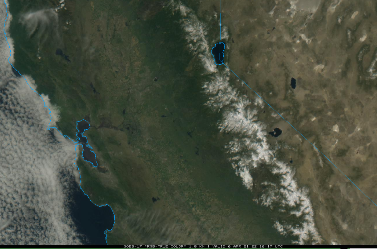
The visible satellite image (below) this afternoon shows mostly clear skies across CA and the winter snowpack in the Sierra. Not much change or slightly warmer weather is expected tomorrow along with increasing winds in the afternoon.
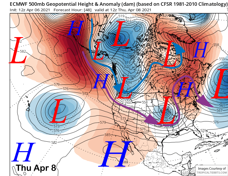
The models move a short wave east of CA on early Thursday (image below) resulting in increased wind tomorrow afternoon and night, otherwise not much change in the weather and continued spring conditions across most of the mountain are expected through Saturday.
Long Range (Days 5+):
The longer-range guidance has basically backed on any significant snowfall and odds for a powder day before Canyon/Chair 22 closes on April 18th has diminished considerably since the last update.
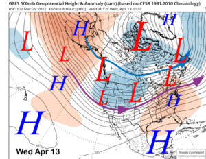
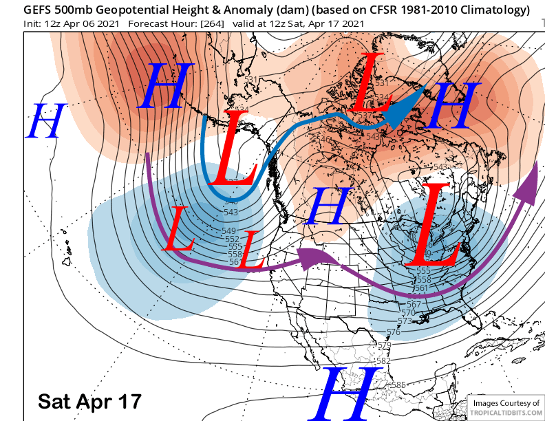
A stationary high pressure ridge (image below) is forecast to hold along the West Coast through the middle part of next week of longer now that will block any stronger storm systems from moving into California.
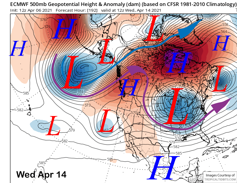
The operational models do try to sneak a weak upper-low under the ridge toward the end of next week (image below) and the ECM/GFS do have some light snowfall in the forecast. However, the vast majority of the ensemble runs are dry.
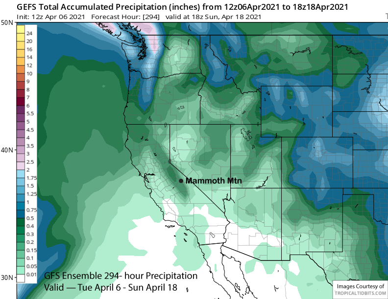
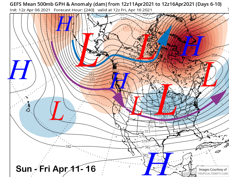
The GFS ensemble does move the long-wave trough closer to the coast by Canyon closing weekend (image below), but it is unclear whether any potential storms will move far enough southward for enough snowfall for powder conditions in Mammoth. It looks like spring in the models.
Overall, the GFS ensemble has about a quarter inch of liquid (image below) for the time period through the morning of April 18th. So the odds are not looking good now for any powder days before Chair 22 closes. Luckily there is still plenty of good terrain open through Memorial Day if there happens to be a late season surprise. WG