4-19-2021 @ 10:30 AM Good morning from the Eastern Sierra, we have clear blue skies from Mammoth Lakes to Bishop today.
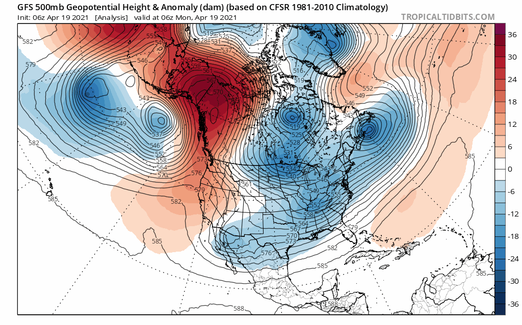
The weather forecast over the next week to 10 days looks like a typical April pattern we can get into with warm then cold and showery then warm again and then a chance for a good snowfall and then back to warm again.
Highs will be in the low 50s at the 9000 foot level today (Main Lodge) with a 60 in Mammoth Lakes, mid to upper 60s at Crowley Lake and the low 80s down in Bishop by mid-afternoon.
Lows the next few nights will be in the upper 20s at Main Lodge with 30s in Mammoth Lakes, and low 40s down in Bishop.
Winds the next few days will be out of the southwest 10 to 15 mph, with gusts as high as 25-35 mph. Lower elevations will have light winds at times 5-15 MPH out of the SW.
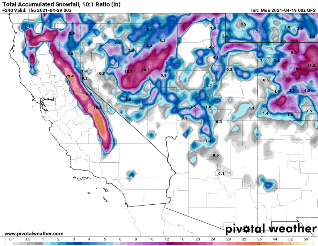
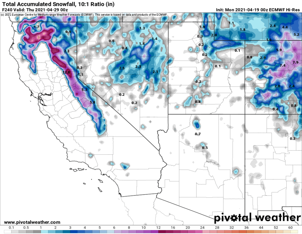
Long Range the GFS wants to bring in a moderate low pressure system Sunday night into Tuesday with 18-24 inches of snow, looking at the EU it has amounts showing that are in the 3-6 inch range for snowfall.
There is a tropical system in the western pacific that will influence how this all pans out, for now, we will call for a chance of snow late in the weekend into early next week with rain in the lower elevations possible.
Snowman
PS: Please consider supporting and partnering with us because You love seeing my posts, reports, and photos/videos of the area. Here is the link to learn more.