Powder Forecast –Friday April 23rd, 2021
Ted Schlaepfer CCM —- Mammoth Mountain WeatherGuy
Snowfall forecasts are valid at the Sesame snow course (Main Lodge) for the prior 24 hours as reported in the 6-7 AM morning snow report.
**Snowfall forecast confidence ranges from very low (1) to very high (5)
Sat 4/24 = 0”
Sun 4/25 = 2 – 3” (H20 = 0.25” – 0.30”) **2
Mon 4/26 = 6 – 9” (H20 = 0.75” – 1.00”) **3
Tue 4/27 = 0 – 1”
Wed 4/28 = 0”
Thu 4/29 = 0”
Fri 4/30 = 0”
Sat – Mon 5/2 – 5/4 = 0 – 2”
April Snowfall = 2.5”
April Forecast = 10 – 15”
Detailed 4-day Snowfall Forecast:
Sat 4/24 – No snowfall expected until late at night when light snowfall starts. Accumulation 2 – 3” by Sunday AM, 3”+ up top
Sun 4/25 –Snow, heavy at times through morning/midday with snowfall continuing through the evening hours before tapering off overnight. Accumulations 6 – 9”, 10”+ up top.
Mon 4/26 –Light snow showers are possible at times through Monday night. No significant accumulation expected.
Tue 4/27 – Slight chance for a snow flurry AM, otherwise dry weather returns.
Forecast Summary:
Short Term (Days 1 – 4):
The infrared satellite image (below) this afternoon shows an upper level low-pressure system in the eastern Pacific moving toward the NorCal coast. It will move inland early tomorrow and only passing clouds, cooler temperatures, and breezy/gusty southwest winds are expected in Mammoth as it will move east through CA too far northward for any snowfall.
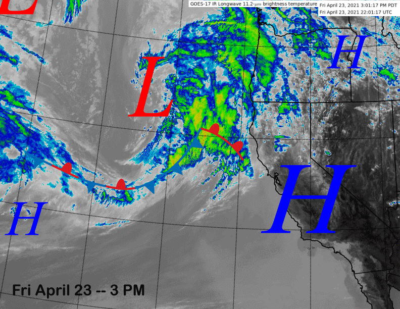
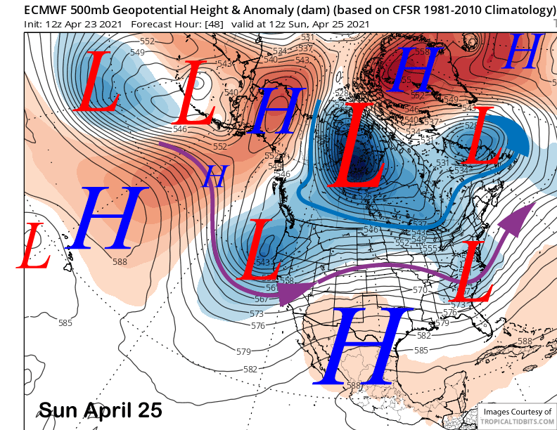
The next weather system (image below) will quickly move into California behind the first on Sunday and it will be far enough southward for snowfall in Mammoth. It will slowly move out of the state by early Tuesday, although most of the snowfall is expected Sunday that will be a rider of the storm day.
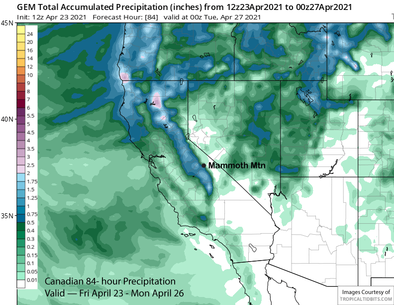
The GFS operational model is by far the snowiest with snowfall liquid equivalent around 1.75” for the event (image below). The ECM operational model is by far the driest with less than an inch of liquid forecast. The Canadian model is in between the two with around an inch (two images below) while the GFS ensemble is closer to the ECM op (three images below).
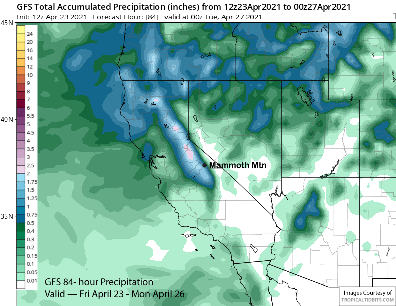

The jet dynamics seem favorable to support at least an inch of liquid, if not closer to 1.5” as there is good orographic southwest flow into the range backed by a 100-knot upper level jet. There is also decent moisture available for the trough with a precipitable water plume of around 1” off the Central Coast.
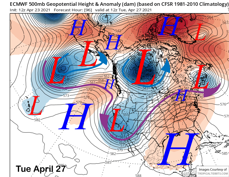
Thus, the forecast leans toward the higher amounts with at least an inch of liquid expected and maybe closer to 1.5” at Main. That should be good enough for close to a foot of snowfall with snow levels 6000 feet Sunday, lowering to 4000 feet Sunday night. Temperatures should stay cold on Monday with light snow showers with the low slowly moving out of CA and Tuesday only slightly warmer, primarily during the afternoon. Last call for powder this season.
Long Range (Days 5+):
The longer-range guidance is generally showing a more typical spring pattern with no clear signs of any more powder days.
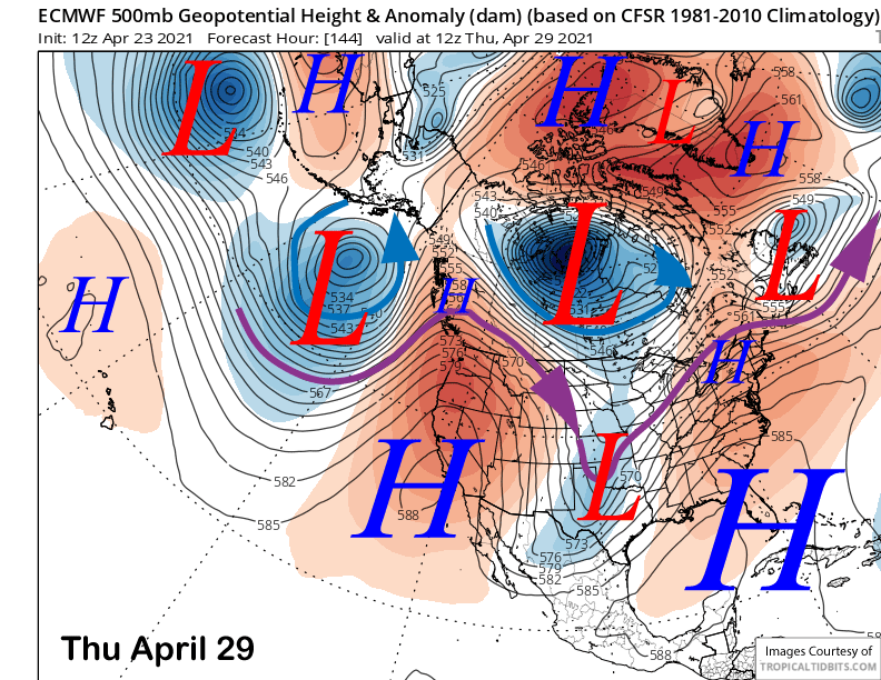
The ECM (image below) and other model build a strong ridge into CA by the middle/end of next week for fair and warmer conditions. That will lead to spring conditions on the entire mountain by Wednesday and certainly Thursday.
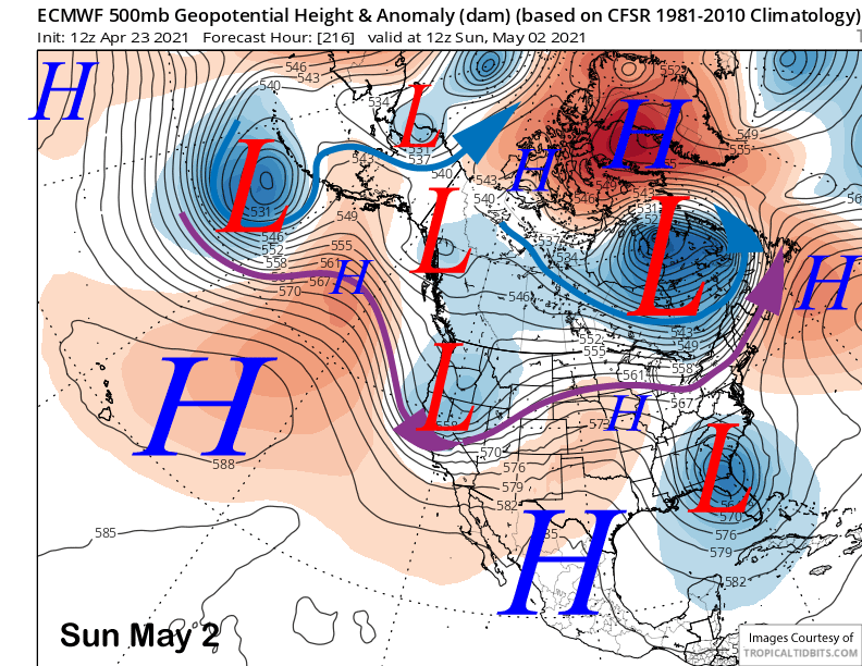
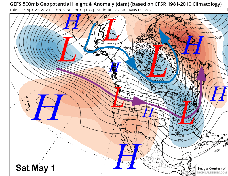
The longer range ECM model (image below) does move a trough into CA out of the North over the following weekend for colder weather and also some light snowfall. The GFS ensemble (two images below) has the trough moving into the West Coast a day earlier and much farther northward, so that ECM solution is doubtful.
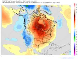
The fantasy range GFS ensemble 11-15 day (image below) has a fairly typical spring pattern with a weak long-wave trough east of CA across the interior West and a blocking ridge in the Eastern Pacific. That pattern supports a slider type system every few days under generally fair and dry conditions along with seasonable temperatures or typical spring conditions. WG