Powder Forecast –Tuesday May 4th, 2021
Ted Schlaepfer CCM —- Mammoth Mountain WeatherGuy
Snowfall forecasts are valid at the Sesame snow course (Main Lodge) for the prior 24 hours as reported in the 6-7 AM morning snow report.
**Snowfall forecast confidence ranges from very low (1) to very high (5)
Wed 5/5 = 0”
Thu 5/6 = 0”
Fri 5/7 = 0”
Sat 5/8 = 0”
Sun 5/9 = 0”
Mon 5/10 = 0”
Tue 5/11 = 0”
Wed – Fri 5/12 – 5/14 = 0”
May Snowfall = 0”
May Forecast = 0 – 5”
Detailed 4-day Snowfall Forecast:
Wed 5/5 through Sat 5/8 – No snowfall expected all days
Forecast Summary:
Short Term (Days 1 – 4):
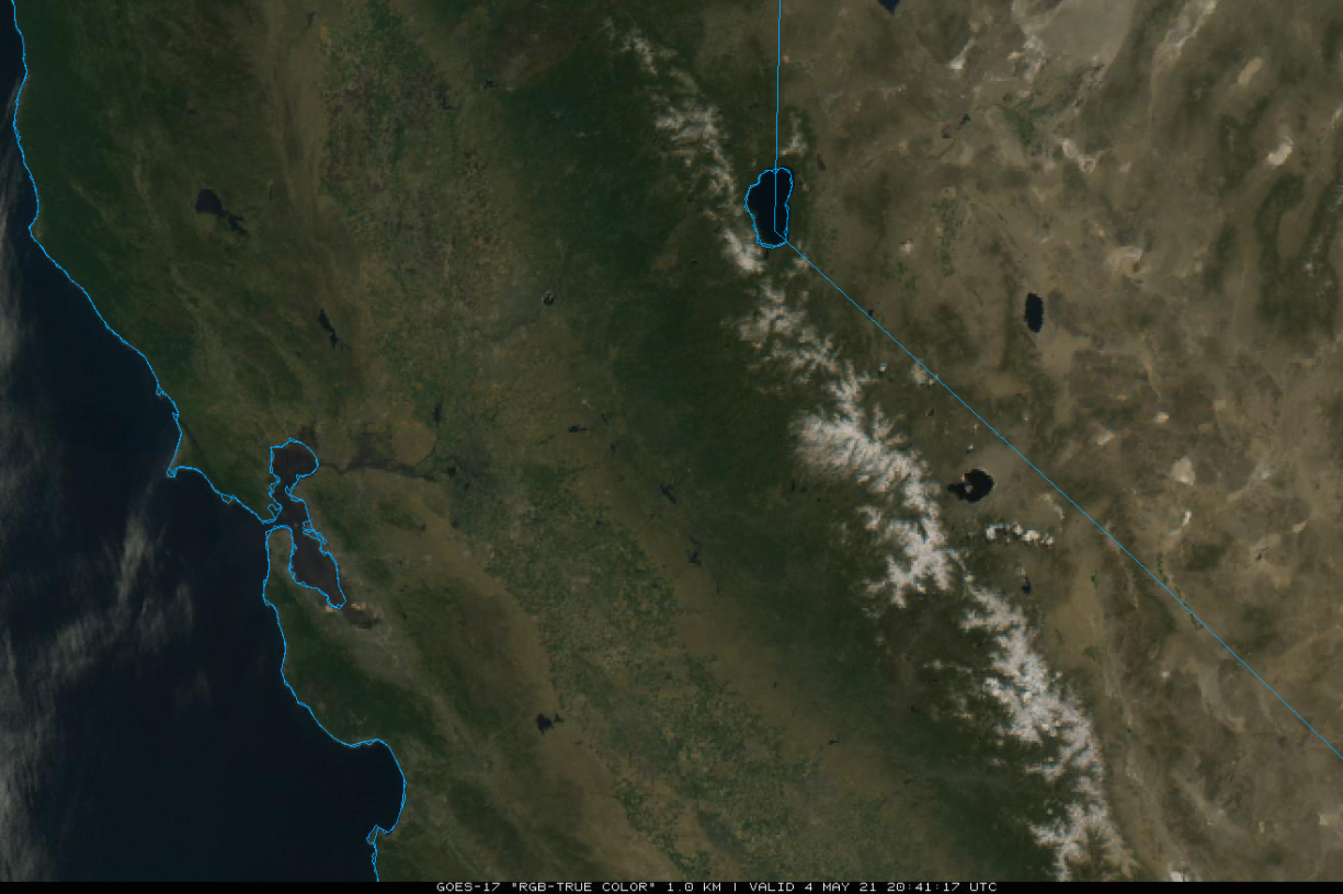
The visible satellite image (below) this afternoon shows clear skies over California including the dwindling snowpack in the Sierra. High pressure will continue to hold over CA through tomorrow for fair weather and spring conditions.
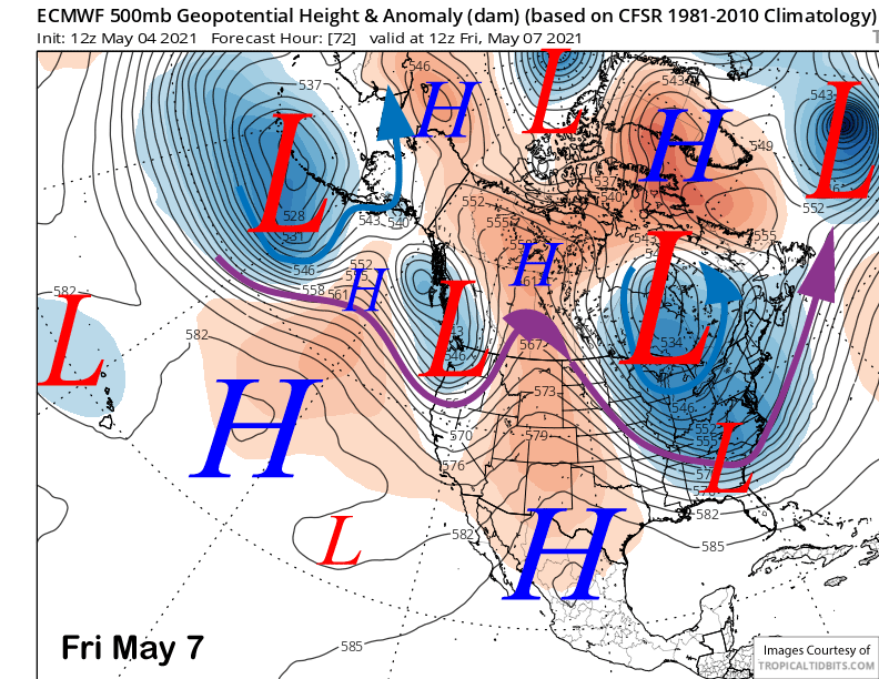
An upper level trough will move into the PacNW Thursday and brush NorCal on Friday (image below) resulting in slightly cooler weather and breezy winds. Weak high pressure will then re-build over the area Saturday for continued fair weather and little change in temperatures.
Long Range (Days 5+):
The longer-range guidance is generally showing a typical spring pattern with no clear signs of any very late-season powder days.
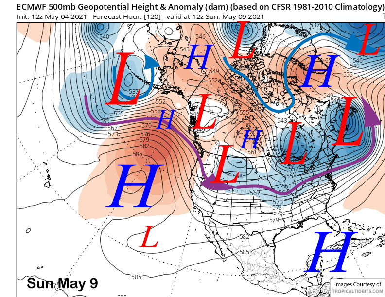
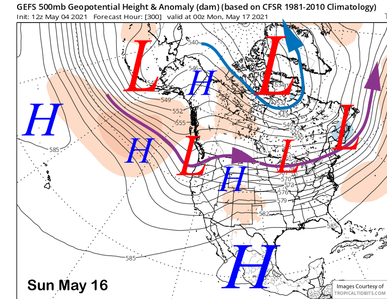
A weather system will move east of the Sierra as a slider type storm on Sunday (image below) and into Monday resulting in slightly cooler weather and probably an increase in winds. Spring conditions will likely continue for most of the mountain except for possibly the top that might firm up a bit, primarily Sunday.
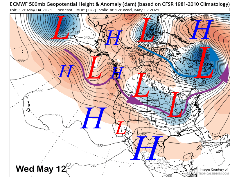
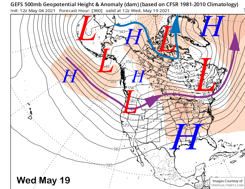
Weak high pressure will build in its wake into the middle part of next week (image below) before another weather system approaches California toward the end of next week or following weekend.
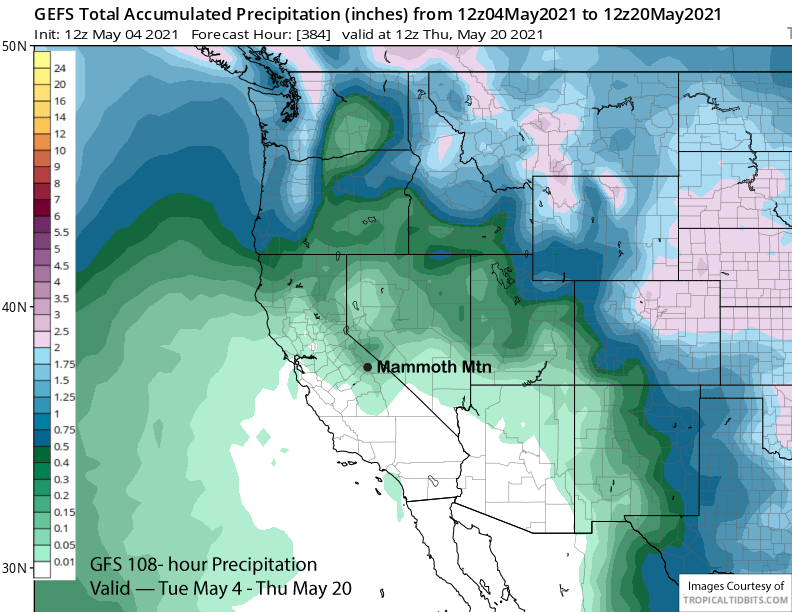
The GFS ensemble mean (two images below) favors only a weak trough moving onshore with the jet stream well north of Mammoth and into the PacNW. It will probably on mean cooler temperatures and breezy winds in Mammoth.
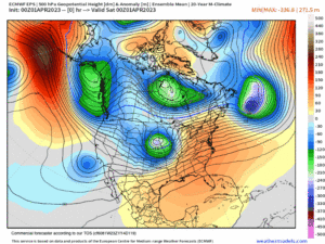
The fantasy range period has a weak long-wave trough across the Interior West and weak zonal flow into the West Coast (image below). That pattern would result in weak weather systems moving well north of Mammoth and generally seasonable temperatures. A heat-wave is not favored under this pattern.
Overall, the ensembles are not favoring any powder days in the foreseeable future with the GFS ensemble mean showing less than a tenth inch of liquid (image below) for the 15-day period. Unless there is a storm on the horizon, this powder blog will now be updating only weekly on Tuesdays until the end of the season. WG