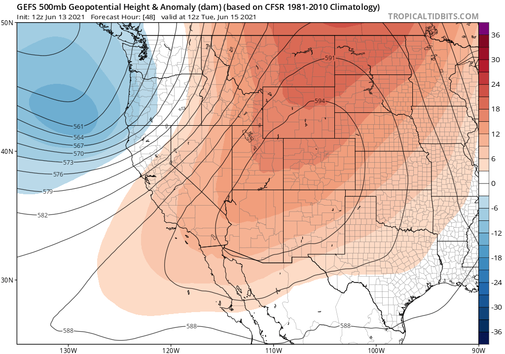
Good evening it’s Sunday, June 5th, 2021
This afternoon’s window cast is showing clear skies from Mammoth Lakes to June Lakes and down to Bishop.
There is a Red Flag Warning posted for Today and Monday. Fire Restrictions are in place until next Fall when we get snow.
It’s been very warm the last few days with downright hot conditions in the Bishop and Round Valley areas. Next week will be much more Spring-like, read on for the details.
Checking in on current conditions, at the top of Mammoth Mountain (11,053 Feet) the temperature is 52 with a WSW wind at 53 MPH gusting to 61 MPH.
At the Main Lodge and up in the Mammoth Lakes Basin (8900 Feet) the temperature is 61 with winds out of the WSW at 19 MPH gusting to 41 MPH.
Down in Mammoth Lakes, the temperature is 72 with light to moderate winds at times.
In Crowley Lake, the temperature is 83, and down in the Bishop / Round Valley areas the temperature is at 97.
Forecast for the Eastern High Sierra from Bishop to Mammoth Lakes and over the Inyo Forest High Country
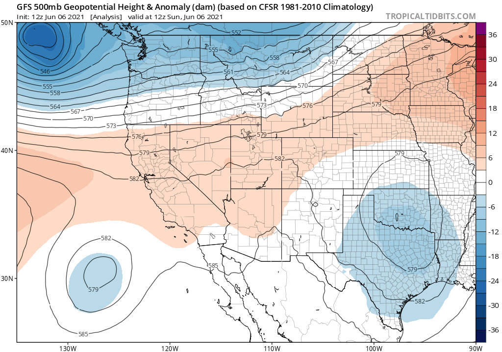
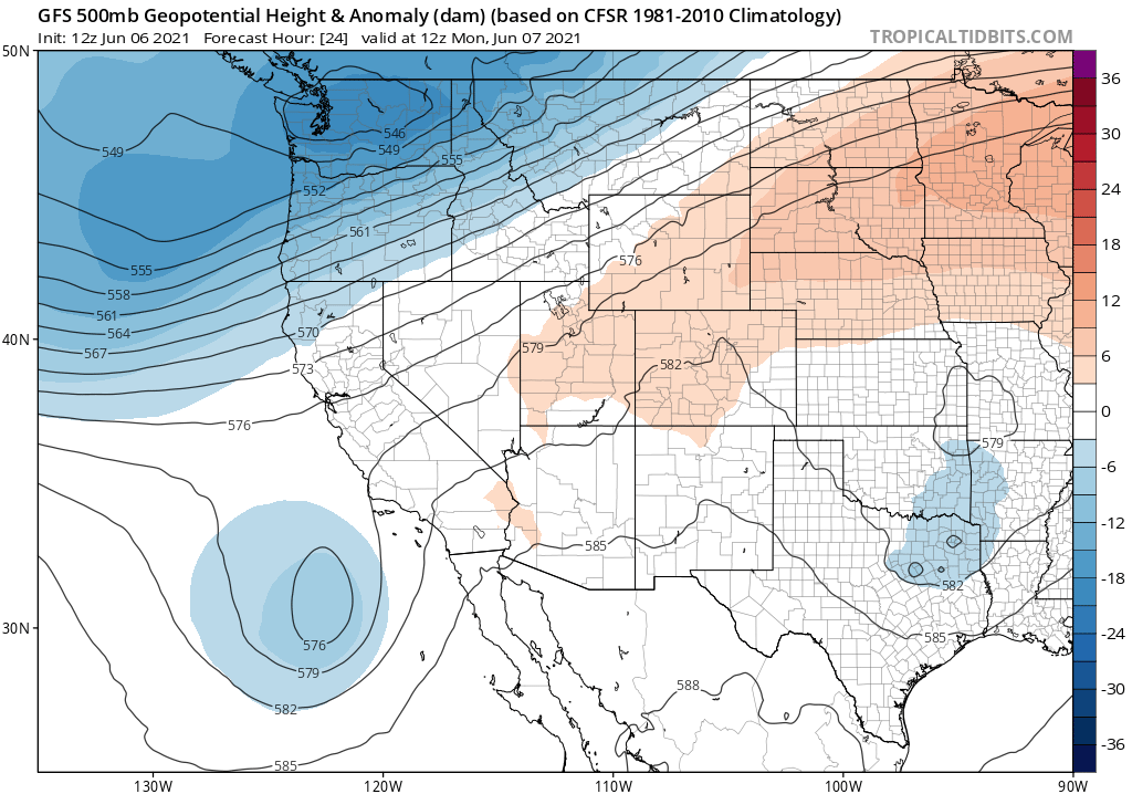
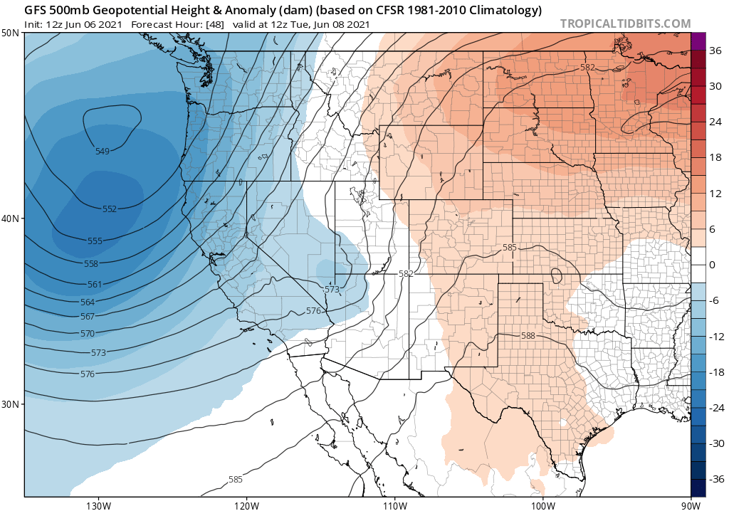
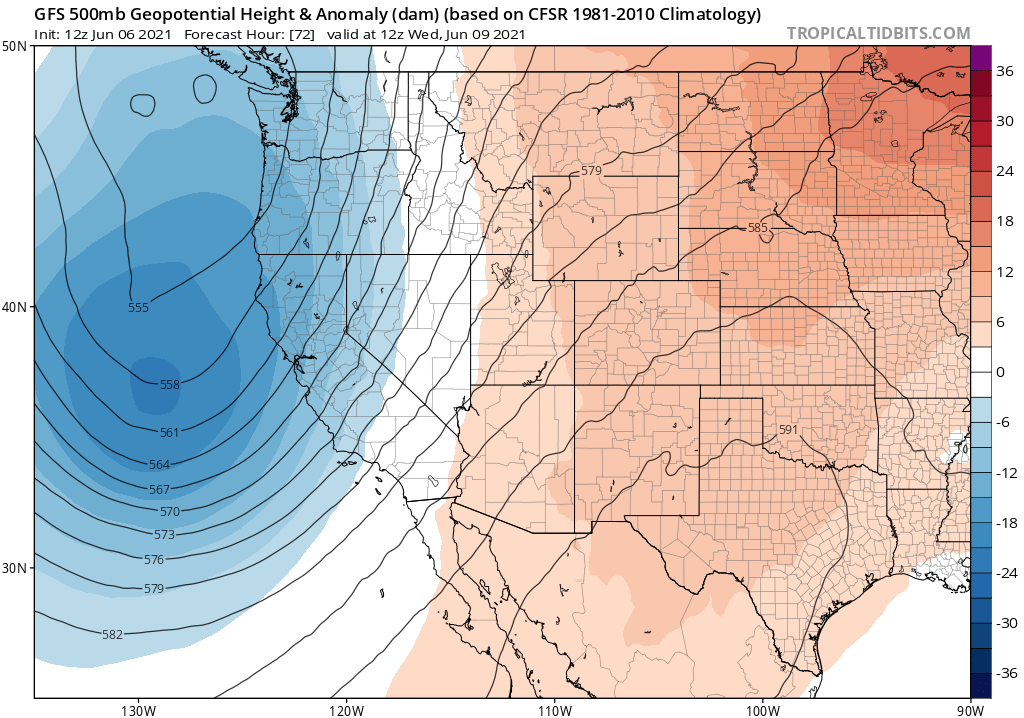
A big cool down is on the way say goodbye to the pre-summer warmth and heat. If you’re camping it’s going freeze overnight around mid-week.
For the Mammoth Lakes Basin & Mammoth Mountain at Main Lodge (at the 8900-foot level).
Highs on Monday will be in the low 60s with an overnight low in the upper 40s through Monday.
Highs by Tuesday will be in the mid-50s then upper 40s on Wednesday. With a 57 for Thursday in the forecast.
Lows will be getting cold with a 44 tonight, 37 Monday night 35 on Tuesday night, and 28 Wednesday Night.
Mammoth Lakes (at the 7900-foot level) on Monday expects highs in the low 70s then dropping into the low 60s on Tuesday. Wednesday highs will be into the mid to upper 50s. By Thursday into the weekend highs in town will be back to the low 70s.
Overnight lows in Mammoth will be in the 40s the next couple of nights and then drop into the 30s Tuesday and Wednesday. A few areas in town might get down to the freezing level on Wednesday night.
For Crowley Lake and Long Valley (at the 7000-foot level) highs will be in the upper 70s on Monday with low 70s on Tuesday with night times lows in the upper 40s to low 50s.
Highs drop into the 60s on Tuesday with overnight lows into the 30s. It’s also possible that down in Crowley it hits the freezing mark Wednesday night.
Down in Bishop and Round Valley highs will be in the low 90s on Monday with mid to upper 80s on Tuesday and low 80s Wednesday and Thursday. Lows the next couple nights will be down in the 50s and down into the 40s Tuesday and Wednesday nights.
Wind Forecast
Winds over the next few days will be out of the southwest at 15 to 25 mph, with gusts as high as 35 mph. Over the higher elevations above 9000 feet expect to continue to see gusts in the 40-65 MPH range the next few days.
Air Quality and Fire Weather Watch
The air quality is in good shape at this time, however, we have a bit of haze in the Northern Owens Valley.