Weather Forecast & Summary for Mammoth to Bishop, California
A trough of low pressure remains off the west coast and is bringing light to moderate SW winds to the area from Bishop to Mammoth Lakes.
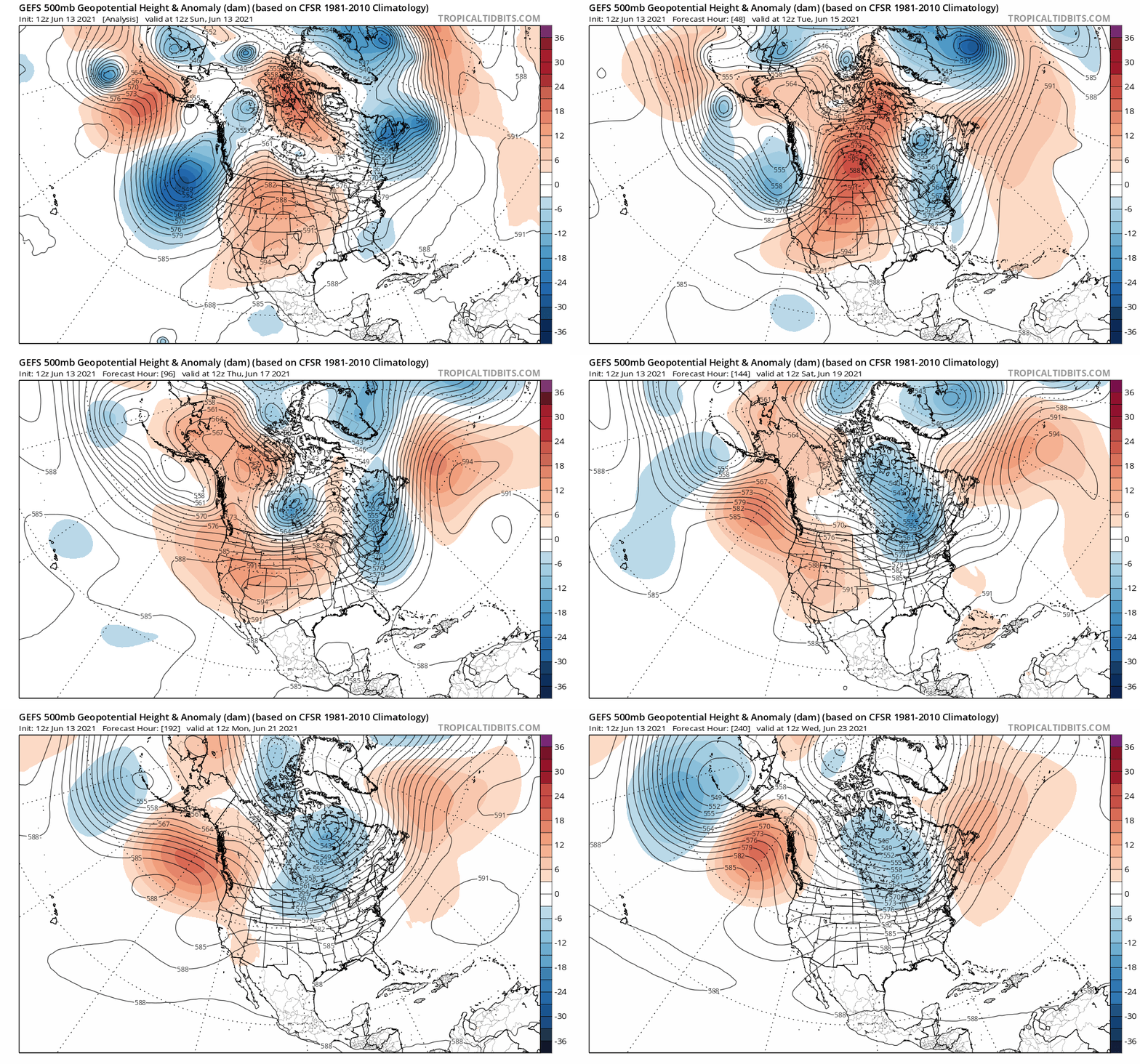
Day time highs have been rising a bit as surface heights have started to come up from the high pressure system over the 4 corners area.
Mammoth Lakes and the higher elevations are still cool temperature wise but the warm up as started at lower elevations below 7500 feet.
It’s down right hot at the 4200 foot level in Bishop with a temperature of 99 being reported as I type this report.
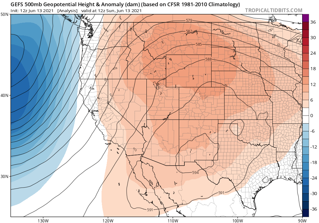
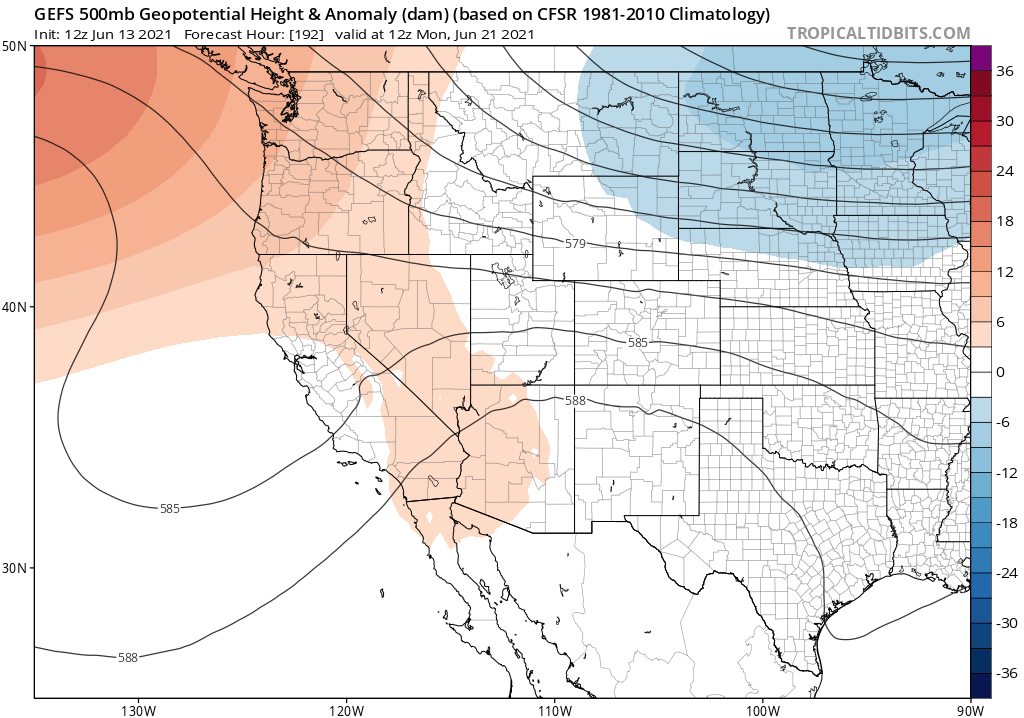
The low pressure system off the west coast starts to lift north north east on Monday and the high pressure system to the west starts to build further into California and Nevada.
That low off the coast will be kicking up some pretty strong gusts on Monday so the NWS has issued a Red Flag Warning for all areas of the Eastern Sierra.
Temperatures both day and night will continue to be about the same on Monday as we saw on Sunday. With the mid 70s in Mammoth for highs and lows in the upper 40s. Bishop should be in the low 100’s with over night lows in the mid 50s.
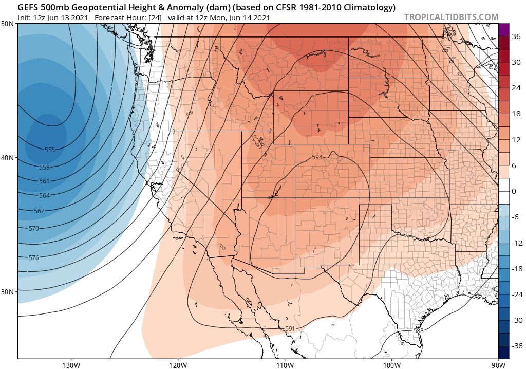
By Tuesday the low continues to lift the the NNE and the 4 corners highs nudges a bit closer. Expect a 5-7 degrees jump in temperatures for the high country with the low 80s possible in Mammoth Lakes.
Bishop and the Owens Valley on Tuesday and beyond til Saturday will be under an excessive heat warming so beware if you traveling.
Winds will also be gusty in the Bishop and Owens Valley area into Tuesday night with gust 15-25+ MPH at times.
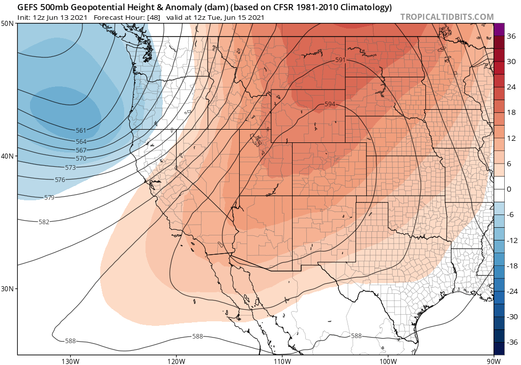
By Wednesday into Friday the high pressure system will be peaking in the Eastern Sierra. Heights this high could bring record breaking temperatures to the area for the second time this June.
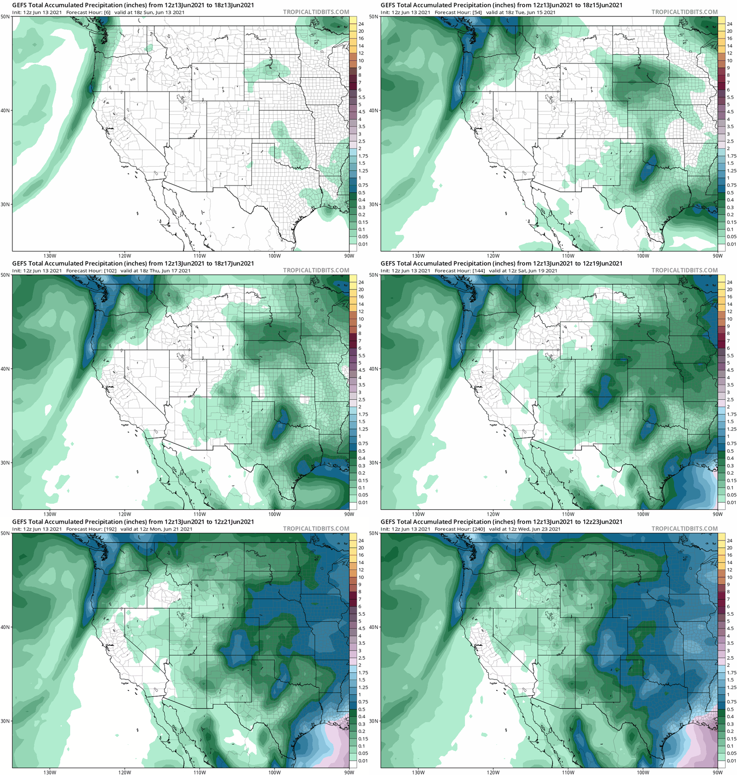
Along with the heat by Wednesday there could be some build ups over the White Mountains above Bishop and then into Sierra on Thursday into Friday. There will be just a slight chance of a thunder storm at this time on Thursday and Friday.
Highs in Mammoth Lakes are forecasted to get into the mid to upper 80s Wednesday into Friday. For Bishop and the 395 corridor highs are going to be peaking in the 105-107 degree range. Winds during the afternoon hours will be out of the SW at 10-25 MPH at times over all elevations.
FYI: This is the type of weather that you want to bring some fans along with you if your going to be in a condo. There is no AC for the most part in the high country so it’s helps air out the warm stale air quickly.
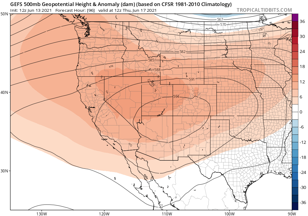
Over the weekend highs will cool a bit from their peak but it’s still going to be warm to hot with Mammoth Lakes in the low 80s. Bishop and the 395 corridor will still be in the low 100s during the afternoon and early evening hours.
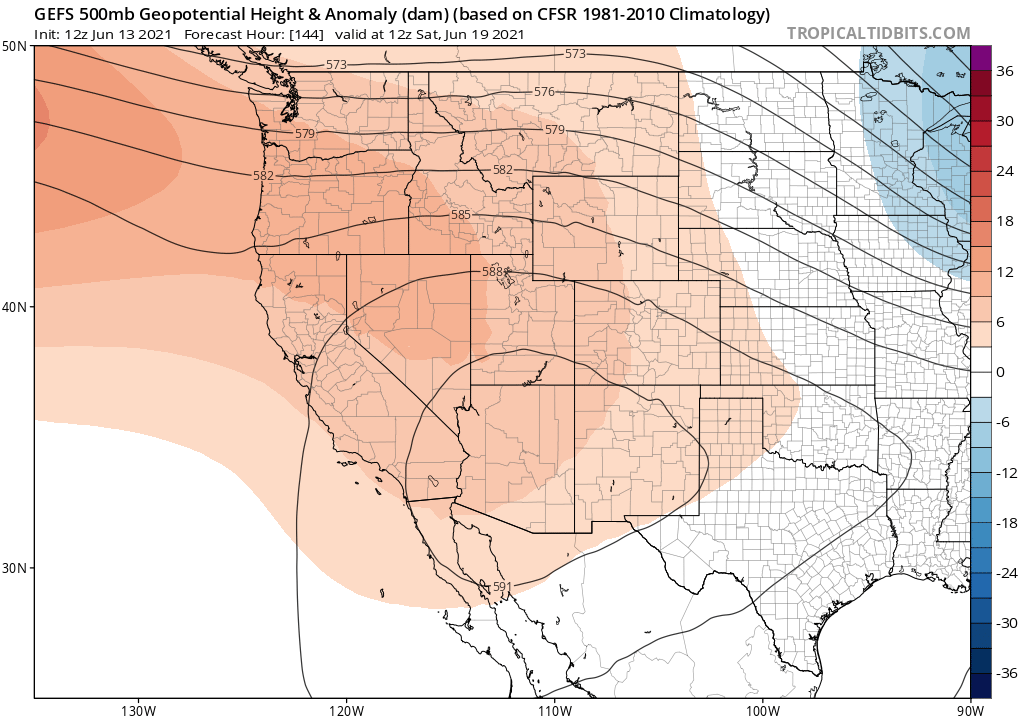
By the first day of Summer Monday June 21st the heat wave will be just about over and it looks like a cooler week 2 could be in the offering. We will take a closer looks at next weeks outlook when I post again on Wednesday evening.
