
Mammoth Lakes and Eastern Sierra Weather for Friday, August 20th, 2021 @ 9:25 AM
Good morning we have some light haze across the Eastern Sierra this morning. AQI levels are in the 50s from Bishop to Mammoth Lakes.
Today looks to be the best time to get outside and play or get your work done before the winds change back to the West / South West.
Once the winds change expect the haze and dissipated smoke to increase for several days.
As you can see in the image below from this morning there is a ton of yucky to air to our west now. When the winds change much of that will blow over us as it moves off to our east in time.
The bottom line is Eastern Sierra is going to see waves of light to moderate haze and smoke at times until at least mid Fall. It’s going to take the first snow and rains of the upcoming wet season to get these fires to start to die off.
For now, keep a heads up on the forecast and plan your outdoor adventures for days like today.

Synopsis: The Eastern Sierra has had a nice cool down of the last few days, just as forecasted. Over the weekend a second trough will influence our weather and keep temperatures nice and cool. Winds will also shift to the West / South West so expect a couple of days of elevated haze and bad air quality before most of the dissipated smoke to our west and southwest exits California.
By the middle of next week into the following weekend, heights will rise again and highs will be back into the low 80s in Mammoth and upper 90s for Bishop.

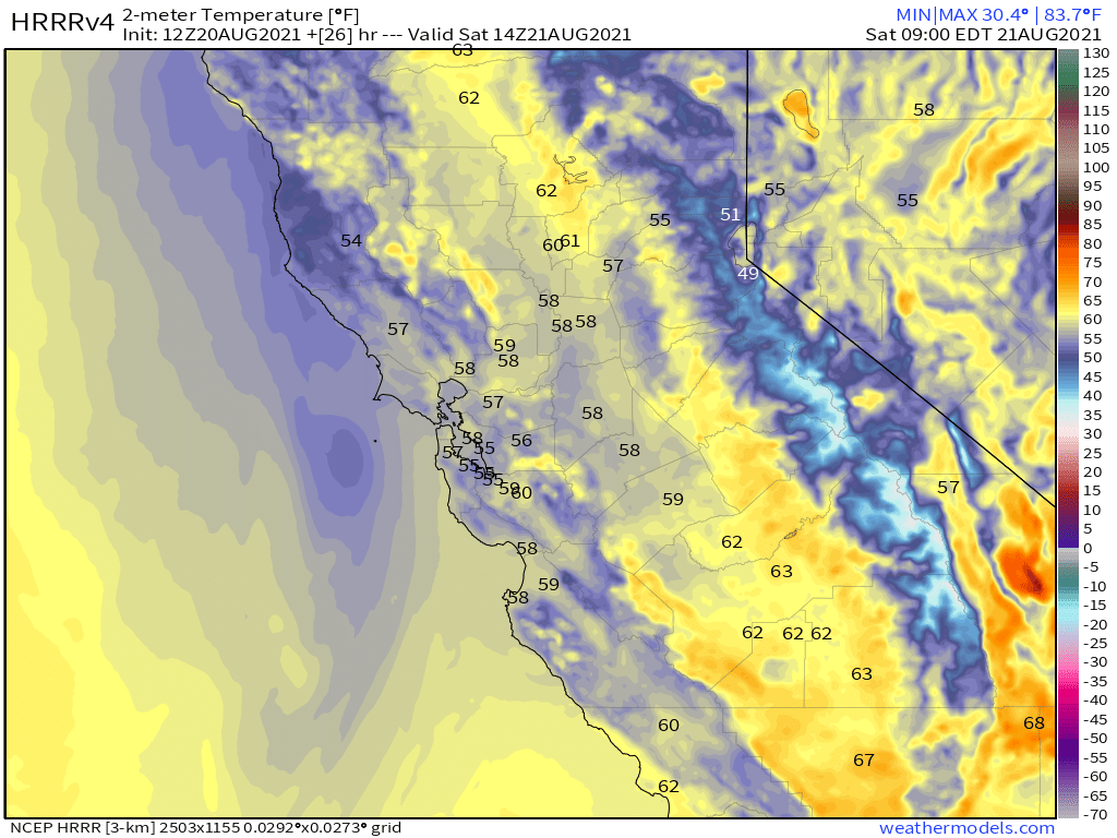
Temperatures: Highs will be in the mid-60s on Mammoth Mountain and up in the Mammoth Lakes Basin at the 9000-foot level.
Mammoth Lakes will be in the low to mid-70s with Bishop into the upper 80s to low 90s. Expect high to come up about 3-5 degrees over the weekend.
Night-time lows have cooled now into the mid-40s for the high country and into the mid-50s for Bishop and Round Valleys.
Winds: The forecast is calling for a switch back to winds out of the West to South West over the weekend. Winds will be in the 10-15 MPH range in the lower elevations with upper elevations seeing gusts in the 20-30 MPH range at times.
Here are the links to the local NWS Forecasts for Main Lodge & the Mammoth Lakes Basin, Mammoth Lakes, June Lake, Crowley Lake, and Bishop.
Extended Outlook: Next week there will be a warm-up with above-average highs during the afternoon hours into the low 80s for Mammoth Lakes with Bishop into the low 100’s. Wind flows look to be out of the SW next week.
Looking out towards the early Fall season we can expect to start to see insider sliders show up by mid to late September into early October. Many a year there will also be the first dusting of snow later in the month of September.
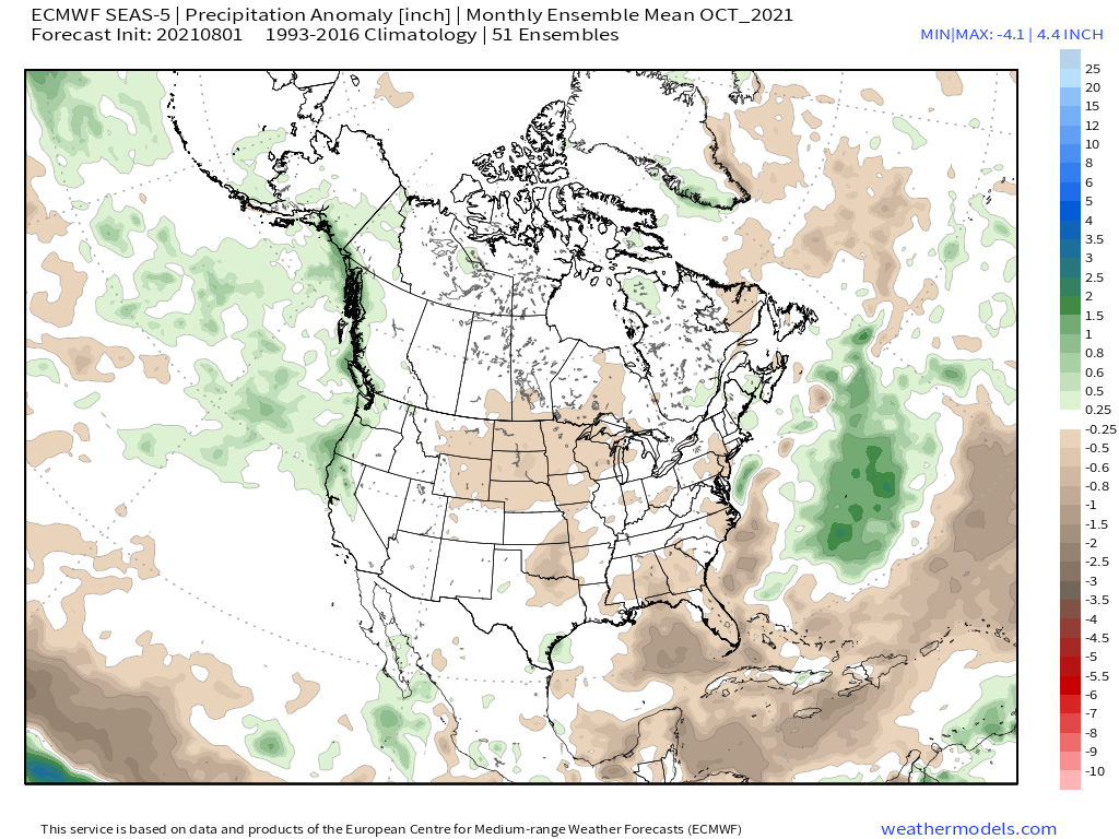
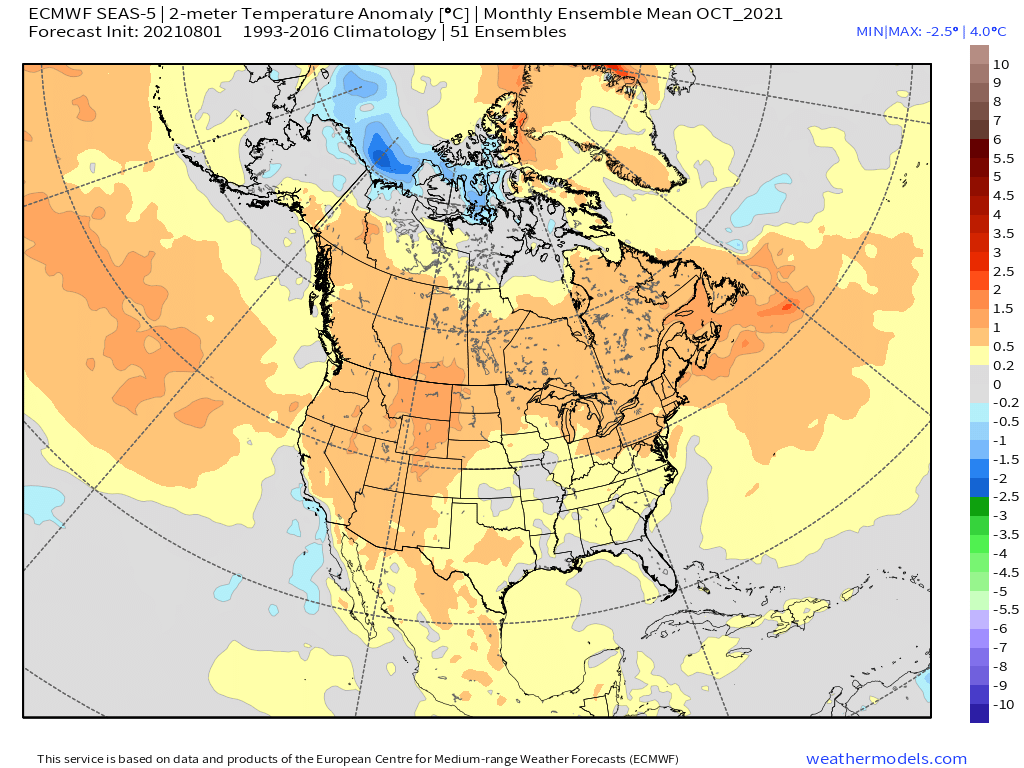
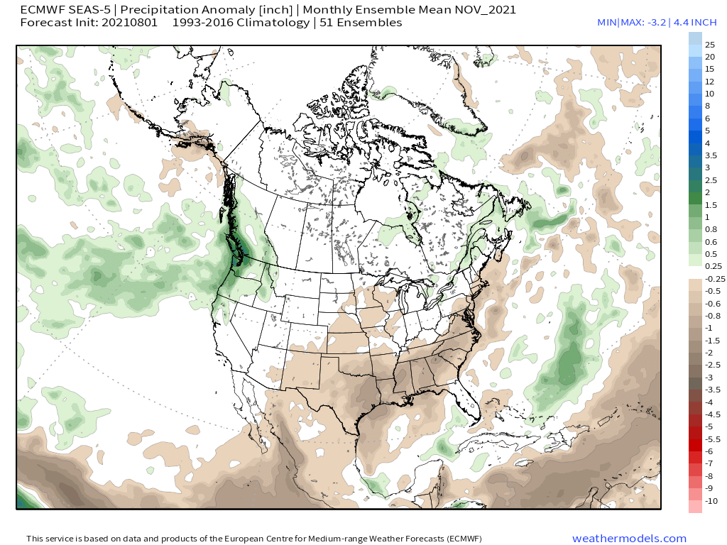
It’s any ones guess what to expect during October into November. Over the last 20 years or so it seems that time period is more dry than wet anymore. Hopefully, we can get an early-season AR into the area during early to mid-November to lay some base down.
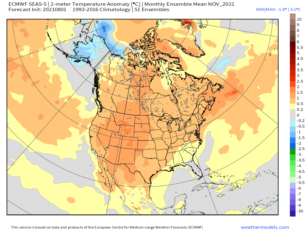
For the upcoming winter, most of the extended models have us in a neutral ENSO state, with several showing a weak La Nina. As of now, I expect the chances of an average snowfall winter are much greater than the 3rd year of exponential drought.
I posted the latest outlook from the ECMWF for October – December down the page a bit.


Current Update Friday, August 20th @ 12:37 PM
HRRR Temperature Forecast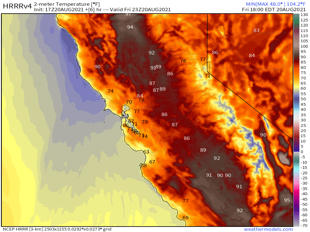
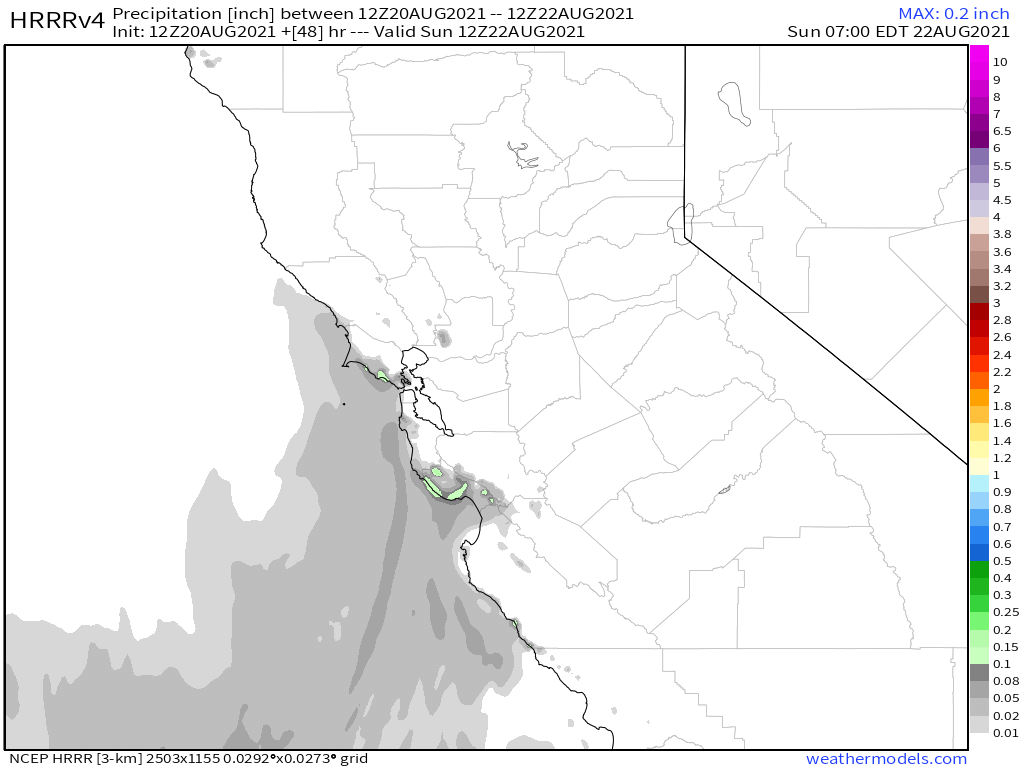
HRRR Precipitation Forecast
HRRR Current Dew Point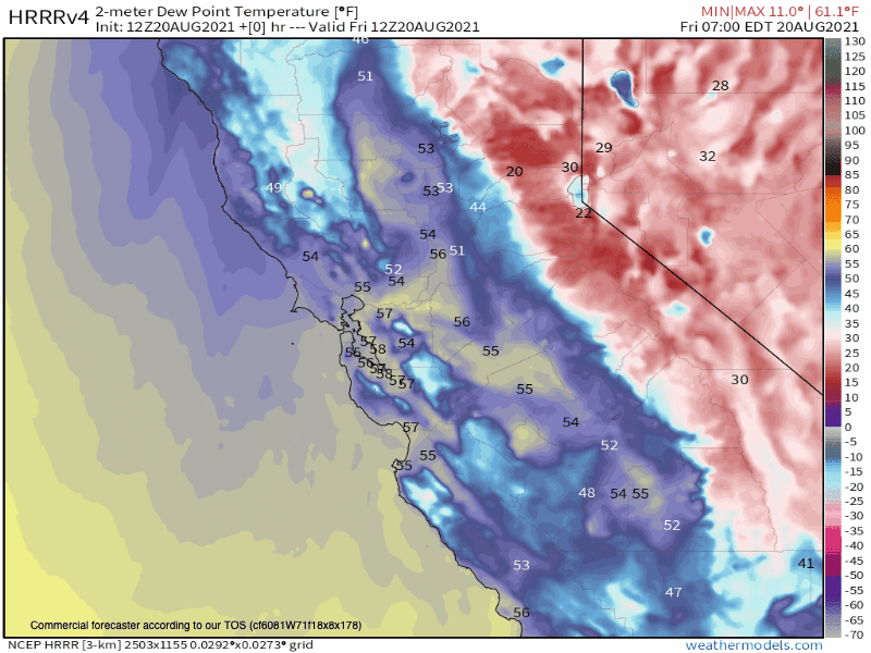
HRRR Current Humidity Levels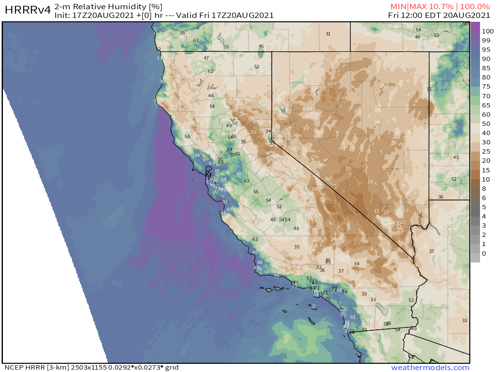
Precipitable Water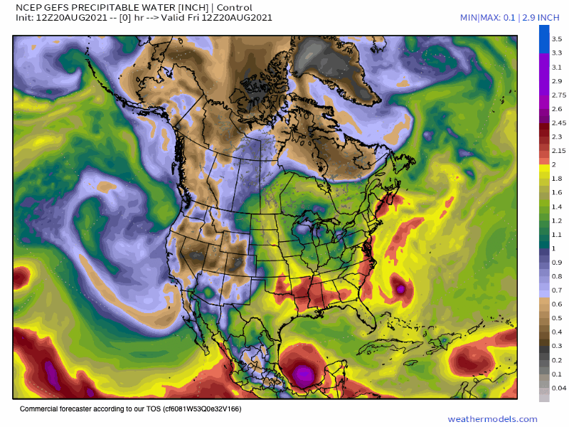
ECMWF Accumulated Precipitation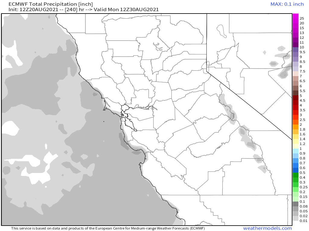
ECMWF EPS Ensemble going out 10 days / 240 hour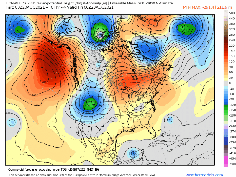
Temperature Anomaly EPS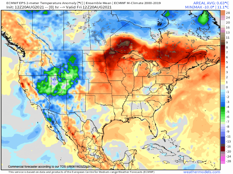
Long Range Outlooks from the ECMWF
Who Are We?
 Steve Taylor – Mammoth Snowman – Over the last 30+ years, Snowman has spent countless hours studying and learning about Mammoth Mountain Weather and Snow Conditions first hand. He has been skiing around the hill with marked ski poles since March of 1991 so he can measure the fresh snowfall amounts out on the hill.
Snowman started blogging this information back in 1990 on the old Mammoth BBS system, then the RSN Forums and then on to MammothSnowman.com in 2004 with Video & Photo Blog report. (No YouTube back then). Facebook got added to the fold back in 2008 and then the Facebook Group in 2016.
Reports, videos, and photos from the website have been featured on both local TV Stations here in Mammoth, along with AP, Fox, ABC, CBS, and NBC News.
 Ted Schlaepfer – Mammoth WeatherGuy – The Powder Forecast – Posted Tuesday and Fridays at 5 PM November into Mid May. These forecasts are now responsible for many people getting multiple powder days on Mammoth Mountain over the years.
Ted’s Bio: Ted has been a full-time Meteorologist (CCM) for the past 25+ years. He has always been fascinated with the weather,” skiing was just a natural extension of my love for snow and rain. I started skiing at age 5, first discovered Mammoth in 1979 as a youth, and have been a regular visitor since the late ’80s.”.
Here is the link to The WeatherGuys Powder Forecast Page.
Click Here to Learn More About the People Who Make MammothSnowman.com a Reality


