
Mammoth Lakes and Eastern Sierra Weather for Wednesday, September 15th, 2021 @ 7:50 AM
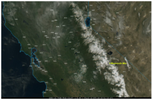
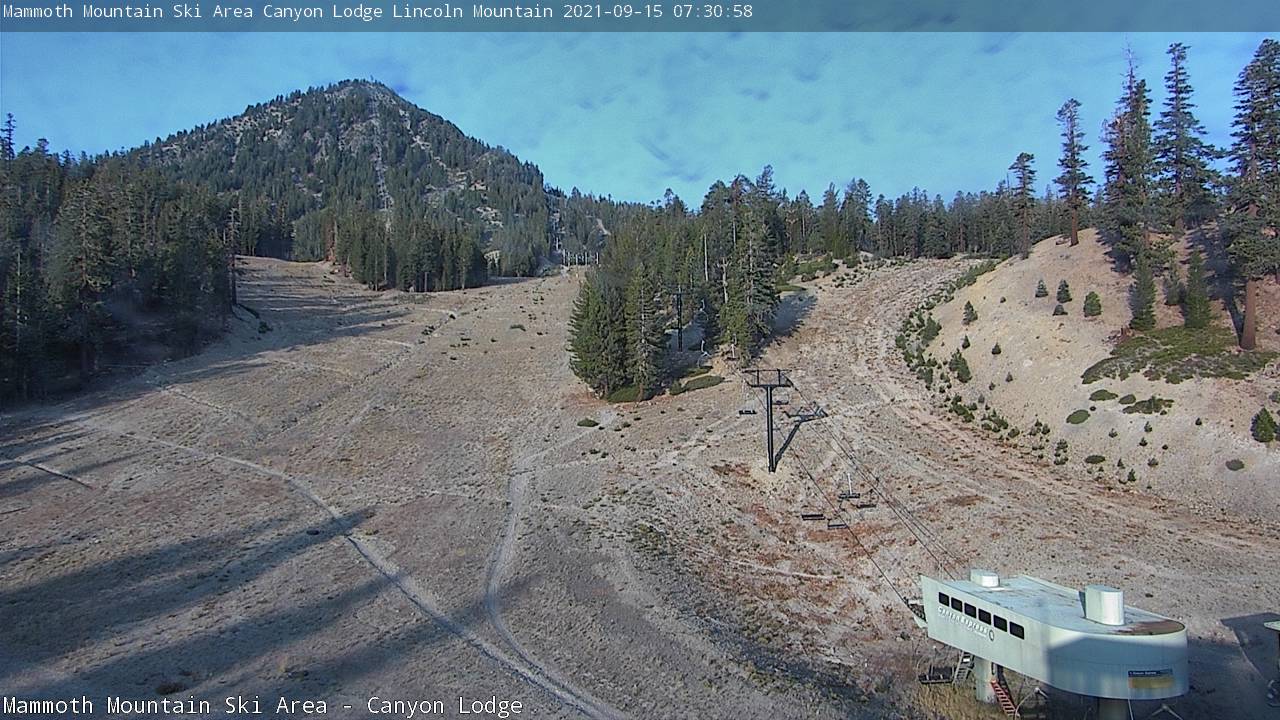
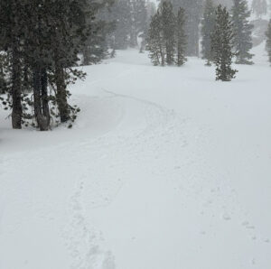
Good morning everyone, checking the window-cast via area webcams, we have hazy skies in the area this morning.
Up at the top of Mammoth Mountain, there is a temperature of 47 with an NE wind to 15 MPH with gusts to 21 MPH. Down at Main Lodge, the temperature is 45. In Mammoth Lakes the temperature this morning is 45 and down in Bishop, there is a temperature of 48 degrees.
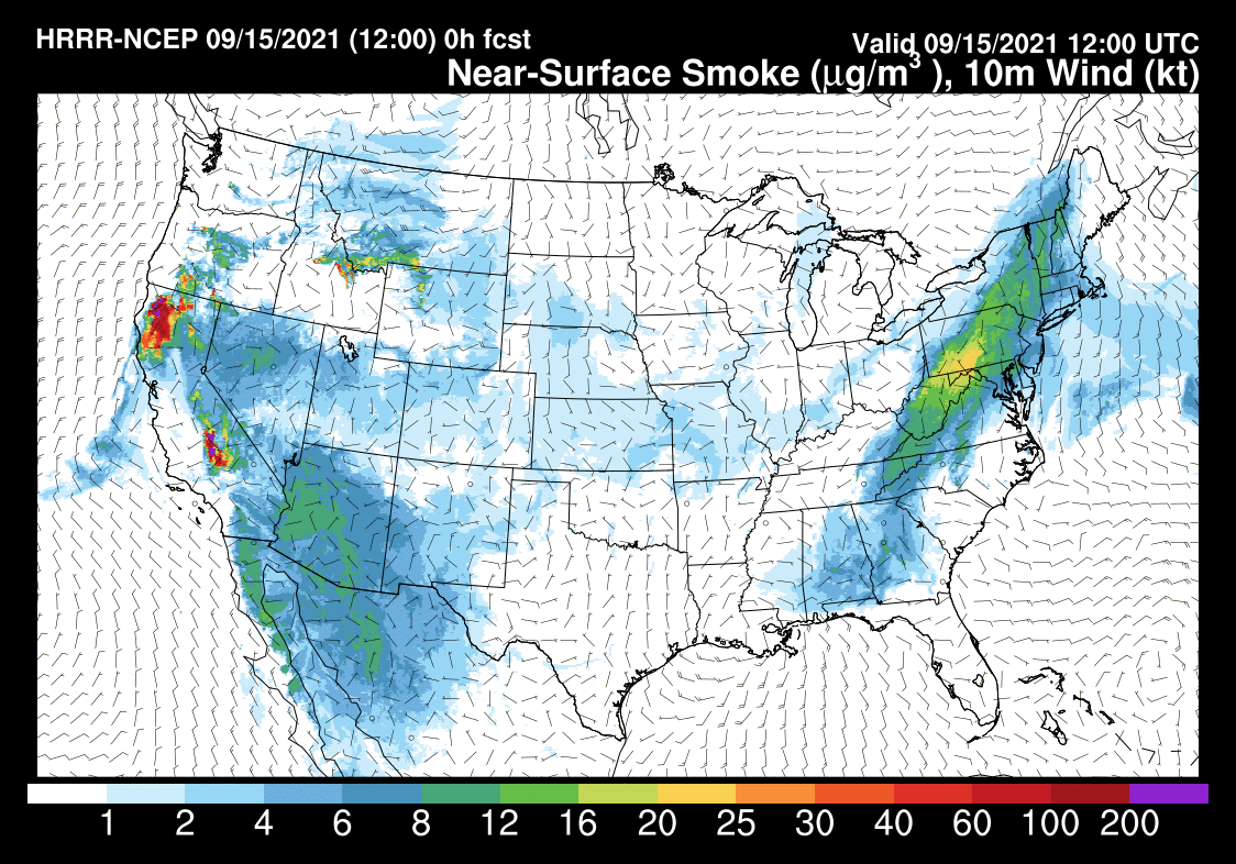
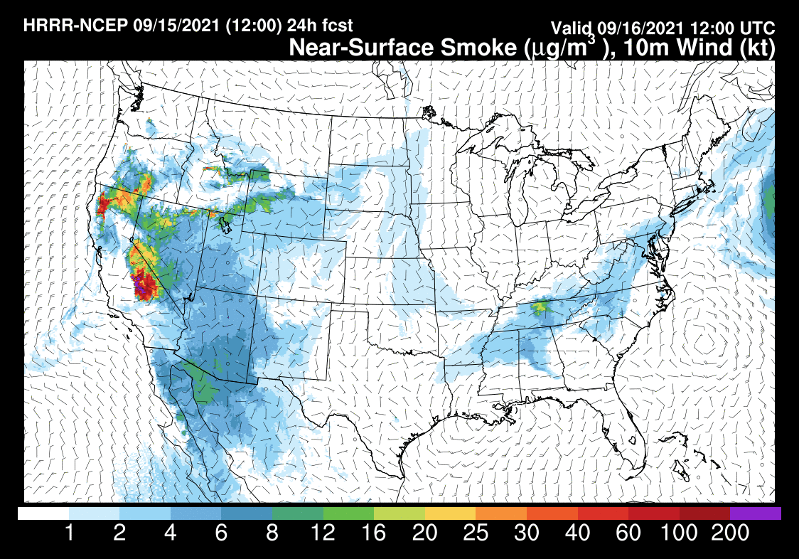
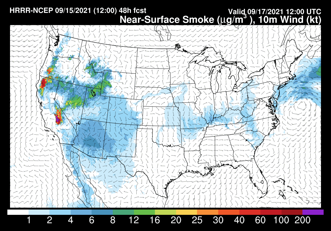
The KNP Complex and Windy wildfires in Tulare County continue to spread smoke, haze, and reduced air quality throughout the Eastern Sierra. AQI levels are in the moderate range today.
Temperatures: Mammoth Lakes will be in the mid-70s today with overnight lows in the 40s. Down in Bishop highs are now expected in the lowers 90s during the afternoon hours with overnight lows in the 40s. Expect a nice cooldown of 4-6 degrees over the weekend.
Wind Forecast: Winds will be turning to the SW later today at 10-15 MPH with gusts to 30 MPH. Expect stronger gusts over the higher elevations.
Here are the links to the local NWS Forecasts for Main Lodge & the Mammoth Lakes Basin, Mammoth Lakes, June Lake, Crowley Lake, and Bishop.
Fire and Smoke Forecast: The storms that moved thru the area a few days back kicked off two new fires in the Kings Canyon National Park. They are the Complex and Windy wildfires and they are located in Tulare County. Those fires will continue to spread smoke and reduced air quality throughout the area.
These two fires are being fought as full suppression events. However the terrain the 2 fires are in means they will be burning with some moderate smoke output for the time being. The fire activity is over 75 miles away and is no threat to our area except for the haze and smoke.
The good news is this weekend’s weather system at some point will blow most of the haze and smoke out of the area once again.


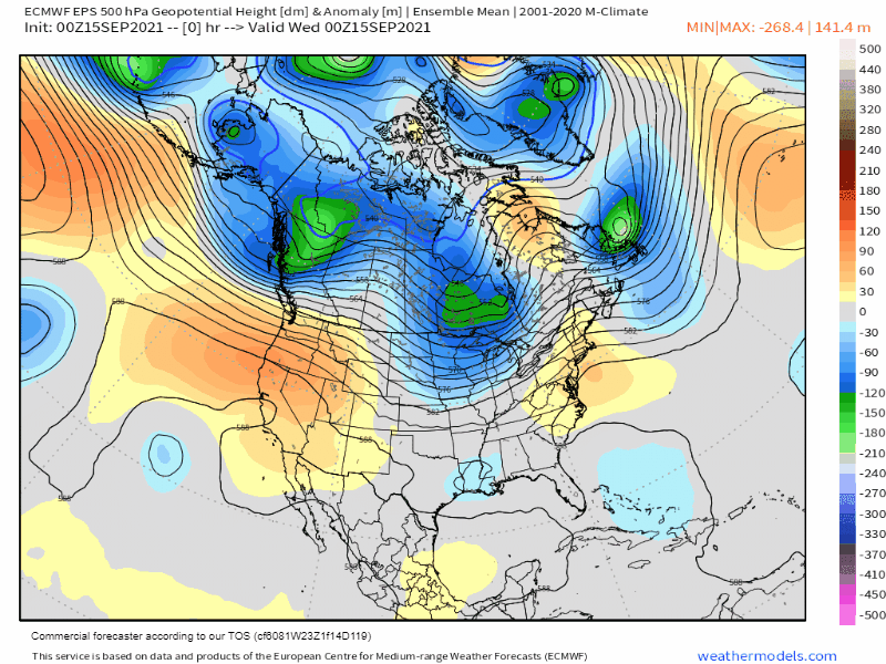
Weather Synopsis: 9-15 7:23 AM – A ridge of high pressure has been bringing warm days and mild nights to the Eastern Sierra.
By Friday a new low-pressure system will start to influence the area with a taste of Fall. Expect moderate to strong winds over the weekend with elevated fire risks and cooler temperatures.
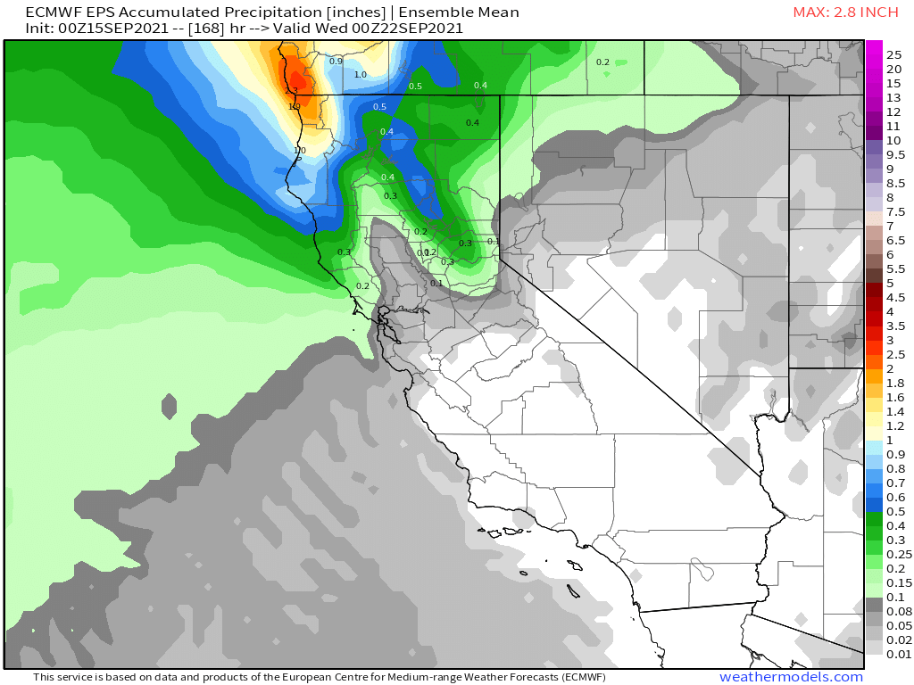
There could be a few light showers over the higher elevations at some point on Sunday. As of now, there is a low-end chance of the first dusting of snow above 9000 feet.
By next Tuesday the next progressive ridge of high pressure will be moving into the area for a warm-up to average temperatures.
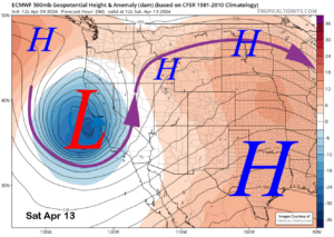
There is just a trace of precipitation in the forecast that ends right at about Mt Whitney. The two images below are a couple of the model runs from the last 24 hours.
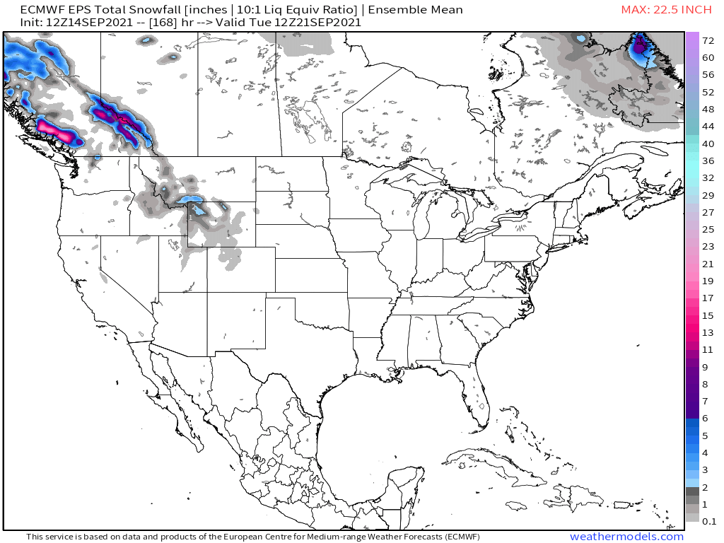
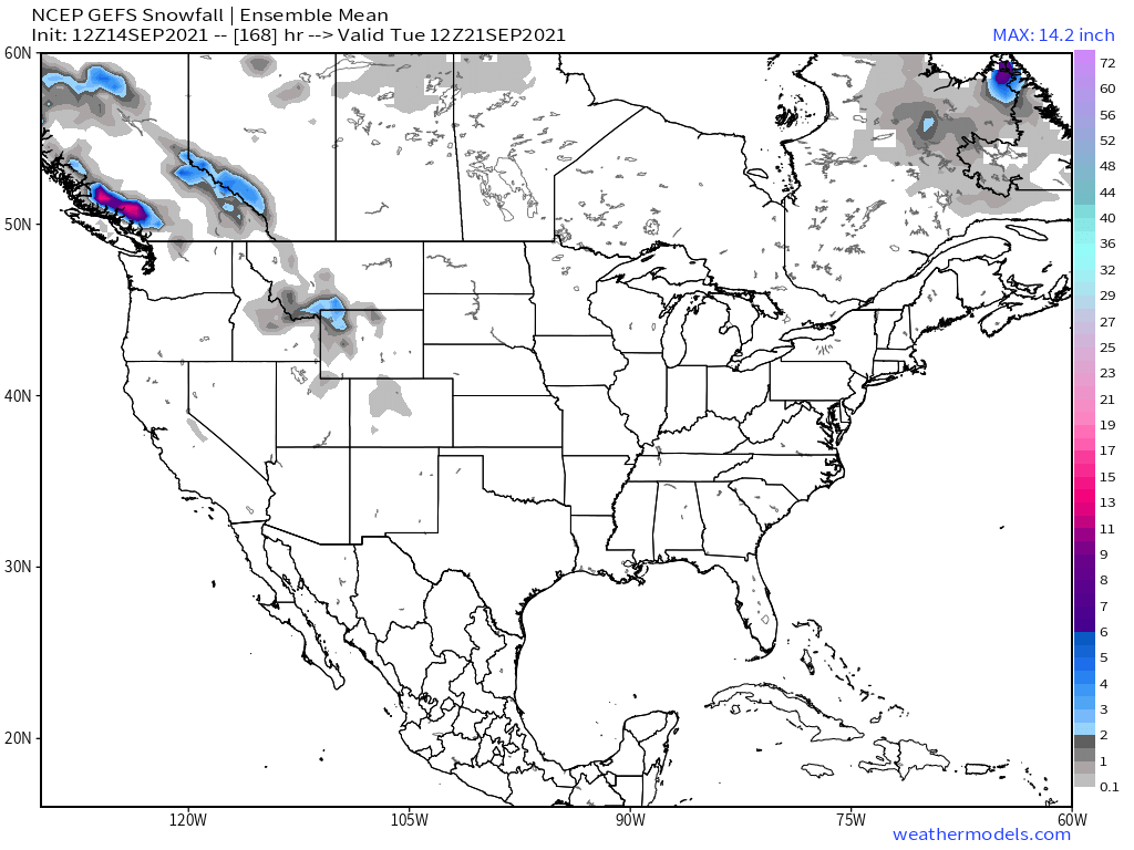
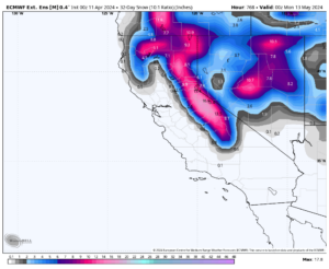
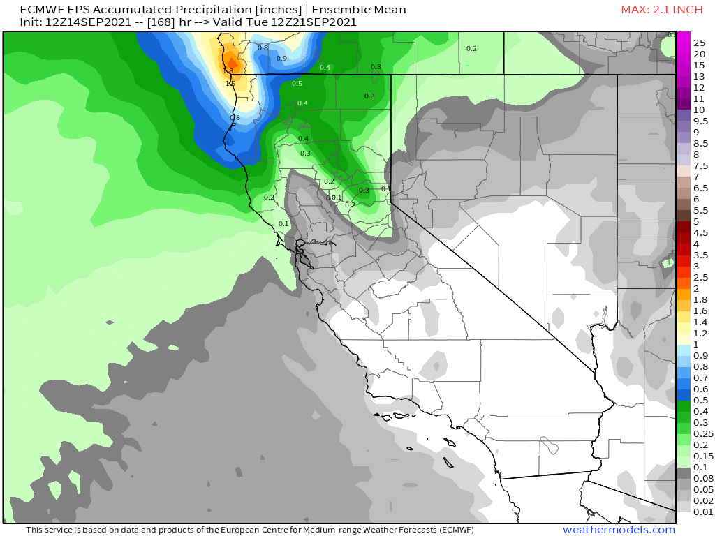 The two images below show if there is a possibility of the first dusting of snow for Mammoth Mountain and the higher peaks around the Eastern Sierra. Right now the EPS says no and the GEFS has as dusting down to about Bishop Creek.
Fantasy Land Long Range Outlook: The New ECMWF Long range charts got released on the 5th, I have posted the outlooks for the October – January time frame down the page.
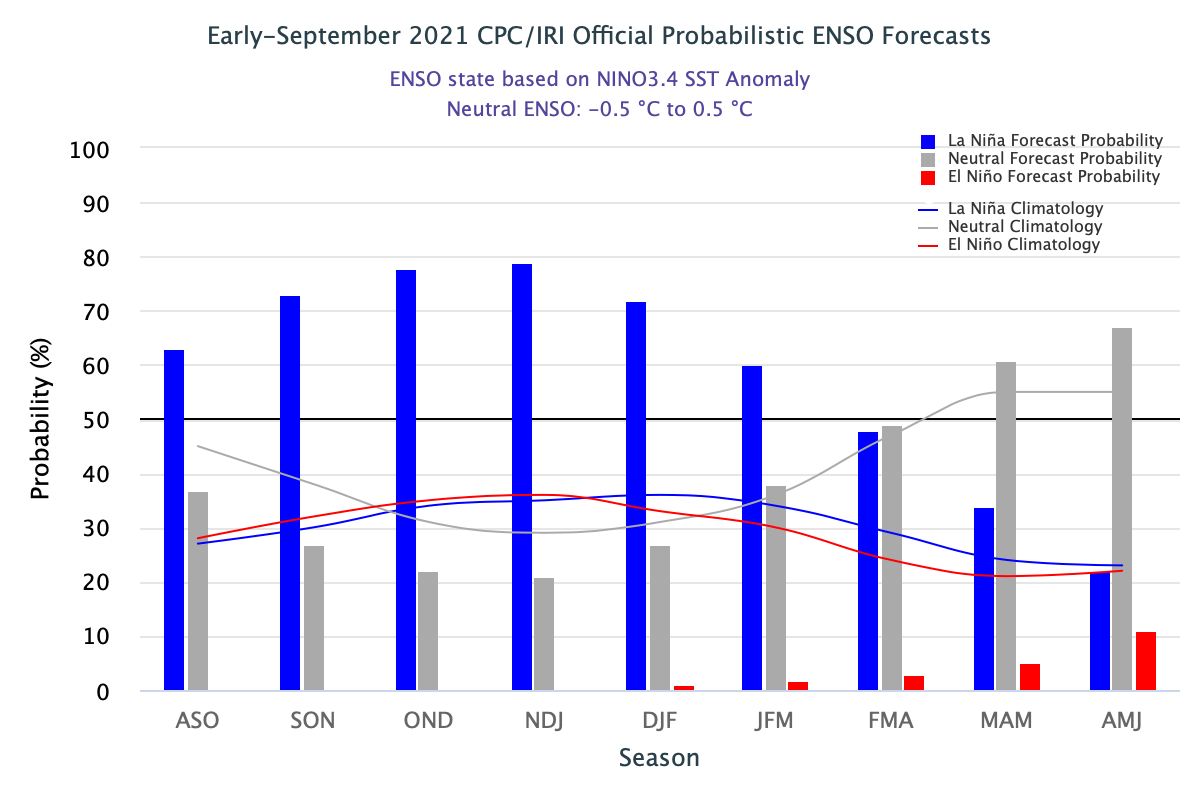
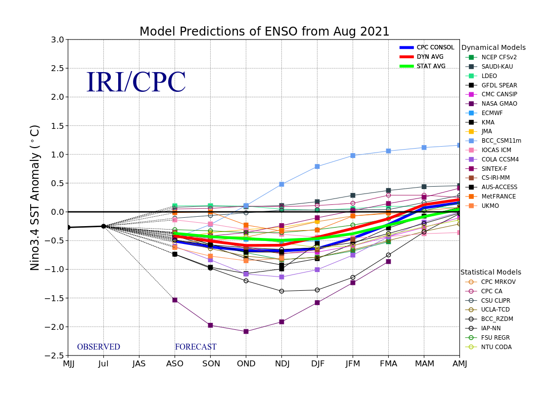
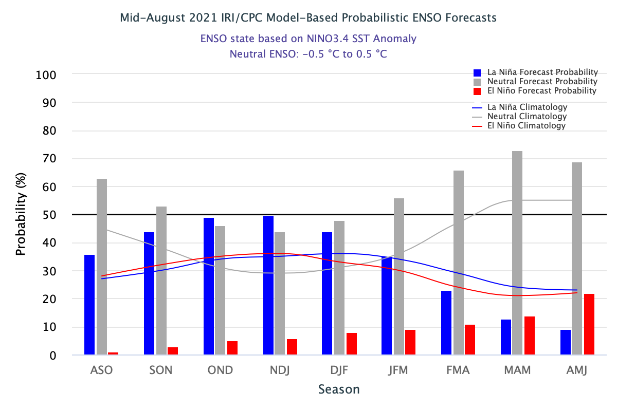
ENSO outlook, it’s back to a majority of models showing a weak La Nina once again.
“The strength of La Niña is determined by the extent that the sea surface temperature anomalies fall at or below the -0.5°C threshold. A La Niña is classified as weak when the anomalies range from -0.5°C to -0.9°C, moderate when the anomalies range from -1.0°C to -1.4°C, and strong when the anomalies are -1.5°C or less. The table below lists all thirteen of the La Niña episodes, including their maximum intensities, since the winter of 1949-50”
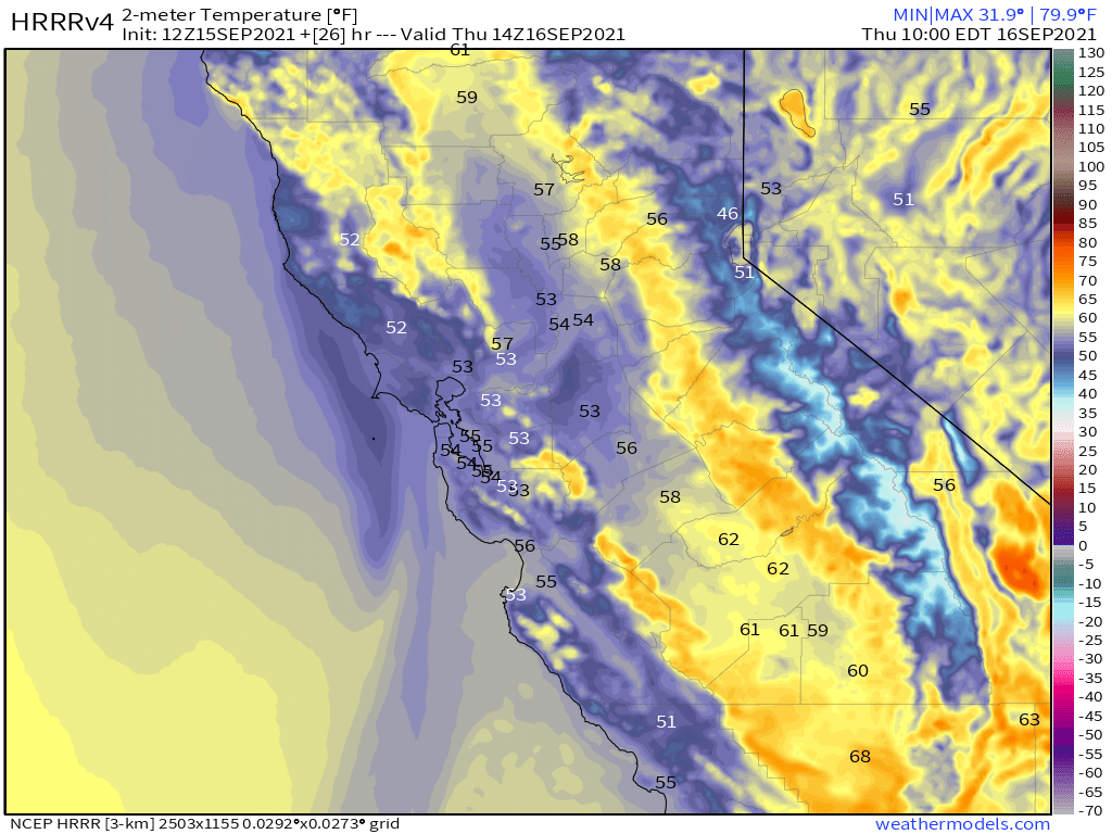
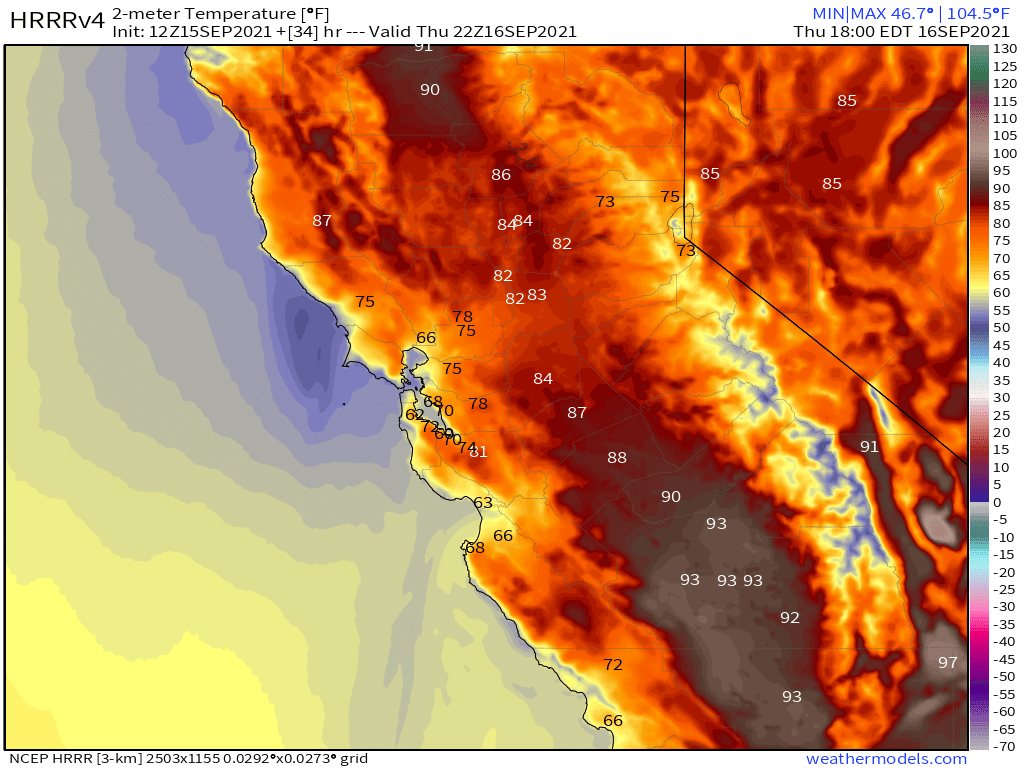
HRRR Temperature Forecast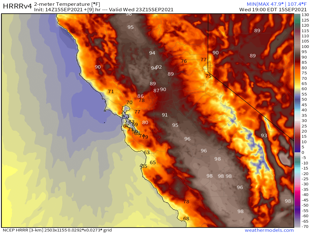
HRRR Precipitation Forecast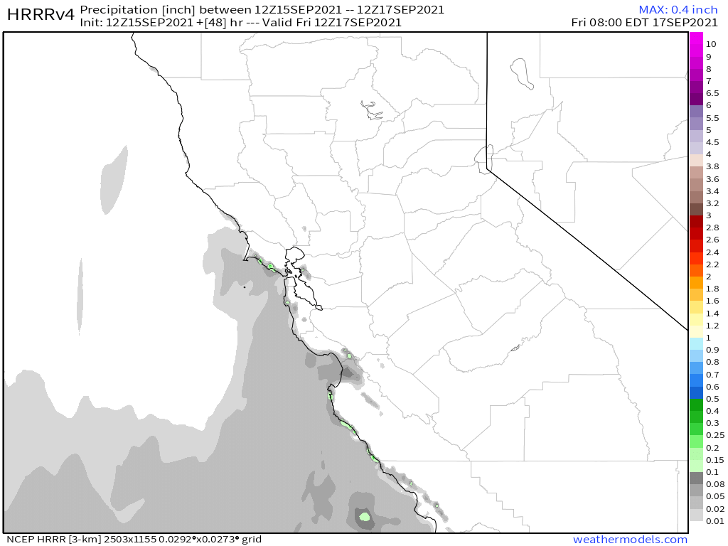
HRRR Current Dew Point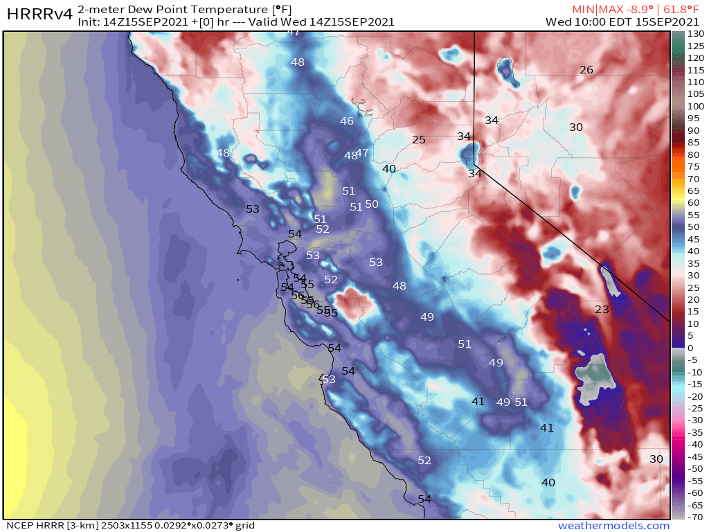
HRRR Current Humidity Levels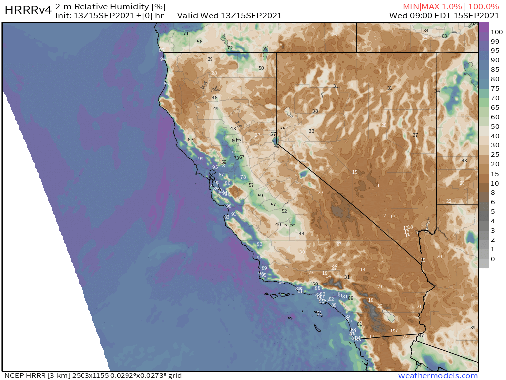
ECMWF EPS Ensemble 500 HA (360 HR)
EPS Temperature Anomaly (360 HR)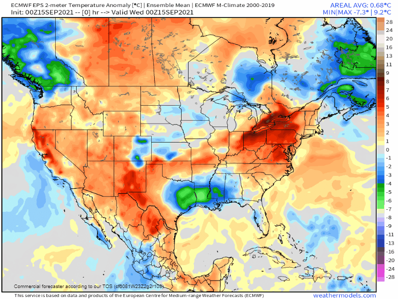
ECMWF EPS Accumulated Precipitation (360 HR)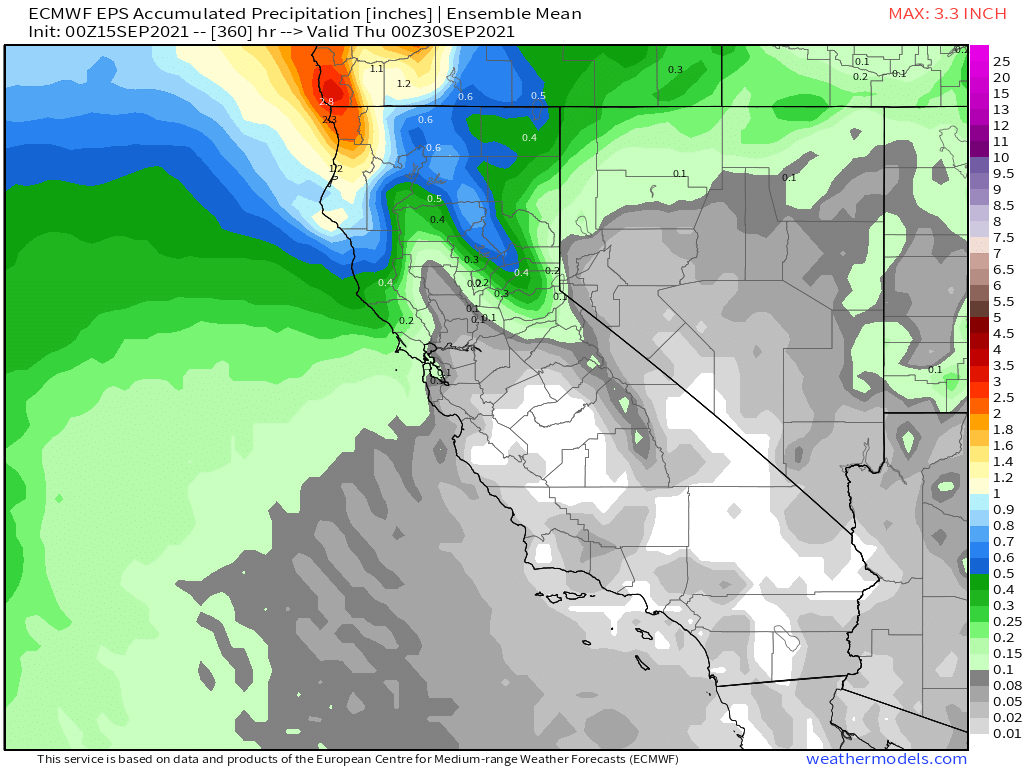
ECMWF EPS Total Snowfall (360 HR)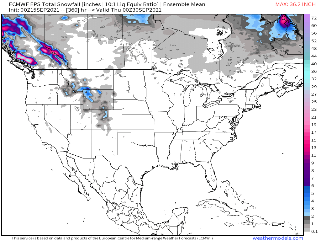
GFS Total Snowfall (384 HR)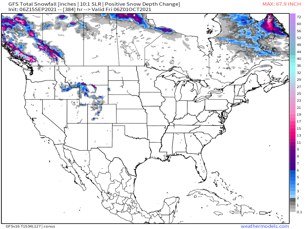
EPS Precipitation Anomaly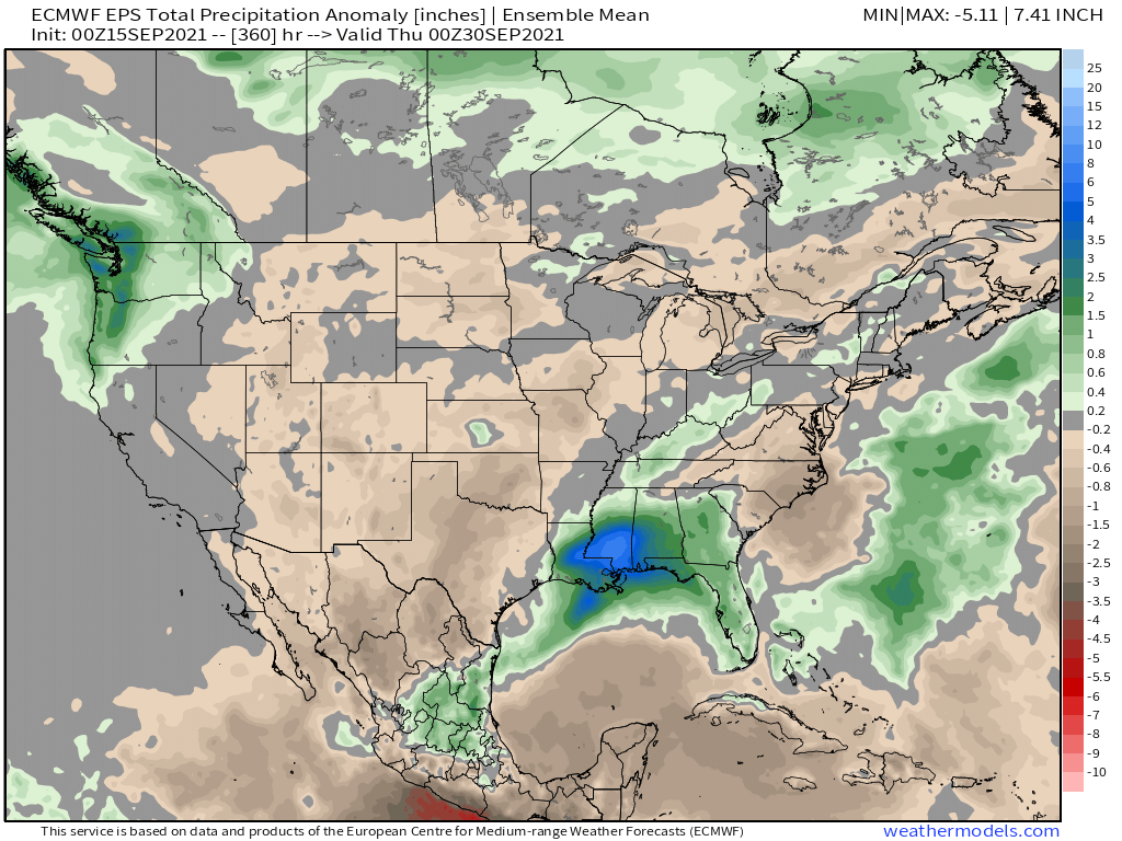
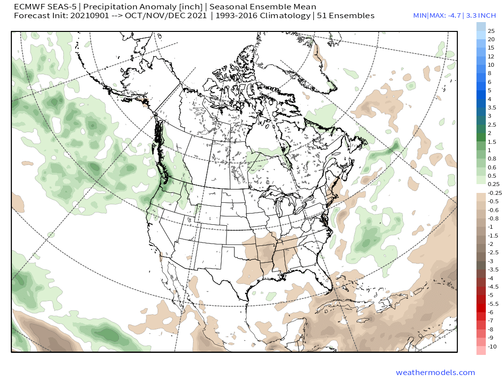
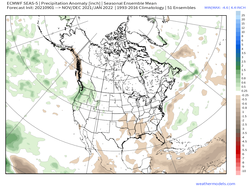
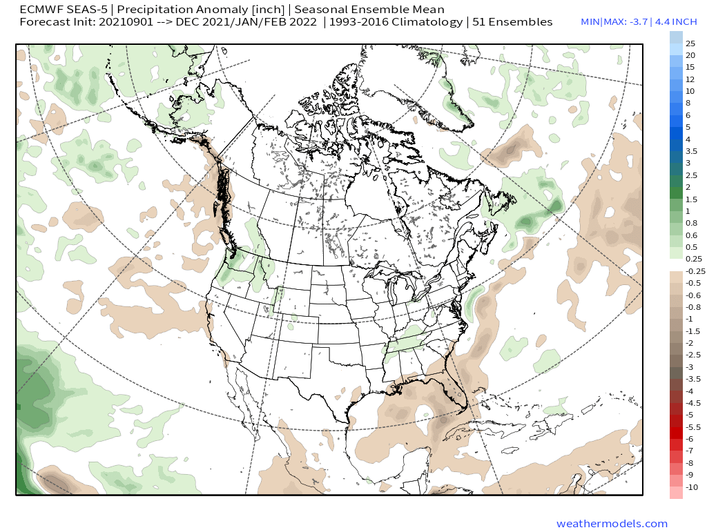
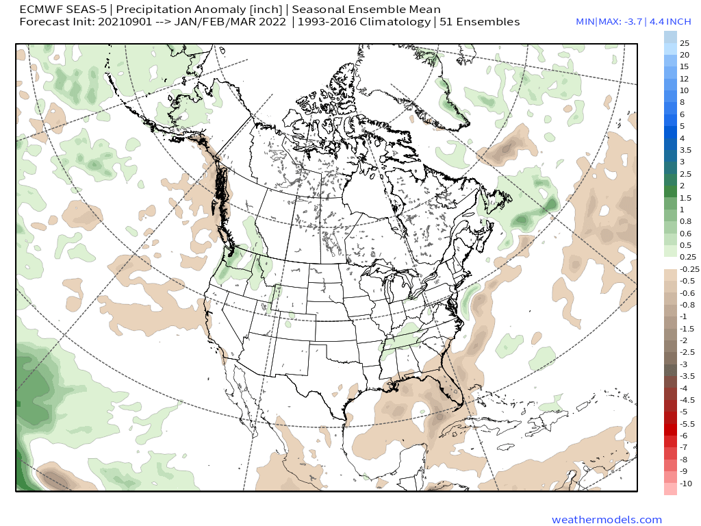
ECMWF Seasonal Ensemble Mean – Monthly Update 9-5-2021
Who Are We?
 Steve Taylor – Mammoth Snowman – Over the last 30+ years, Snowman has spent countless hours studying and learning about Mammoth Mountain Weather and Snow Conditions first hand. He has been skiing around the hill with marked ski poles since March of 1991 so he can measure the fresh snowfall amounts out on the hill.
Snowman started blogging this information back in 1990 on the old Mammoth BBS system, then the RSN Forums and then on to MammothSnowman.com in 2004 with Video & Photo Blog report. (No YouTube back then). Facebook got added to the fold back in 2008 and then the Facebook Group in 2016.
Reports, videos, and photos from the website have been featured on both local TV Stations here in Mammoth, along with AP, Fox, ABC, CBS, and NBC News.
 Ted Schlaepfer – Mammoth WeatherGuy – The Powder Forecast – Posted Tuesday and Fridays at 5 PM November into Mid May. These forecasts are now responsible for many people getting multiple powder days on Mammoth Mountain over the years.
Ted’s Bio: Ted has been a full-time Meteorologist (CCM) for the past 25+ years. He has always been fascinated with the weather,” skiing was just a natural extension of my love for snow and rain. I started skiing at age 5, first discovered Mammoth in 1979 as a youth, and have been a regular visitor since the late ’80s.”.
Here is the link to The WeatherGuys Powder Forecast Page.
Click Here to Learn More About the People Who Make MammothSnowman.com a Reality


