Mammoth Mountain & Eastern Sierra Recreational Weather Forecast
Wednesday, September 29th, 2021 @ 6:24 PM
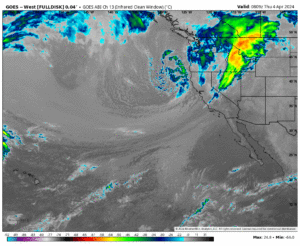
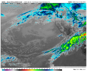
Good evening everyone, checking the window cast we have clear blue skies. We have had a couple days if crystal clear skies in the area.
Taking a look at local conditions the last couple of days. Yesterday at the top of Mammoth Mountain there was a high of 37. There was a low of 27 this morning with a high today of 39. The peak wind gust today was 45 MPH out of the ENE.
In Mammoth Lakes, the temperature peaked at 52 degrees on Tuesday with a low of 28 degrees this morning. Today’s high was 59. There was a peak wind gust today of 10 MPH out of the NW.
Down in Bishop on Tuesday there was a temperature of 79 degrees with a low of 45 degrees this morning and today’s high was 77. There was a peak wind gust of 5 MPH out of the WSW today.
Temperatures: For Mammoth Mountains Main Lodge highs will be in the low to mid 60s with night time lows in the uppers 30s to low 40s.
Mammoth Lakes will have highs in the mid 60s up to 70 over the weekend with night times lows in the mid to upper 30s after tonight’s possible freeze. For Bishop and Round Valleys looks for highs in the upper 70s to low 80s with night time lows in the mid 40s.
Winds: Overall winds will be out of the North East at 5 – 10 MPH.
Precipitation: All clear thru next weekend now. Next chance would be the middle of next week for a dusting with more possible right after that.
Here are the links to the local NWS Forecasts for Main Lodge & the Mammoth Lakes Basin, Mammoth Lakes, June Lake, Crowley Lake, and Bishop.
Fire and Smoke Forecast: Skies look to stay cleared out from most of the haze and smoke over the next several days and possibly longer.

9-29-21 Wednesday Update @ 3:44 PM
Here is a summary of what’s going on at this time and what might be expected over the next 10 days.
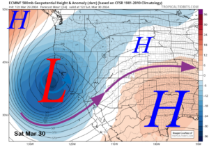
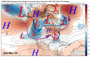
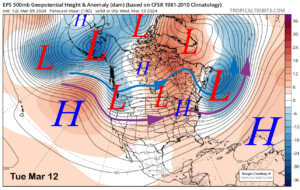
All models agree on several things over the next 7 days, first, a trough is exiting the area at this time and will be replaced by some ridging over the weekend into early next week.
The ridge is progressive and will be replaced by a long wave trough off the California coast that possibly hangs out beyond the 10 day forecast.
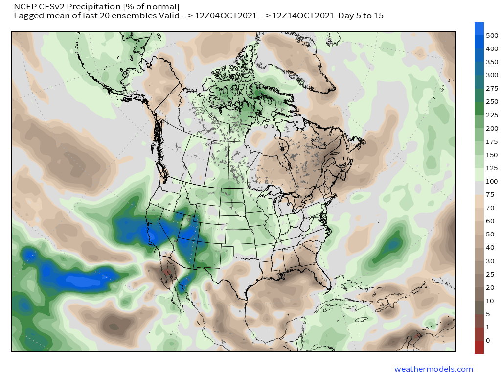
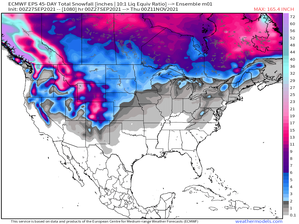
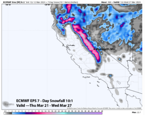
Precipitation wise the EPS ensemble model wants to send several fronts are way in the 7-14 day period with several dustings of snow.
It’s a bit early for a pattern like this but who knows maybe it will turn into something. Time to watch and wait and be patient.
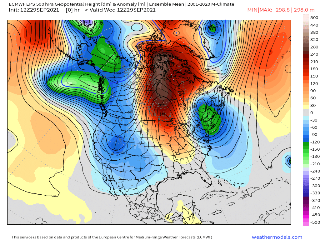
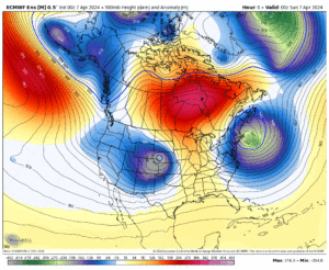
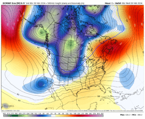
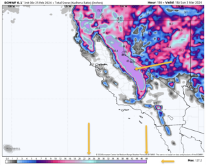
Here is a GIF that shows the next 10 days. I go over some of the days on this loop in more detail below.
 ______________________
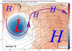
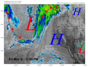
In this first image from the EPS you are looking at what was going on mid morning today. The low that brought all the cooling and the dusting of snow to the top of Mammoth Mountain is now moving into Utah.
With this set up we get NE winds that keep all the haze and smoke over on the west side of the Sierra. It’s times like these where it can be extra clear with very limited haze.
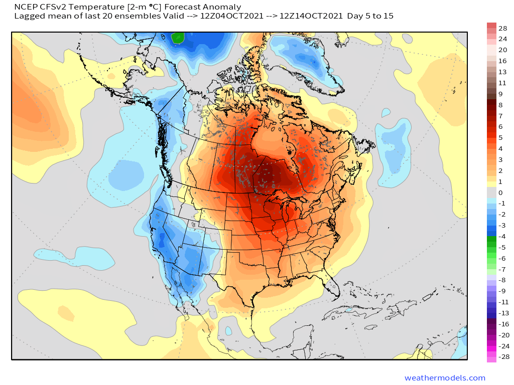
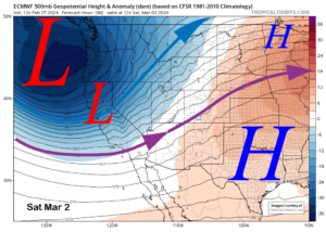
By Friday heights are up under some ridging in the area. That will bump up the temperatures by at least 5-7+ degrees.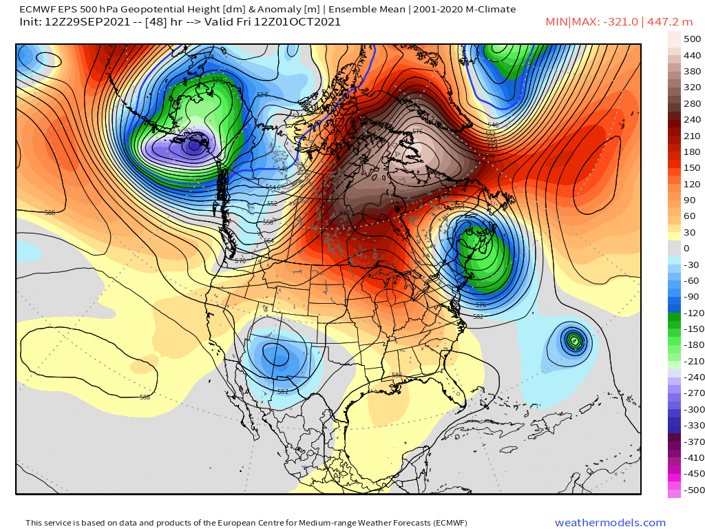
The ridging peaks on Sunday as temperatures rise several more degrees Saturday into Sunday. 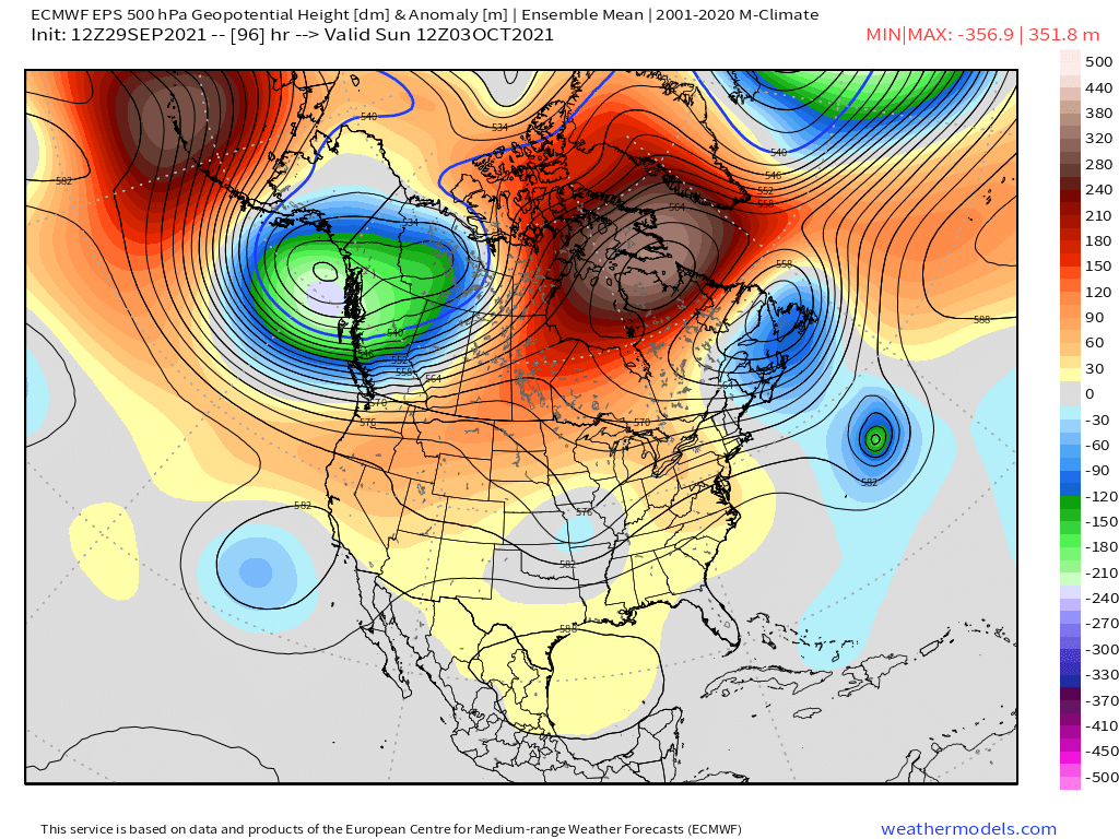
At this point the all models diverge bit on what happens next, the EPS late Tuesday into Wednesday introduces very light precipitation for the higher elevations with a dusting of snow.
Confidence is low on how this all plays out, sure is fun to watch and think about what the results of this pattern would be. 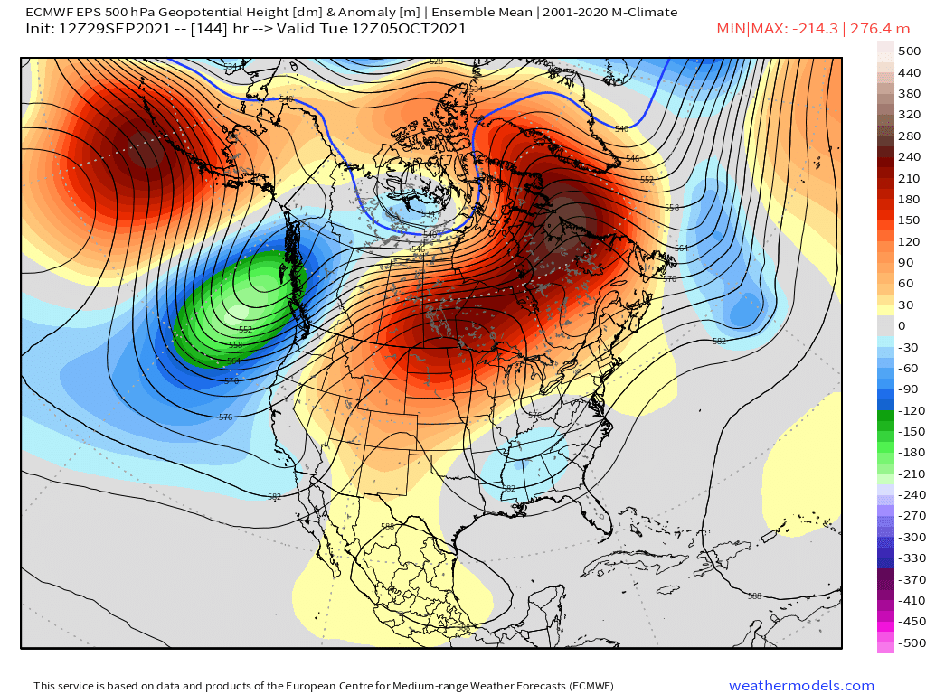
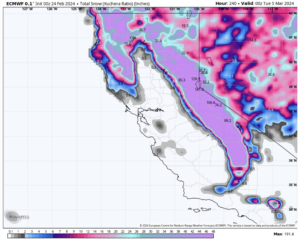
Way out at day 8 the Low is still there bringing more snow showers at times to the higher elevations. Confidence is even lower low this far out. 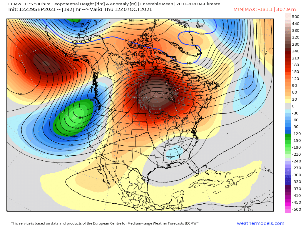
And the Long Wave Trough is still with us at day 10. Going to be fun to watch if this really does happen. 


Fantasy Long Range Outlook – 9-29-2021 @ 4:35 PM
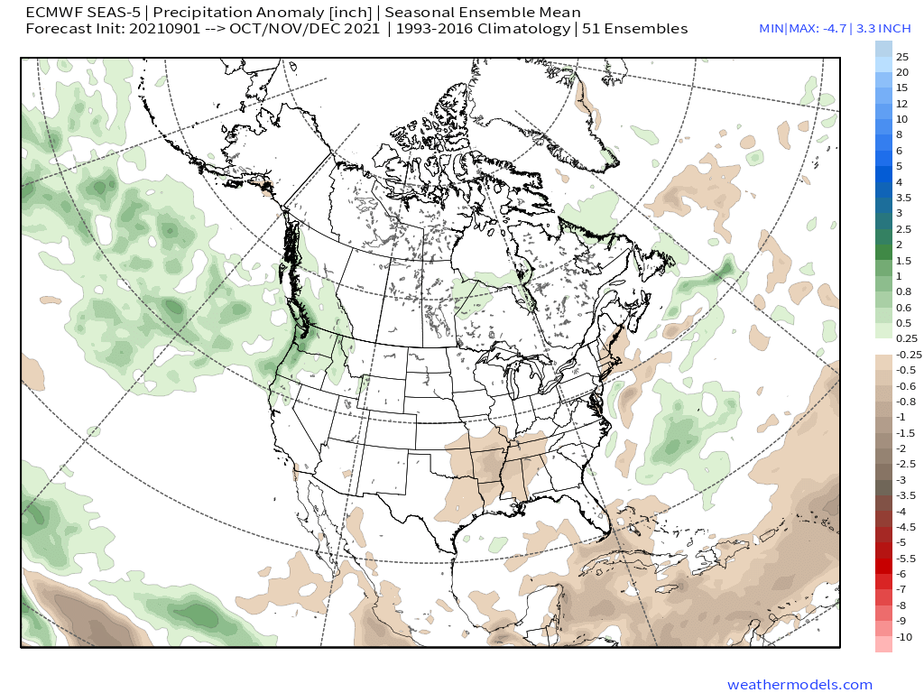
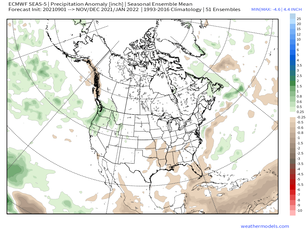
ECMWF Seasonal Ensemble Mean – Monthly Update from 9-5-2021
Who Are We?
 Steve Taylor – Mammoth Snowman – Over the last 30+ years, Snowman has spent countless hours studying and learning about Mammoth Mountain Weather and Snow Conditions first hand. He has been skiing around the hill with marked ski poles since March of 1991 so he can measure the fresh snowfall amounts out on the hill.
Snowman started blogging this information back in 1990 on the old Mammoth BBS system, then the RSN Forums and then on to MammothSnowman.com in 2004 with Video & Photo Blog report. (No YouTube back then). Facebook got added to the fold back in 2008 and then the Facebook Group in 2016.
Reports, videos, and photos from the website have been featured on both local TV Stations here in Mammoth, along with AP, Fox, ABC, CBS, and NBC News.
 Ted Schlaepfer – Mammoth WeatherGuy – The Powder Forecast – Posted Tuesday and Fridays at 5 PM November into Mid May. These forecasts are now responsible for many people getting multiple powder days on Mammoth Mountain over the years.
Ted’s Bio: Ted has been a full-time Meteorologist (CCM) for the past 25+ years. He has always been fascinated with the weather,” skiing was just a natural extension of my love for snow and rain. I started skiing at age 5, first discovered Mammoth in 1979 as a youth, and have been a regular visitor since the late ’80s.”.
Here is the link to The WeatherGuys Powder Forecast Page.
Click Here to Learn More About the People Who Make MammothSnowman.com a Reality


