Powder Forecast –Friday October 29th, 2021
Ted Schlaepfer CCM —- Mammoth Mountain WeatherGuy
Snowfall forecasts are valid at the Sesame snow course (Main Lodge) for the prior 24 hours as reported in the 6-7 AM morning snow report.
**Snowfall forecast confidence ranges from very low (1) to very high (5)
Sat 10/30 = 0”
Sun 10/31 = 0”
Mon 11/1 = 0”
Tue 11/2 = 0 – 2” (H2O = 0.00” – 0.20”) **3
Wed 11/3 = 0”
Thu 11/4 =0 – 2”
Fri 11/5 = 0 – 2”
Sat – Mon 11/6– 8 = 0”
October Snowfall = 32”
October Forecast = 32”
Detailed 4-day Snowfall Forecast:
Sat 10/30 and Sun 10/31 – No snowfall expected both days.
Mon 11/1 — Dry during the morning, then there is a chance for light snow during the afternoon and evening hours. Storm accumulations 0 – 2” Main Lodge; 0 – 3” up top.
Tue 11/2 – No snowfall expected.
Forecast Summary:
Short Term (Days 1 – 4):
Welcome to the powder forecasts for the 2021-22 ski season that is already off to an early and best start since 2004. Thanks to the anomalous big storm on Monday, Mammoth opened early and is boasting a 3 foot base up top already.
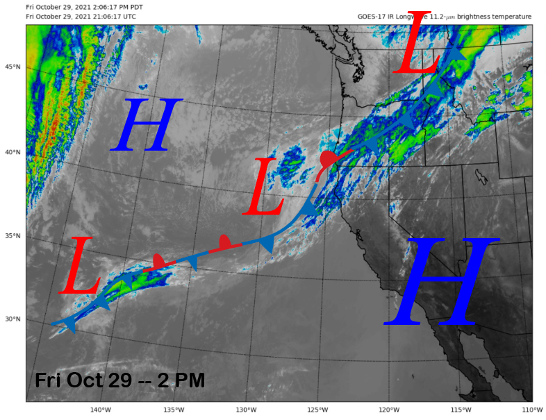
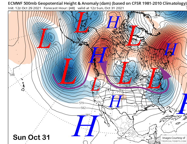
As far as the current weather, the afternoon satellite image (below) shows weak storm system positioned off the NorCal coast. The weather system is forecast to move inland tomorrow and into Sunday (two images below) with any precipitation staying across the northern half of the state and Mammoth remaining dry. Temperatures will cool a bit tomorrow followed by a little more cooling Sunday.
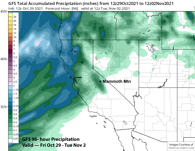
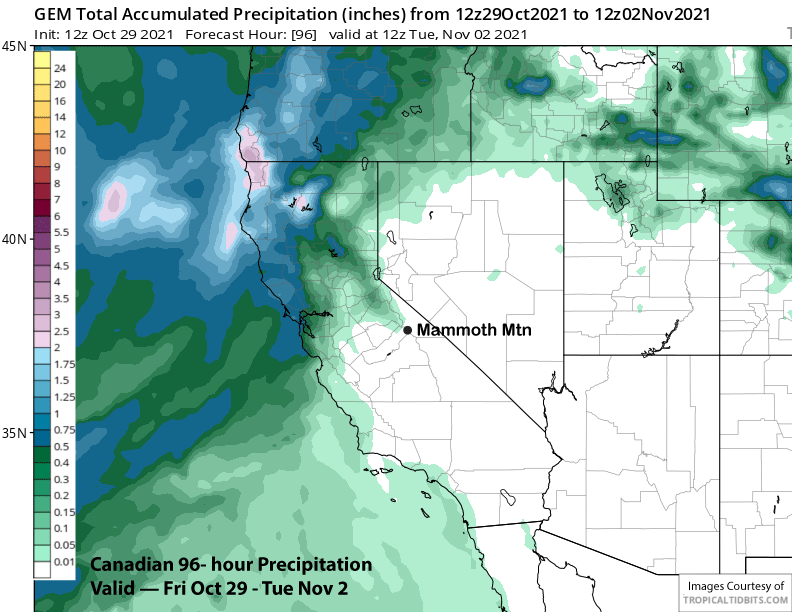
Another weather system, also rather weak, will move into central and northern California on Monday (image below) and into Tuesday. This one will have a good amount of moisture to work with, but there are still questions about whether there will be enough jet stream dynamics to push the front far enough eastward into the Sierra near Mammoth.
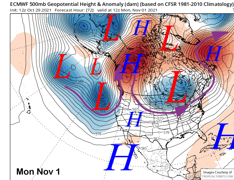
The ECM and GFS models (GFS below) both show around a quarter inch of liquid with the passage of the weak storm while the latest Canadian model (two images below) keeps the precipitation north of Mammoth with just passing clouds and wind. Current forecast follows the ECM ensemble mean that has around 0.20” of liquid, but nothing is certainly a possibility in this scenario. Snow levels will be around 8500-9000 feet.
Dry and warmer weather returns Tuesday with probably a lot of lingering passing cloudiness. Freezing levels are forecast to rise back up to near 11,000 feet again, so snowmaking will be limited.
Long Range (Days 5+):
The longer-range guidance is looking fairly decent for the first half of November. Under normal circumstances, the first storms of the season usually occur during the first half of the month. We already got that out of the way and the numerical guidance does favor more chances during this period.
After a dry day Wednesday, the ECM model (image below) moves a fast moving short-wave through the region around Thursday next week. While likely not a big storm, it is forecasting a couple to a few inches of snowfall with it passage. The Canadian model is a bit slower, but has a similar type trough moving through about 12 hours later, also resulting in a couple inches of snowfall.
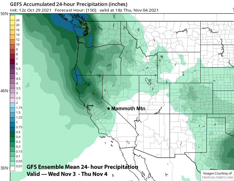
However, the GFS is weaker and much farther north with the weather system and keeps Mammoth dry. The GFS ensemble mean isn’t completely dry, but only shows about a tenth of an inch of liquid (image below) while the ECM mean has about a quarter inch. So the best case scenario right now will only be about a couple inches of snowfall.
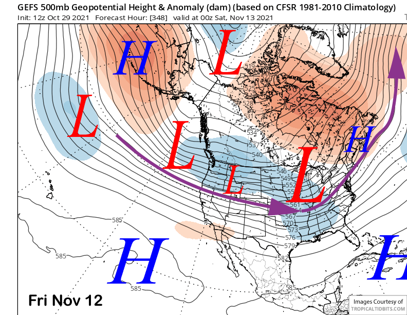
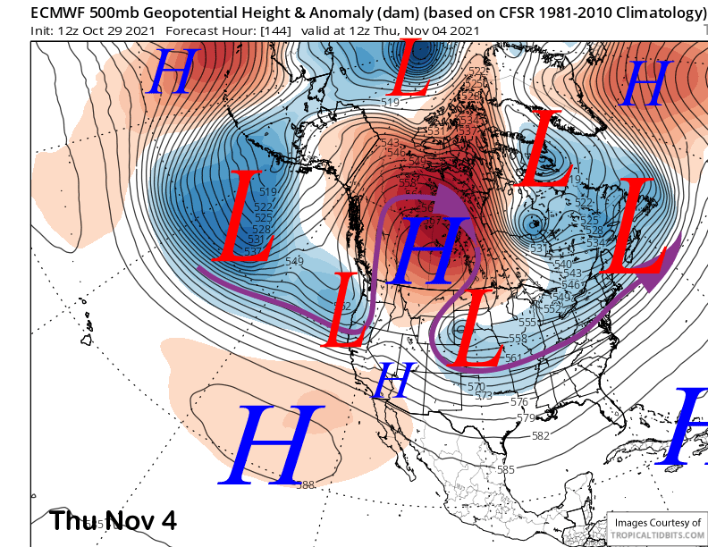
Dry weather will likely return for the end of next week and into the following weekend when high pressure build into the state (image below). Then the next chance for snowfall according to the GFS ensemble mean (image below) will be around Monday November 8th when a rather deep trough moves into the West Coast and shunts the ridge eastward.
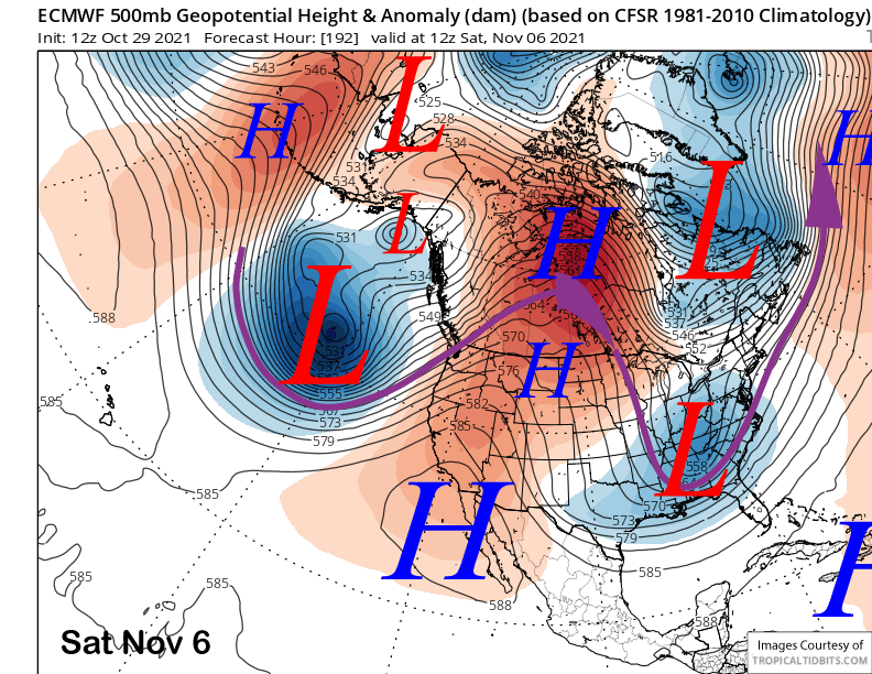
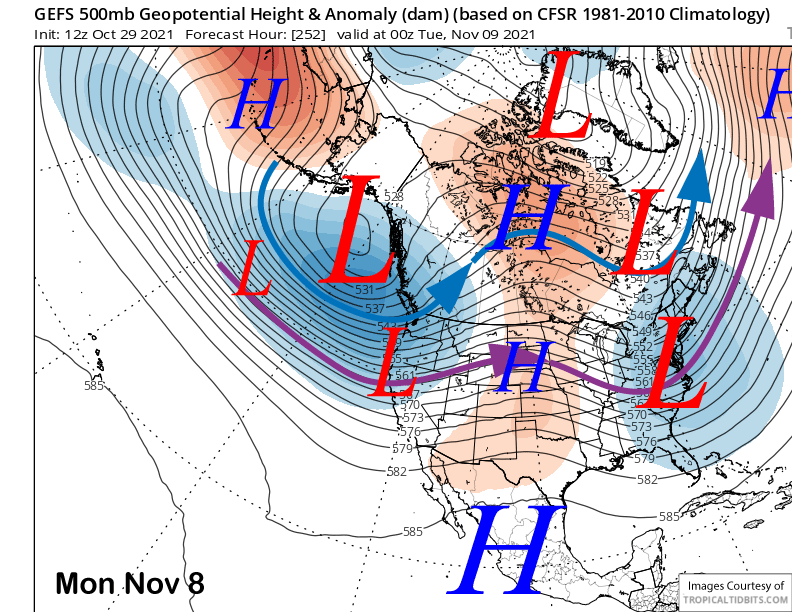
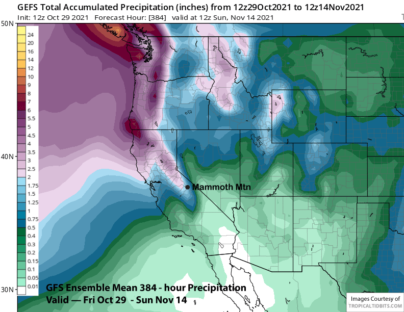
Right now, most of the rain/snow stays to the North with only moderate amounts for Mammoth. However, a slight shift southward and bigger snowfall could happen, especially since it is favoring such a deep trough for this time of year. This is certainly the best chance for powder conditions over the next 15-day period. Most of the nearly 2” of predicted liquid precipitation in the forecast chart below is associated with this trough passage.
That model keeps the jet stream flow zonal for most of that week (image below) with most of the energy moving into the PacNW and NorCal. There certainly could be some glancing blows farther southward into Mammoth though, we will have to wait and see how it pans out. Longer range fantasy charts are not super wet second half of November, so hopefully at least one of these storms will happen for both base-building and of course, powder conditions. WG