Powder Forecast –Friday November 12th, 2021
Ted Schlaepfer CCM —- Mammoth Mountain WeatherGuy
Snowfall forecasts are valid at the Sesame snow course (Main Lodge) for the prior 24 hours as reported in the 6-7 AM morning snow report.
**Snowfall forecast confidence ranges from very low (1) to very high (5)
Sat 11/13 = 0”
Sun 11/14 = 0”
Mon 11/15 = 0”
Tue 11/16 = 0”
Wed 11/17 = 0”
Thu 11/18 = 0”
Fri 11/19 = 0 – 1”
Sat – Mon 11/20 – 22 = 0”
November Snowfall = 8”
November Forecast = 10 – 25”
Detailed 4-day Snowfall Forecast:
Sat 11/13 through Tue 11/16 – No snowfall expected all days.
Forecast Summary:
Short Term (Days 1 – 4):
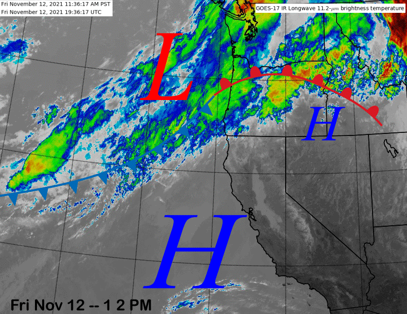
The current infrared satellite image (below) shows a strong ridge of high pressure situated just off the coast with a plume of moisture moving into the PacNW associated with an AR for them.
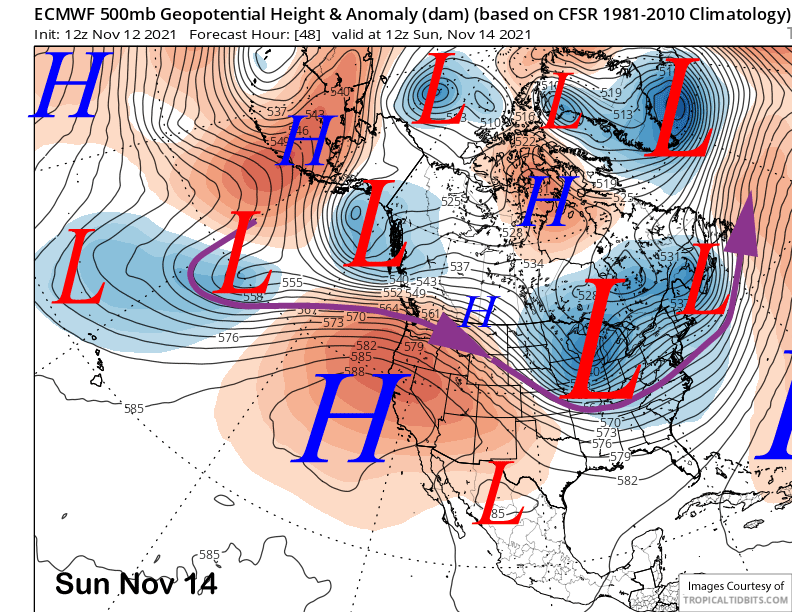
The high-pressure ridge is forecast to build into the state over the weekend (image below) and peak in strength early Sunday. That means more spring-like weather in autumn with temperatures into the middle/upper 40s up top and middle to upper 50s at Main.
The ridge starts to weaken early next week in response to a passing inside slider system and temperature are expected to cool off enough by Tuesday to allow for at least some limited snowmaking. No snowfall is expected with that weather system.
Long Range (Days 5+):
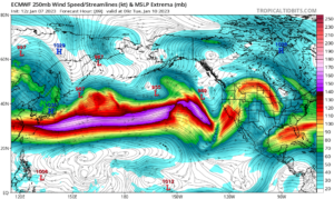
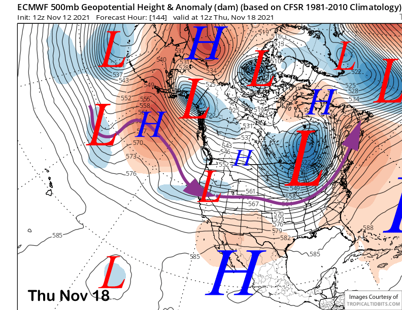
The longer-range guidance is still looking mostly dry for the most part. The latest 12Z run of the ECM model does move a short wave in weak zonal flow into the state around Thursday next week (image below). That model is forecasting some light snowfall with its passage.
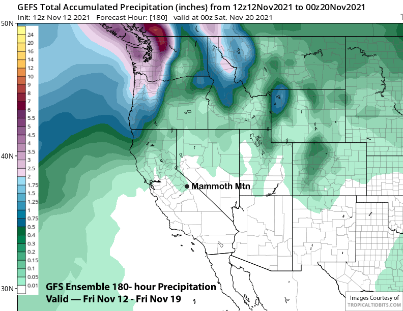
The Canadian and GFS models both have the short wave forecast as an inside slider type system that are mainly dry. The GFS ensembles (image below) are only showing very light amounts of precipitation through next Friday with continued dry weather the better bet. Temperatures will probably become mores seasonal next week with at least night-time snowmaking happening.
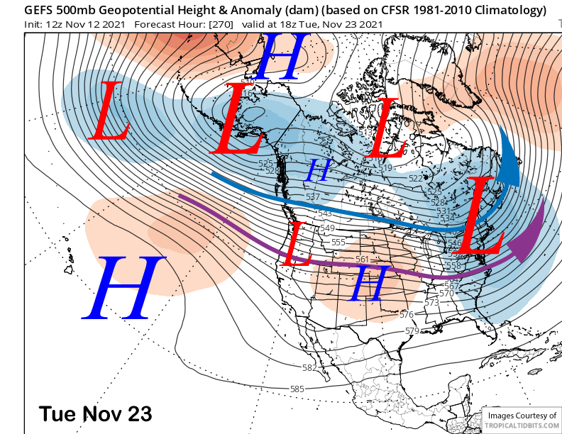
The GFS ensemble mean (image below) has a trough moving well north of Mammoth and into the PacNW around the Tuesday before Thanksgiving, otherwise high pressure is expected to hold over the state through Thanksgiving (two images below) or longer.
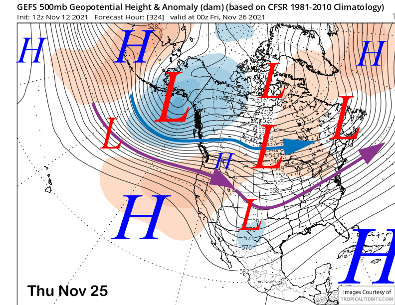
The GFS ensemble mean does flatten the ridge at the end of the forecast period with zonal flow developing into the West Coast, but mostly north of Mammoth. The ECM mean keeps the ridge mostly in place. Overall, it still appears that the next good chance for meaningful snowfall won’t be until the end of the month or early December. WG