Powder Forecast –Tuesday November 16th, 2021
Ted Schlaepfer CCM —- Mammoth Mountain WeatherGuy
Snowfall forecasts are valid at the Sesame snow course (Main Lodge) for the prior 24 hours as reported in the 6-7 AM morning snow report.
**Snowfall forecast confidence ranges from very low (1) to very high (5)
Wed 11/17 = 0”
Thu 11/18 = 0”
Fri 11/19 = 0”
Sat 11/20 = 0 – trace”
Sun 11/21 = 0”
Mon 11/22 = 0”
Tue 11/23 = 0”
Wed – Fri 11/24 – 26 = 0”
November Snowfall = 8”
November Forecast = 10 – 25”
Detailed 4-day Snowfall Forecast:
Wed 11/17 through Sat 11/20 – No snowfall expected all days except for a chance for flurries late Friday night and/or early Saturday.
Forecast Summary:
Short Term (Days 1 – 4):
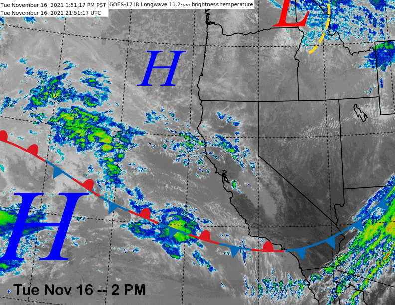
The current infrared satellite image (below) shows a weak high pressure ridge building into the region after the passage of a weak system yesterday that resulted in just passing clouds. Temperatures cooled today, but remain seasonably mild with mid-30s up top and mid-40s Main. Little change in the weather is expected through Thursday except for more high clouds on Thursday.
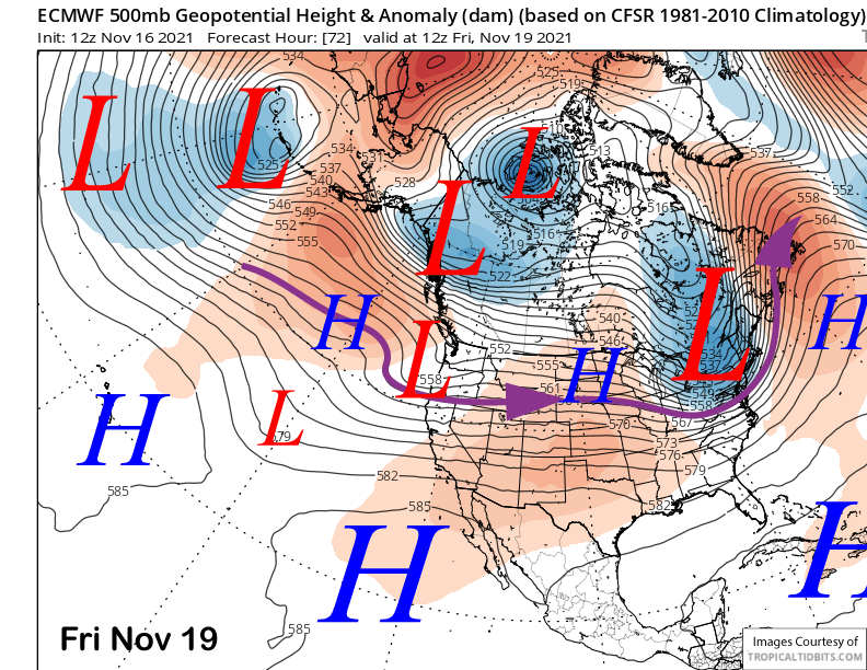
The models (ECM below) move a weakening short-wave into NorCal Friday with any meaningful precipitation expected to remain north of Mammoth. There could be some flurries overnight Friday and early Saturday, but that is about it. Temperatures will become more seasonable by Friday and Saturday that will allow for some night-time snowmaking.
Long Range (Days 5+):
The longer-range guidance is still looking dreary in the ten day range, but is offering hope in the fantasy 11-15 day period.
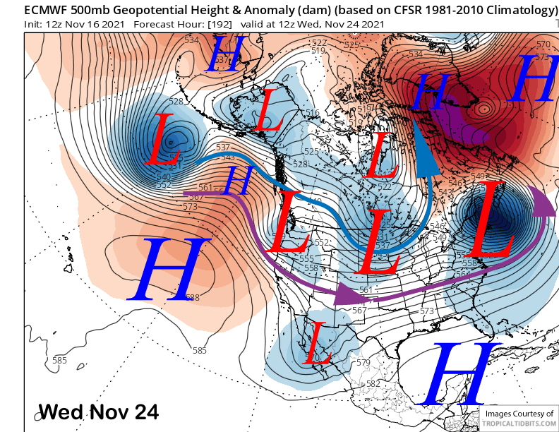
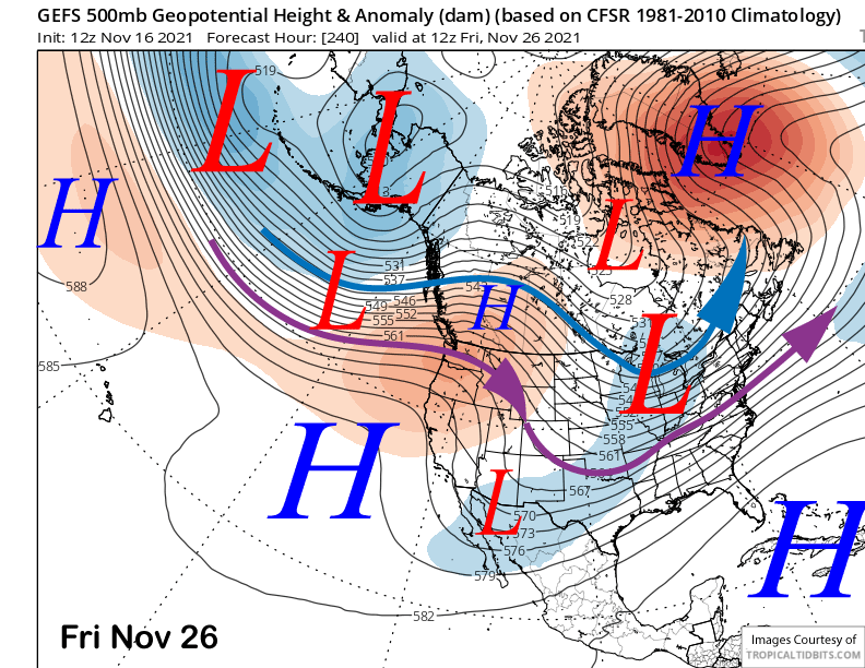
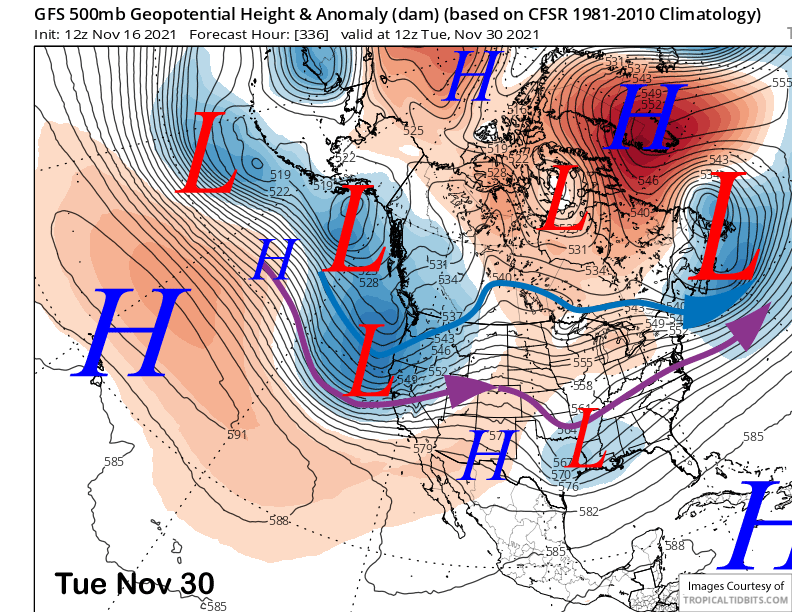
The models are mostly in agreement of developing a ridge over CA by Sunday and next Monday (image below) before an inside slider short-wave moves southward just east of CA around mid-week (two images below) and the Thanksgiving holiday.
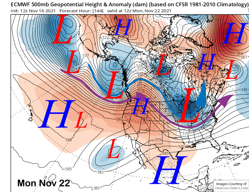
That means that fair and dry weather late over the weekend and early next week will be replaced by colder and breezy weather around the holiday. If this scenario verifies, snowmaking should be good. Otherwise, high pressure (image below) should rebuild over the state during the holiday weekend for fair, dry, and seasonable or seasonably warm weather.
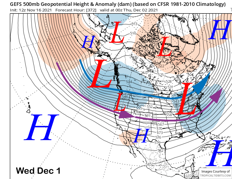
Changes in the generally dry pattern are then possible in the fantasy range period as the GFS model is now advertising a more favorable pattern for snowfall. The 12Z run of the operational GFS model (image below) moves a deep trough into CA and Mammoth at the end of the month.
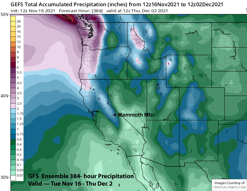
The GFS ensemble mean somewhat supports this scenario with a robust zonal just stream into the West Coast and the southern branch into NorCal (purple arrow). The mean is showing about 1” of liquid for the last few days of the forecast period (two images below)
It is still very far out in time to get excited about, however, early December is the right time for storms to increase in central CA climatologically. Hopefully we will be watching it come to fruition over the next two weeks. WG.


