Powder Forecast –Tuesday November 30th, 2021
Ted Schlaepfer CCM —- Mammoth Mountain WeatherGuy
Snowfall forecasts are valid at the Sesame snow course (Main Lodge) for the prior 24 hours as reported in the 6-7 AM morning snow report.
**Snowfall forecast confidence ranges from very low (1) to very high (5)
Wed 12/1 = 0”
Thu 12/2 = 0”
Fri 12/3 = 0”
Sat 12/4 = 0”
Sun 12/5 = 0”
Mon 12/6 = 0”
Tue 12/7 = 0 – 2”
Wed – Fri 12/8 – 10 = 0 – 3”
November Snowfall = 8”
November Forecast = 8”
Detailed 4-day Snowfall Forecast:
Wed 12/1 through Sat 12/4 – No snowfall expected all days.
Forecast Summary:
Short Term (Days 1 – 4):
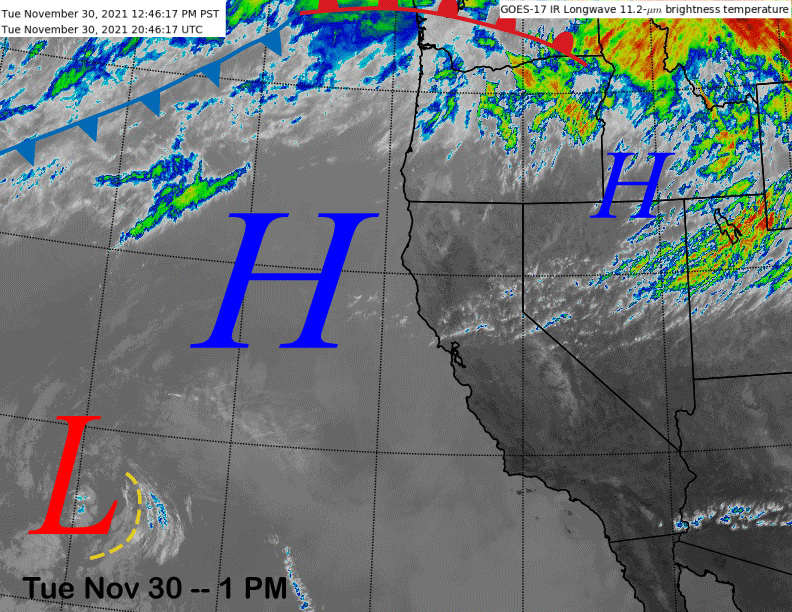
The current infrared satellite image (below) shows high pressure stretching from the eastern Pacific into Idaho with a quasi-stationary low-pressure system well off the SoCal coast.
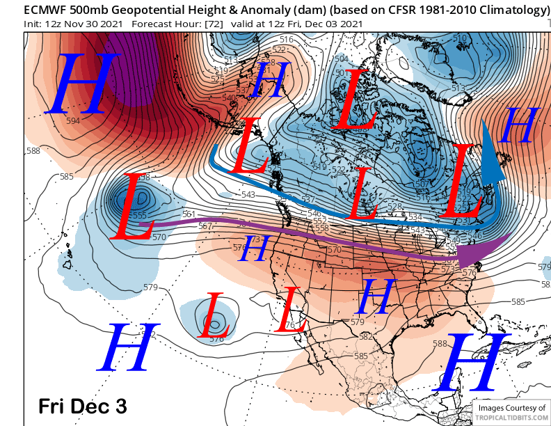
Models keep the ridge in place for the rest of the week (image below) for generally little change in the weather pattern. Basically, the fair and mild weather will continue for the next four days with limited snowmaking opportunities under the mild temperatures.
Long Range (Days 5+):
The longer-range guidance continues to shift the “carrot” further out in time and dangling hope in the 11-15 day range, while continuing to keep the 10-day forecast period mostly dry, although colder weather should return next week.
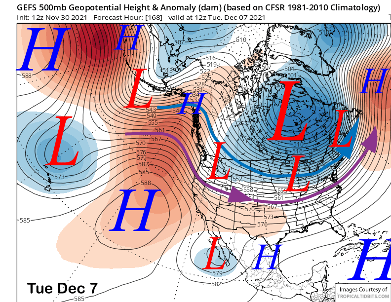
The latest ECM model peaks the ridge in strength on Sunday (image below) and Monday after a brief dip in strength Saturday. So, the fair/dry/mild pattern will last through Monday midday.
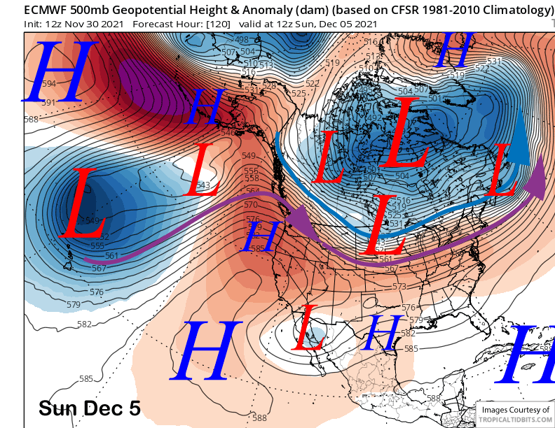
The models then move an inside slider type system through eastern California Monday night and Tuesday (ECM model below). These systems are usually dry, but this one will pick up some moisture feeding over the central Pacific ridge and may produce some light snowfall by early Tuesday.
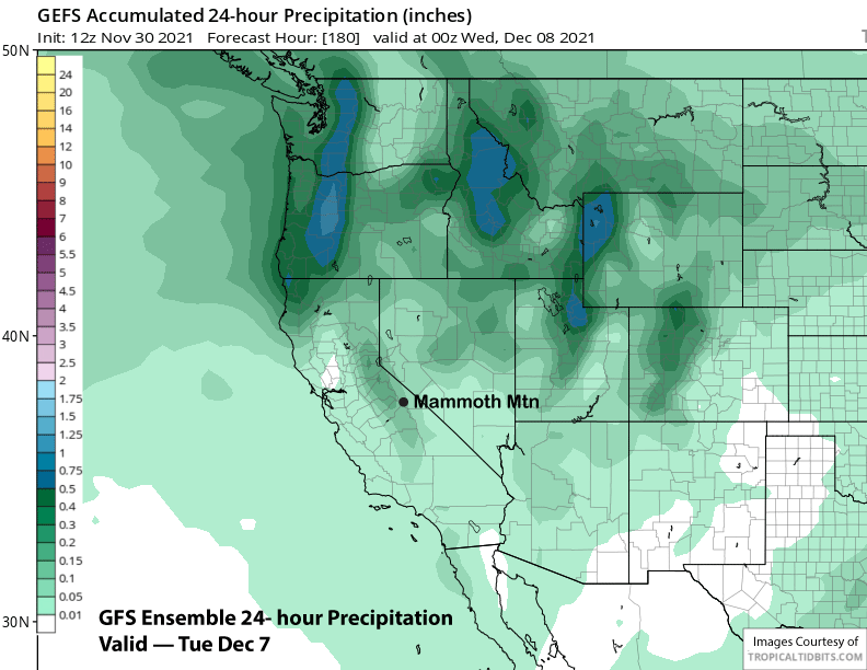
If it tracks a bit farther westward, then amounts could be heavier. Right now, the GFS ensemble (image below) favors a more eastward track on its way to the southeast. That model is showing only very light amounts of precipitation (two images below) and the ECM mean is similar.
Overall, a couple inches of snowfall is possible early next week with deep powder unlikely and also a decent chance for nothing. Nonetheless, the pattern shift will move colder air into the Sierra and snowmaking will become more effective by the middle part of next week.
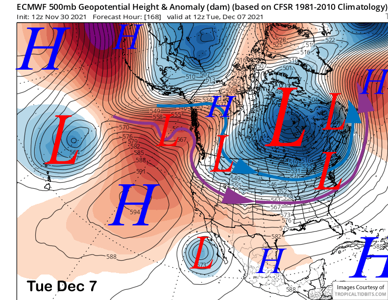
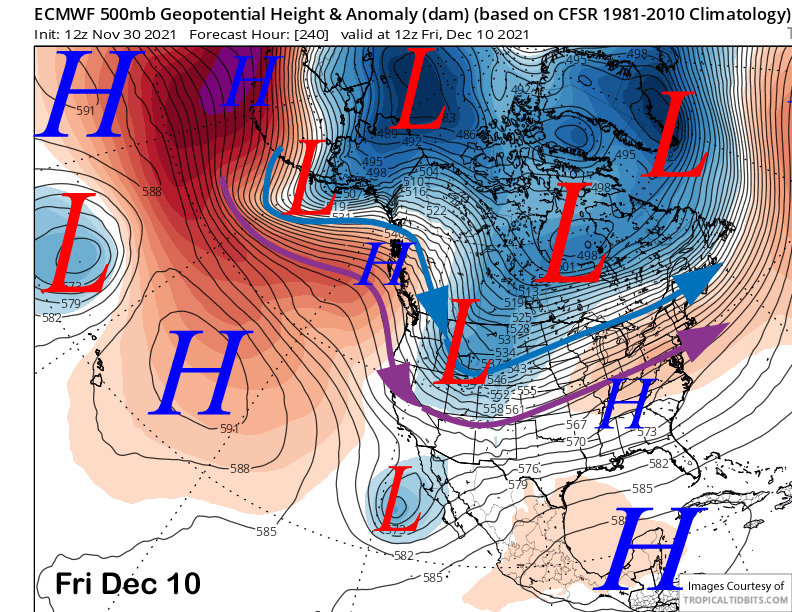
After building back the ridge for a day or two, the ECM model moves another slider type system into the eastern Sierra toward the end of next week (image below). For many runs over the past couple of days, the GFS model had been advertising a wetter system for the end of next week. The model has now backed off and is now also showing a slider type storm. The GFS ensemble is also supporting that solution (two images below).
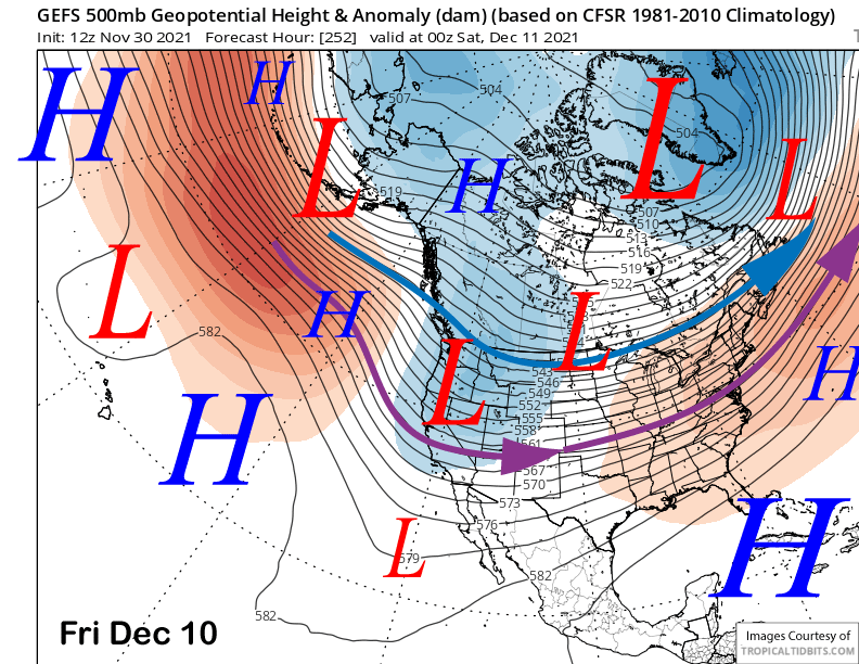
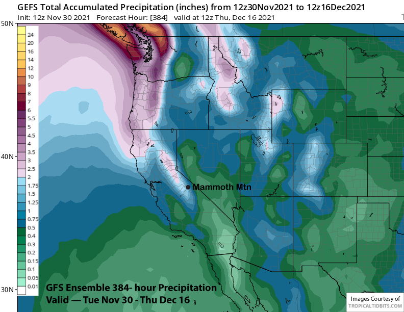
The GFS ensemble builds a weak ridge into the state in the wake of that system, then develops a weak trough along CA in the fantasy period heading into mid-month (image below). Total precipitation from that model hasn’t change much of the past few posts at a little over an inch (image below) as it just shifts the potential snowfall farther out in time with each run.
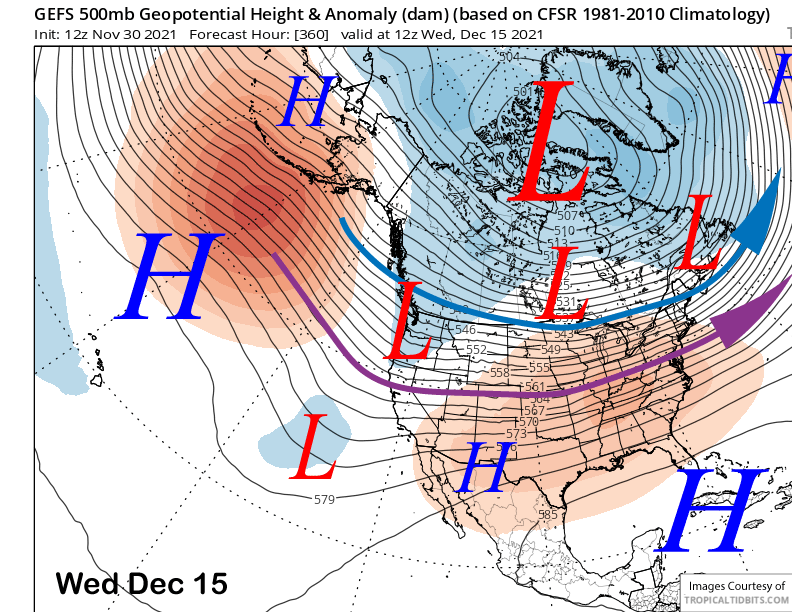
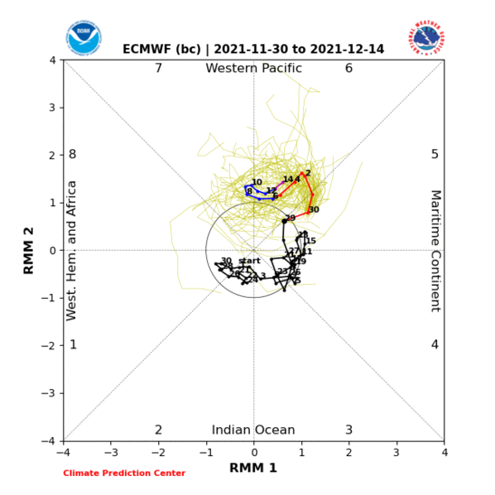
The models are likely struggling with the MJO pattern. There is a suggestion now that it will only briefly move into phase 7 (image below) before retrogressing back westward into phase 6. Phase 6 is dry until around the end of the third week of December when there is a weak signal for increased precipitation.
Overall, the ECM ensemble mean fantasy period does show a deeper trough along the West Coast heading into mid-month and deeper than the GFS ensemble mean. The long range ECM climate model keeps the precipitation going second half of December. So a stormy second half of December certainly could happen as I suspect that what goes around (dry) will eventually come around (wet). WG


