Powder Forecast –Friday December 3rd, 2021
Ted Schlaepfer CCM —- Mammoth Mountain WeatherGuy
Snowfall forecasts are valid at the Sesame snow course (Main Lodge) for the prior 24 hours as reported in the 6-7 AM morning snow report.
**Snowfall forecast confidence ranges from very low (1) to very high (5)
Sat 12/4 = 0”
Sun 12/5 = 0”
Mon 12/6 = 0”
Tue 12/7 = 0 – 1”
Wed 12/8 = 0”
Thu 12/9 = 0”
Fri 12/10 = 3 –6”
Sat – Mon 12/11 – 13 = 3 – 6”
December Snowfall = 0”
December Forecast = 50 – 70”
Detailed 4-day Snowfall Forecast:
Sat 12/4 and Sun 12/5 – No snowfall expected both days.
Mon 12/6 – Chance for light snow showers or flurries during the afternoon and evening, windy. Trace to 1” accumulation only.
Tue 12/7 – No snowfall expected
Forecast Summary:
Short Term (Days 1 – 4):
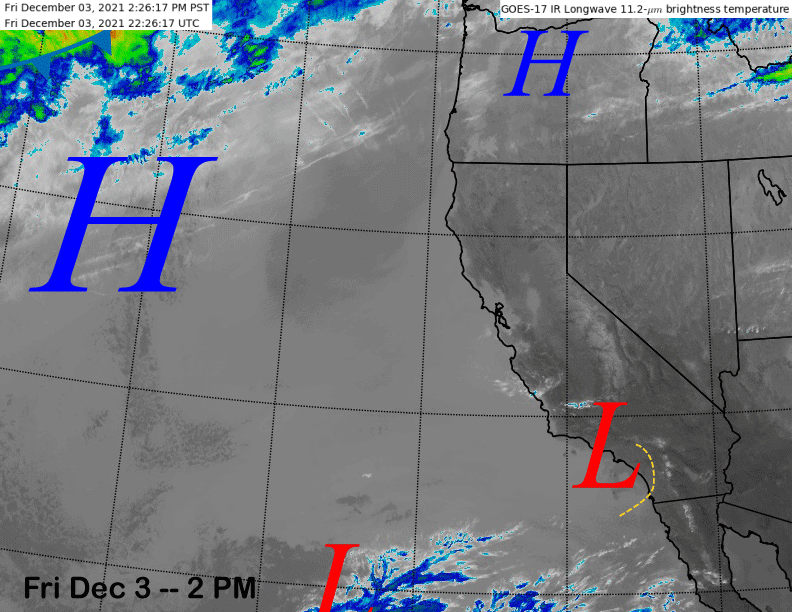
The current infrared satellite image (below) shows high pressure centered north and west of CA with a couple weak low pressure areas over SoCal and off the coast. Those systems will slowly move eastward over the next 36 hours well south of Mammoth.
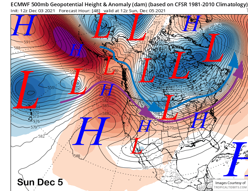
High pressure will rebuild later Saturday and into Sunday (image below) and warmer weather will return for a day Sunday after the slightly cooler days today and tomorrow when there will likely be some overnight/early morning snowmaking opportunities.
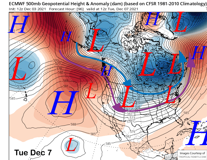
Changes in the weather pattern finally start to occur early next week. Models are now in agreement that an inside slider type weather system will move through Mammoth on Monday into Tuesday (ECM model below) resulting in colder and windy weather along with some light snow showers or flurries. Not surprising since it is a slider, all the models have backed off with any significant snowfall now.
It won’t be super cold, but snowmaking should be better by Monday night and for most of next week with dry weather returning Tuesday and Wednesday.
Long Range (Days 5+):
The longer-range guidance is certainly looking better now, especially just beyond the 10-day period with the first “winter-like” storm now probable for the end of next week.
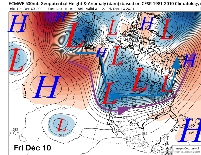
The latest ECM model 12Z deterministic run has now come into better alignment with the GFS and Canadian models that started to show more favorable solutions over the last many runs. It moves a cold upper level low (image below) into CA like the other models Thursday into Friday resulting in much colder weather, windy conditions, and also snowfall.
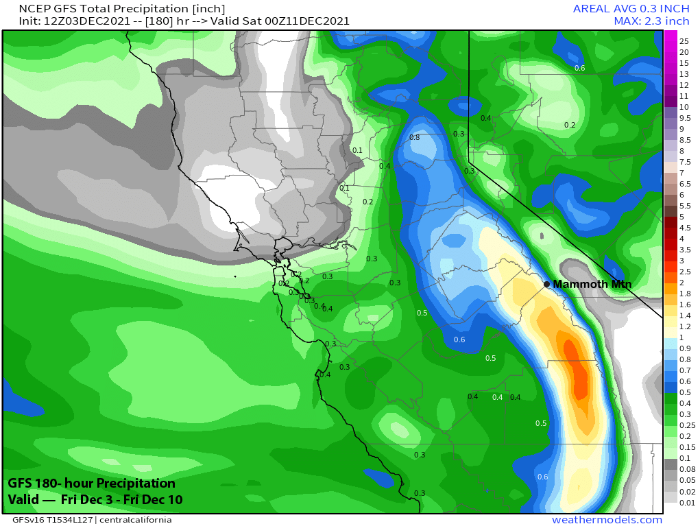
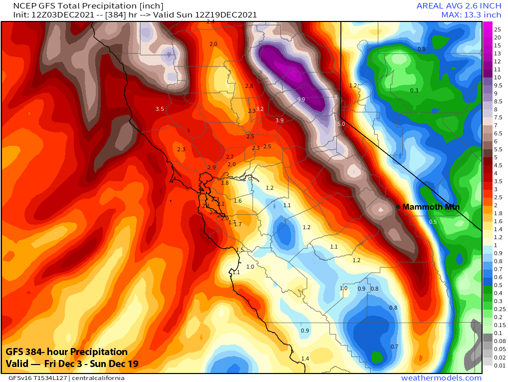
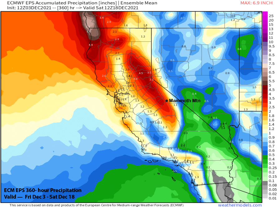
All the operational models are showing decent amounts now with the ECM (image below) and GFS (two images below) models both showing around an inch of liquid with the passage of the system. The Canadian is similar. That could equate to close to a foot of snowfall at Main Lodge and 6-9” at Canyon.
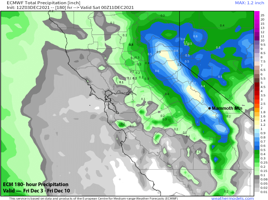
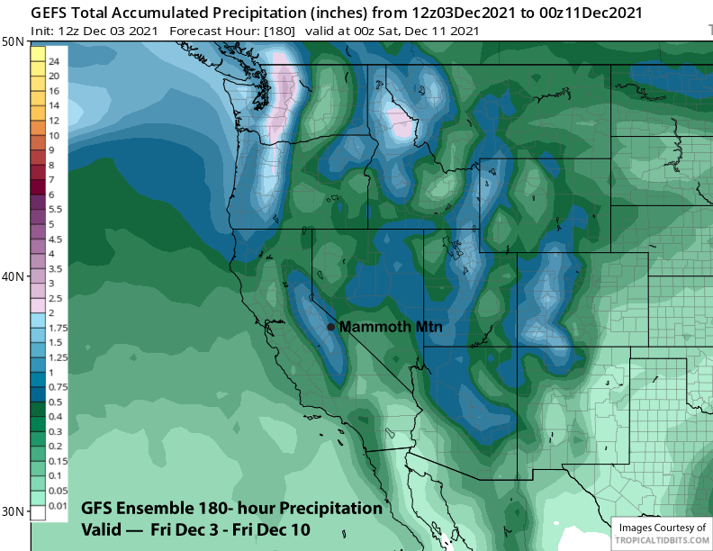
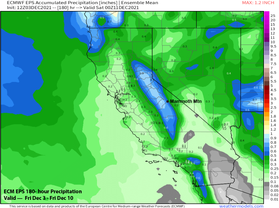
The ensemble mean of the GFS (image below) is also showing about an inch while the ECM mean (two images below) has about half that amount. There is still some uncertainty with the potential snowfall, but a decent storm is looking possible. Current forecast has 6-12” of snowfall for Main starting Thursday midday and continuing into Friday midday.
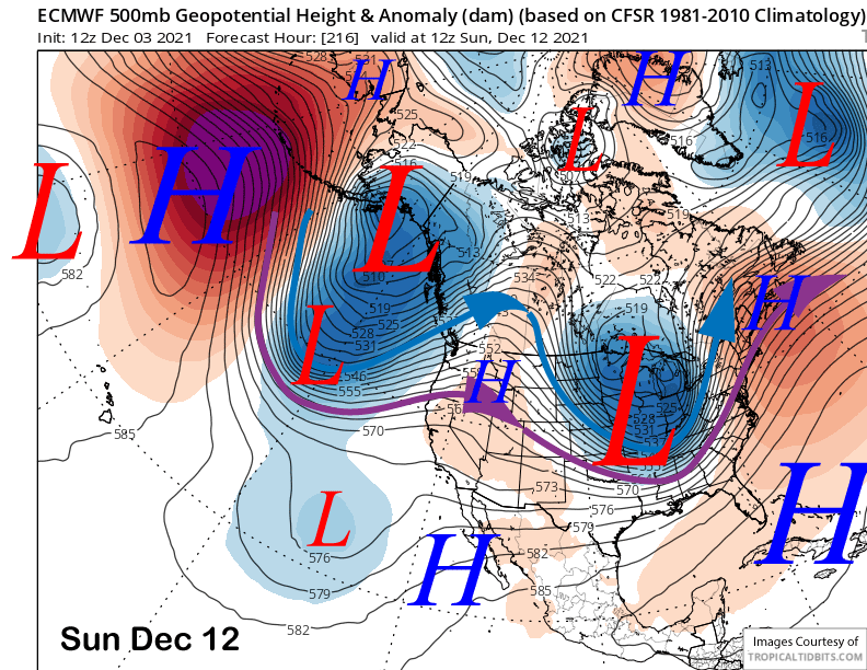
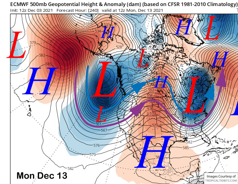
After a break over the weekend, the models are mostly in agreement that a trough will set-up off the West Coast with the jet stream extending southward into CA by early the following week (ECM images below). That solution would be favorable for increasing snowfall for Mammoth as a series of storms could move through the state.
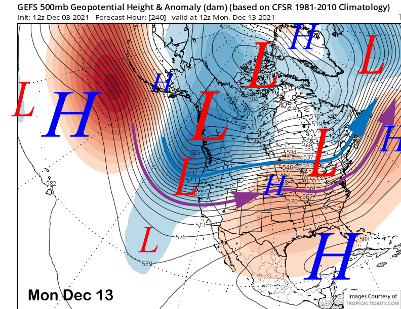
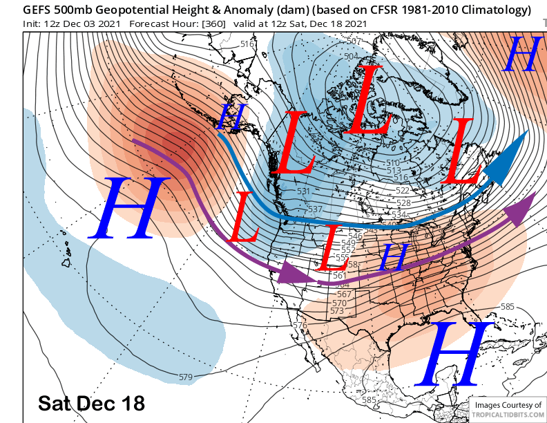
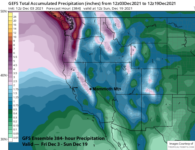
The GFS ensemble mean (image below) is also showing a similar trough setting up over the same time period and then mostly keeps a weak trough along the coast in place for the rest of the period (two images below). The ECM ensemble is similar. The latest GFS operational run is probably the best case scenario for this outlook as it has a few good storms moving through the state over the period and about 5” liquid (3 images below) for Mammoth (~4 feet of snow).
However, the GFS ensemble mean has only about half that amount (image below) and the ECM ensemble has about 3” liquid (two images below). At this point, we can only hope that the GFS operational model is right. Nonetheless, if the ensemble means are close, there should be enough snowfall at Canyon for them to open on time.
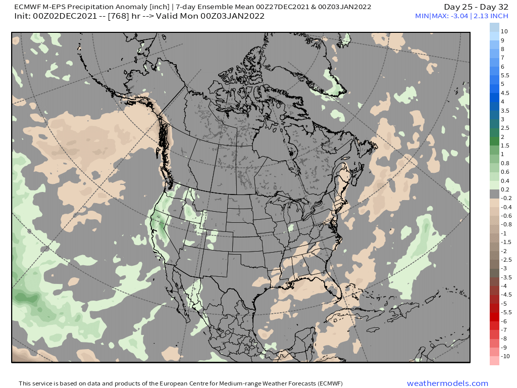
The long range ECM climate model tapers off, but doesn’t end, the storminess over the Christmas week before increasing the storminess again toward the end of the month and into early 2022 (image below). That is likely tied to the model moving the MJO back westward into phase 6 before swinging it eastward again into phase 7 end of the month. Confidence is low with that solution as the models are not in agreement with the MJO forecast.
Overall, it looks like that stubborn high pressure ridge will be gone by early next week with a more typical winter pattern then expected for the rest of the year. Current monthly forecast favors near average December snowfall (~60”). WG


