Powder Forecast –Friday December 24th, 2021
Ted Schlaepfer CCM —- Mammoth Mountain WeatherGuy
Snowfall forecasts are valid at the Sesame snow course (Main Lodge) for the prior 24 hours as reported in the 6-7 AM morning snow report.
**Snowfall forecast confidence ranges from very low (1) to very high (5)
Sat 12/25 = ~7” (H20 = 0.75”)**5
Sun 12/26 = 16 – 22” (H20 = 1.50” – 1.75”)**4
Mon 12/27 = 8 – 15” (H20 = 0.50” – 0.75”)**3
Tue 12/28 = 20 – 30” (H20 = 1.35” – 1.50”)**3
Wed 12/29 = 0 – 2”
Thu 12/30 = 0 – 6”
Fri 12/31 = 0
Sat – Mon 1/1 – 1/3 = 0”
December Snowfall = ~98”
December Forecast = 130 – 160”
Detailed 4-day Snowfall Forecast:
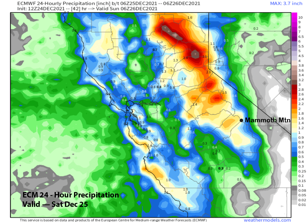
Sat 12/25 – Light snow or flurries during the day, then heavy snowfall develops during the evening and overnight hours, tapering toward dawn. Strong winds overnight and during the early morning Sunday. Accumulations 16 –22” by Sunday AM at Main, 24”+ up top
Sun 12/26 – Light snow showers during the day, then snowfall intensity increases overnight. Accumulations 8 –15” by Monday AM at Main, ~20” up top
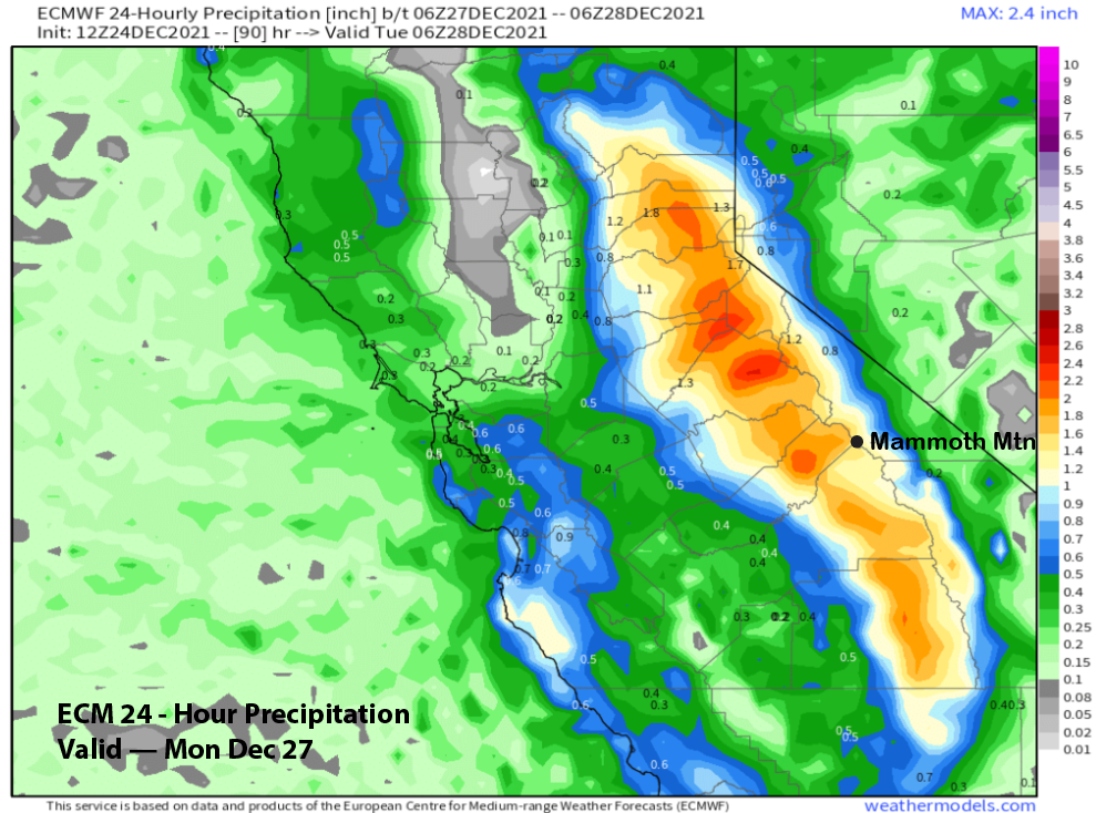
Mon 12/27 – Heavy snow during the daytime hours, tapering off during the evening, ending overnight. Accumulations 20 –30” by Monday AM at Main, ~20” up top
Tue 12/28 – No snowfall expected until possibly overnight. Accumulations 0 –2” by Wednesday AM.
Forecast Summary:
Short Term (Days 1 – 4):
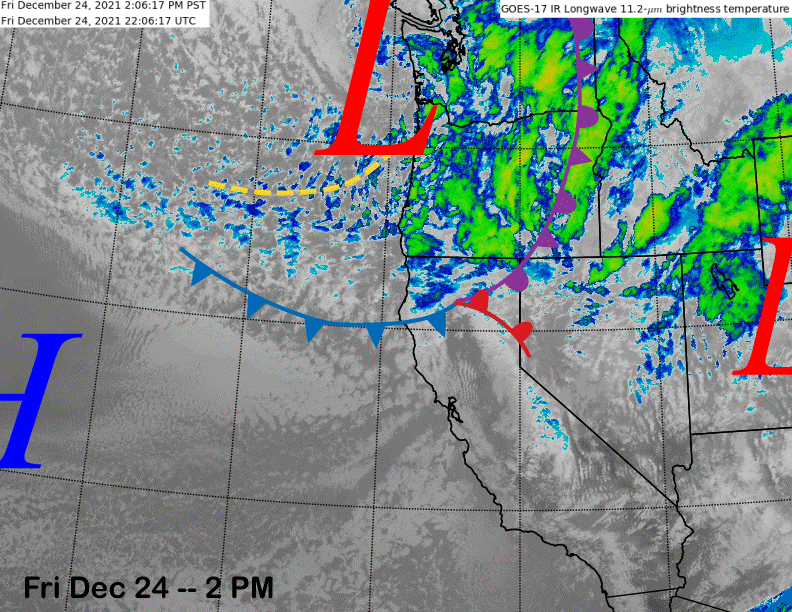
The infrared satellite image (below) this afternoon shows the next storm system now moving through the PacNW and into NorCal with the old storm already eastward into Utah.
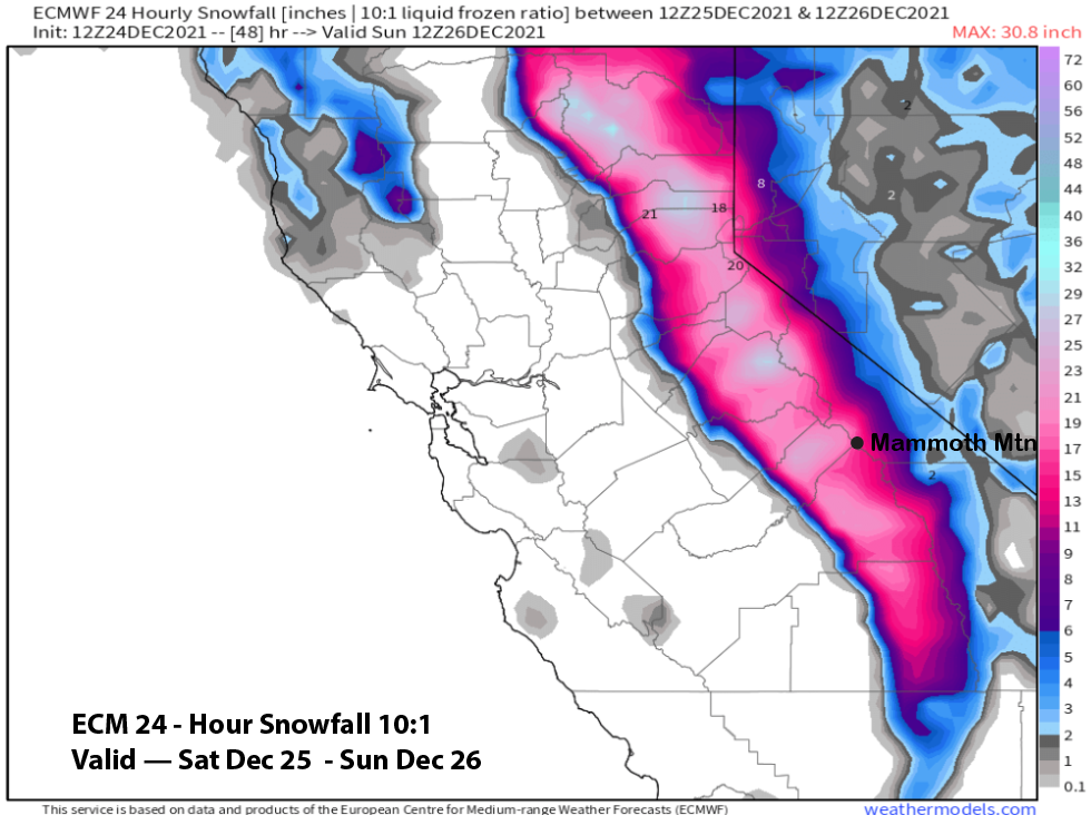
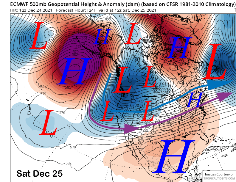
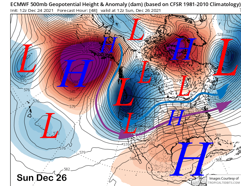
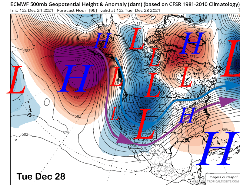
Models move the next storm into Mammoth tomorrow (image below) with the heavier snowfall developing during the late afternoon and evening with the trough passage expected by early Sunday AM (two images below) when very strong winds are expected.
The guidance generally shows about two inches of liquid with the passage of the storm (images below) as it won’t be as wet as the previous system. That is because it is colder with snow levels starting out around 4500 feet before lowering by early Sunday to 2000 feet. Thus, this will not be Sierra cement type snowfall and lighter than usual. Ratios should be in the 10-12”:1” range with the lightest stuff as the snowfall is tapering off Sunday morning.
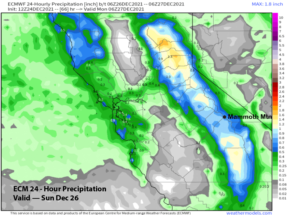
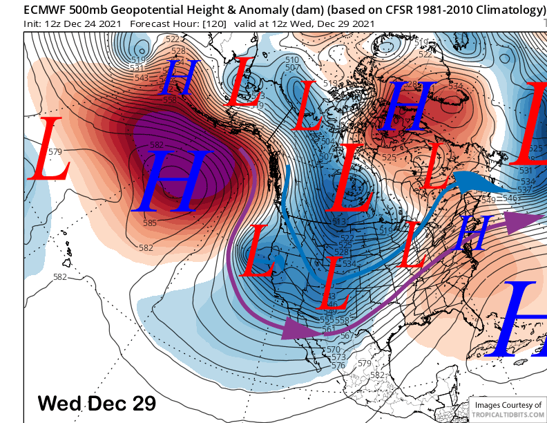
The models then quickly move the next upper-level and coldest low of the series of storms into the Sierra on Sunday night and Monday (image below) as there won’t be much of a break between storms.
Liquid amounts with this storm will be less and up to 1.5” (image below), but with a dry and cold air mass already in place, this will be the lightest powder in a long while with snow ratios in the 15-20”:1” range.
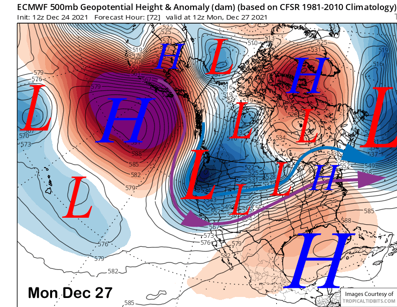
Thus, a couple feet or more of light and dry powder is likely at Main by Monday night when the snowfall ends. Tuesday could be a bluebird morning with incredible powder and snow conditions more reminiscent of Utah or Colorado type snow. Temperatures will be cold though, likely in the teens, as models keep the flow northerly and a weak short wave passing southward west of the Sierra (image below).
Long Range (Days 5+):
The longer-range guidance is a bit mixed in the shorter term and then favors storms to return in early 2022.
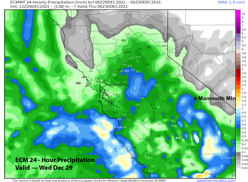
The ECM model moves another wave southward in the northerly jet around Wednesday (image below) with the other models having the low-pressure system in a slightly different location. The location is key because if it is too far off the coast, then any precipitation will remain west of the Sierra.
That ECM solution does produce about half an inch liquid for Mammoth (image below) that would be at least 6” of snowfall. Confidence is low as the slight wobble could mean dry conditions. We’ll see, another small burst of fluffy powder could keep conditions epic though.
The guidance does favor a period of dry weather to develop by New Years’ weekend. The ECM (image below) builds a short-wave ridge into CA for dry conditions next Saturday and that is believable because it never rains on the Rose Bowl parade and this solution would keep that statement true.
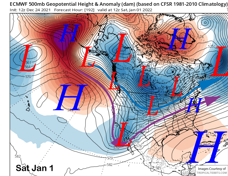
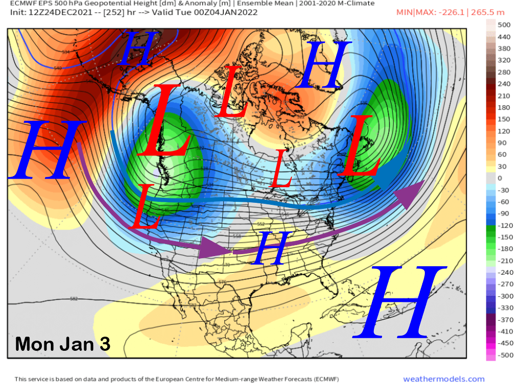
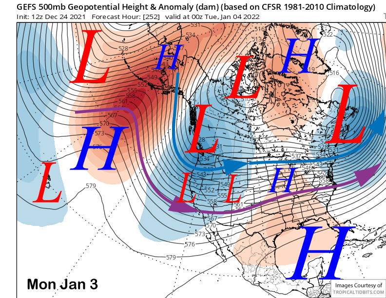
Like a “good” broken record, the longer range fantasy guidance is again in remarkable agreement that a deep long-wave trough will get re-established along the West Coast and southward into CA over the first week of 2022 (images below). That would mean a return of storms that week and likely more powder days and riders of the storm opportunities.
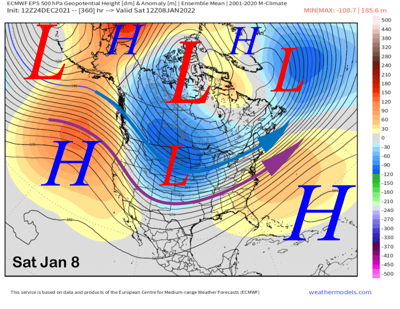
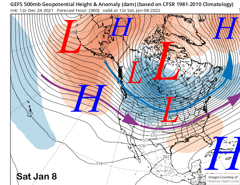
The super long-range guidance does finally shift the trough eastward at the back end of the period and around the end of the first week of January (images below). That would mean a return to dry weather that is eventually inevitable.
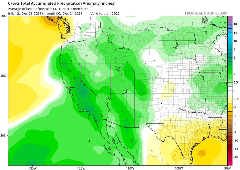
As far as next month, the CFS model has trended wetter over the last many handful of runs and now shows above normal precipitation for CA (image below). That model was right about December when I posted an image on November 23rd, and it is about the same day in the month as back then, with about a seven day lead time until the next month starts. Fingers crossed and Merry Christmas. WG