Powder Forecast –Tuesday January 18th, 2022
Ted Schlaepfer CCM —- Mammoth Mountain WeatherGuy
Snowfall forecasts are valid at the Sesame snow course (Main Lodge) for the prior 24 hours as reported in the 6-7 AM morning snow report.
**Snowfall forecast confidence ranges from very low (1) to very high (5)
Wed 1/19 = 0”
Thu 1/20 = 0”
Fri 1/21 = 0”
Sat 1/22 = 0”
Sun 1/23 = 0”
Mon 1/24 = 0”
Tue 1/25 = 0”
Wed – Fri 1/26 – 1/28 = 0”
January Snowfall = 0”
January Forecast = 0 – 15”
Detailed 4-day Snowfall Forecast:
Wed 1/19 through Sat 1/22 – No snowfall expected all days.
Forecast Summary:
Short Term (Days 1 – 4):
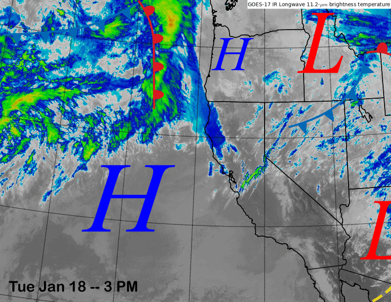
The infrared satellite image (below) today shows a weak weather system moving eastward well north of Mammoth and another one moving into Arizona south of Mammoth. High pressure off the coast will build into the state for the next few days for continued fair/dry weather.
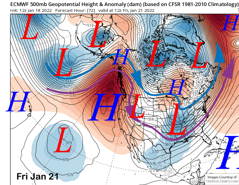
The ECM (image below) and other models then move an inside slider short-wave southward east of CA and through Nevada on Friday and into Saturday for a burst of northeast winds and slightly colder temperatures, otherwise dry weather continues into next weekend.
Long Range (Days 5+):
The longer-range guidance is mostly unchanged, with bad news in the shorter term, and hope for a change in the overall weather pattern in the fantasy range.
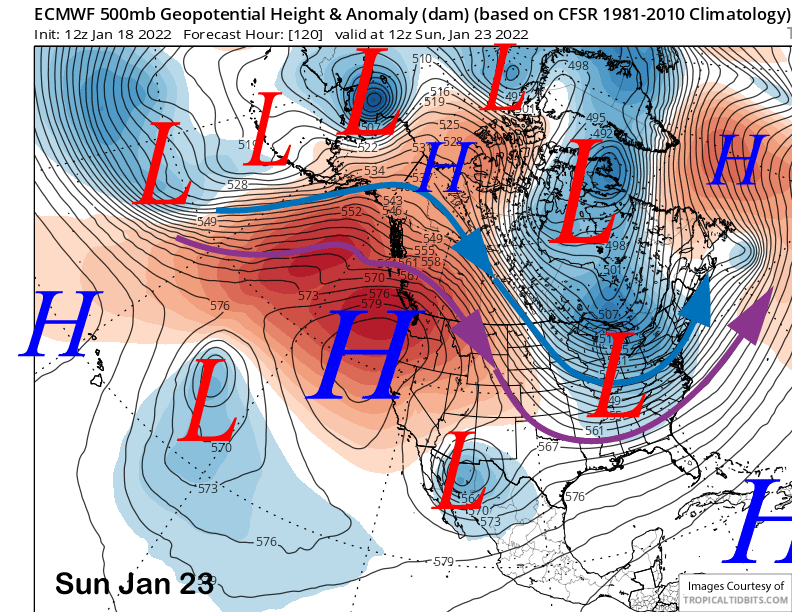
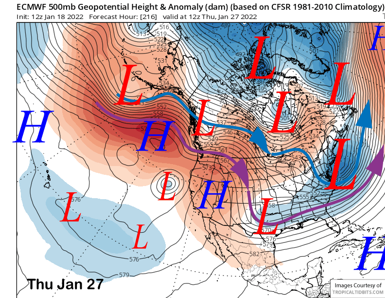
The ECM model rebuilds the ridge over the West Coast late over the upcoming weekend (image below), although it has it centered over the PacNW with light NE winds for the eastern Sierra. It scoots the ridge northward by mid-week (two images below) and develops a very weak cut-off low along the coast. That should result in slightly colder temperatures and maybe a little bit of NE winds.
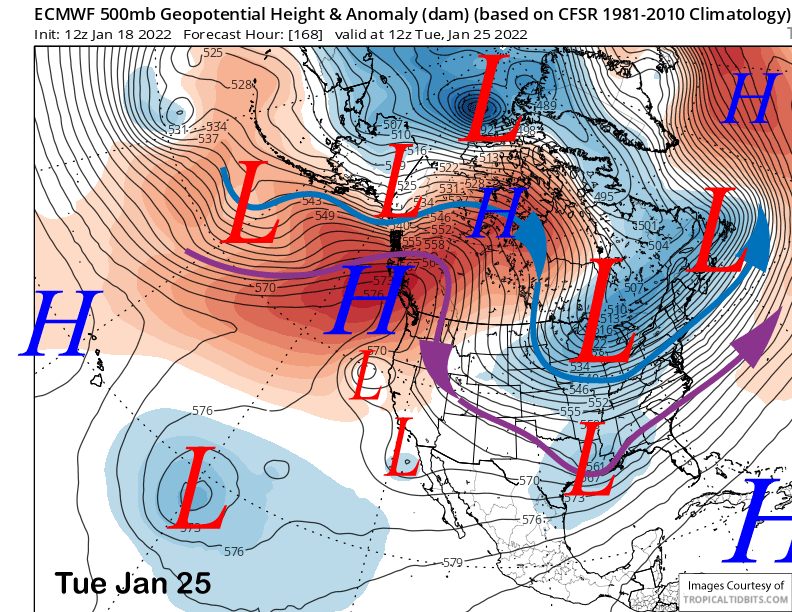
The ECM model keeps the dry conditions ongoing through the end of the week with the ridge briefly rebuilding (image below). Not sure that exact solution will happen, but I am pretty sure dry weather will continue through the 10-day period as shown by the ECM below (two images below).
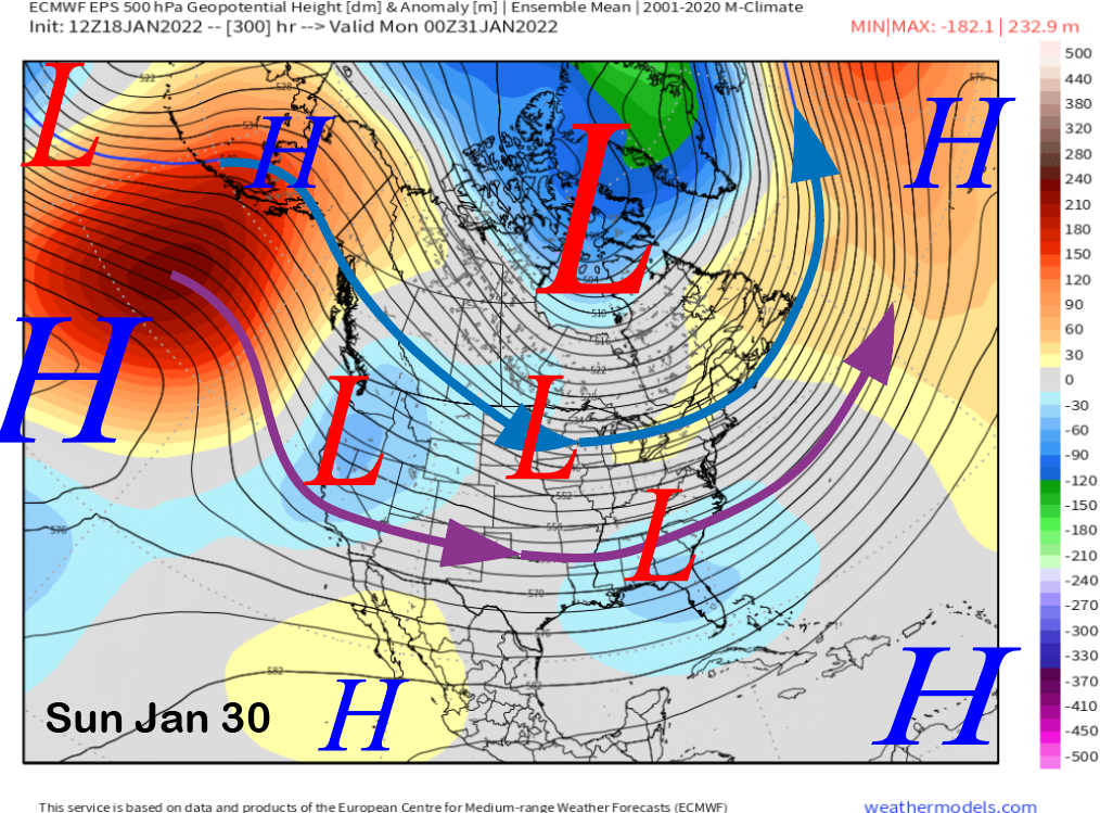
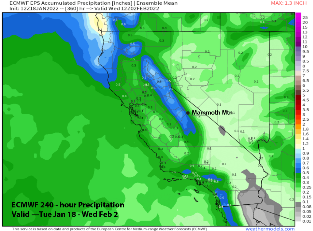
The longer-range guidance has continued the trend noted in the last post of the longwave trough over the middle and eastern part of the nation shifting westward during the 11-15 day period. The ECM EPS shifts it westward enough by the end of the month (image below) for at least a weak storm to move through.
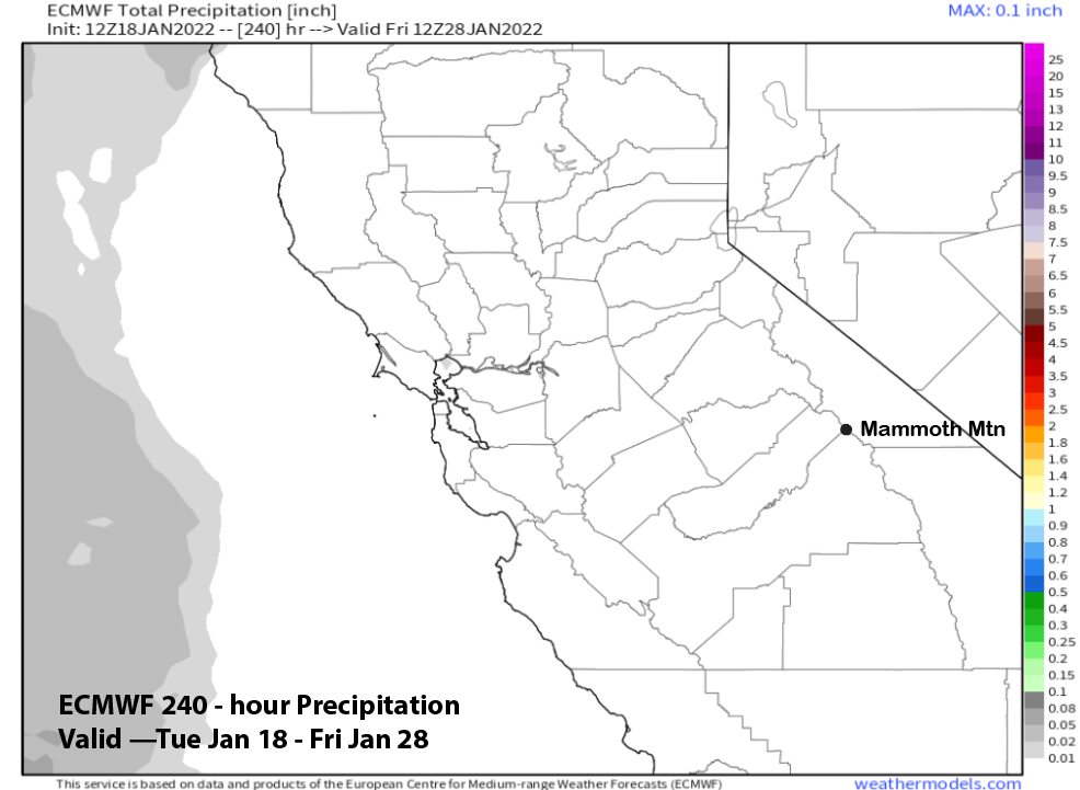
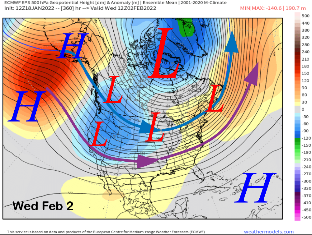
That model along with the GFS ensemble continues to deepen the longwave trough along the West Coast while also moving a bit farther westward (image below) during early February. That could allow a stronger storm to move through, although the ECMWF EPS precipitation forecast for the entire period is not showing big amounts yet (two images below) with just under half an inch of liquid for the period.
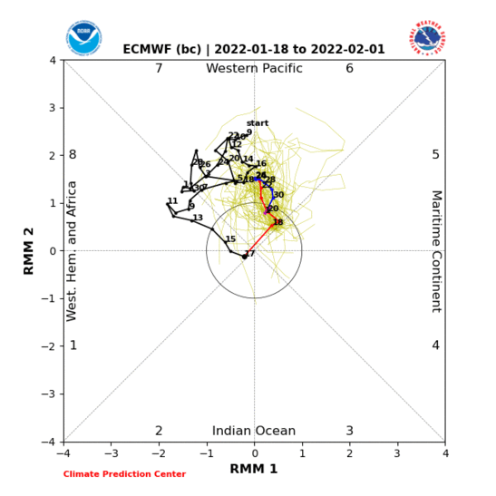
However, as I said in the last post, I am not confident in the models for the 11-20 day period due to the lack of coherence between the models with the MJO forecast and potential influence. The MJO is currently weak and inside the unit circle on the RMM chart with the models not in agreement with its evolution over the next two weeks or longer.
The ECM model (image below) over the next week/two keeps trying to move the signal back to the western Pacific or phase 6, but seems to be picking up on inter-seasonal Rossby wave activity instead of a coherent MJO. Thus, that forecast doesn’t seem like it will verify.
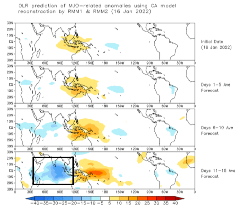
The CPC likes to tout their analog reconstruction models and that model (image below) shows the MJO re-emerging in the Indian Ocean (black box) or phase 2/3 in the 11-15 time frame. Based on its current position, that makes more sense. Studies have shown that an active MJO in phase 2 can force a negative PNA pattern that is more favorable for winter storms in CA.
However, recently updated MJO historical precipitation analogs (image below) using the new 1991-2020 climatology shows that the timing might not match up if it emerges too fast in phase 2 during the drier end of January and not the wetter early February period. It could then move too fast eastward (blue line) and miss the wet periods of phase 2/3 in February while moving into the drier phase 4.
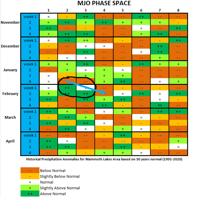
Overall, there is a chance that no snow may fall this month as the next chance for snowfall isn’t until just before the end of the month. After that, we can keep our fingers crossed that the MJO emerges strongly during early February in phase 2 and then remains in the Indian Ocean (phase 2/3) for at least the first part of the month. WG


