Powder Forecast –Tuesday January 25th, 2022
Ted Schlaepfer CCM —- Mammoth Mountain WeatherGuy
Snowfall forecasts are valid at the Sesame snow course (Main Lodge) for the prior 24 hours as reported in the 6-7 AM morning snow report.
**Snowfall forecast confidence ranges from very low (1) to very high (5)
Next Update on Saturday, not Friday this week
Wed 1/26 = 0”
Thu 1/27 = 0”
Fri 1/28 = 0”
Sat 1/29 = 0”
Sun 1/30 = 0”
Mon 1/31 = 0”
Tue 2/1 = 1 – 3”
Wed – Fri 1/29 – 1/31 = 0 – 3”
January Snowfall = 0”
January Forecast = 0”
Detailed 4-day Snowfall Forecast:
Wed 1/26 through Sat 1/29 – No snowfall expected all days.
Forecast Summary:
Short Term (Days 1 – 4):
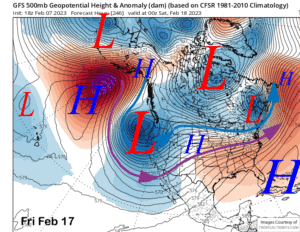
The infrared satellite image (below) today shows clear skies across most of the West as high pressure is firmly in place. A weak inside slider moved east of the Sierra early today and only produced colder temperatures and a bit of east wind up top for Mammoth.
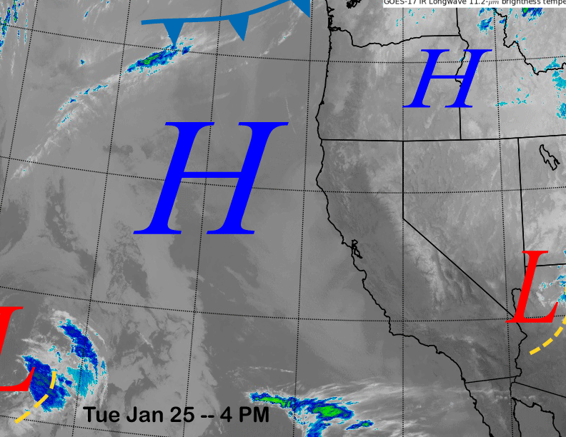
High pressure will remain in control for the rest of the week before a weak low pressure system approaches the coast at the end of the week (image below). That system won’t do much except maybe increase the wind a bit as dry weather will continue into next weekend.
Long Range (Days 5+):
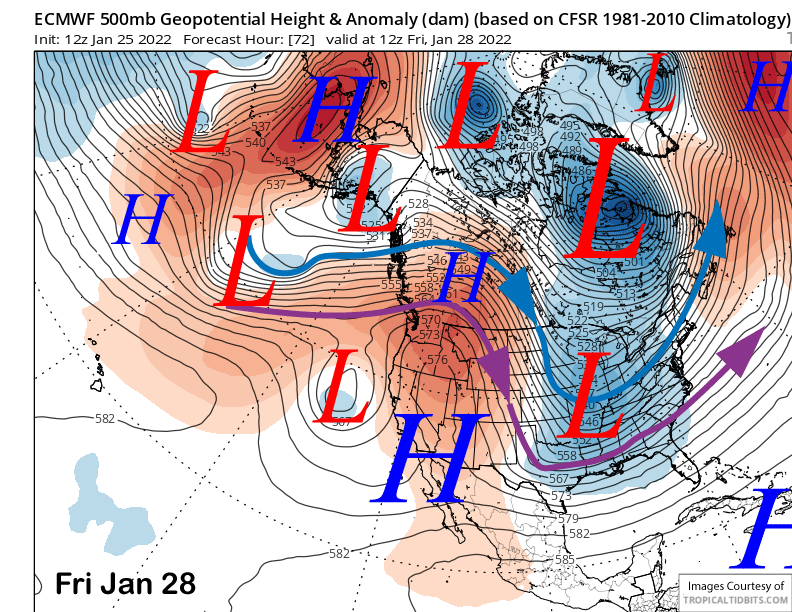
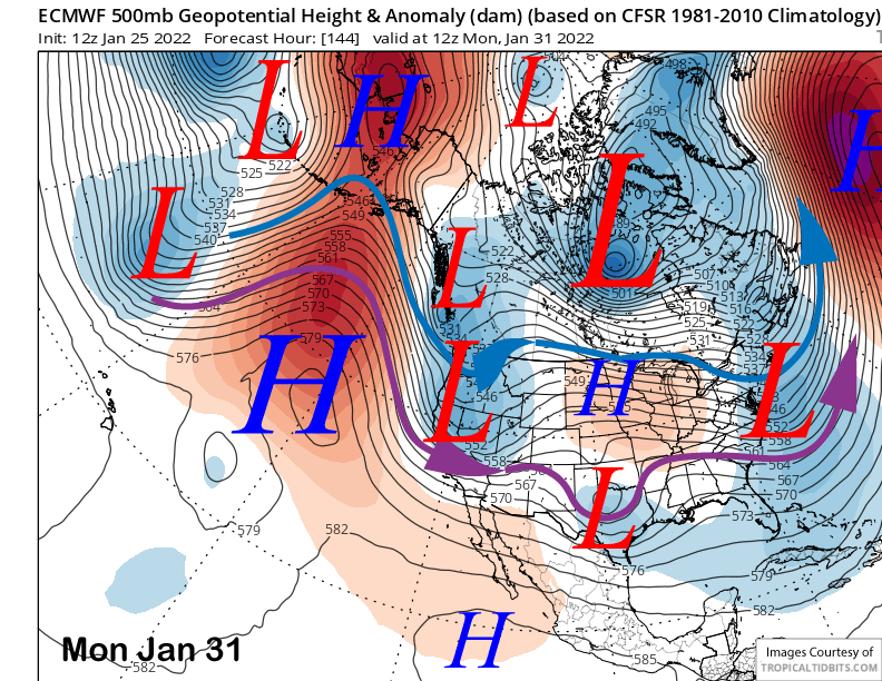
The longer-range guidance has switched back to dismal after looking like there could be a transition in the weather pattern.
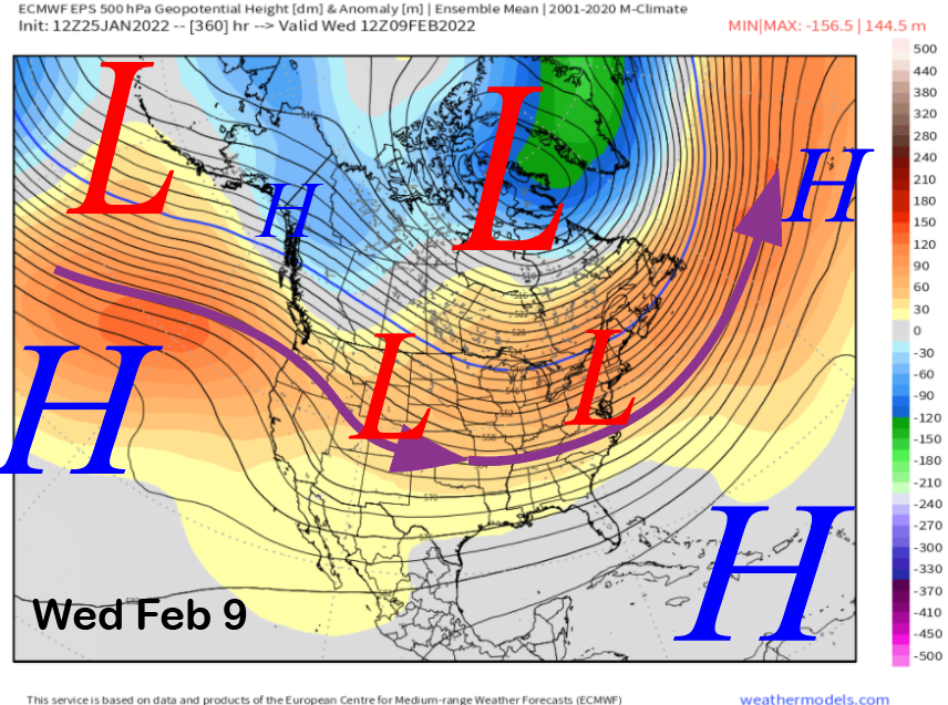
The weather system that was hoped to bring the return of powder conditions to Mammoth during the first few days of February is now forecast by the models (ECM below) to be weaker and the trough not far enough offshore for good over-water trajectory to pull in needed moisture to produce heavy snowfall.
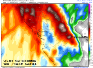
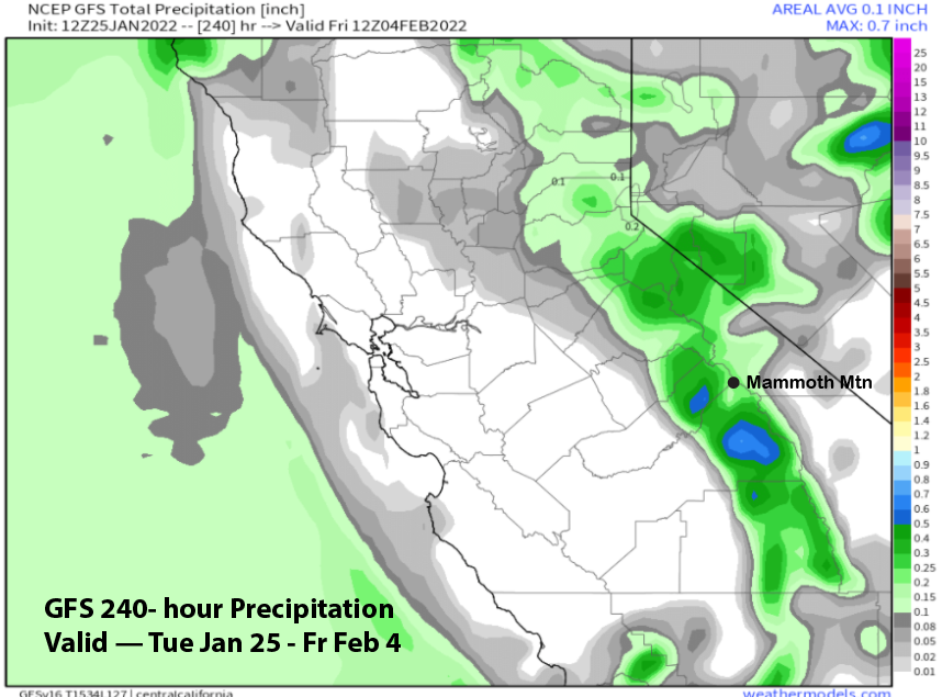
Thus, model QPF is now not showing much with the best-case scenario maybe a few inches. It does look like snow will begin Sunday night and continue at times next Monday before ending Monday night. The 12Z ECM does have about 0.40” liquid (image below) while the GFS only has about a tenth or so (two images below).
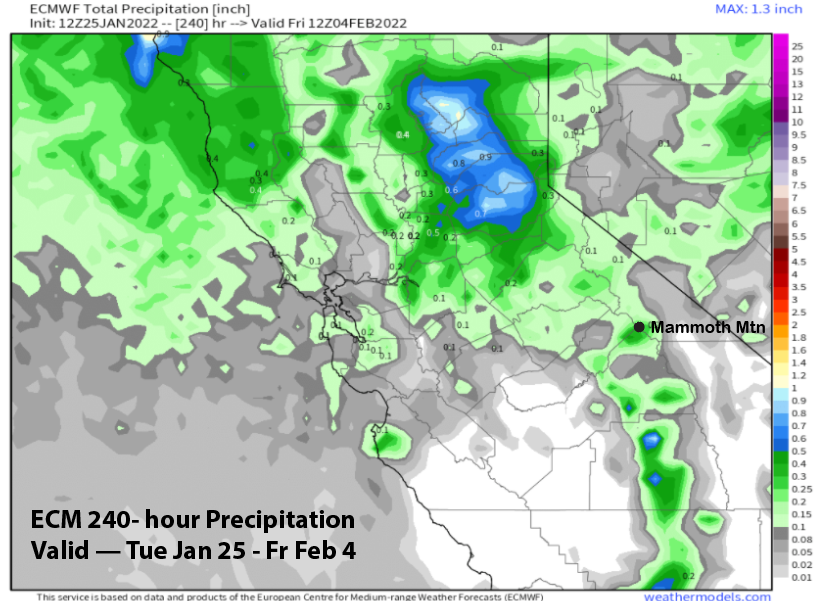
Overall, powder conditions are not favored now and it is looking like a dust on crust event considering the hard pack that is currently in place off-piste across the mountain.
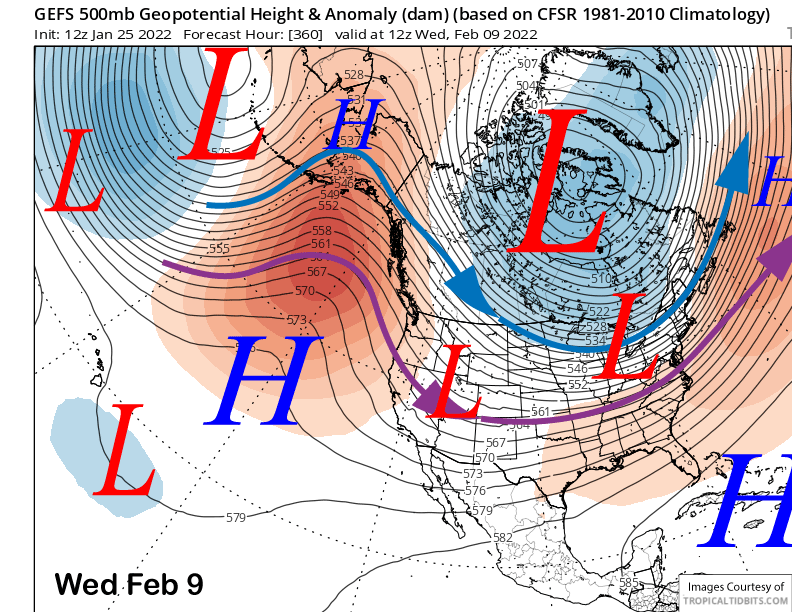
The ECM model rebuilds the ridge of high pressure (image below) for the rest of the week for fair and dry weather. The other models are similar.
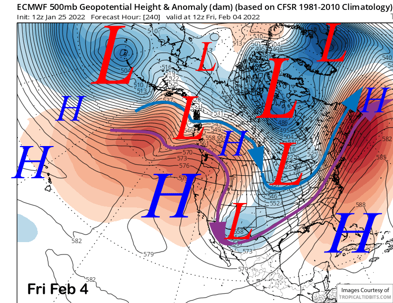
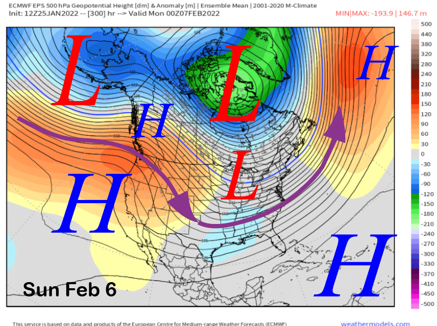
The high pressure ridge is forecast to remain just off the coast by the ensembles through the following weekend (images below) as a deep trough occurs again across the MidWest and East. Thus, the first part of February is looking dry.
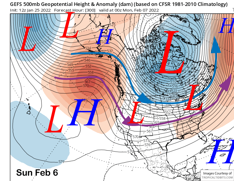
The guidance is favoring that ridge to remain in place for the rest of the period (image below) with dry weather possible for even longer if the climate models are to be believed as they are favoring that ridge in the wrong place into mid-February now. All we can do right now is hope the long range models are wrong again and we win the coin toss this time. WG