Powder Forecast –Friday February 11th, 2022
Ted Schlaepfer CCM —- Mammoth Mountain WeatherGuy
Snowfall forecasts are valid at the Sesame snow course (Main Lodge) for the prior 24 hours as reported in the 6-7 AM morning snow report.
**Snowfall forecast confidence ranges from very low (1) to very high (5)
Sat 2/12 = 0”
Sun 2/13 = 0”
Mon 2/14 = 0”
Tue 2/15 = ~ 1”
Wed 2/16 = 1 – 3”
Thu 2/17= 0”
Fri 2/18 = 0”
Sat – Mon 2/19 – 2/21 = 0 – 3”
February Snowfall = 0”
February Forecast = 10 – 25”
Detailed 4-day Snowfall Forecast:
Sat 2/12 through Mon 2/14 – No snowfall expected all days except for a chance for light snow overnight Monday and into Tuesday, maybe an inch accumulation.
Tue 2/15 – Chance for light snow during the day, ending Tuesday evening, windy. Accumulations by Wednesday AM 1 – 3”
Forecast Summary:
Short Term (Days 1 – 4):
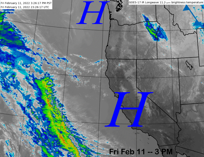
The infrared satellite image (below) today shows high pressure has built strongly across the entire West Coast for continued fair weather along with light winds and temps into the upper-40s at Main and 30s up top where it is a little breezy.
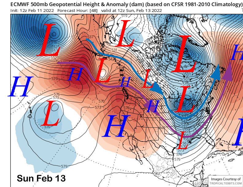
High pressure is expected to hold through the weekend (image below) for little change in the weather pattern into Monday. Temps may be a bit colder Monday along with increasing SW winds during afternoon and evening.
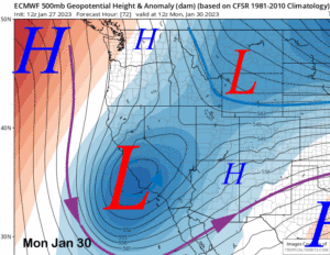
That is due to a short-wave trough that will dive southward from the Gulf of Alaska/W. Canada and into CA on Tuesday. The latest ECM moves the center of the upper low southward through eastern CA (image below) while the latest 18Z run of the GFS is a little farther westward (two images below).
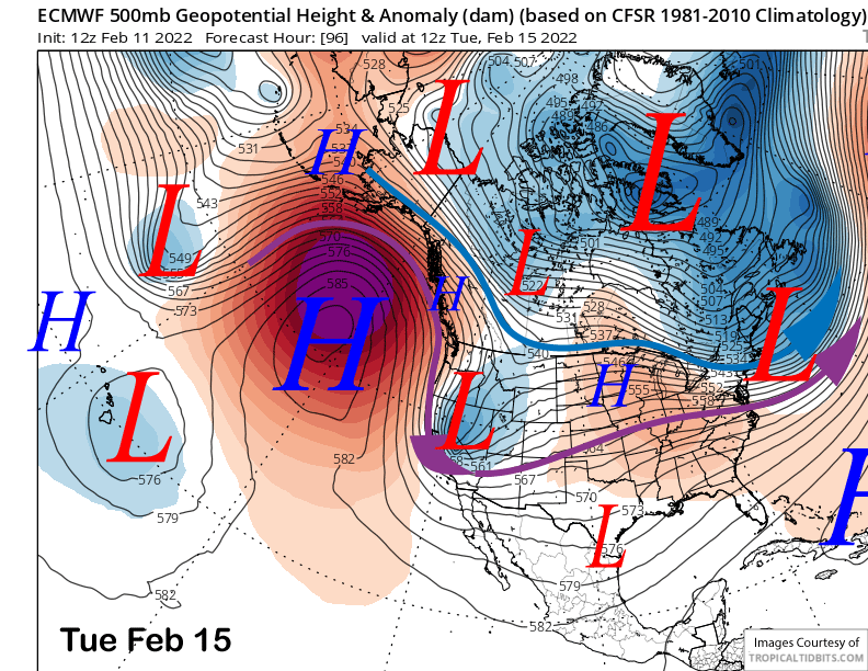
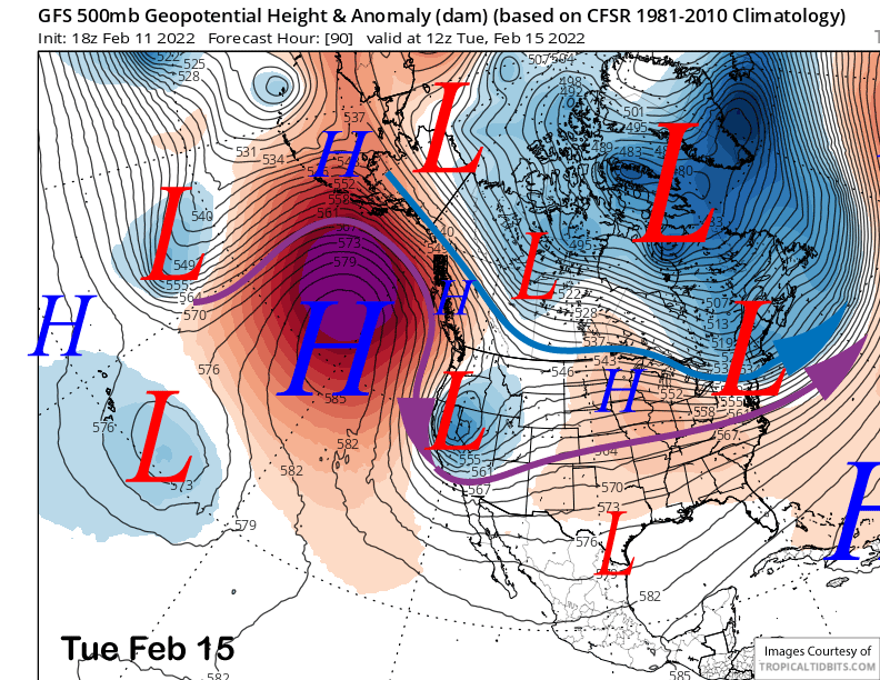
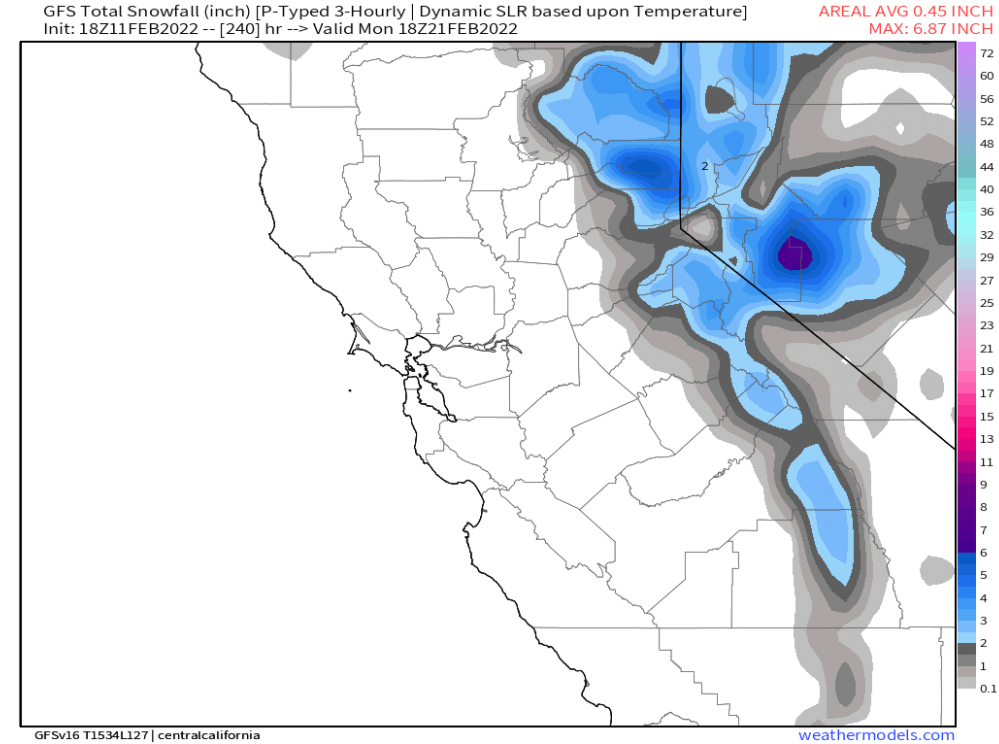
Thus, the GFS is showing slightly higher amounts (image below) at around a quarter inch versus the 12Z ECM that has about a tenth (two images below). Both of those solutions would be just dust on crust, however, many ECM ensembles are showing more than a quarter inch, a few around half an inch, and some of earlier GFS runs had an inch of liquid.
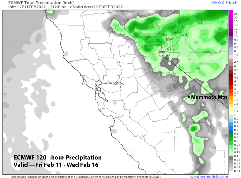
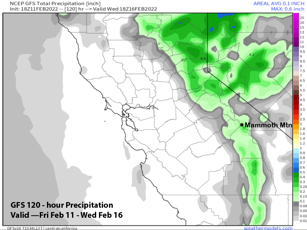
That means there is an outside chance for low-end powder conditions as the exact track southward and strength of the system is still not certain. But it will be a moisture starved system and very big amounts won’t happen. Current forecast favors a couple to a few inches.
Long Range (Days 5+):
The longer-range guidance is still looking fairly dismal for powder days through the end of the month, although there are a couple chances for weaker storms.
The ECM model rebuilds the ridge over CA by the end of next week (image below) for a return to fair and seasonable temperatures.
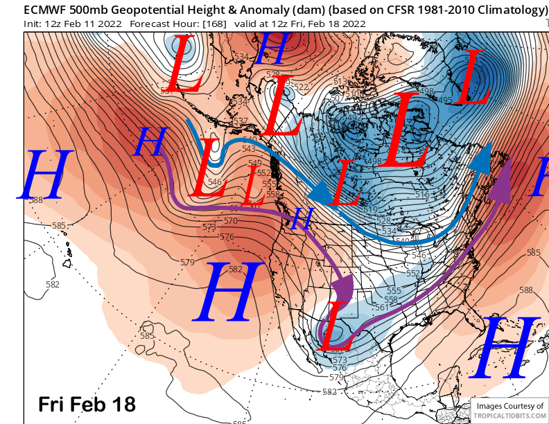
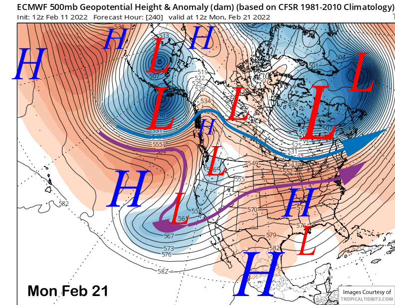
That model then moves a splitting short wave into CA around the 20-22nd (image below) that would lead to a chance for light snowfall. The Canadian solution shows another inside slider while the GFS is farther westward than the Canadian, but still has a mostly inside track through CA. Nonetheless, there is a chance for at least light snowfall that will hopefully trend in the right direction as we get closer.
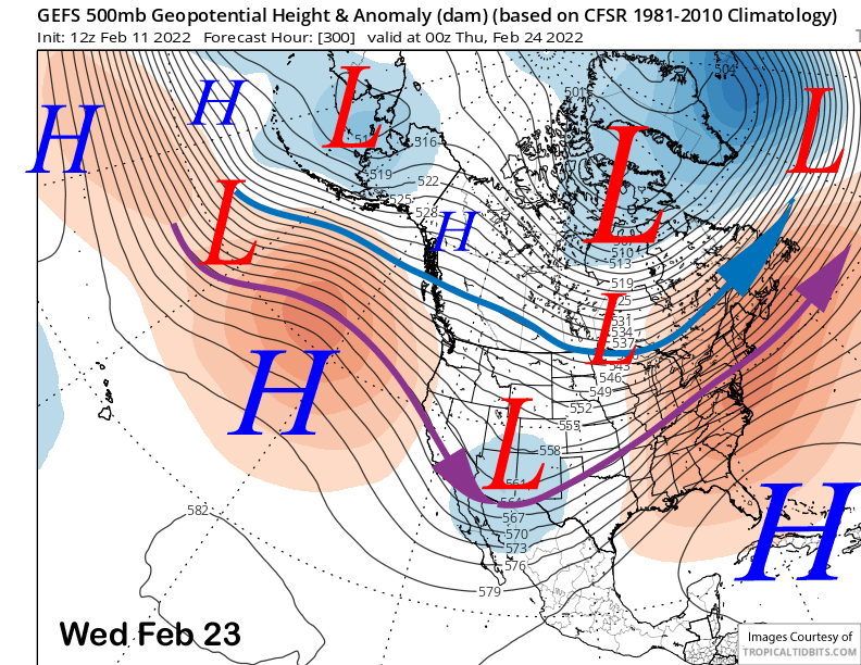
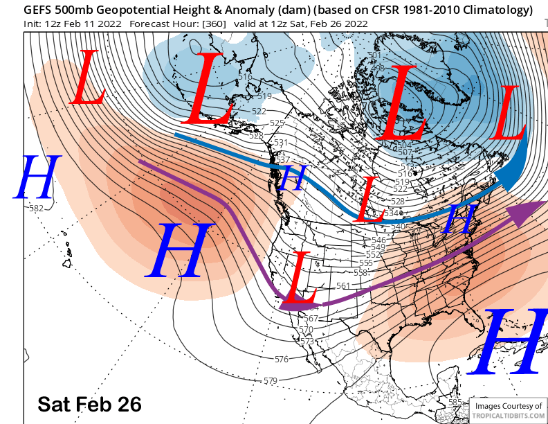
The GFS ensemble rebuild the ridge off the coast for the rest of the 16-day period (images below) and keeps the long-wave trough too far eastward for any productive storms to move through CA. That pattern would mean more inside slider type storms. The ECM EPS is similar.
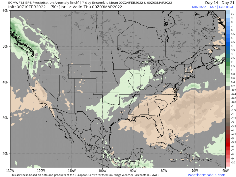
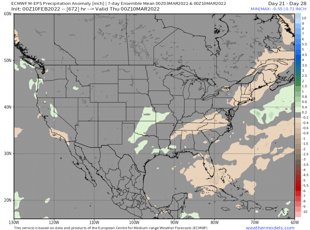
And those solutions fit well with the ECM EPS 45-day forecast released yesterday that shows the dry pattern basically lasting through week 3 now and into early March (image below). It has now flipped back from dry to at least average precipitation for week 4 (two images below) and keeps it going through week 5. The CFS model is similar. So, unless there is a surprise, the wait continues. WG