Weather Overview: A strong inside slider will be influencing the weather over the next few days. You can expect strong winds along with snowfall developing by late Monday. By mid-week, the low moves to our SE and will bring back the NE flow with continued cool weather thru at least Thursday. After that short wave riding will be with us Saturday into at least part of Sunday.
Today’s wind will be the main weather story with gusts up top today already in excess of 140 MPH. By late Monday night, snow showers should move into the area and be off and on into early Wednesday morning. Snowfall ratios will be in the 15-1 to 20-1 range so Mammoth will get more inches out of the limited QPF that’s coming in with this inside slider.
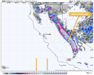
Take a look at the snowfall forecast charts down the page that I have posted for you. It does look like the higher elevations could see 5-10 inches of light and dry powder, however, the NWS is going with 2-4 inches.
Also to note areas on Mammoth Mountain that experience moderate to strong winds will have the snow blow right off. So if you’re out on the hill on Tuesday and Wednesday watch for spots that are still boilerplate hard.
If you’re going to be out on the hill Tuesday expect much less wind with SW wind speeds in the 15-25 MPH range and gusts in the 30-40 MPH range over the higher elevations. Snowfall looks to be light to moderate at times, with the heaviest snowfall above 9000 feet. Highs at the 9000-foot level with be around 18 degrees with morning lows in the single digits.
By Wednesday expect pt sunny skies with a few snow showers possible, highs will still be cold with an 18 forecasted for the Main Lodge area. Winds will be out of the northwest at 15-25 with higher gusts over the upper elevations.
Lower Elevations: Expect cooling highs with lots of wind from Mammoth Lakes down to Bishop. All areas could see snow showers on Tuesday into Tuesday night.
Snowfall Outlook: The ECMWF has the least amount of snow in the 3-8+ inch range with ratios 15:1 to 20:1
The GEFS is right on at 5-10+ inches at 20:1 snowfall ratios for the upper elevations of Mammoth Mountain.
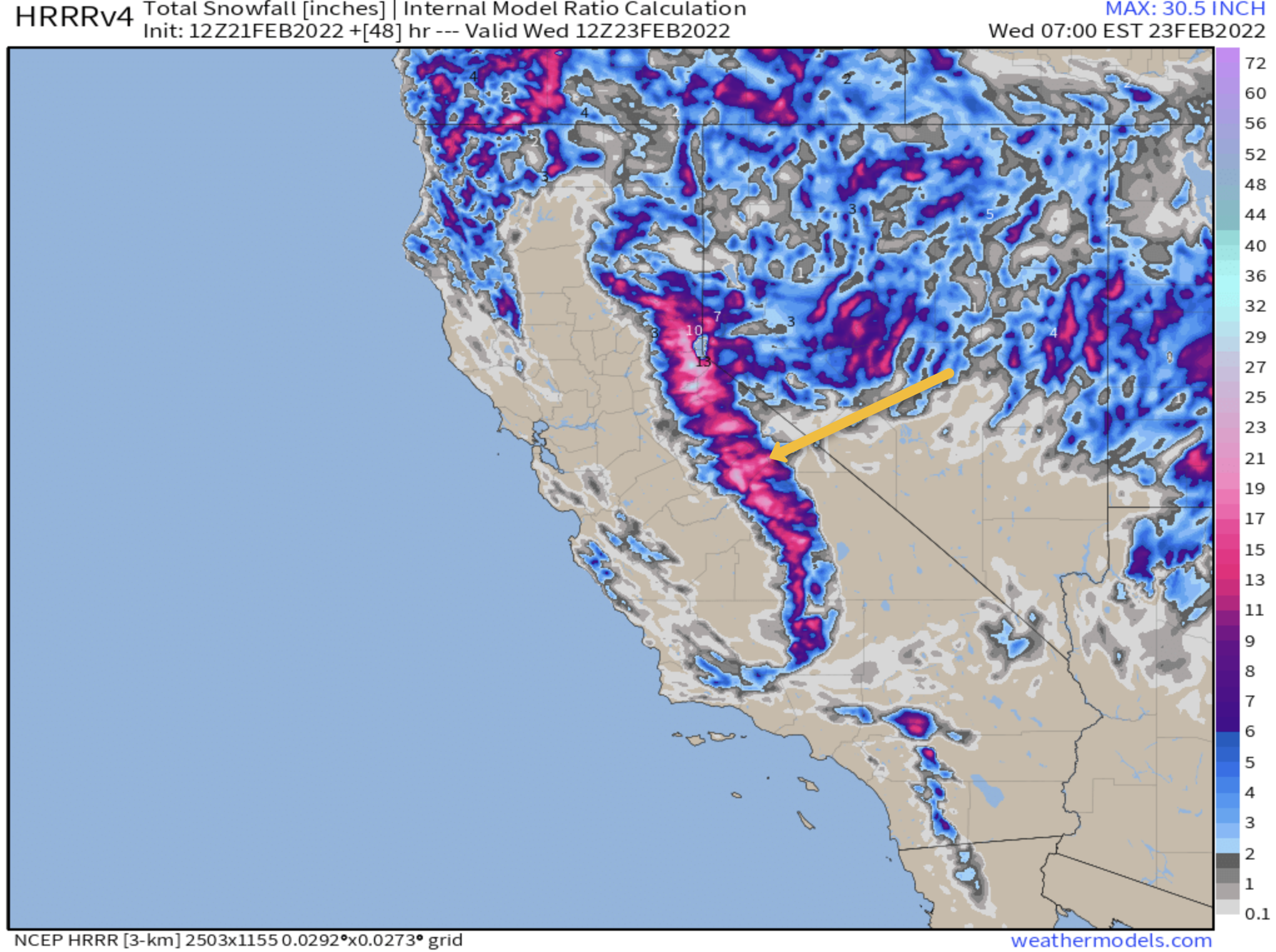
The HRRR is on hyper snow mode this morning with 6-12+ inches of snow for Mammoth Mountain out of this inside slider.
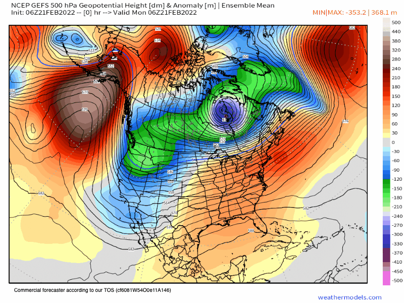
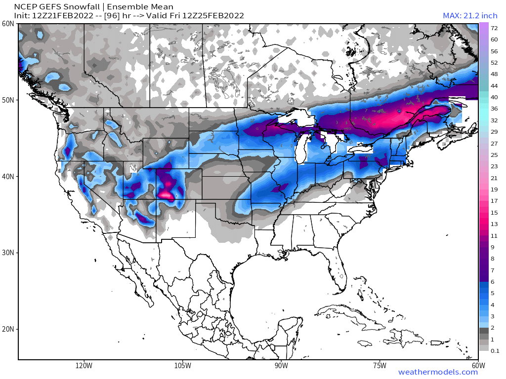
Take a look at how the inside slider evolves on the GEFS Ensemble mean. Going to feel a lot more like winter this week than it has in a while. By the weekend we get a nice ridge into the area before more troughing looks to be in next week’s outlook.