Powder Forecast –Tuesday April 5th, 2022
Ted Schlaepfer CCM —- Mammoth Mountain WeatherGuy
Snowfall forecasts are valid at the Sesame snow course (Main Lodge) for the prior 24 hours as reported in the 6-7 AM morning snow report.
**Snowfall forecast confidence ranges from very low (1) to very high (5)
Wed 4/6 = 0”
Thu 4/7 = 0”
Fri 4/8 = 0”
Sat 4/9 = 0”
Sun 4/10 = 0”
Mon 4/11 = 0”
Tue 4/12 = 1 – 3”
Wed – Fri 4/13 – 4/15 = 1 – 3”
March Snowfall = 5 – 20”
March Forecast = 0”
Detailed 4-day Snowfall Forecast:
Wed 4/6 through Sat 4/9 – No snowfall expected all days.
Forecast Summary:
Short Term (Days 1 – 4):
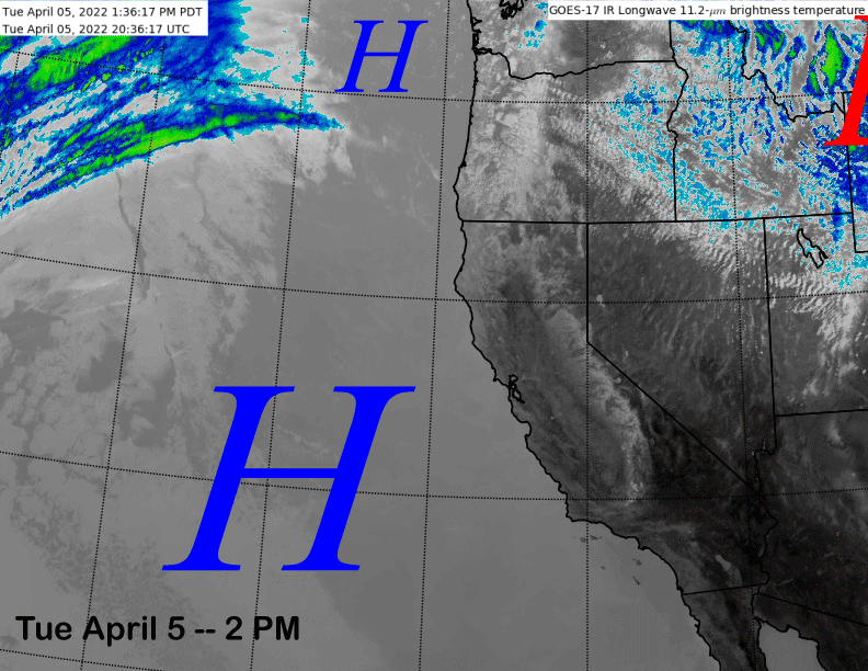
The infrared satellite image (below) today shows strong high pressure centered off the Central CA coast that stretches northward into the PacNW. This has resulted in continued fair weather and spring conditions.
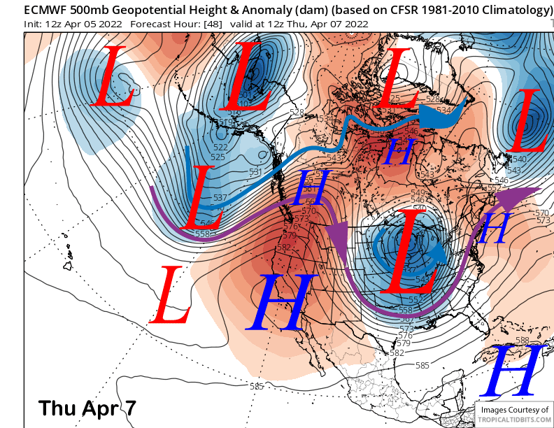
The strong high-pressure ridge will continue to build into the state over the next couple of days, peaking in strength on Thursday (image below). It will continue to edge eastward on Friday and into Saturday while only weakening slightly with the end result a few days of even warmer spring conditions. Those lower areas might get quick sticky during the afternoons.
Long Range (Days 5+):
The longer-range guidance has at least been consistent with one thing so far in 2022. When it looks like there is a decent chance for snowfall in the extended time frame, that snowfall chance ends up slowly fading away as the forecast gets closer in time to reality. This time is no different.
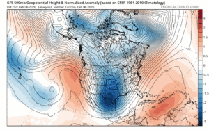
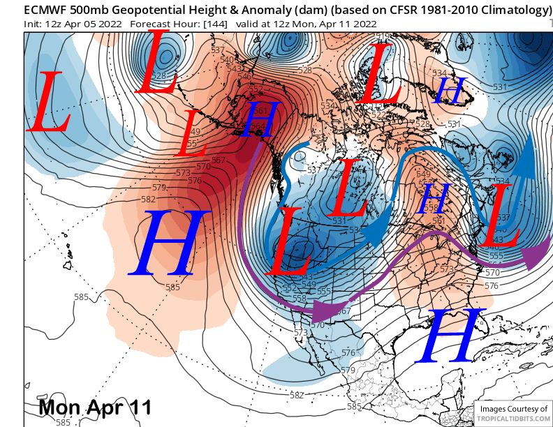
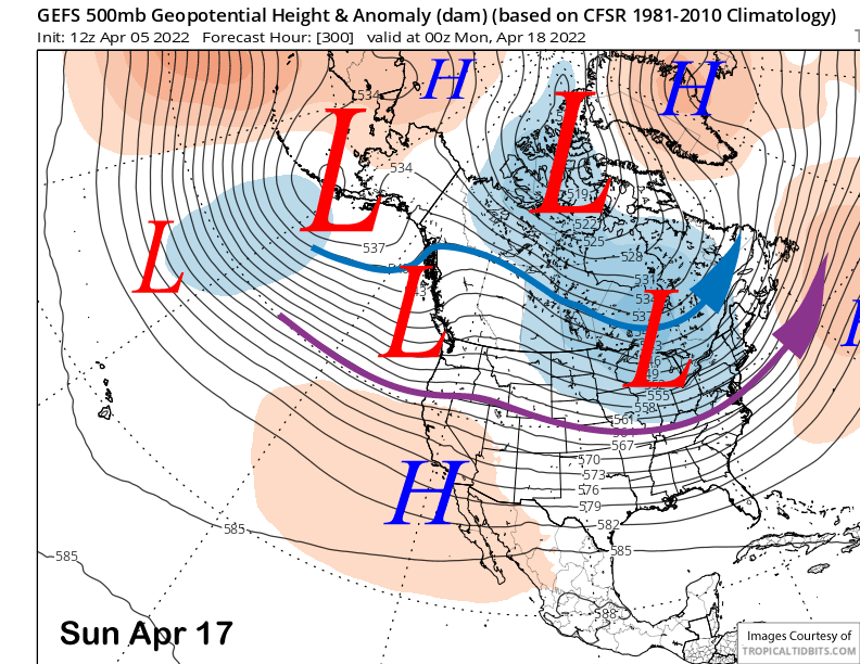
The models are still showing a deep trough moving into CA by early next week (image below), but it looks like it will be another moisture starved high-latitude type trough with the main effect being colder temps and gusty winds.
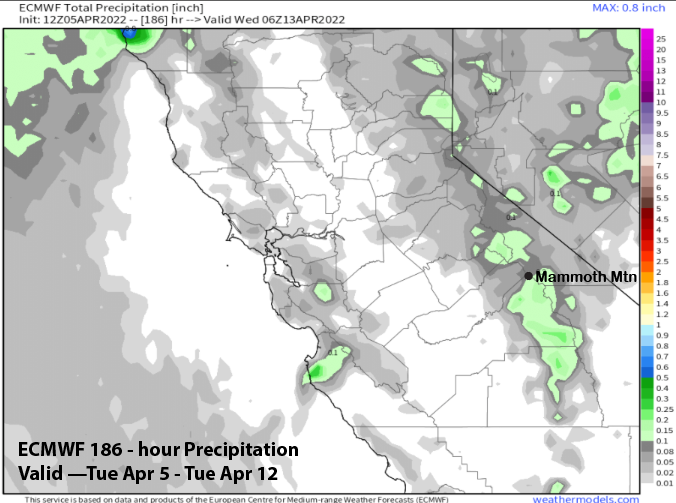
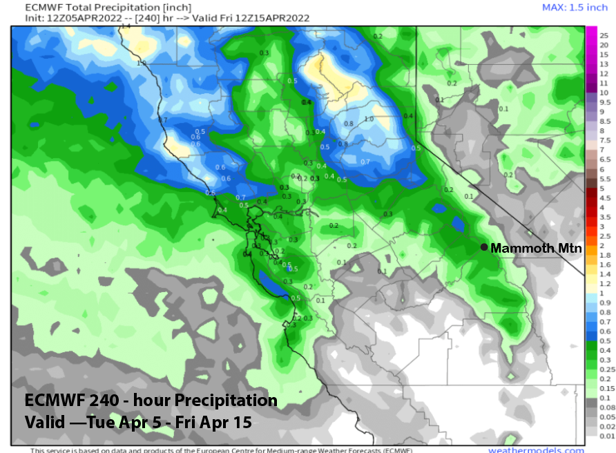
Only a fist fistful of ensembles are showing decent snowfall now with the majority favoring only light amounts, including the operational runs like the ECM that has only about a tenth of an inch (image below) of liquid or maybe an inch of snowfall. Thus, it might just be dust on crust and not enough for powder.
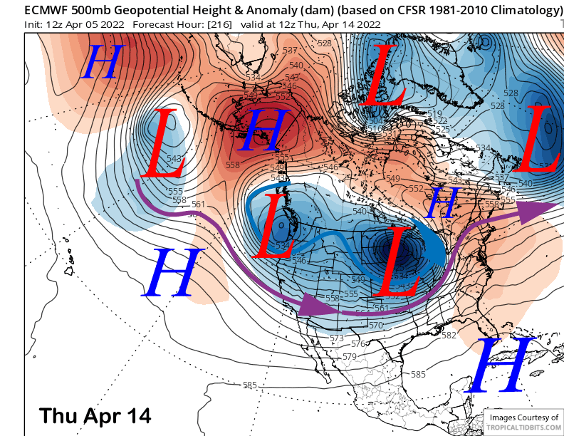
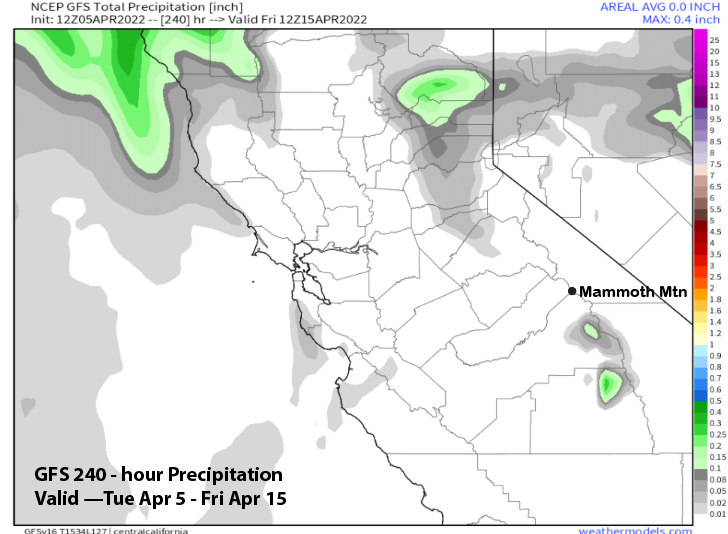
The ECM model does keep the longwave trough along the West Coast into mid-week (image below) and the Canadian is similar, but slightly farther northward. The GFS is more progressive with ridging building into the state and the GFS ensemble also favors that solution.
If the ECM is right, there could be some light snowfall as that model has over a quarter inch liquid (image below) with a short-wave moving through Wednesday night and Thursday morning. If the GFS is right, then dry weather continues through the entire forecast period (image below).
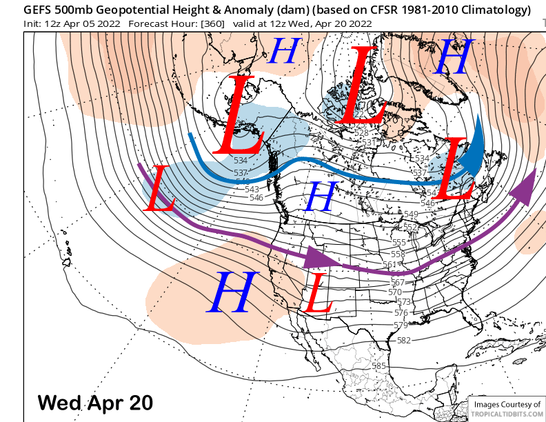
The GFS ensemble (image below) has zonal flow into the West Coast after mid-month (and the Canyon closing), but the jet stream a bit too far northward for any significant snowfall southward into Mammoth. It pushes the jet a bit farther northward (two images below) toward the end of the forecast period.
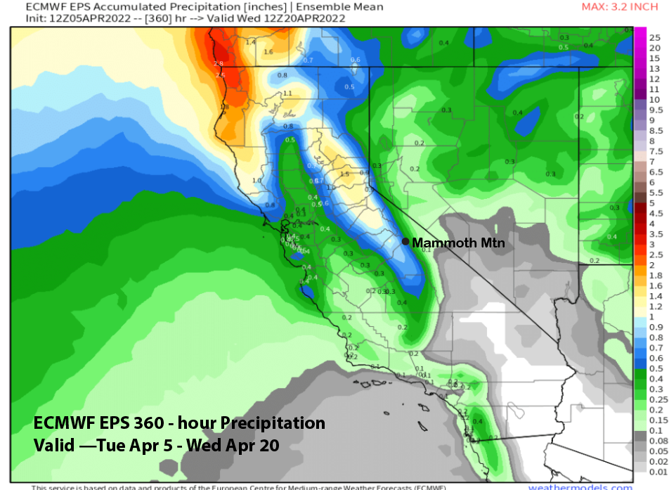
The ECM EPS is a little different. It has ridging developing more strongly just after mid-month and then suggests troughing into CA again toward the end of the period. That model is showing about 2/3 inch liquid for the period (image below).
Overall, even though the guidance is not in general agreement about the 8-15 day pattern, none of the model suites are favoring any late season significant snowfall events, but just chances for small spring storms. Not much else to say at this point except there can always be a late season surprise. WG