Good morning on this Sunday, May 1st, 2022 @ 10:10 AM – Wind Advisory Today and again for Monday in all areas of the Eastern Sierra.
You will find clear skies at this time from Mammoth Mountain to Bishop along with very windy conditions on Mammoth Mountain and down in the Bishop area.
Yesterday there was a high at the top of Mammoth Mountain of 37 degrees. This morning’s low was 25 with current winds out of the SSW at 59 with gusts to 69 MPH.
Down in Mammoth Lakes, winds are out of the SW at 6 MPH with gusts to 21 MPH. Winds at Crowley Lake are out of the NNW at 7 MPH with gusts to 17 MPH.
Down in the Bishop and Mill Pond Areas, winds are 15-20 MPH with gusts to 30 MPH out of the north.
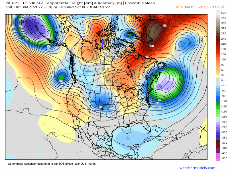
Weather Summary: An endless series of weak inside sliding lows will continue to bring windy conditions at times to all areas of the Eastern Sierra.
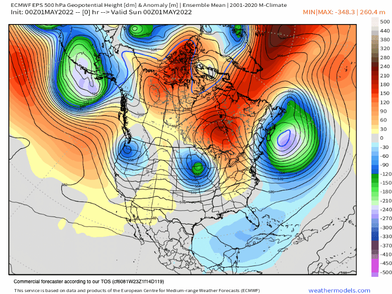
Right now the EPS model shows there are lows lined up to come thru Today, Tuesday, and then again next weekend.
That trend will keep the area at or below average temperature-wise. Winds will continue to blow moderately too strong over the higher elevations at times.
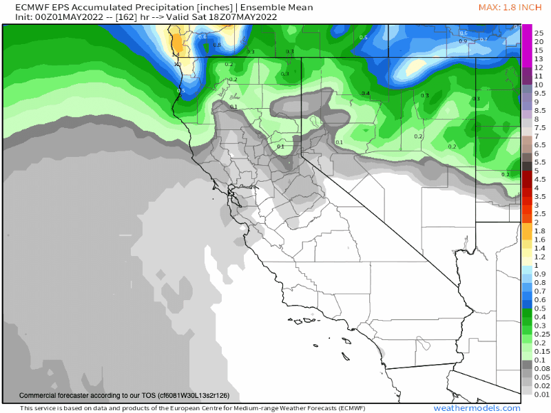
Snowfall from the first 2 lows will be nothing and then next weekend there could possibly be a dusting to an inch or two of snow. Confidence in any snowfall is low at this time.
If you’re going to be out on Mammoth Mountain on Monday expect mostly sunny skies with highs in the upper 40s to low 50s at Main Lodge.
Winds will be coming from the southwest at 15 to 25 mph, with gusts as high as 35-45 MPH around Main Lodge. Winds up on the mid and upper mountain will be in the 45-55 MPH range with gusts to 75-85 MPH.
For Tuesday there will be mostly sunny skies with highs in the upper 40s to low 50s at Main Lodge. Winds will be out of the west turning to the north at 15-25 MPH with stronger gusts to 35-45 MPH possible up top.
Mammoth Lakes Basin, Rock Creek & Bishop Creek Canyons: On Monday expect mostly sunny skies with highs in the upper 40s to low 50s. Winds will be out of the southwest at 15 to 25 mph, with gusts as high as 35-45 MPH
Mammoth Lakes: For Monday and Tuesday highs will be in the upper 50s to low 60s with SW winds increasing on Monday afternoon into the 15-30 MPH range.
Crowley to Toms Place: Monday expect sunny skies with highs into the mid-60s. Expect windy conditions, with a southwest wind at 20 to 30 mph in the morning. Winds could gust as high as 50 mph, not a good day for Crowley Lake fishermen.
Mill Pond to Bishop: Monday expect sunny skies with highs in the low 80s with morning lows around 40. Got to love the 40-degree spilt from high to low each day.
Monday will be breezy, with a southwest wind increasing to 17 to 22 mph in the afternoon. Winds could gust as high as 30-35 mph.
Watch for blowing dust in the Mill Pond and Bishop Area, bikers beware through Monday.
Mid Week: Winds back off Tuesday and then Wednesday and Thursday look great with just normal afternoon winds in the area.
Next Weekends Outlook: As of now a moderately strong inside sliding low with bringing increased winds, cooler highs, and a chance of some snow showers. Confidence is low on the snow showers but the EPS and the GEFS both have them.
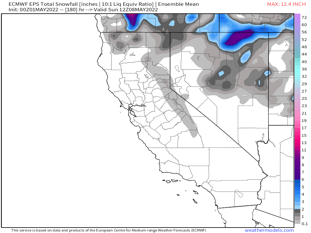
Extended Outlook: Week 2 looks to be more of the same with the ensembles wanting to bring several dusting’s to several inches of snow that week. Winds will continue to blow out of the SW more often than not that week.
Both the EPS and GEFS have weak trofing for the area and state right into early June. As we get out to mid-May expect the lows to be weaker but with continued SW winds over the higher elevation with seasonal high temperatures and lows.
Snowman