Powder Forecast –Friday May 6th, 2022 (No Updates next week)
Ted Schlaepfer CCM —- Mammoth Mountain WeatherGuy
Snowfall forecasts are valid at the Sesame snow course (Main Lodge) for the prior 24 hours as reported in the 6-7 AM morning snow report.
**Snowfall forecast confidence ranges from very low (1) to very high (5)
(No Updates next week)
Sat 5/7 = 0”
Sun 5/8 = 0”
Mon 5/9 = 1 – 2”
Tue 5/10 = 0 – 1”
Wed 5/11 = 0 – 1”
Thu 5/12 = 1 – 3”
Fri 5/13 = 0”
Sat – Mon 5/14 – 5/16 = 0”
May Snowfall = 0”
May Forecast = 5 – 15”
Detailed 4-day Snowfall Forecast:
Sat 5/7 – No snowfall expected.
Sun 5/8 – Dry and very windy through the afternoon, then a period of light/moderate snowfall develops during the late afternoon and evening, accumulations 1 – 2”, around 2” up top
Mon 5/9 – Dry through midday followed by a snow showers or flurries during afternoon and evening. No significant accumulation expected.
Tue 5/10 – Dry through midday followed by a chance for snow showers or flurries during afternoon and evening. No significant accumulation expected.
Forecast Summary:
Short Term (Days 1 – 4):
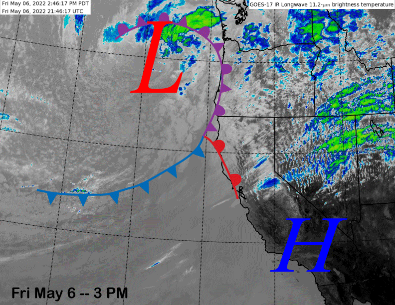
The infrared satellite image (below) this afternoon shows high pressure is still in place over the southern part of the state with the next weather system now moving into the PacNW and NorCal. It will move well north of Mammoth and only a few passing clouds are expected tomorrow.
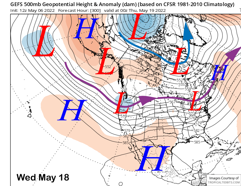
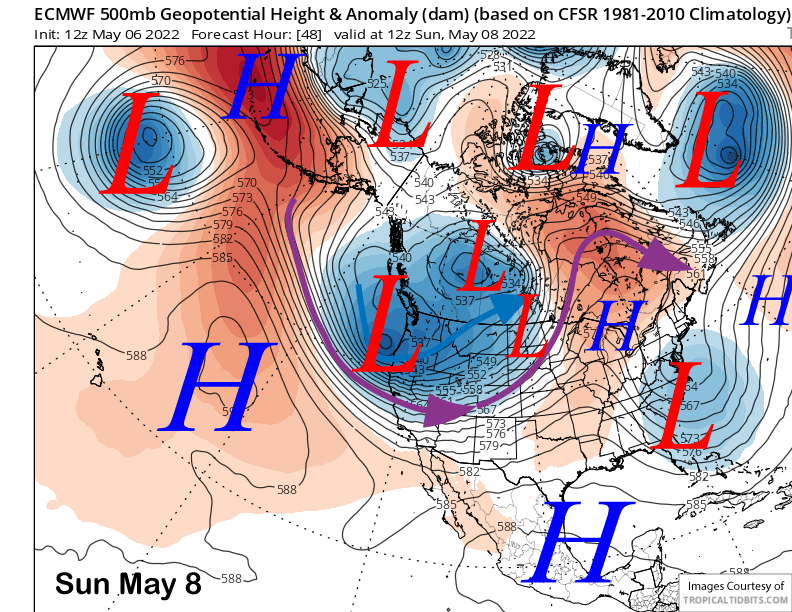
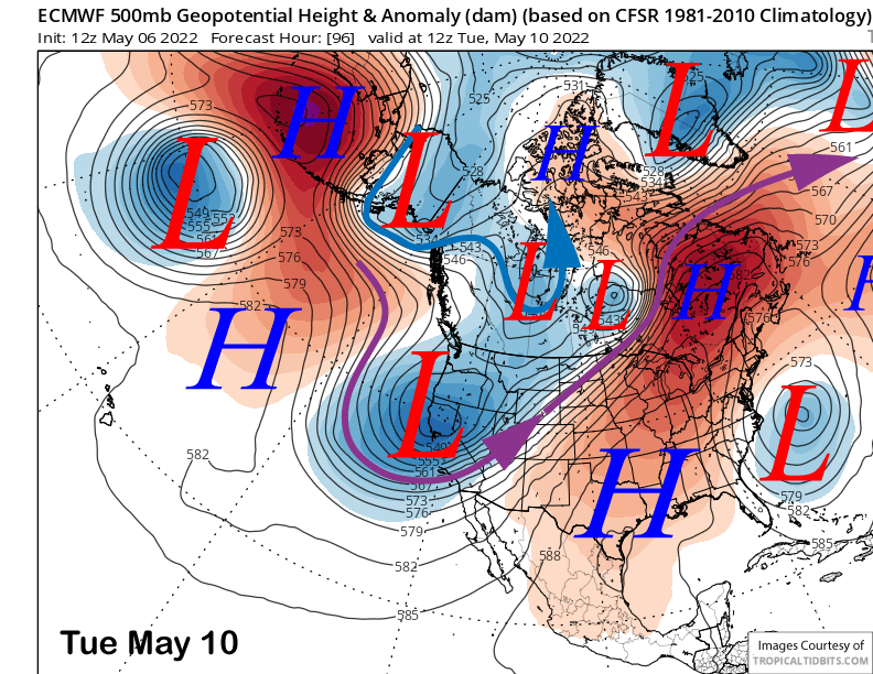
Models are now in agreement that a deep trough of low pressure will develop along the West Coast on Sunday with a potent short-wave moving into CA in the flow (image below). Unfortunately, the system will be moisture-starved and the primary effect will mostly be strong gusty winds and colder temperatures that will last into early next week as the upper-low is forecast to cut-off from the jet stream and only slowly meander through CA (two images below).
The main cold front with the short-wave on Sunday will produce a brief period of snowfall after very strong winds during the day. Light to moderate snow should start by the late afternoon before ending late evening. Only an inch or two is expected at best and it will probably be mostly dust on crust.
Only afternoon/evening snow flurries or snow showers are then expected on Monday and Tuesday with no meaningful accumulation expected either day. Temperatures will remain winter-like though, with teens and 20s expected both days. Winds will remain gusty on Monday, but should lighter on Tuesday.
Long Range (Days 5+):
The longer-range guidance is showing a return to more normal spring conditions by the end of next week and following weekend after one more chance for snowfall around mid-week.
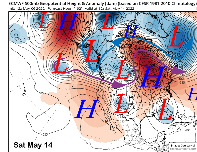
The models eventually move the upper-low out of CA by the end of next week and the ECM (image below) and GFS models move it directly eastward over the Central/Southern Sierra on Wednesday. If that solution verifies, then there could be enough dynamics from the passing low to squeeze out a few inches and enough for low-end powder conditions. But at 5 days out, we will have to get lucky that is doesn’t move south of Mammoth as it often the case with cut-off lows.

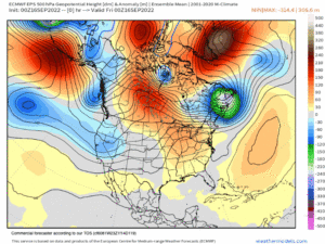
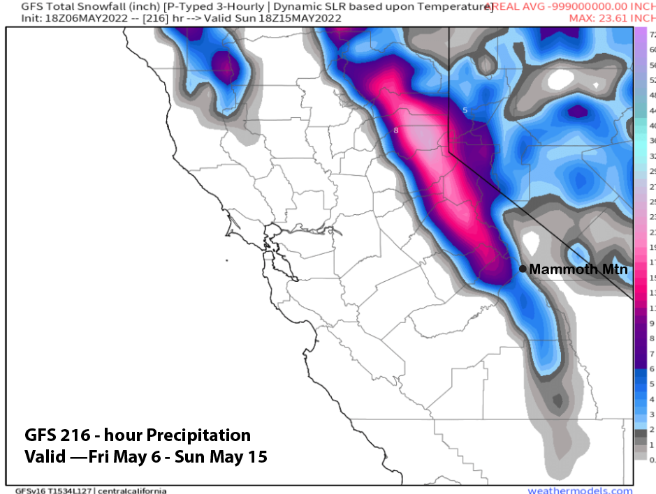
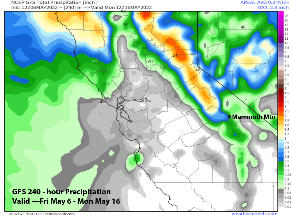
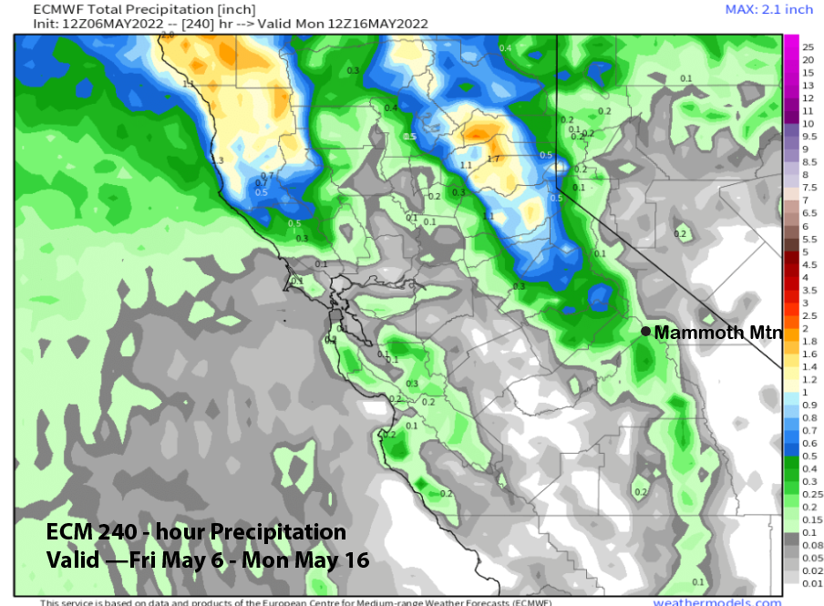
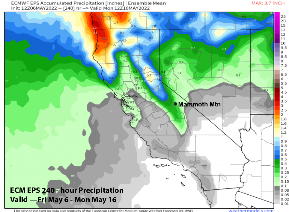
Overall, the model QPF for the 10-day period is not that impressive with the GFS (image below) showing almost a half inch and the ECM (two images below) only showing a couple tenths. Forecast follows a blend of the GFS and ECM EPS (three images below) that has about a third of an inch for the period.
The ECM model then develops ridging (image below) by the following weekend for a return to more typical spring weather. It should continue into the following week.
The GFS ensemble then redevelops the long-wave trough along the West Coast (image below), but has the jet stream too far North for any precipitation in Mammoth. So, unless there is a surprise shift again with the model guidance southward with the jet stream, typical spring weather should continue through mid-month or longer. WG