Powder Forecast –Tuesday May 17th, 2022
Ted Schlaepfer CCM —- Mammoth Mountain WeatherGuy
Snowfall forecasts are valid at the Sesame snow course (Main Lodge) for the prior 24 hours as reported in the 6-7 AM morning snow report.
**Snowfall forecast confidence ranges from very low (1) to very high (5)
(Last Update for the season)
Wed 5/18 = 0”
Thu 5/19 = 0”
Fri 5/20 = 0”
Sat 5/21 = 0”
Sun 5/22 = 0”
Mon 5/23 = 0”
Tue 5/24 = 0”
Wed – Fri 5/25 – 5/27 = 0”
May Snowfall = 3”
May Forecast = ~3”
Detailed 4-day Snowfall Forecast:
Wed 5/18 through Sat 5/21 – No snowfall expected all days.
Forecast Summary:
Short Term (Days 1 – 4):
The infrared satellite image (below) this afternoon shows weak high pressure in place over the state resulting in fair weather and typical spring conditions. High pressure will build in strength tomorrow and Thursday for continued fair weather and even warmer spring temperatures.
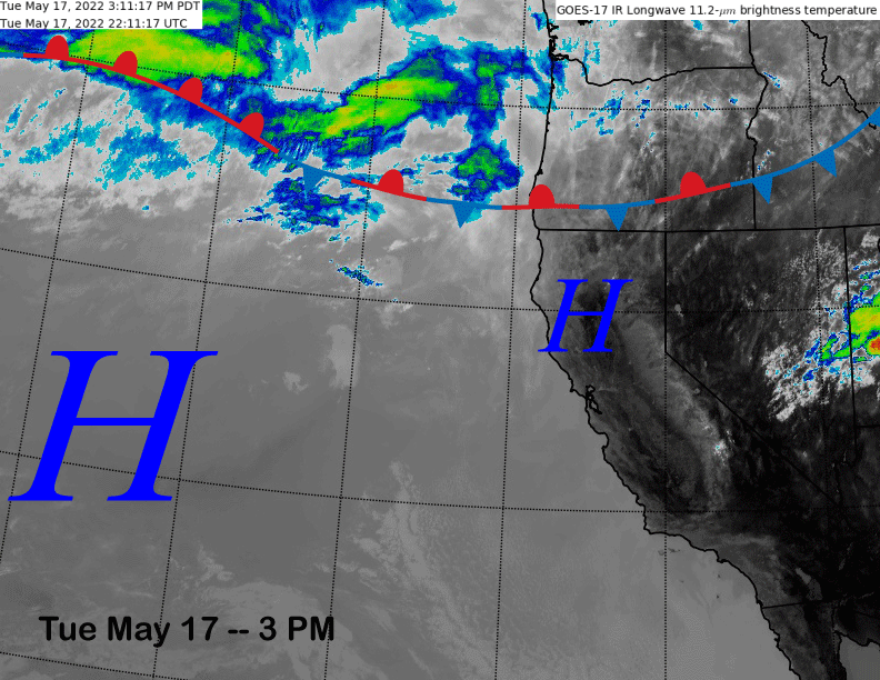
An inside slider type weather system will then move through the eastern part of the state on Friday (image below) and it will cause an increase in northerly winds along with cooler temperatures into Saturday, but no snowfall.
Long Range (Days 5+):
The longer-range guidance is showing fairly typical spring weather with a warmer period expected next week followed cooler weather by the last part of May and into early June. The closing date has now been extended to at least June 5th.
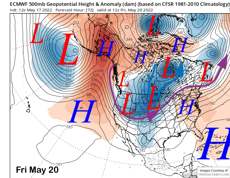
The ECM model (image below) rebuilds the high-pressure ridge early next week with a fairly zonal jet stream pattern into the northern part of the PacNW. That means fair weather and warmer temperatures.
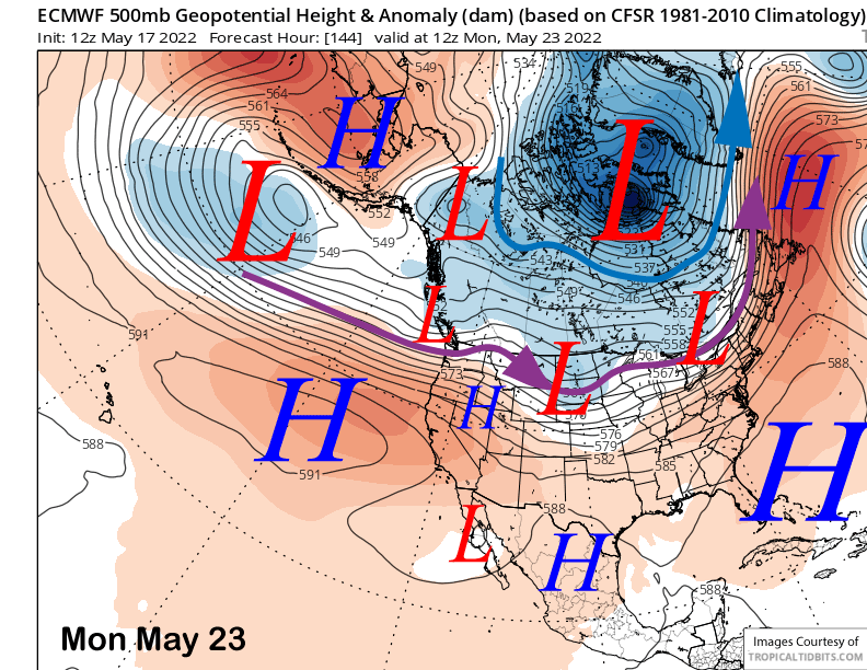
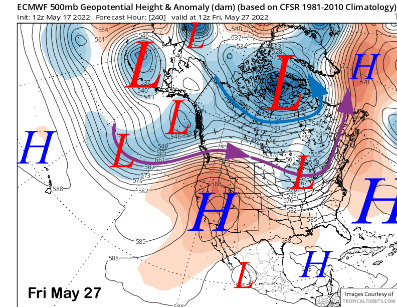
That model does weaken the ridge slightly mid-week with a passing low into the PacNW, otherwise the high-pressure ridge is forecast to mostly remain in place through the end of next week (image below). Except fair weather and warm temperatures on the mountain. Get out there early.
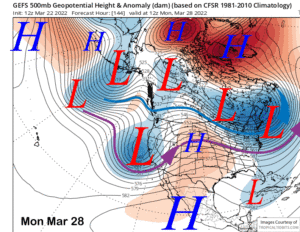
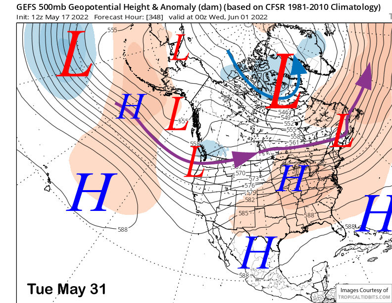
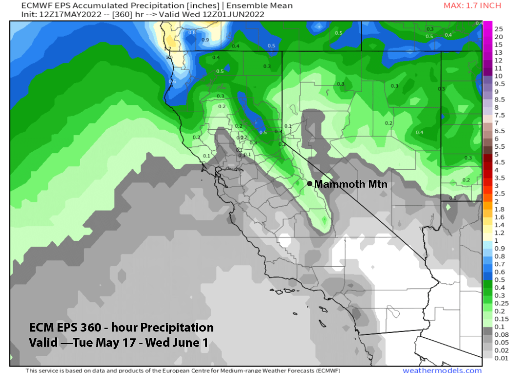
The GFS ensemble mean does favor cooler and more seasonable weather by the last part of May and into early June as it develops a trough along the West Coast (image below). However, the jet stream is way too far north for any snowfall in Mammoth and the ECM EPS QPF (two images below) agrees, as it is not showing any significant precipitation for the rest of the month.
Overall, it looks like the remainder of the season will be corn snow and spring skiing as powder days toward the end of May or early June are very rare. Unless there is a late season anomaly, this will be the last update for the season. This blog will be back in November. Have a great summer. WG