Recreational Weather for Mammoth Mountain and Eastern Sierra
Hello and good day, this is your Mammoth Mountain and Eastern Sierra Weather forecast for June 24th, 2022
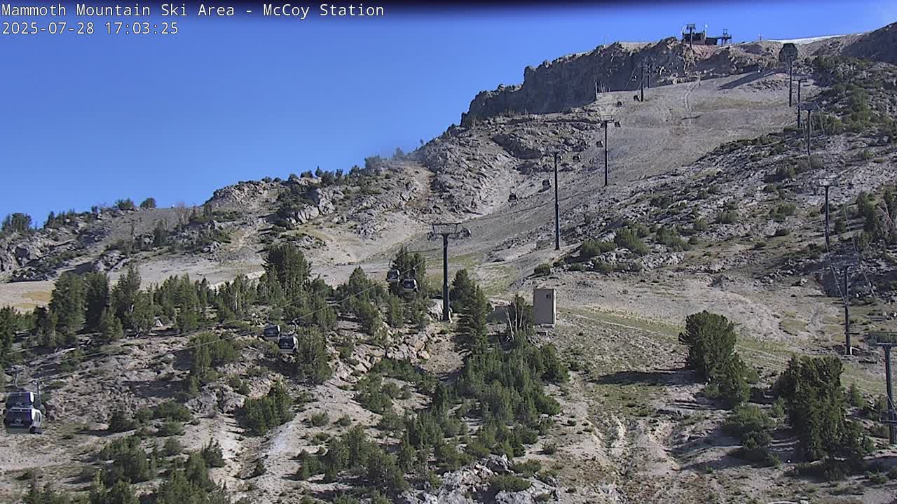
The window cast shows clear blue skies from Mammoth Mountain to Bishop today. Air Quality in the area remains perfect.
Over the last couple of days, there have been some clouds and build-ups along with a few rain showers. Did not see any lightning strikes or hear any thunder myself as most of the action stayed to the west of the Eastern Sierra.
The next few days look great to get out for an adventure. There still could be an isolated thunderstorm so take cover if you happen to hear thunder.
Temperatures in the high country at 8900 feet aka the Main Lodge and the Mammoth Lakes Basin will be in the upper 60s to low 70s over the weekend.
Lows at night for you campers will be in the upper 40s. Winds over the country will be light except in areas where there is thunderstorm action.
Down in Mammoth Lakes, temperatures will be in the mid-70s with overnight lows in the upper 40s with mostly light winds at times.
For Crowley, Lake highs will be around 80 with overnight lows in the low 50s. Bishop and the Mill Pond areas will be cool in the morning hours and then hot in the mid-90s by mid-afternoon.
Here are the links to the specific highs, lows, and wind speeds for many of the major recreation points in the Eastern Sierra: Mammoth Mountain Main Lodge, Top of Mammoth Mountain, Mammoth Lakes, June Lake, Crowley Lake, Toms Place, Rock Creek Lake, Bishop & Mill Pond, South Lake.
**Locals Tip: As we move into Summer if you’re coming up bring a fan with you if you’re staying in a condo or home. They help big time when it’s warm and muggy in the high country. We have 4 of them along with ceiling fans that run when it’s Summer time. No AC in Mammoth so be prepared.
Have a great day and I hope to see you out on the hill for some Mountain Bike action soon,
Snowman
10 Day Outlook Model Runs
Over the next 10 days the isolated T Storms will be with us to start and then by Monday ridging will warm the area up to about 7-10 degrees above the average high for this time of the year.
The ridging will be replaced by guess what? Yep more troughing off the West Coast and into the eastern Sierra for the July 4th weekend.
If that comes thru you can expect below-average temperatures for what is usually one of the hotter weeks of the year. Along with the cooler highs at the end of the period, I would expect breezy conditions for the higher elevation starting around next Thursday sometime.
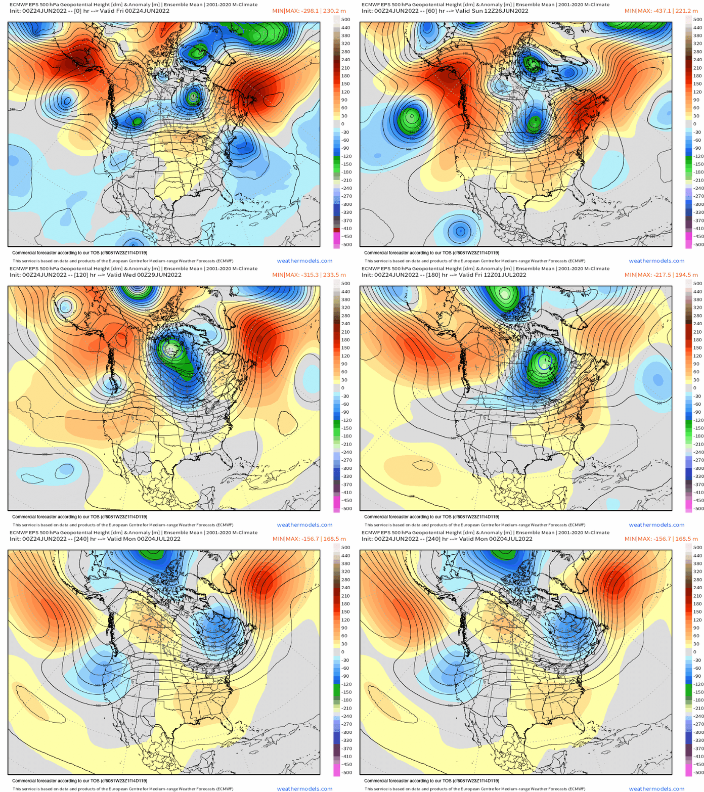
EPS 10 Day Temperature Anomaly Chart
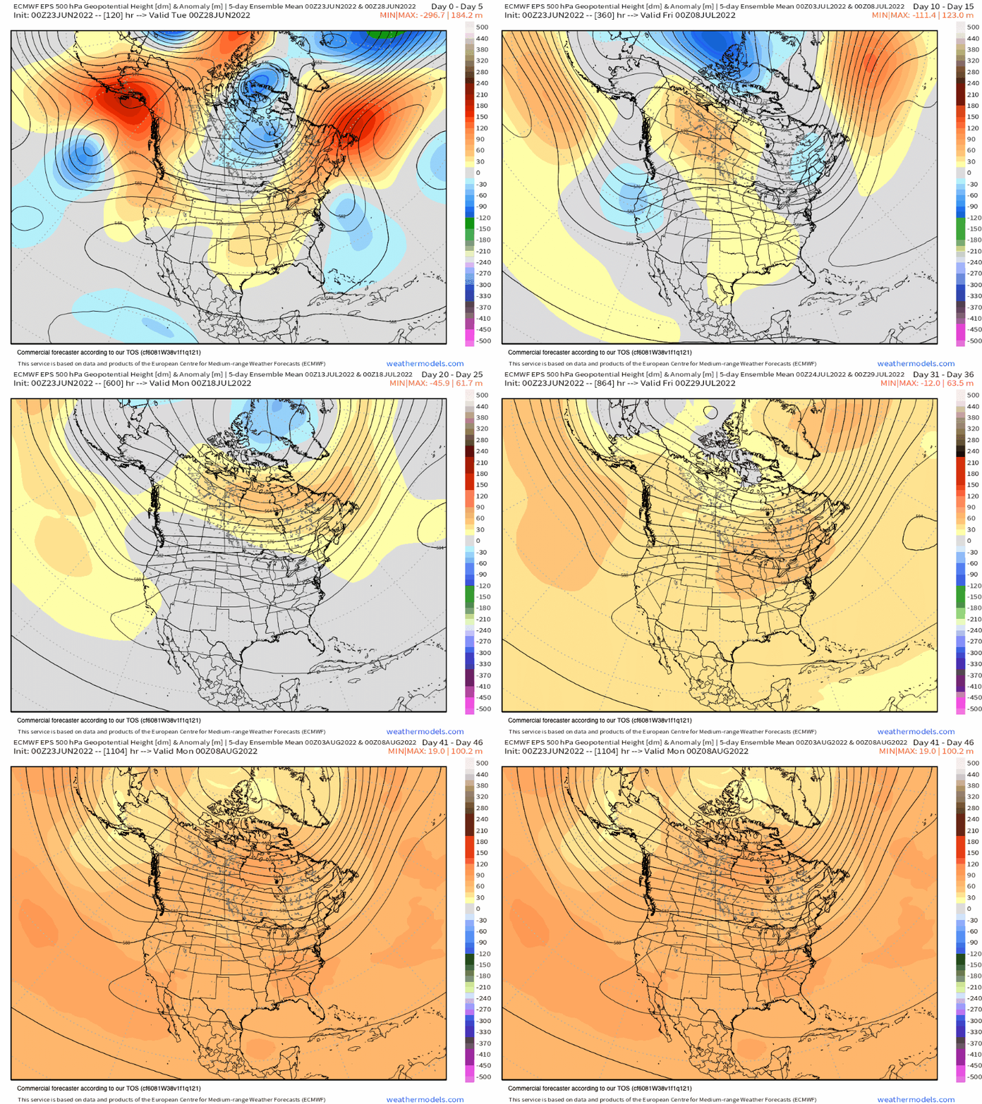
EPS 10 Day 24 Hour Precipitation Chart
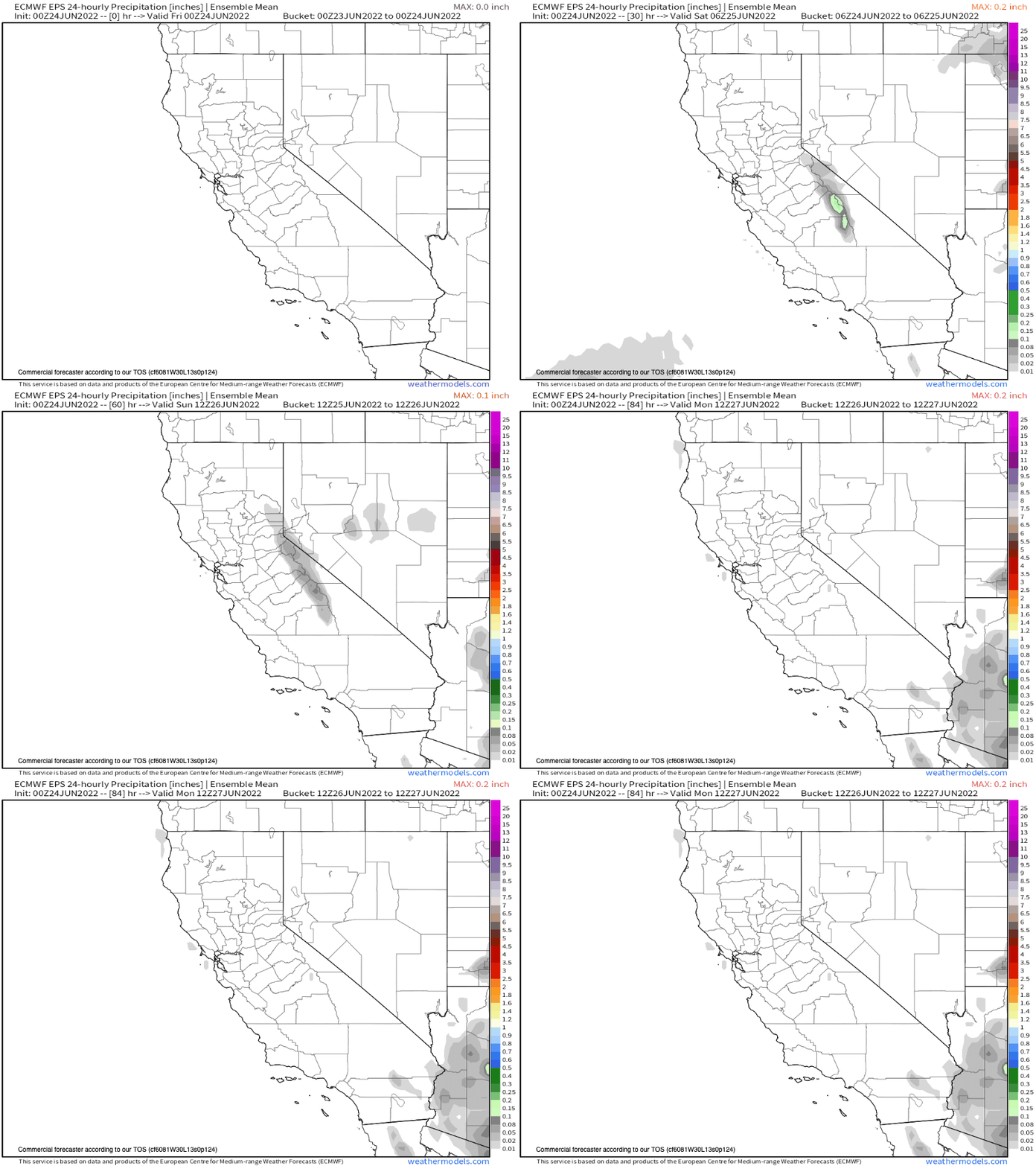
EPS 45 Day Ensemble Mean
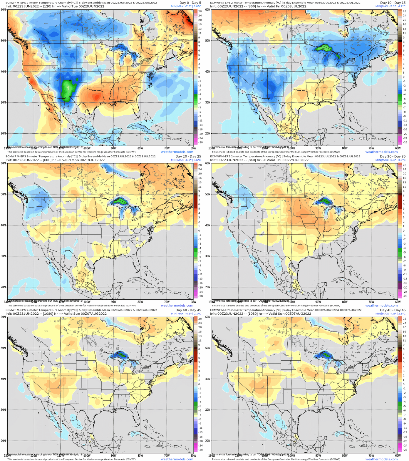
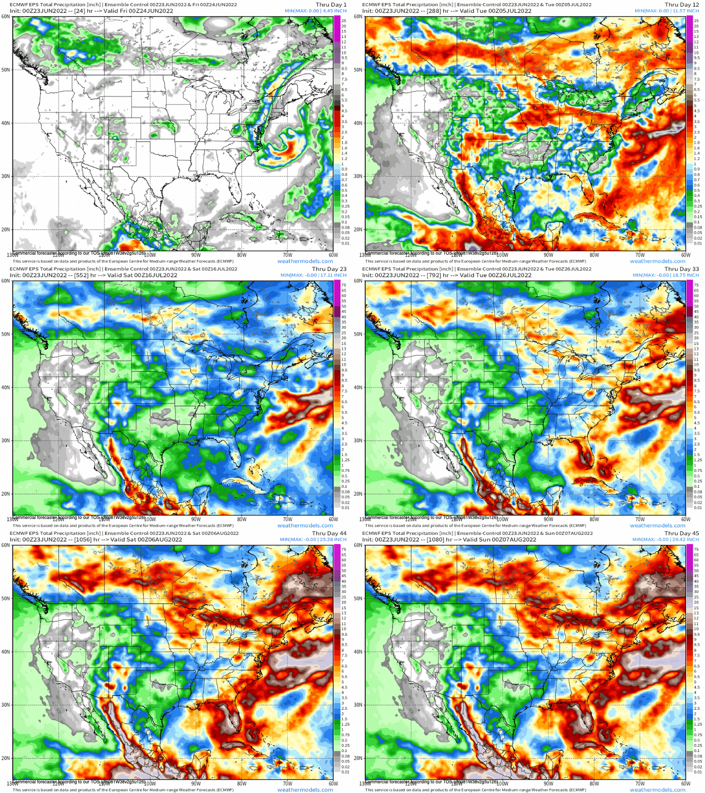
There are 2 updates a week that we get for this the EPS 45 Day, the run below is from the 23rd of June.
This is the EPS 45 Day Height Anomaly GIF.

EPS 45 Day Temperature Anomaly Chart – After this week the 45 day chart below does not show any major heat waves.
EPS 45 Day Precipitation Anomaly Chart – There are a couple shots for precipitation later this month.
ECMWF Seasonal Ensemble Mean - Next Update 7-6-22
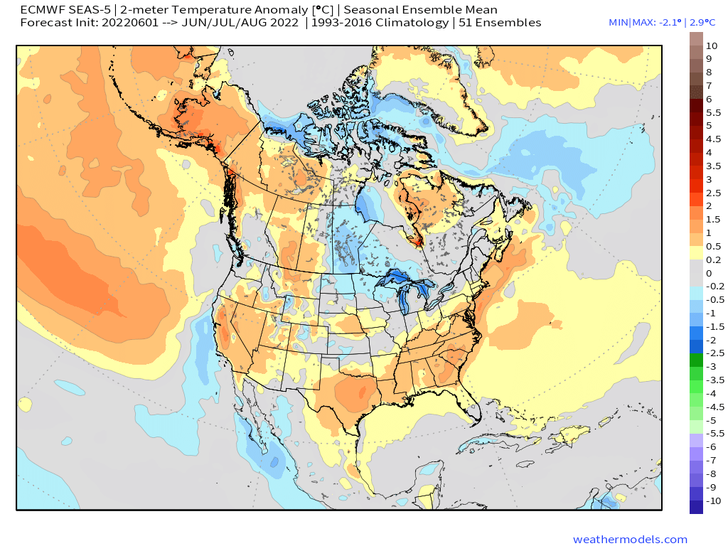
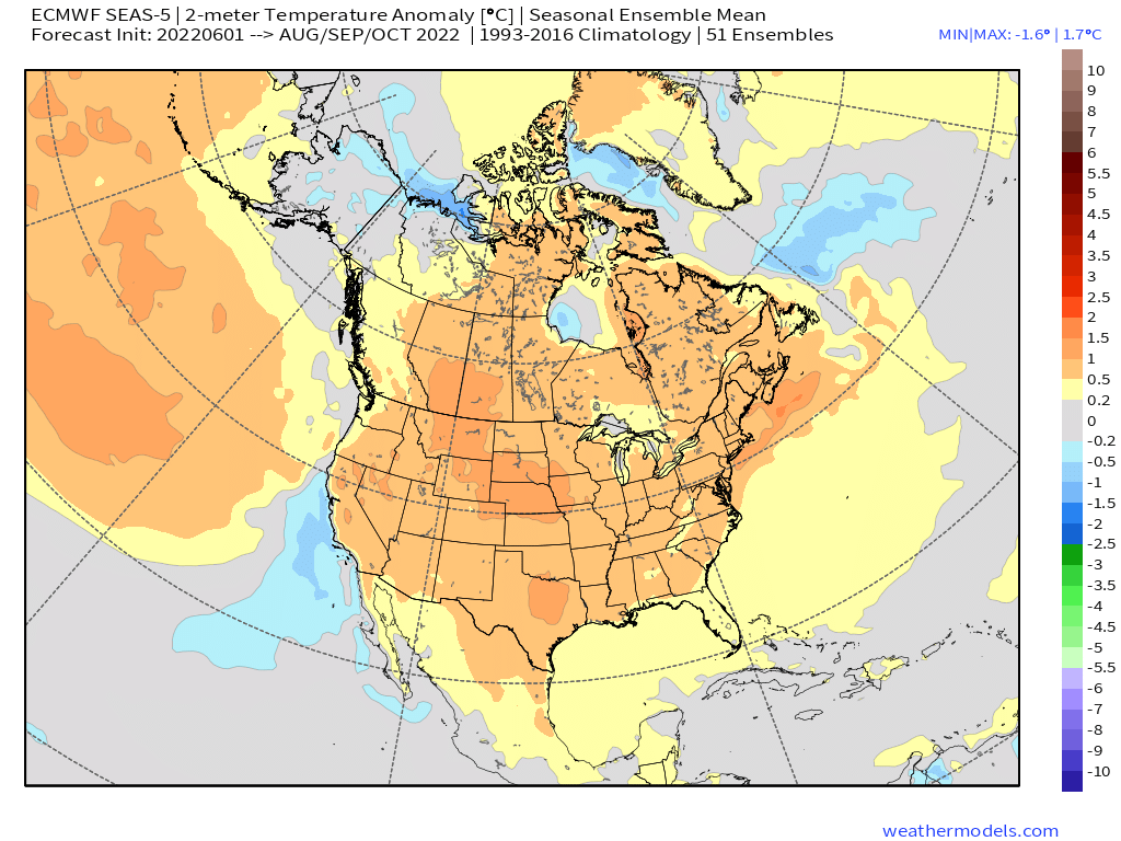
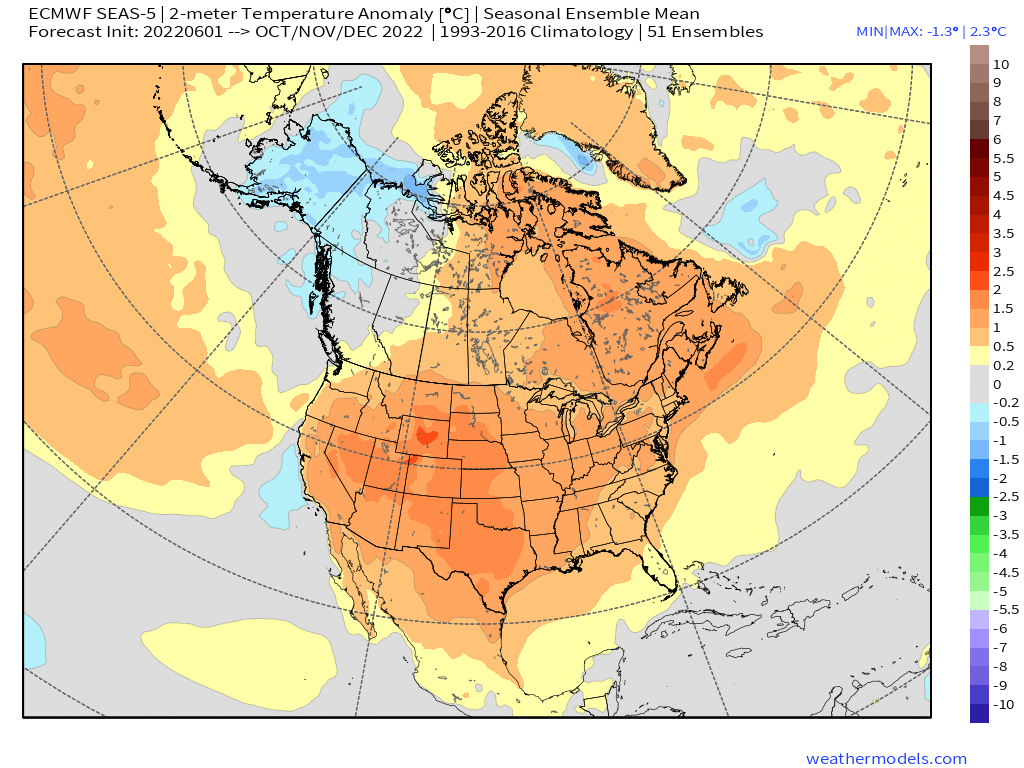
Here is the ECMWF Seasonal Ensemble Mean forecast that goes out 6 months. This model updates once a month with the images coming at around the 5th of the month.
The trend for temperatures over the next 6 months is more of the same with above normal highs. The Fall season at this point looks toasty. Let’s hope it flips over to a cooler solution over the next few months.
I know I am hoping and praying for a nice cold November.
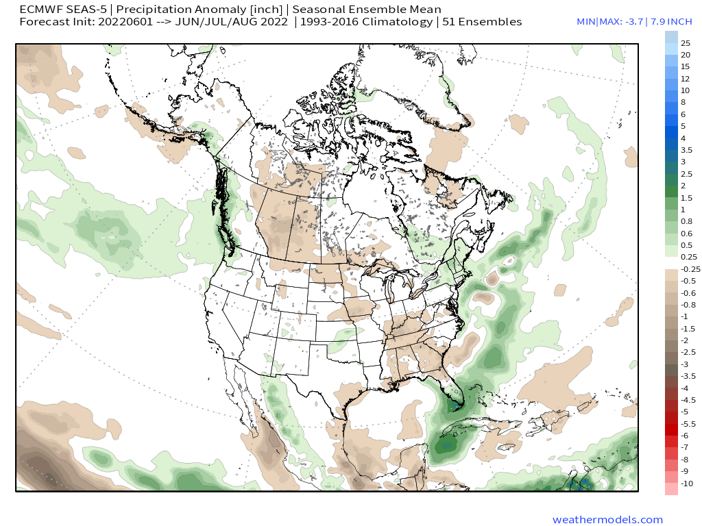
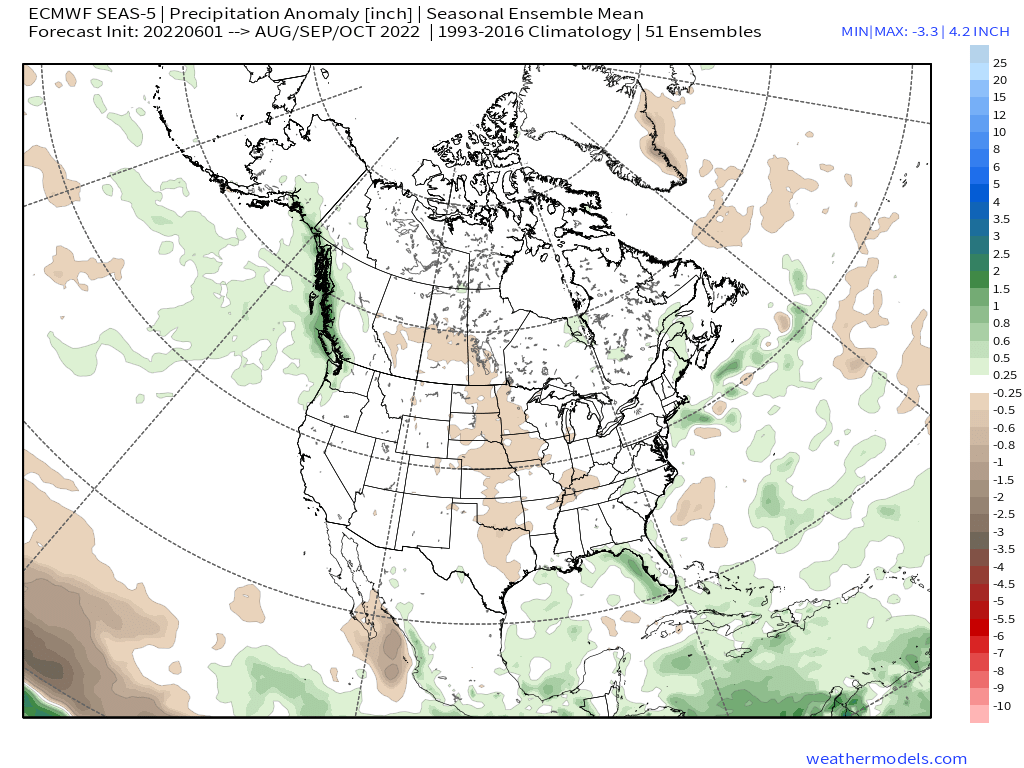
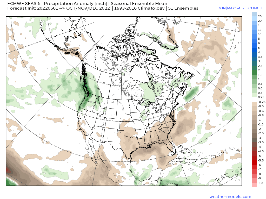
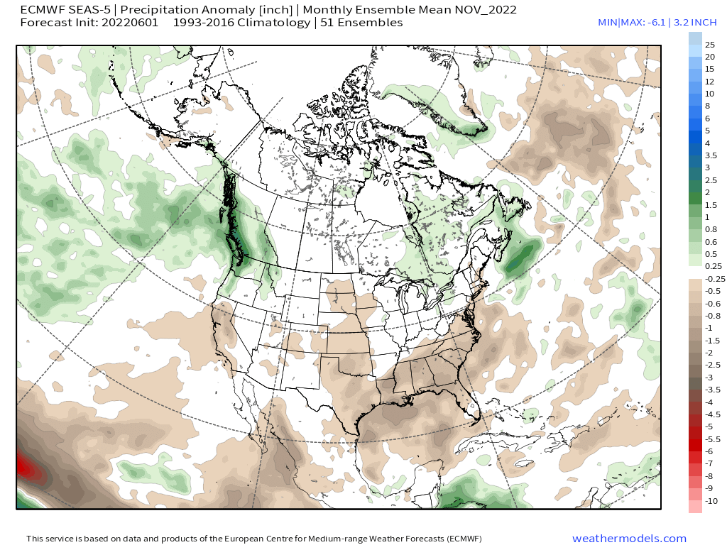
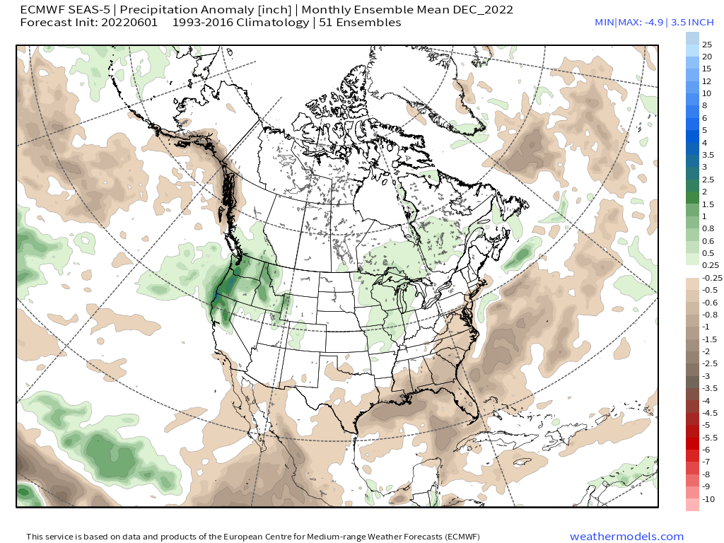
Looking below at the Precipitation Anomaly they have average precipitation right through September. October also looks drier with November even drier before the December run has Mammoth Mountain picking up average to above average snowfall.
Below is the single model run for November 2022
Below is the single model run for December 2022
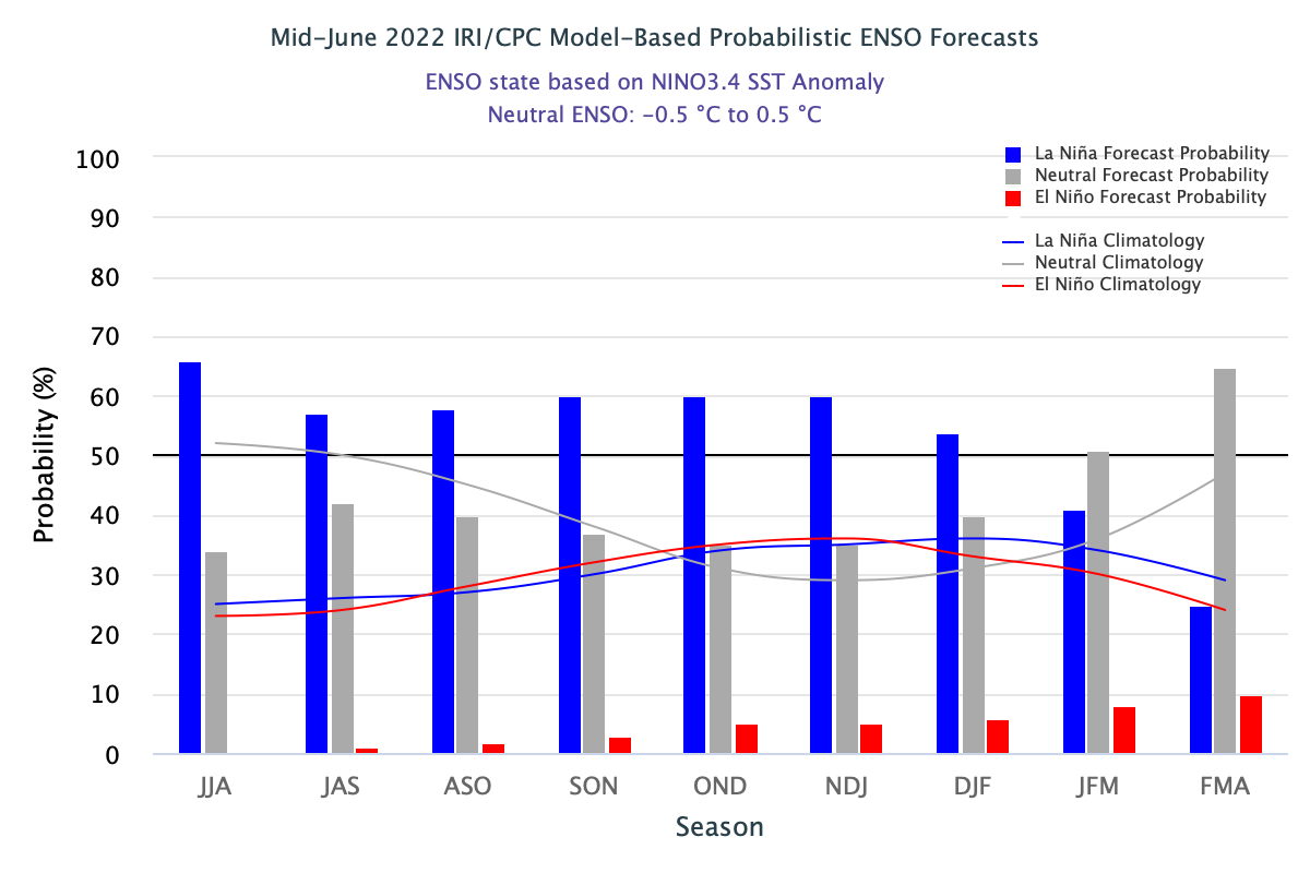
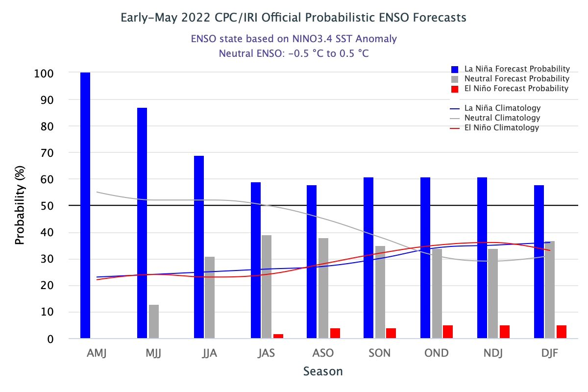
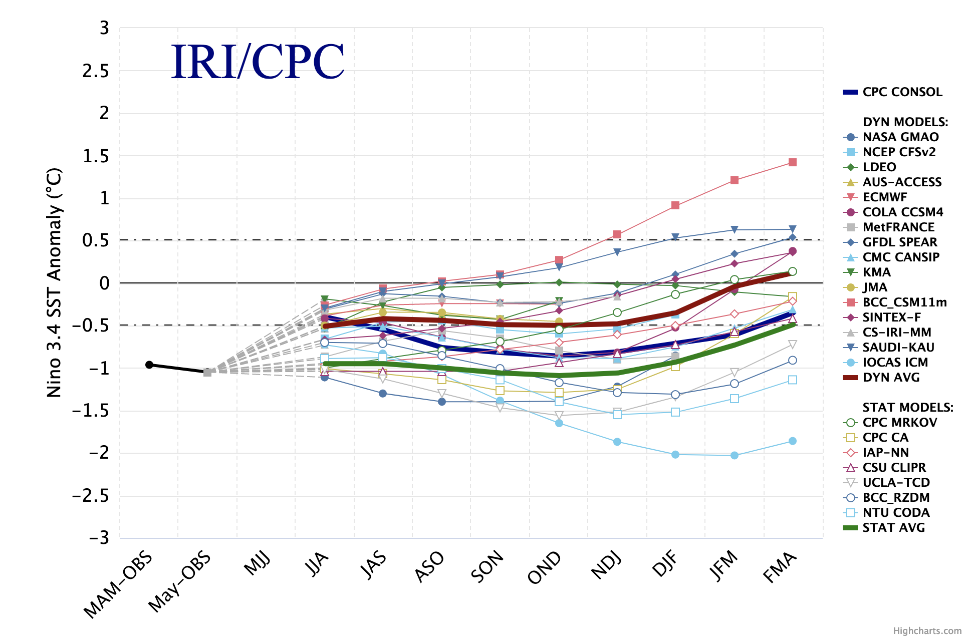
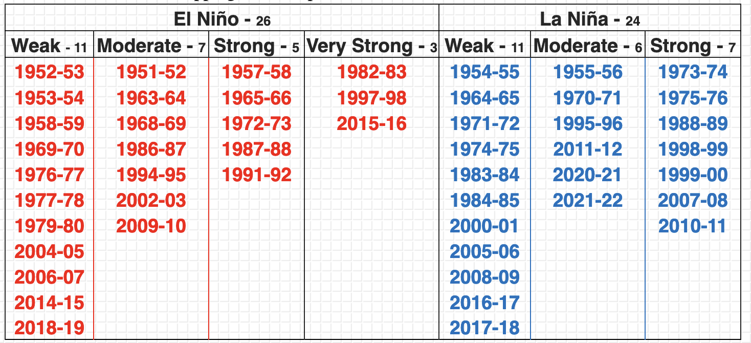
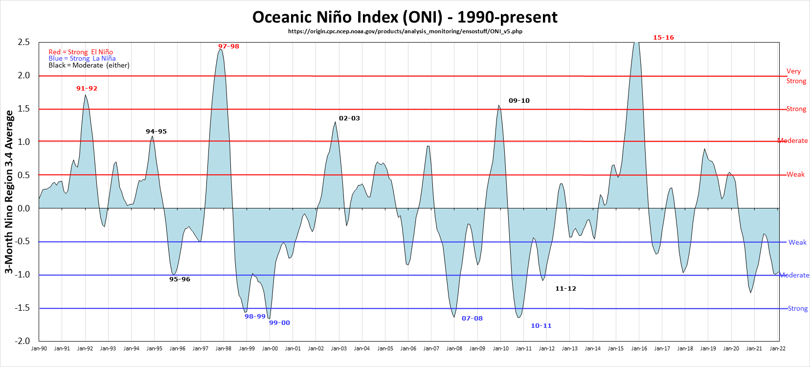
ENSO - La Nina & El Nino
6-2013-22 Looking for latest information on the ENSO?

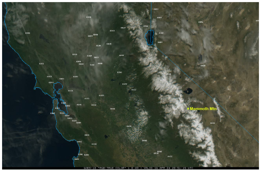
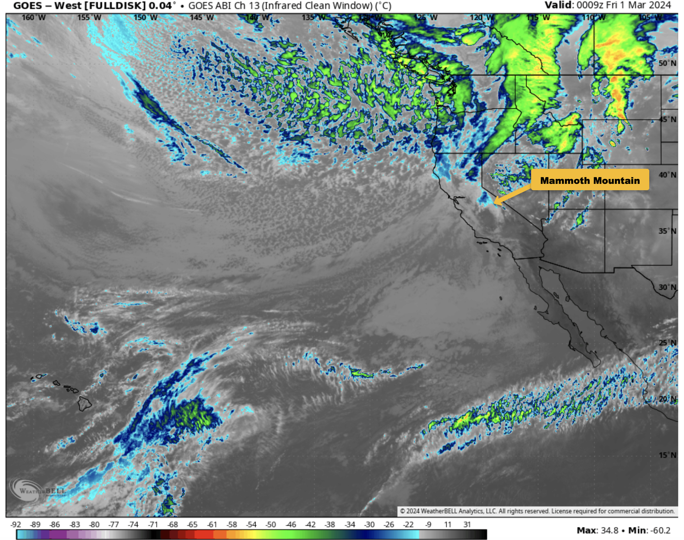
Satellite Image
Mammoth Mountain and Eastern Sierra Weather Posts

Mammoth Mountain Recreational Weather & Travel Forecast
Mammoth Mountain Recreational Weather & Travel Forecast
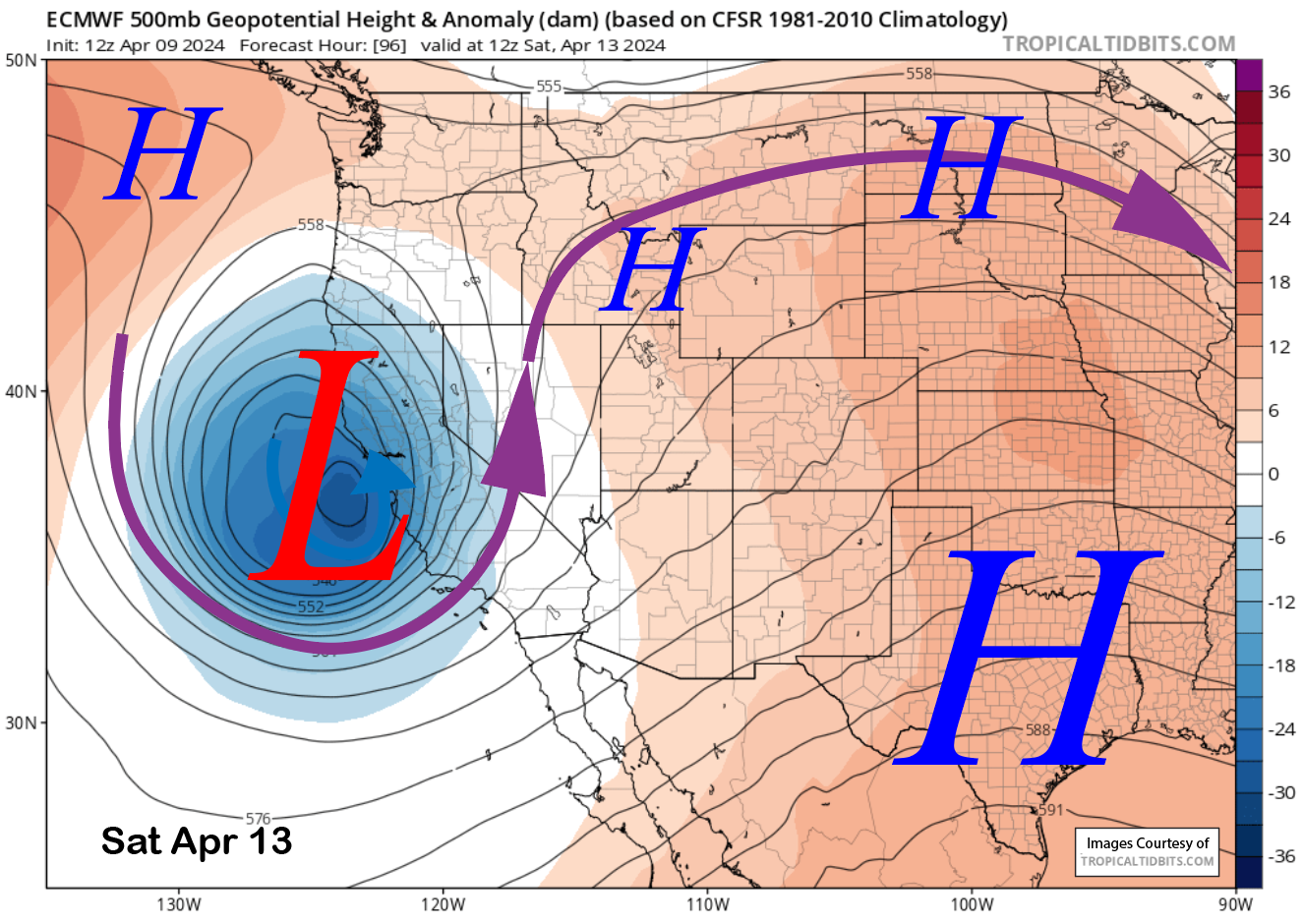
Powder Forecast – Tuesday April 9th, 2024
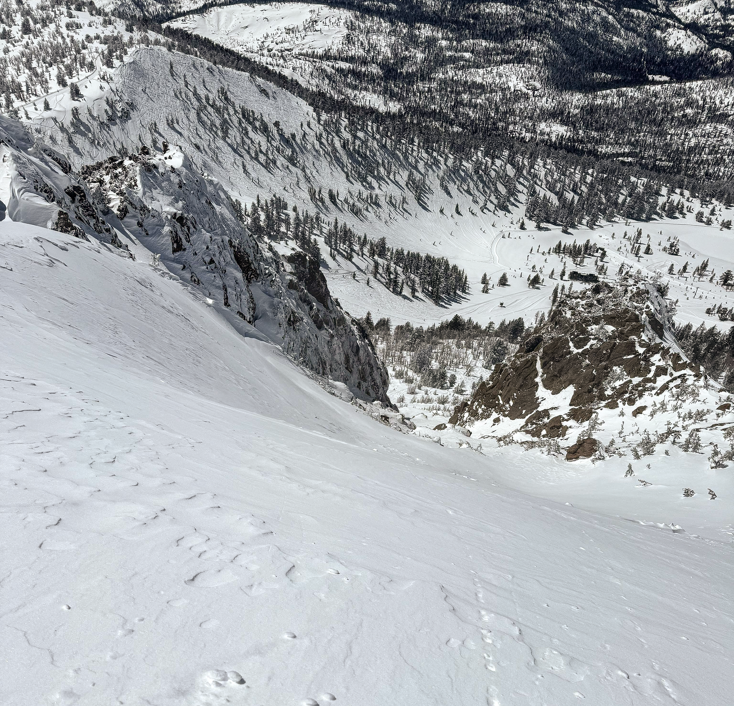
Sunday Morning Update from the Snowman
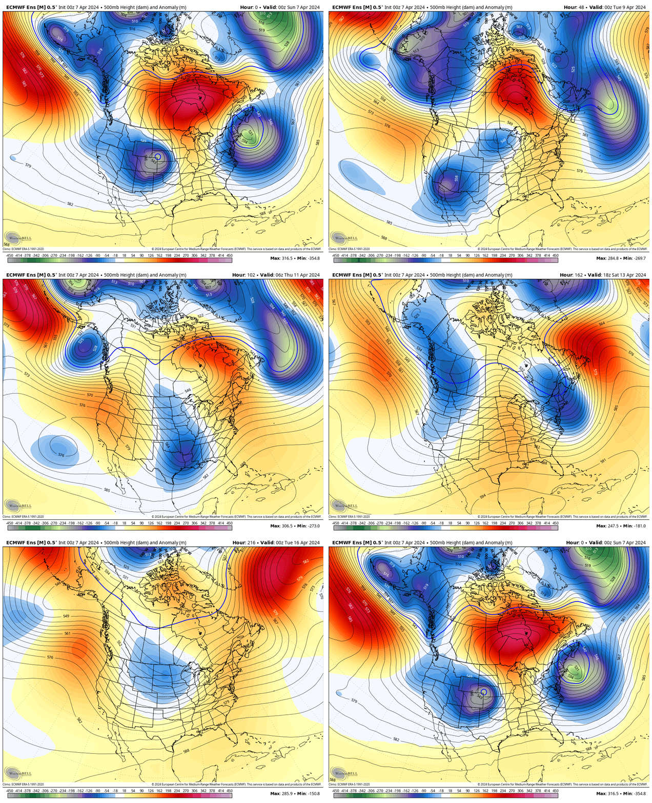
Mammoth Mountain Recreational Weather & Travel Forecast
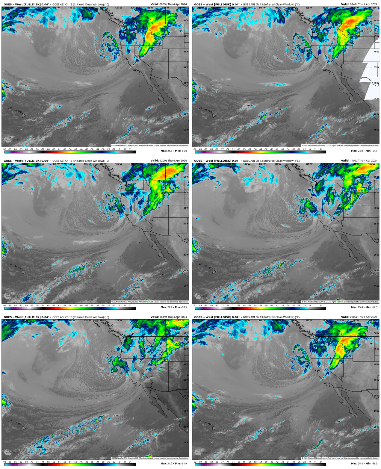
Mammoth Mountain Recreational Weather & Travel Forecast
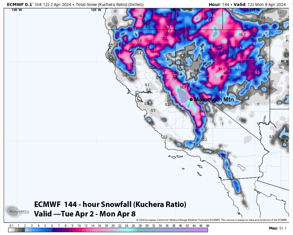
Powder Forecast –Tuesday April 2nd, 2024
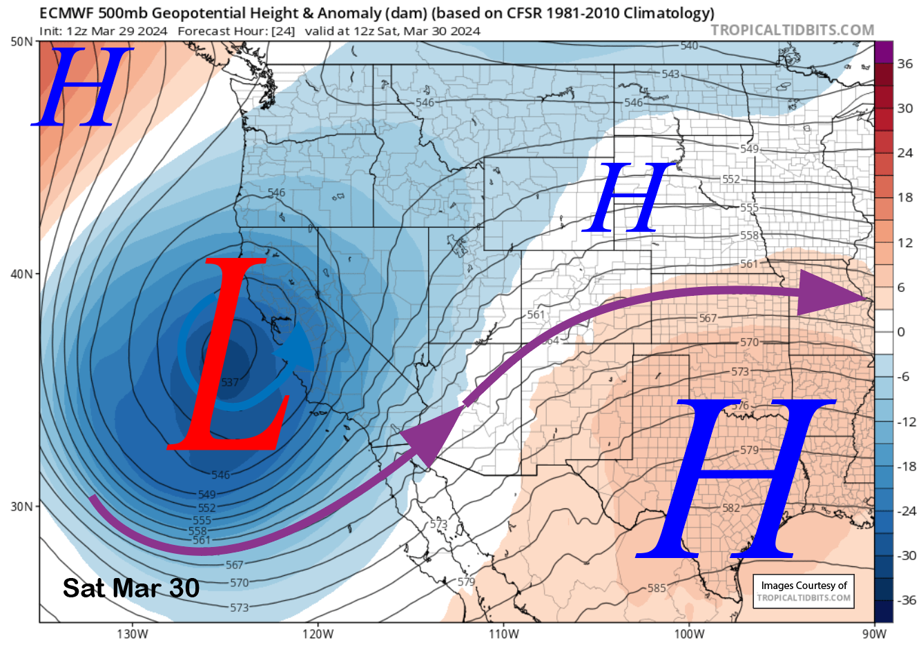
Powder Forecast –Friday March 29th, 2024
Mammoth Mountain Recreational Weather & Travel Forecast
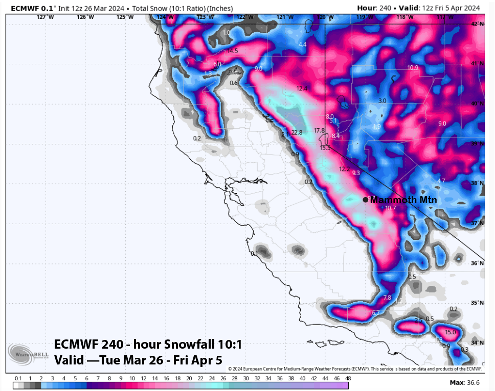
Powder Forecast –Tuesday March 26th, 2024
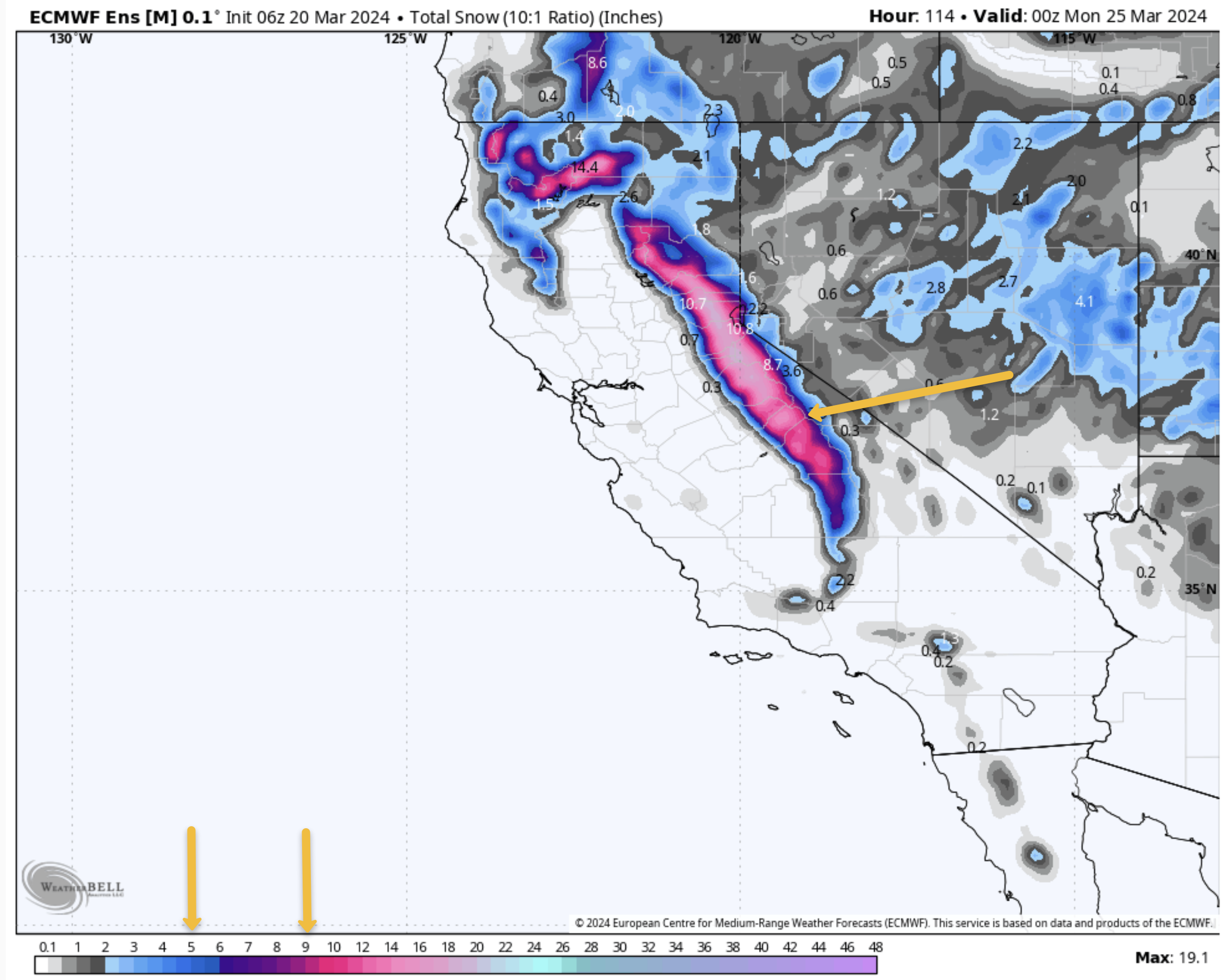
Mammoth Mountain Recreational Weather & Travel Forecast
Mammoth Mountain Recreational Weather & Travel Forecast
Powder Forecast – Friday, March 15th, 2024
Powder Forecast –Tuesday March 12th, 2024
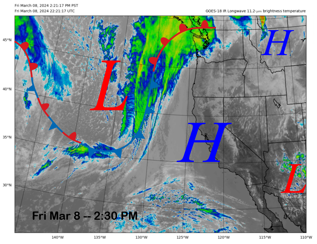
Powder Forecast – Friday March 8th, 2024
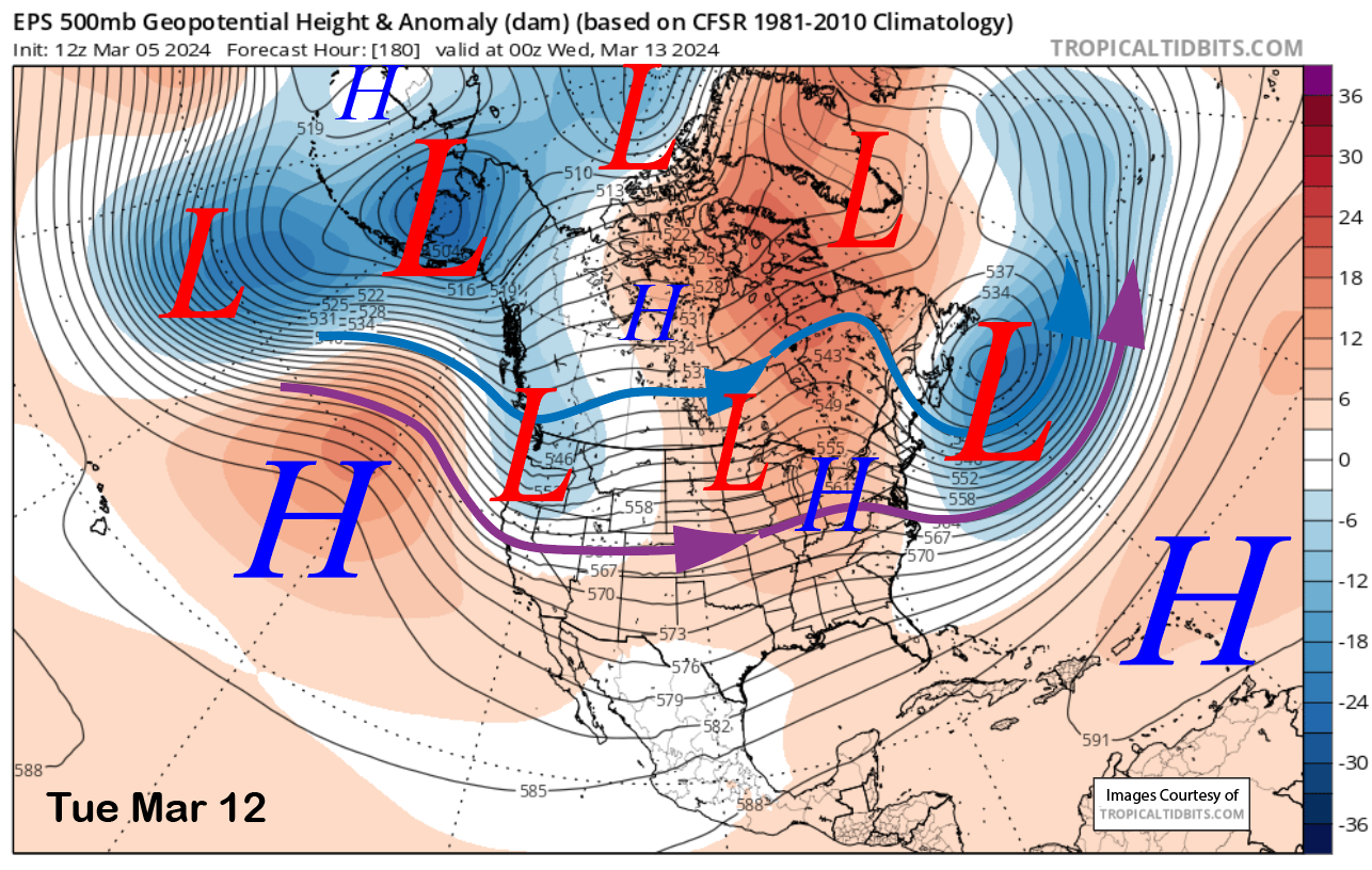
Powder Forecast –Tuesday March 5th, 2024
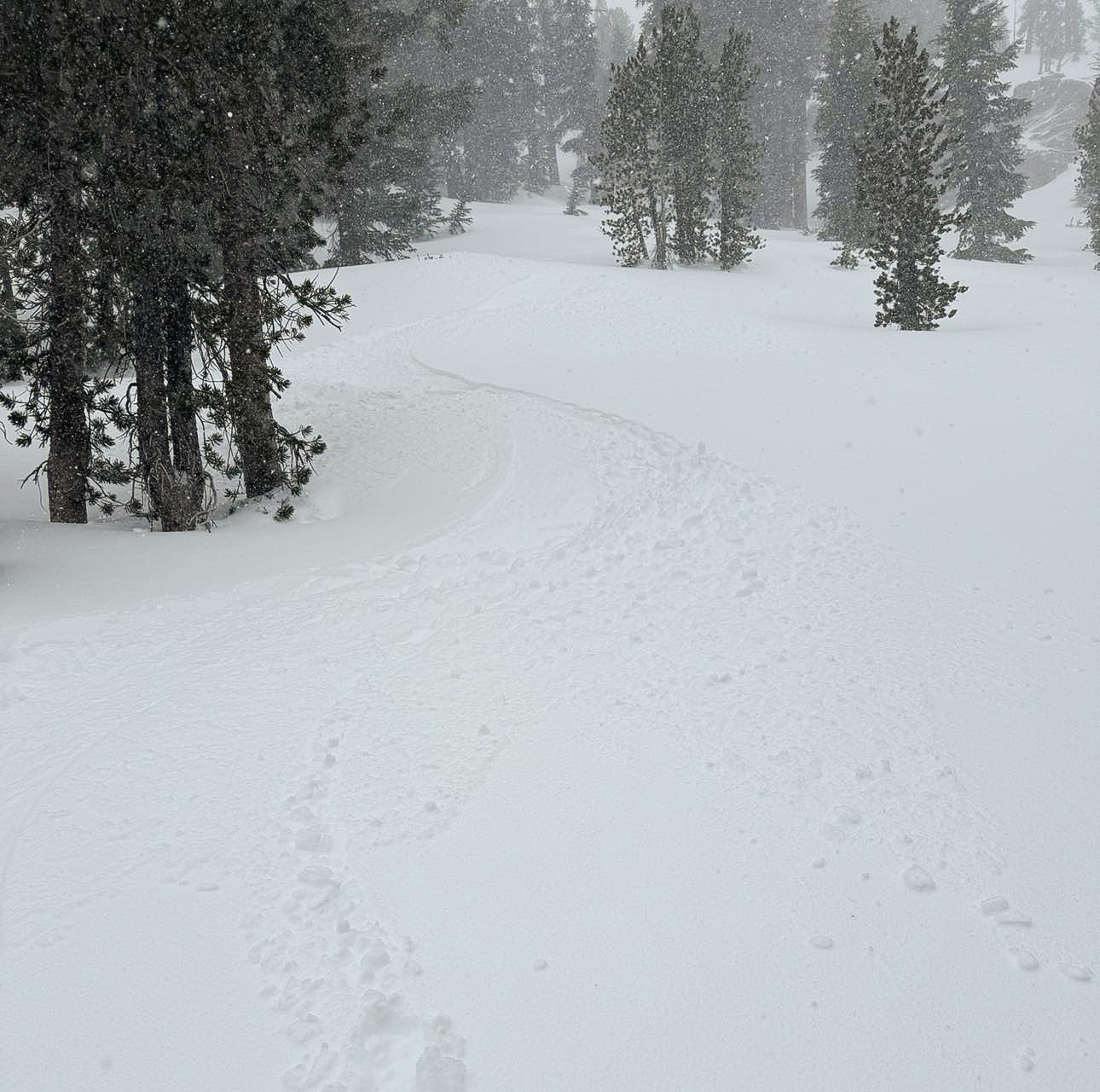
Mammoth Snowman Saturday Morning Storm Update
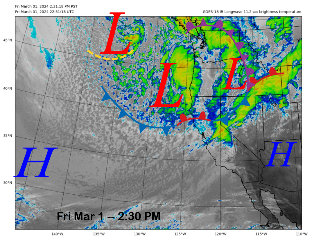
Powder Forecast –Friday March 1st, 2024
Mammoth Mountain Recreational Weather and Travel Forecast
Mammoth Mountain Weather Update
Powder Forecast – Tuesday February 27th, 2024
Mammoth Mountain Recreational Weather & Travel Update
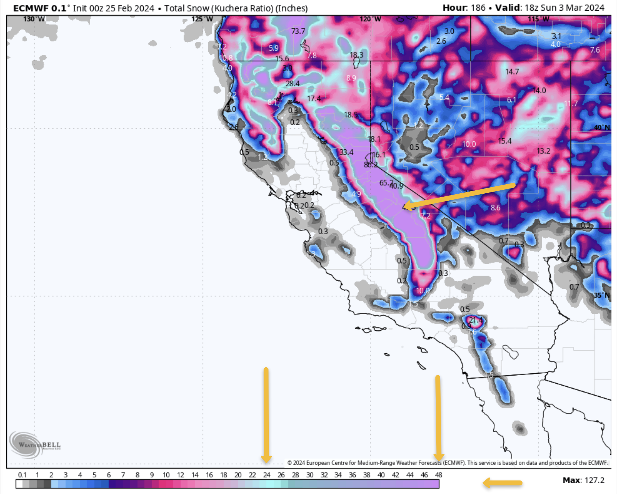
Mammoth Mountain Recreational Weather & Travel Update
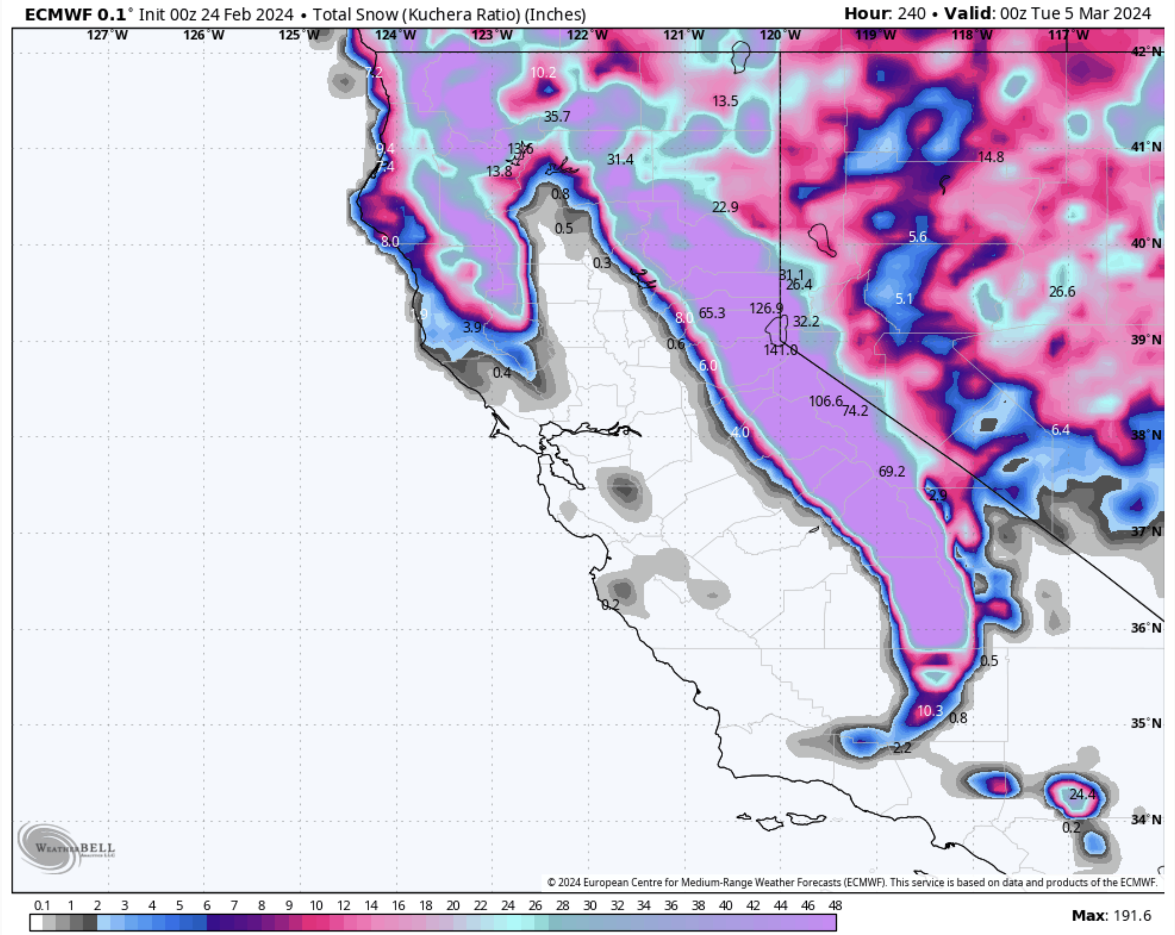
Mammoth Mountain Recreational & Travel Weather Update
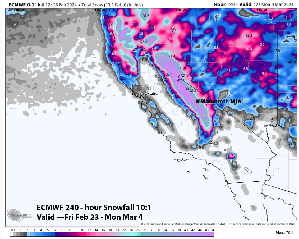
Powder Forecast –Friday February 23rd, 2024
Who Are We?
 Steve Taylor – Mammoth Snowman – Over the last 30+ years, Snowman has spent countless hours studying and learning about Mammoth Mountain Weather and Snow Conditions first hand. He has been skiing around the hill with marked ski poles since March of 1991 so he can measure the fresh snowfall amounts out on the hill.
Snowman started blogging this information back in 1990 on the old Mammoth BBS system, then the RSN Forums and then on to MammothSnowman.com in 2004 with Video & Photo Blog report. (No YouTube back then). Facebook got added to the fold back in 2008 and then the Facebook Group in 2016.
Reports, videos, and photos from the website have been featured on both local TV Stations here in Mammoth, along with AP, Fox, ABC, CBS, and NBC News.
 Ted Schlaepfer – Mammoth WeatherGuy – The Powder Forecast – Posted Tuesday and Fridays at 5 PM November into Mid May. These forecasts are now responsible for many people getting multiple powder days on Mammoth Mountain over the years.
Ted’s Bio: Ted has been a full-time Meteorologist (CCM) for the past 25+ years. He has always been fascinated with the weather,” skiing was just a natural extension of my love for snow and rain. I started skiing at age 5, first discovered Mammoth in 1979 as a youth, and have been a regular visitor since the late ’80s.”.
Here is the link to The WeatherGuys Powder Forecast Page.
Click Here to Learn More About the People Who Make MammothSnowman.com a Reality
