


EPS 500 Height Anomaly Chart out 240 hours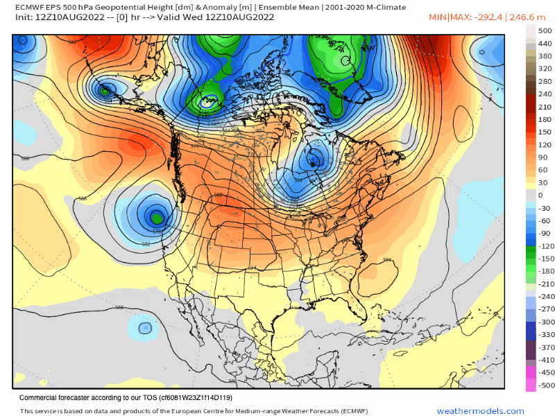
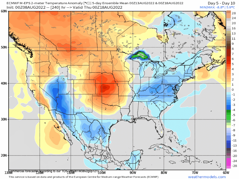
EPS 10-Day Temperature Anomaly Chart 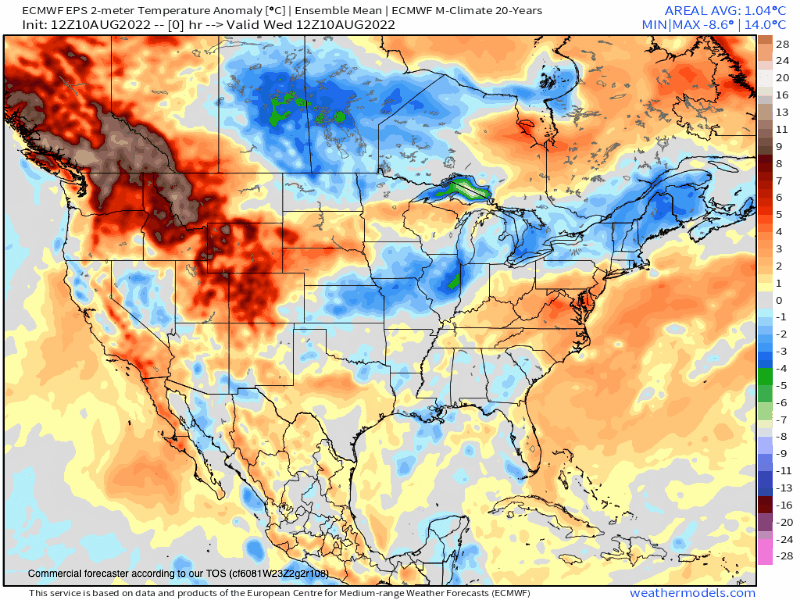
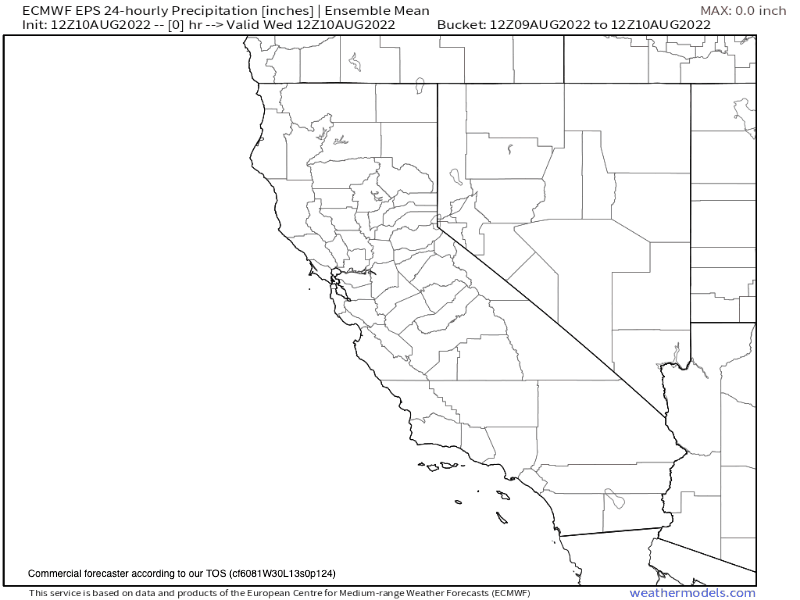
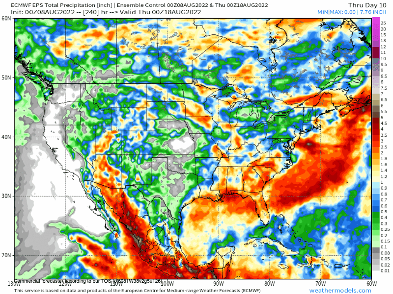
EPS 10 Day 24 Hour Precipitation Chart
8-10-2022 @ 3 PM This is the EPS 45-Day Height Anomaly GIF
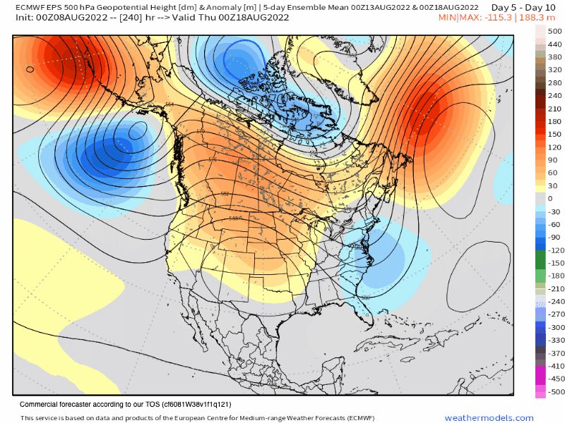
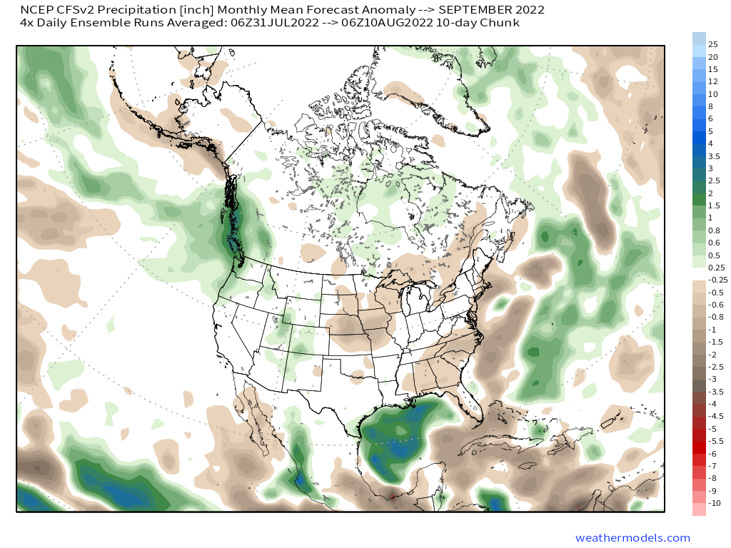
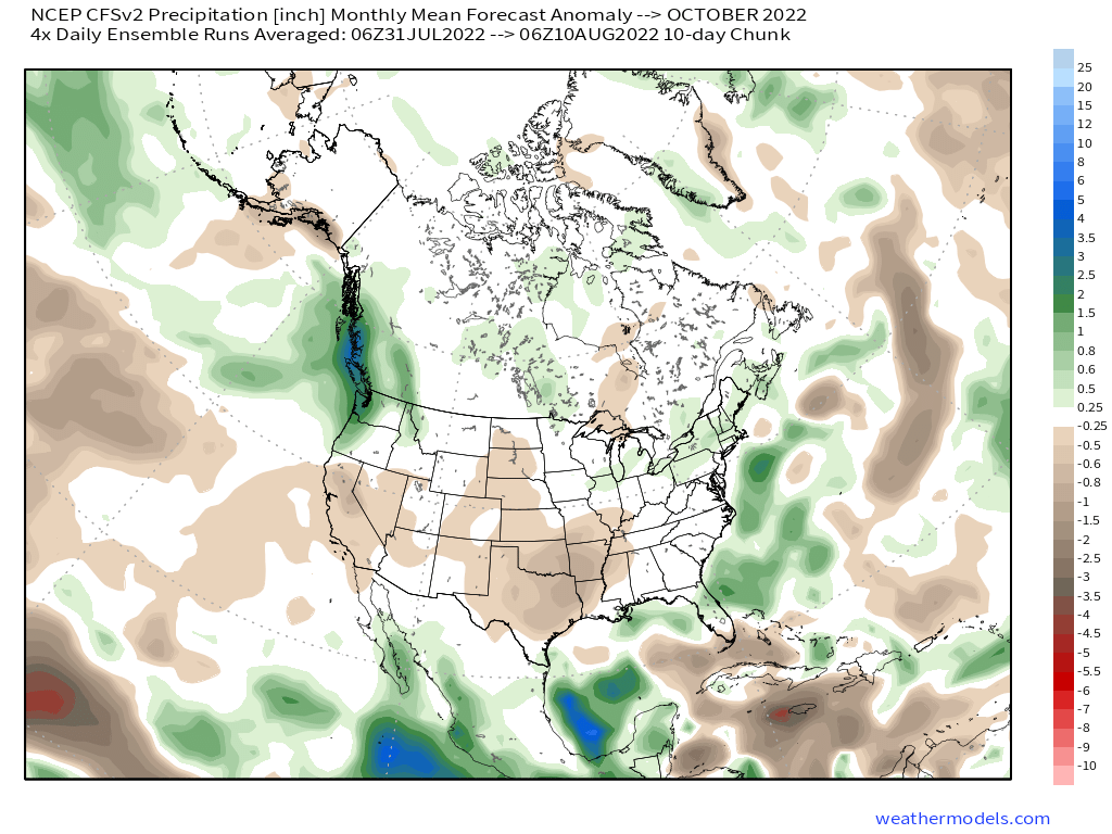
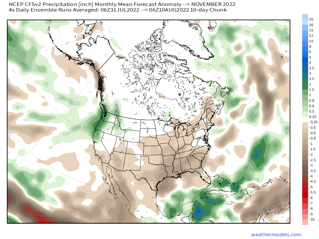
Looking at the model run below it goes almost out the start of Fall and there are still none of what I call the death ridges in site for the West. It does look like more muggy days and then some warmer and dry Summer days are left.
But still, no extreme high pressure ridges like we have seen the last two years. There is still time for that to change but at this point, I would not expect the Summer to end anything like the last 2 years.
The big question at this point that nobody wants to really talk about today is how will the wildfire season in California play out before the first snows fall.
As long as the Monsoonal flow continues with the wet storms the chance for big fires will be suppressed. What happens after that gets cut off is anybody’s guess.
On the model run below we do see a monsoonal flow still in early September so let’s hope that flow remains nice a wet.
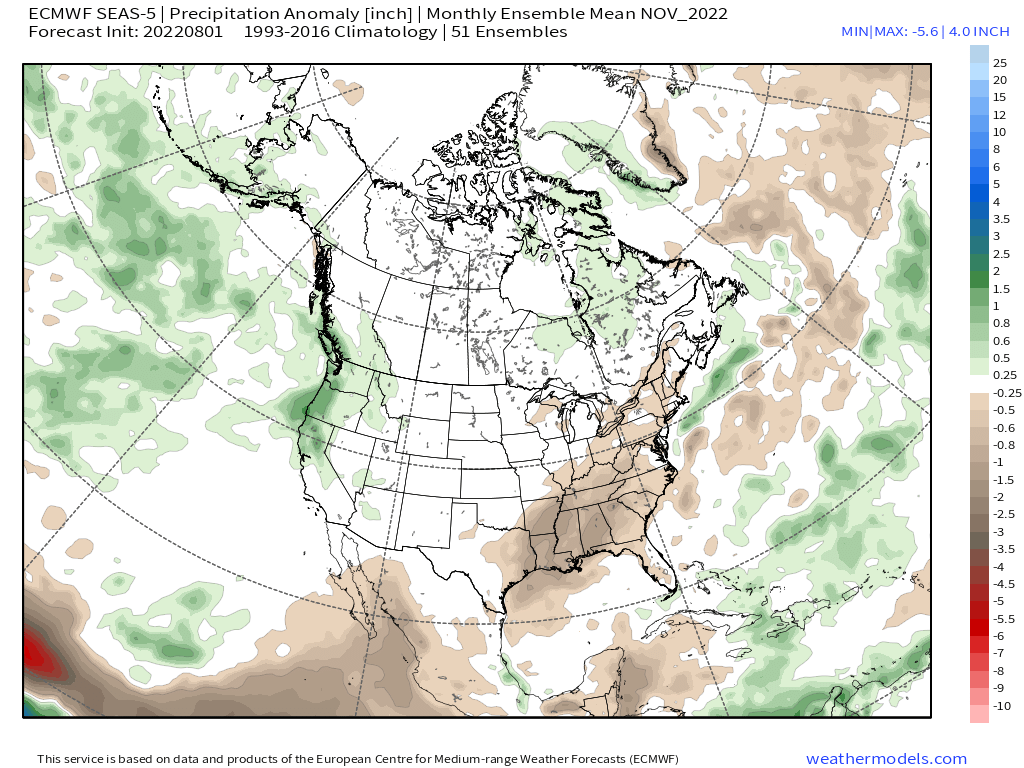
EPS 45 Day Temperature Anomaly
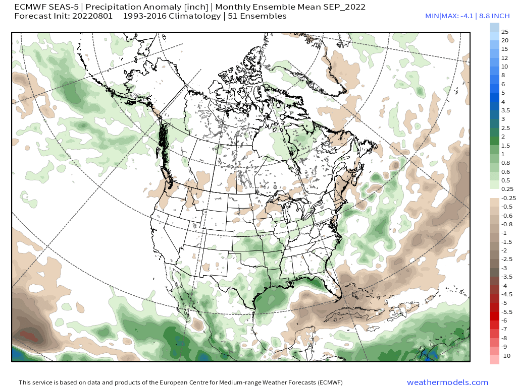
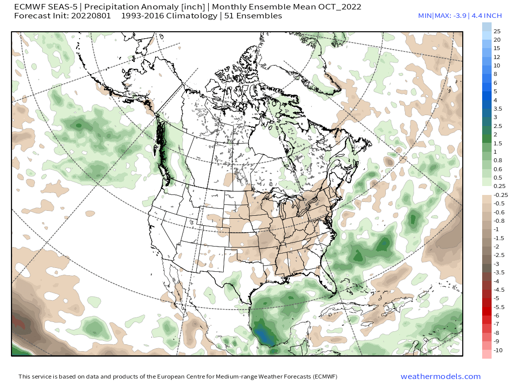
EPS 45 Day Precipitation Anomaly Chart
8-10-2022
**The new Euro data comes out each month around the 5th of the month. The next update on this data will be around September 7th here at the Mammoth Snowman website.


Who Are We?
 Steve Taylor – Mammoth Snowman – Over the last 30+ years, Snowman has spent countless hours studying and learning about Mammoth Mountain Weather and Snow Conditions first hand. He has been skiing around the hill with marked ski poles since March of 1991 so he can measure the fresh snowfall amounts out on the hill.
Snowman started blogging this information back in 1990 on the old Mammoth BBS system, then the RSN Forums and then on to MammothSnowman.com in 2004 with Video & Photo Blog report. (No YouTube back then). Facebook got added to the fold back in 2008 and then the Facebook Group in 2016.
Reports, videos, and photos from the website have been featured on both local TV Stations here in Mammoth, along with AP, Fox, ABC, CBS, and NBC News.
 Ted Schlaepfer – Mammoth WeatherGuy – The Powder Forecast – Posted Tuesday and Fridays at 5 PM November into Mid May. These forecasts are now responsible for many people getting multiple powder days on Mammoth Mountain over the years.
Ted’s Bio: Ted has been a full-time Meteorologist (CCM) for the past 25+ years. He has always been fascinated with the weather,” skiing was just a natural extension of my love for snow and rain. I started skiing at age 5, first discovered Mammoth in 1979 as a youth, and have been a regular visitor since the late ’80s.”.
Here is the link to The WeatherGuys Powder Forecast Page.
Click Here to Learn More About the People Who Make MammothSnowman.com a Reality


