


After a cooler weekend, you can expect a large dome of high pressure to build in for about 7-10 days. That will result in above-average highs and drier conditions. Fire Crews in the west will be on high alert.
Highs in Mammoth will be around 80 again with the Bishop area in the upper 90s to low 100s. The high country will be the place to be with highs at the 8900-foot resort levels in the low to mid-70s with overnight lows in the low 50s.
As the heat builds you can expect to see some build-ups with virga and in a few locations those drops could make it to the ground.
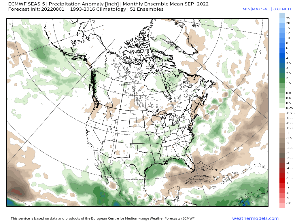
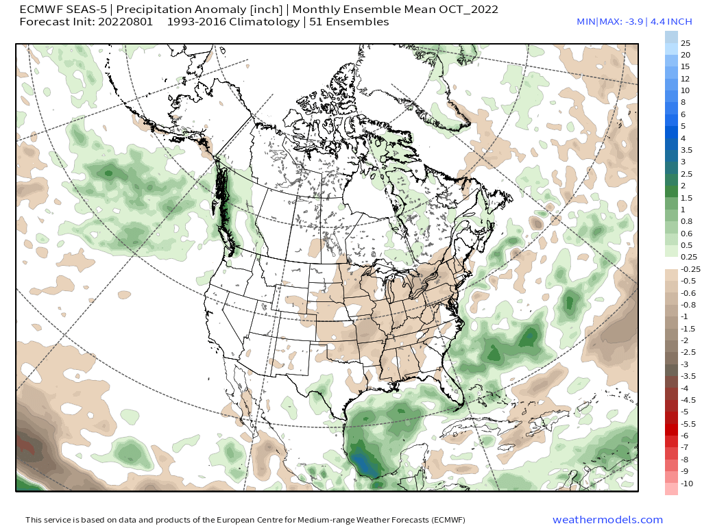
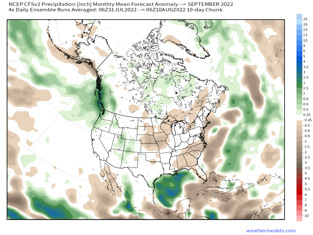
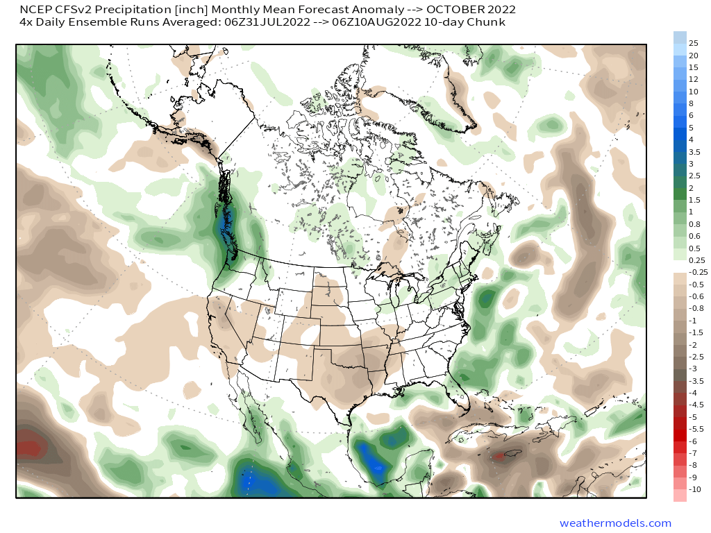
Way off in the Ultra Fantasy Forecast the GEFS and the EPS ensembles have the monsoonal flow working its way back into the entire Eastern Sierra. QPF from that pattern could turn out to be decent if the GEFS turns out the winner in the long-range setup.
Let’s hope that’s the case as vegetation here and around the entire state is getting very very dry once again. Some good rains in September would a major blessing.
Now that we are at the end of Summer I know my big question is when we will see that first dusting on the Whites, or the top of Bloody Coulier, or even the top of Mammoth Mountain?
The first 2 locations mentioned in more years than not get that first light dusting around the fall equinox. Right now the models have that first dusting around the 28th of September as a possible date.
Snowman
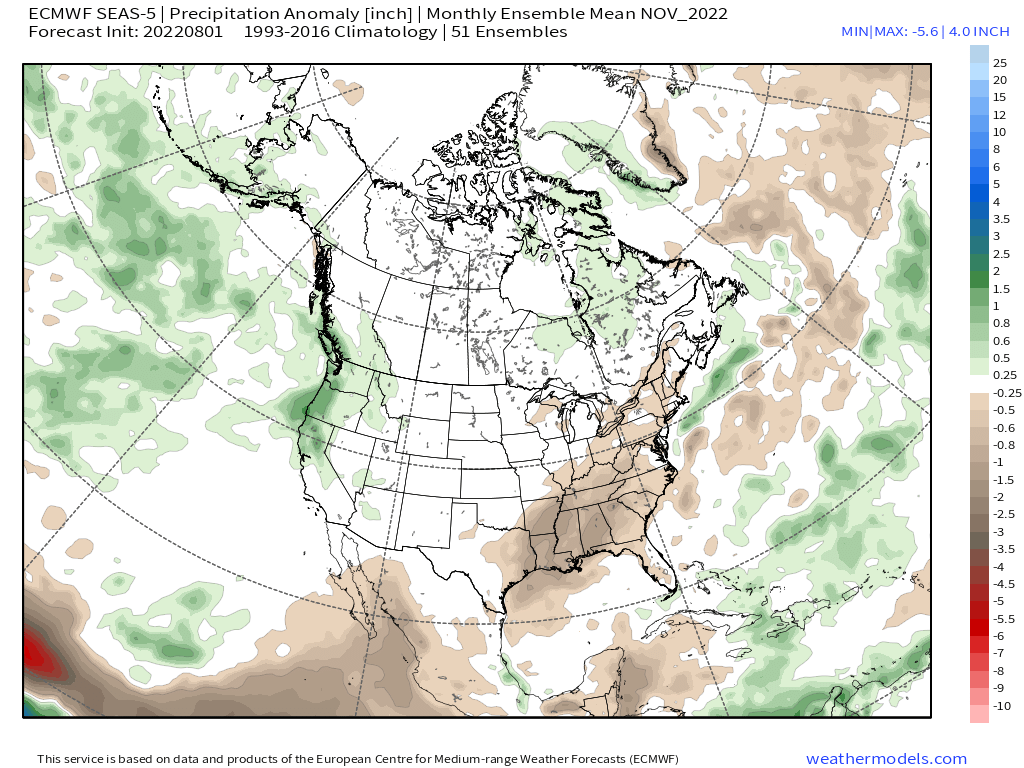
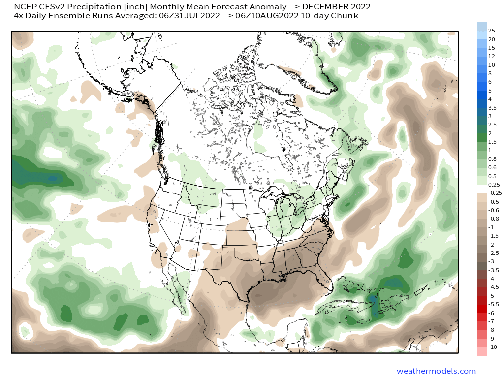
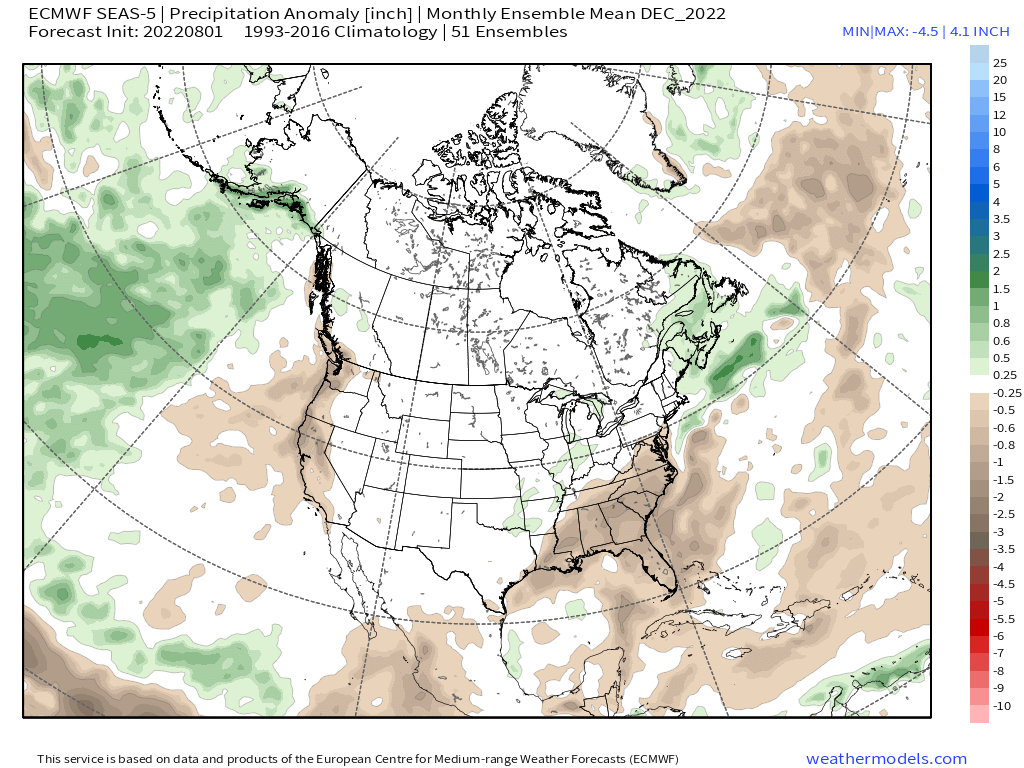
Below are the most current EPS and then the GEFS 500 Height Anomaly Ensemble Mean Runs
EPS 10-Day Temperature Anomaly Ensemble Mean
EPS 10 Day 24 Hour Precipitation Ensemble Mean
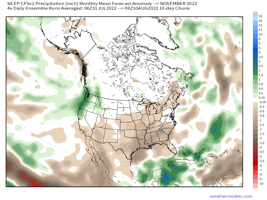
GEFS 45 Day Precipitation Chart
8-10-2022
**The new Euro data comes out each month around the 5th of the month. The next update on this data will be around September 7th here at the Mammoth Snowman website.


Who Are We?
 Steve Taylor – Mammoth Snowman – Over the last 30+ years, Snowman has spent countless hours studying and learning about Mammoth Mountain Weather and Snow Conditions first hand. He has been skiing around the hill with marked ski poles since March of 1991 so he can measure the fresh snowfall amounts out on the hill.
Snowman started blogging this information back in 1990 on the old Mammoth BBS system, then the RSN Forums and then on to MammothSnowman.com in 2004 with Video & Photo Blog report. (No YouTube back then). Facebook got added to the fold back in 2008 and then the Facebook Group in 2016.
Reports, videos, and photos from the website have been featured on both local TV Stations here in Mammoth, along with AP, Fox, ABC, CBS, and NBC News.
 Ted Schlaepfer – Mammoth WeatherGuy – The Powder Forecast – Posted Tuesday and Fridays at 5 PM November into Mid May. These forecasts are now responsible for many people getting multiple powder days on Mammoth Mountain over the years.
Ted’s Bio: Ted has been a full-time Meteorologist (CCM) for the past 25+ years. He has always been fascinated with the weather,” skiing was just a natural extension of my love for snow and rain. I started skiing at age 5, first discovered Mammoth in 1979 as a youth, and have been a regular visitor since the late ’80s.”.
Here is the link to The WeatherGuys Powder Forecast Page.
Click Here to Learn More About the People Who Make MammothSnowman.com a Reality


